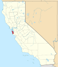
Moss Beach, California

Last updated

Moss Beach
Moss Beach Shoreline, April 2007.jpg
Moss Beach shoreline, April 2007. Part of the Franciscan formation is visible near the beach
San Mateo County California Incorporated and Unincorporated areas Moss Beach Highlighted.svg
Location in San Mateo County and the state of California
Usa edcp location map.svg
Red pog.svg
Moss Beach
Location in the United States
USA California location map.svg
Red pog.svg
Moss Beach
Moss Beach (California)
Location Map San Francisco Bay Area.png
Red pog.svg
Moss Beach
Moss Beach (San Francisco Bay Area)
Coordinates: 37°31′31″N122°30′46″W / 37.52528°N 122.51278°W / 37.52528; -122.51278
Country United States
State California
County San Mateo
Area
[1]
  Total2.254 sq mi (5.837 km2)
  Land2.254 sq mi (5.837 km2)
  Water0 sq mi (0 km2)  0%
Elevation
[2]
66 ft (20 m)
Population
  Total3,214
  Density1,400/sq mi (550/km2)
Time zone UTC-8 (Pacific)
  Summer (DST) UTC-7 (PDT)
ZIP code
94038
Area code 650
FIPS code 06-49446
GNIS feature ID 1659183
A panorama of Moss Beach Mossbeach-pan.jpg
A panorama of Moss Beach
Beach within Fitzgerald Marine Reserve looking south Mosserazorback.jpg
Beach within Fitzgerald Marine Reserve looking south

Moss Beach is a coastal census-designated place in San Mateo County, California, with a year 2020 census population of 3,214. Located in Moss Beach are the Fitzgerald Marine Reserve, a marine sanctuary; the Half Moon Bay Airport, the historic Moss Beach Distillery; and the Seal Cove Inn, a destination lodging property. Moss Beach is a cool coastal microclimate that gives one a sense of separation from the nearby metropolitan San Francisco Bay Area and assures that summer temperatures are generally mild.

Contents

History

Moss Beach began as a resort destination, with its first hotel built in 1881 by Juergen Wienke. [4] It grew with the advent of the Ocean Shore Railroad. [5]

Geography

Monterey cypress trees atop coastal bluff Mosscyperazorback.jpg
Monterey cypress trees atop coastal bluff

Moss Beach is situated at 37°31'31" North latitude, 122°30'46" West (37.525240, -122.512811), [6] approximately 20 miles (32 km) south of San Francisco and 50 miles (80 km) north of Santa Cruz, California. Nearby towns include Montara to the north, El Granada, Princeton-by-the-Sea, and Half Moon Bay to the south. According to the United States Census Bureau, the CDP has a total area of 2.3 square miles (6.0 km2), all land.

Demographics

2010

The 2010 United States Census [7] reported that Moss Beach had a population of 3,103. The population density was 1,377.0 inhabitants per square mile (531.7/km2). The racial make-up of Moss Beach was 2,280 (73.5%) White, 25 (0.8%) African American, 43 (1.4%) Native American, 118 (3.8%) Asian, 9 (0.3%) Pacific Islander, 494 (15.9%) from other races, and 134 (4.3%) from two or more races. Hispanic or Latino of any race were 903 persons (29.1%).

The census reported that 2,983 people (96.1% of the population) lived in households, 12 (0.4%) lived in non-institutionalized group quarters, and 108 (3.5%) were institutionalized.

There were 1,062 households, of which 359 (33.8%) had children under the age of 18 living in them, 607 (57.2%) were opposite-sex married couples living together, 85 (8.0%) had a female householder with no husband present, 41 (3.9%) had a male householder with no wife present. There were 49 (4.6%) unmarried opposite-sex partnerships, and 14 (1.3%) same-sex married couples or partnerships.251 households (23.6%) were made up of individuals, and 68 (6.4%) had someone living alone who was 65 years of age or older. The average household size was 2.81. There were 733 families (69.0% of all households); the average family size was 3.35.

710 people (22.9%) were under the age of 18, 234 people (7.5%) aged 18 to 24, 699 people (22.5%) aged 25 to 44, 1,097 people (35.4%) aged 45 to 64, and 363 people (11.7%) were 65 years of age or older. The median age was 43.2 years. For every 100 females, there were 99.9 males. For every 100 females age 18 and over, there were 97.6 males.

There were 1,154 housing units at an average density of 512.1 per square mile (197.7/km2), of which 868 (81.7%) were owner-occupied, and 194 (18.3%) were occupied by renters. The homeowner vacancy rate was 1.2%; the rental vacancy rate was 6.3%. 2,448 people (78.9% of the population) lived in owner-occupied housing units and 535 people (17.2%) lived in rental housing units.

2000

At the 2000 census, [8] there were 1953 people, 740 households and 526 families residing in the Census Designated Place (CDP). The population density was 1,092.5 inhabitants per square mile (421.8/km2). There were 771 housing units at an average density of 431.3 per square mile (166.5/km2). The racial make-up in 2010 was 62.9% non-Hispanic White, 0.7% non-Hispanic African American, 0.2% Native American, 3.8% Asian, 0.3% Pacific Islander, 0.3% from other races, and 2.6% from two or more races. 29.1% of the population were Hispanic.

There were 740 households, of which 36.1% had children under the age of 18, 58.9% were married couples, 7.4% had a female householder with no husband present, and 28.9% were non-families. 18.4% of all households were made up of individuals, and 2.6% had someone living alone who was 65 years of age or older. The average household size was 2.64 and average family size was 2.98.

The median household income was $91,992 and the median family income was $99,307. Males had a median income of $81,619 and females $41,411. The per capita income was $41,283. 4.3% of the population and 3.2% of families were below the poverty line. 2.2% of those under the age of 18 and 2.7% of those over 64 were below the poverty line.

Climate

Moss Beach has a Mediterranean climate (Köppen Csb) typical of the West Coast that is characterized by mild, rainy winters and cool, mild to warm summers, with an average temperature of 55°F (13 °C).

The area experiences some warmer degrees than Half Moon Bay due its proximity to San Francisco and coastal influence fog all year round and an Indian summer.

There is no significant snow occurring in Moss Beach in winter months. Though snowfall along the coast in Moss Beach has never been measurable, however, snow flurries were observed in December 1972 and 1976.

Hot weather is not unusual; the average annual days with highs of 90 °F (32 °C) or higher can occur in summertime. Cold weather is also rare with lows of 44.3 °F (6.8 °C) or lower. Typical of Northern California, most of the rain falls from November to April. The normal annual precipitation is 27.2 inches (691 mm). There is often fog and overcast during the night and morning hours, usually clearing to offshore during the afternoon. Persistent sea breezes help to moderate the climate along the coast.

January is the coolest month with an average high of 57.5 °F (14.2 °C) and an average low of 44.3 °F (6.8 °C). August and September are the warmest months with an average high of 70.6 °F (21.4 °C) and an average low of 53.8 °F (12.1 °C) within the summer months.

Climate data for Moss Beach, California
MonthJanFebMarAprMayJunJulAugSepOctNovDecYear
Mean daily maximum °F (°C)57.5
(14.2)
59.6
(15.3)
61.1
(16.2)
62.9
(17.2)
64.8
(18.2)
67.9
(19.9)
69.2
(20.7)
70.1
(21.2)
70.6
(21.4)
68.3
(20.2)
62.5
(16.9)
57.6
(14.2)
64.3
(18.0)
Daily mean °F (°C)50.9
(10.5)
52.6
(11.4)
53.7
(12.1)
55.0
(12.8)
57.4
(14.1)
60.0
(15.6)
60.6
(15.9)
62.4
(16.9)
62.2
(16.8)
59.9
(15.5)
55.2
(12.9)
51.2
(10.7)
56.8
(13.8)
Mean daily minimum °F (°C)44.3
(6.8)
45.6
(7.6)
46.3
(7.9)
47.1
(8.4)
49.9
(9.9)
52.0
(11.1)
53.9
(12.2)
54.6
(12.6)
53.8
(12.1)
51.5
(10.8)
47.8
(8.8)
44.8
(7.1)
49.3
(9.6)
Average precipitation inches (mm)5.3
(130)
5.1
(130)
3.8
(97)
1.7
(43)
0.8
(20)
0.2
(5.1)
0.1
(2.5)
0.2
(5.1)
0.3
(7.6)
1.4
(36)
3.1
(79)
5.2
(130)
27.2
(685.3)
Average rainy days1212117532.534591184.5
Source: [9]

Politics

Typical Moss Beach Streetscape Mosslanerazorback.jpg
Typical Moss Beach Streetscape

Locally, Moss Beach and other portions of the unincorporated Midcoast is represented by the elected Midcoast Community Council.

In the California State Legislature, Moss Beach is in the 13th Senate District , represented by Democrat Josh Becker, and in the 22nd Assembly District , represented by Republican Juan Alanis. [10]

Federally, Moss Beach is in California's 16th congressional district , represented by Democrat Anna Eshoo. [11]

Noteworthy features

Because of the air currents off the Pacific Ocean, Moss Beach experiences above average fog levels, but also high quality ambient air. Situated along the coast of Moss Beach is the Fitzgerald Marine Reserve, a California designated area of Special Biological Significance. The reserve has a scenic blufftop trail through cypress groves overlooking the Pacific Ocean, historically significant tidepools, and a variety of marine animals and pelagic birds. The outcroppings along the beach are part of the Franciscan Complex. [12]

Montara State Marine Reserve & Pillar Point State Marine Conservation Area extend offshore from Moss Beach. Like underwater parks, these protected areas help conserve ocean wildlife and marine ecosystems.

Moss Beach Distillery photographed standing at cliffedge Mossdesterazorback.jpg
Moss Beach Distillery photographed standing at cliffedge

An occurrence of the rare plant Hickman's potentilla, Potentilla hickmanii, was observed by E.C. Suttliffe in 1933 [13] in the vicinity of the mouth of San Vicente Creek within Moss Beach. This colony was not further documented for decades, but another colony was discovered [14] toward the end of the 20th century north of Moss Beach. The plant was listed as California endangered in 1973 and as an endangered species by the United States government in 1998.

Off State Route 1 is Moss Beach Distillery, a restaurant that has its roots in bootleg liquor during Prohibition. The building is a California Point of Historical Interest. The restaurant, which claims to be haunted, was featured on the television series Ghost Hunters , where they revealed that owners of the distillery have created hoaxes simulating paranormal activity.

Transportation

Primary road access is via State Route 1 (the Cabrillo Highway) from the north and south.

SamTrans route 117 provides service to Moss Beach with service from Linda Mar in Pacifica to Half Moon Bay.

Related Research Articles

<span class="mw-page-title-main">Discovery Bay, California</span> Census-designated place in California, United States

Discovery Bay is a census-designated place (CDP) in eastern Contra Costa County, California in the United States, about 60 miles (97 km) from San Francisco. It is located in the San Francisco Bay Area. As of 2020, its population was 15,358, a 15% percent gain from 13,352 at the 2010 census.

<span class="mw-page-title-main">Rodeo, California</span> Census-designated place in California, United States

Rodeo is a census-designated place (CDP) located in Contra Costa County, California, in the East Bay sub-region of the San Francisco Bay Area, on the eastern shore of San Pablo Bay, 25 miles northeast of San Francisco. The population was 9,653 at the 2020 census. The place is named for the rodeos common in the late 19th century. Cattle from the surrounding hills were regularly driven down through the old town district to a loading dock on the shoreline of San Pablo Bay for shipment to slaughterhouses, a practice which continued through the early 20th century. Rodeo is served by the Interstate 80 freeway and State Route 4 and used to be served by the first transcontinental railroad which still passes through Rodeo. Rodeo has not been a stop on the railroad since the 1950s.

<span class="mw-page-title-main">Tara Hills, California</span> Census-designated place in California, United States

Tara Hills is a census-designated place (CDP) in Contra Costa County, California, United States. The population was 5,126 at the 2010 census.

<span class="mw-page-title-main">McKinleyville, California</span> Census-designated place in California, United States

McKinleyville is a census-designated place (CDP) in Humboldt County, California. McKinleyville is located 5.25 miles (8.4 km) north of Arcata, at an elevation of 141 feet (43 m). The population was 15,177 at the 2010 census, up from 13,599 at the time of the 2000 census.

<span class="mw-page-title-main">Bolinas, California</span> Unincorporated community in California, United States

Bolinas is an unincorporated coastal community and census-designated place in Marin County, California, United States. As of the 2020 census it had a population of 1,483. It is located on the California coast, approximately 13 miles (21 km) northwest of San Francisco, and 27 miles (43 km) by road.

<span class="mw-page-title-main">Dillon Beach, California</span> Census-designated place in California, United States

Dillon Beach is a census-designated place (CDP) in Marin County, California, United States. It is located 3.25 miles (5.2 km) west of Tomales, at an elevation of 89 ft (27 m). The population was 246 at the 2020 census. Dillon Beach was named after the founder, George Dillon, who settled there in 1858. The area includes a public access beach, as well as a private beach resort, the only private beach in California.

<span class="mw-page-title-main">Kentfield, California</span> Census-designated place in California, United States

Kentfield is a census-designated place (CDP) in Marin County, California, United States, just north of San Francisco. Kentfield is located 2 miles (3 km) southwest of downtown San Rafael, at an elevation of 115 feet. The population was 6,808 at the 2020 census. The ZIP codes are 94904 for street addresses, and 94914 for PO boxes, and are shared with the neighboring community of Greenbrae.

<span class="mw-page-title-main">Muir Beach, California</span> Census designated place in California, United States

Muir Beach is a census designated place (CDP), unincorporated community, and beach on the Pacific Ocean. The community is located 16.5 miles (26.6 km) northwest of San Francisco in western Marin County, California, United States. Unlike many other entities in the area, it is not named directly in honor of conservationist John Muir; instead, it was named after Muir Woods National Monument to capitalize on the latter's popularity. The population was 304 at the 2020 census. The community itself flanks the northwest side of the beach.

<span class="mw-page-title-main">Moss Landing, California</span> Census designated place in United States

Moss Landing, formerly Moss, is an unincorporated community and census-designated place (CDP) in Monterey County, California, United States. It is located 18 miles (29 km) north-northeast of Monterey, at an elevation of 10 feet (3.048 m). It is on the shore of Monterey Bay, at the mouth of Elkhorn Slough and at the head of the submarine Monterey Canyon.

<span class="mw-page-title-main">Cayucos, California</span> Unincorporated community in California, United States

Cayucos is an unincorporated coastal town in San Luis Obispo County, California, along California State Route 1 between Cambria to the north and Morro Bay to the south. The population was 2,505 at the 2020 census, down from 2,592 at the 2010 census.

<span class="mw-page-title-main">El Granada, California</span> Census-designated place in California, United States

El Granada is a village and census-designated place (CDP) in the coastal area of northern San Mateo County, California, United States. The population was 5,481 at the 2020 census. The village is named for the city of Granada, Spain.

<span class="mw-page-title-main">Half Moon Bay, California</span> City in California, United States

Half Moon Bay is a coastal city in San Mateo County, California, United States, approximately 25 miles south of San Francisco. Its population was 11,795 as of the 2020 census. Immediately north of Half Moon Bay is Pillar Point Harbor and the unincorporated community of Princeton-by-the-Sea. Half Moon Bay is known for Mavericks, a big-wave surf location. It is called Half Moon Bay because of its crescent shape.

<span class="mw-page-title-main">Montara, California</span> Census-designated place in California, United States

Montara is a census-designated place (CDP) in San Mateo County, California, United States. The population was 2,833 at the 2020 census. Nearby communities include Moss Beach and Princeton-by-the-Sea.

<span class="mw-page-title-main">Stanford, California</span> Census-designated place in Santa Clara County, California, US

Stanford is a census-designated place (CDP) in the northwest corner of Santa Clara County, California, United States. It is the home of Stanford University. The population was 21,150 at the 2020 census.

<span class="mw-page-title-main">Bodega Bay, California</span> Census-designated place in California, United States

Bodega Bay is a village and census-designated place (CDP) in Sonoma County, California, United States. The population was 912 at the 2020 census. The town, located along State Route 1, is on the eastern side of Bodega Harbor, an inlet of Bodega Bay on the Pacific coast.

<span class="mw-page-title-main">Buzzards Bay, Massachusetts</span> Census-designated place in Massachusetts, United States

Buzzards Bay is a census-designated place (CDP) in the town of Bourne in Barnstable County, Massachusetts, United States. The population was 3,859 at the 2010 census. It is the most populous of the five CDPs in Bourne.

<span class="mw-page-title-main">Baywood-Los Osos, California</span> Unincorporated community in California, United States

Baywood-Los Osos is an unincorporated community in western San Luis Obispo County, California. The population was 14,351 in the 2000 census. It includes the communities of Los Osos, which is located near Morro Bay, Baywood Park, and the former community of Cuesta-by-the-Sea.

<span class="mw-page-title-main">Incline Village, Nevada</span> Census-designated place in Nevada, United States

Incline Village is an upscale census-designated place (CDP) on the north shore of Lake Tahoe in Washoe County, Nevada, United States. The population was 8,777 at the 2010 census. It is part of the Reno−Sparks Metropolitan Statistical Area. Until the 2010 census, the CDP Crystal Bay, Nevada was counted jointly with Incline Village.

<span class="mw-page-title-main">Birch Bay, Washington</span> CDP in Washington, United States

Birch Bay is a protected bay of the east shore of the Salish Sea, between Semiahmoo Bay and Lummi Bay; approximately 100 miles (160 km) north of Seattle and 35 miles (56 km) south of Vancouver, BC, Canada.

<span class="mw-page-title-main">Avila Beach, California</span> Place in California, United States

Avila Beach is an unincorporated community in San Luis Obispo County, California, United States, located on San Luis Obispo Bay about 160 miles (257 km) northwest of Los Angeles, and about 200 miles (320 km) south of San Francisco. The population was 1,576 at the 2010 census. For statistical purposes, the United States Census Bureau has defined Avila Beach as a census-designated place (CDP).

References

  1. "2010 Census U.S. Gazetteer Files – Places – California". United States Census Bureau.
  2. "Moss Beach". Geographic Names Information System . United States Geological Survey, United States Department of the Interior . Retrieved April 18, 2015.
  3. "Geography Profile: 2020 Census Summary File 1 (G001): Moss Beach CDP, California". American Factfinder. U.S. Census Bureau. Retrieved October 25, 2021.
  4. "Visit Half Moon Bay, Moss Beach".
  5. Morrall, June (2010). Moss Beach, June Morrall: 2010. ISBN   9780738580753.
  6. "US Gazetteer files: 2010, 2000, and 1990". United States Census Bureau. February 12, 2011. Retrieved April 23, 2011.
  7. "2010 Census Interactive Population Search: CA - Moss Beach CDP". U.S. Census Bureau. Archived from the original on July 15, 2014. Retrieved July 12, 2014.
  8. "U.S. Census website". United States Census Bureau . Retrieved January 31, 2008.
  9. "Moss Beach, California" . Retrieved July 19, 2020.
  10. "Statewide Database". UC Regents. Archived from the original on February 1, 2015. Retrieved November 29, 2014.
  11. "California's 14th Congressional District - Representatives & District Map". Civic Impulse, LLC. Retrieved March 12, 2013.
  12. College of San Mateo Geology Department
  13. U.S. Federal Register : August 2, 1995, vol. 60, no. 148, pp. 39326-39337.
  14. Fremontia 21(1):25-29 (1993) and 24(1):3-11 (1996)