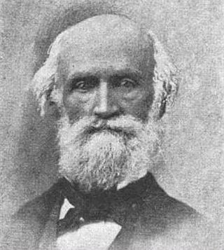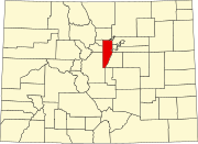
Golden is a home rule city that is the county seat of Jefferson County, Colorado, United States. The city population was 20,399 at the 2020 United States Census. Golden lies along Clear Creek at the base of the Front Range of the Rocky Mountains. Founded during the Pike's Peak Gold Rush on June 16, 1859, the mining camp was originally named Golden City in honor of Thomas L. Golden. Golden City served as the capital of the provisional Territory of Jefferson from 1860 to 1861, and capital of the official Territory of Colorado from 1862 to 1867. In 1867, the territorial capital was moved about 12 miles (19 km) east to Denver City. Golden is now a part of the Denver–Aurora–Lakewood, CO Metropolitan Statistical Area and the Front Range Urban Corridor.

Jefferson County is a county located in the U.S. state of Colorado. As of the 2020 census, the population was 582,910, making it the fourth-most populous county in Colorado. The county seat is Golden, and the most populous city is Lakewood.

Gilpin County is a county located in the U.S. state of Colorado, smallest in land area behind only the City and County of Broomfield. As of the 2020 census, the population was 5,808. The county seat is Central City. The county was formed in 1861, while Colorado was still a territory, and was named after Colonel William Gilpin, the first territorial governor.

Broomfield is a consolidated city and county located in the U.S. state of Colorado. It has a consolidated government which operates under Article XX, Sections 10–13 of the Constitution of the State of Colorado. Broomfield's population was 74,112 at the 2020 United States census, making it the 15th most populous municipality and the 12th most populous county in Colorado. Broomfield is a part of the Denver–Aurora–Lakewood, CO Metropolitan Statistical Area and the Front Range urban corridor.

Morrison is a home rule municipality in Jefferson County, Colorado, United States. The population was 396 at the 2020 census.

The Provisional Government of the Territory of Jefferson was an extralegal and unrecognized United States territory that existed in the Pike's Peak mining region from October 24, 1859, until it yielded to the new Territory of Colorado on June 6, 1861. The Jefferson Territory, named for Founding Father and third United States president Thomas Jefferson, included land officially part of the Kansas Territory, the Nebraska Territory, the New Mexico Territory, the Utah Territory, and the Washington Territory, but the region was remote from the governments of those five territories.

There are more than 1,500 properties and historic districts in the U.S. State of Colorado listed on the National Register of Historic Places. They are distributed over 63 of Colorado's 64 counties; only the City and County of Broomfield currently has none.

Buffalo Creek is an unincorporated community and U.S. Post Office in Jefferson County, Colorado, United States. The ZIP Code of the Buffalo Creek Post Office is 80425.

Robert Williamson Steele was governor of the extralegal Territory of Jefferson, which existed in the western United States from 1859 to 1861, when it was replaced by the Territory of Colorado.
Jefferson County was a county of the extralegal United States Territory of Jefferson that existed from November 28, 1859, until February 28, 1861. Its territory covered a broad swath surrounding the region of the Pike's Peak Gold Rush, and was a functioning democratically elected government until the organization of the Territory of Colorado in 1861. At that time, the successor Jefferson County was permanently created, taking its name from its predecessor and incorporating the heart of its territory.

Old Colorado City, formerly Colorado City, was once a town, but it is now a neighborhood within the city of Colorado Springs, Colorado. Its commercial district was listed on the National Register of Historic Places in 1982. It was founded during the Pikes Peak Gold Rush of 1859 and was involved in the mining industry, both as a supply hub and as a gold ore processing center beginning in the 1890s. Residents of Colorado City worked at some of the 50 coal mines of the Colorado Springs area. It was briefly the capital of the Colorado Territory. For many years, Colorado Springs prohibited the use of alcohol within its border due to the lifestyle of Colorado City's opium dens, bordellos, and saloons. It is now a tourist area, with boutiques, art galleries, and restaurants.

The Lariat Loop National Scenic and Historic Byway is a National Scenic Byway and a Colorado Scenic and Historic Byway located in Jefferson County, Colorado, USA. The byway is a 40-mile (64 km) loop in the Front Range foothills west of Denver through Golden, Lookout Mountain Park, Genesee Park, Evergreen, Morrison, Red Rocks Park, and Dinosaur Ridge. The Lariat Loop connects to the Mount Blue Sky Scenic Byway at Bergen Park.
Arapahoe was one of the first settlements in what is now the U.S. state of Colorado. Nothing remains of the now deserted ghost town in Jefferson County, except a historical marker on the south side of 44th Avenue, between the cities of Golden and Wheat Ridge.

This is an alphabetical list of articles related to the U.S. State of Colorado.

The following outline is provided as an overview of and topical guide to the U.S. state of Colorado:

Salina is a former mining town in Boulder County, Colorado, United States, approximately 7 miles (11 km) west of Boulder. Established in 1874, after Colorado's first gold discovery in 1859, Salina was founded by miners who migrated to Boulder from Salina, Kansas. It is located at the junction of Four Mile Canyon and Gold Run roads. The mining camp was originally accessible only by horseback or wagons pulled by mules but later became part of Colorado's Switzerland Trail when the Greeley, Salt Lake, & Pacific narrow gauge railroad was built in the early 1880s. Today, most of Salina's original structures still stand, including the one-room schoolhouse, Salina School, and church, the Little Church in the Pines, despite some impact from the Fourmile Canyon wildfire in 2010 and historic flooding during the 2013 Colorado floods.
Fort Namaqua, some of its other names are Mariano's Crossing and Namaqua Station, was a trading post from 1858 or 1859. It was located in the present-day city of Loveland, Colorado in Larimer County, Colorado. In 1862, it became a stage station for travelers along the foothills to Denver. A fort was built at the site after 60 horses were driven off the property. Medina also developed a small settlement with people from his hometown of Taos, New Mexico. The site was named Namaqua in 1868, with the establishment of a post office. Buildings were used until the 1920s and were later dismantled. A historical marker is located at Namaqua Park, near the site of the former fort and station. A copper sculpture honors Mariano Medina at the site of the Mariano Medina Family Cemetery.


