Assam is a state in northeastern India, south of the eastern Himalayas along the Brahmaputra and Barak River valleys. Assam covers an area of 78,438 km2 (30,285 sq mi). It is the second largest state in northeastern India by area and the largest in terms of population. The state is bordered by Bhutan and Arunachal Pradesh to the north; Nagaland and Manipur to the east; Meghalaya, Tripura, Mizoram and Bangladesh to the south; and West Bengal to the west via the Siliguri Corridor, a 22-kilometre-wide (14 mi) strip of land that connects the state to the rest of India. Assamese and Boro are the official languages of Assam, while Bengali is an official language in the three districts of Barak Valley.

Ri Bhoi is an administrative district in the state of Meghalaya in India. The district headquarters are located at Nongpoh. The district occupies an area of 2378 km² and has a population of 258,840. As of 2011 it is the second least populous district of Meghalaya, after South Garo Hills.
Karbi Anglong district is one of the 34 administrative districts of Assam in India. Diphu is the administrative headquarter of the district. The district is administered by Karbi Anglong Autonomous Council according to the Sixth Schedule of the Constitution of India. A new district, West Karbi Anglong, was formed out of it in 2016.

Dima Hasao district, is an administrative district in the state of Assam, India. As of 2011, it is the least populous district of Assam.

Nagaon district is an administrative district in the Indian state of Assam. At the time of the 2011 census it was the most populous district in Assam, before Hojai district was split from it in 2016.
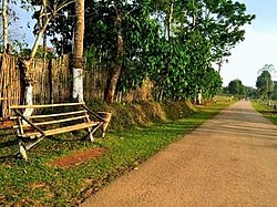
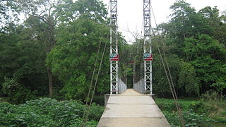
Diphu is the headquarter of Karbi Anglong district in the state of Assam in India. This small town is a popular tourist hill station for people of nearby cities.

The Karbis or Mikir are one of the major ethnic community in Northeast India. They are mostly concentrated in the hill districts of Karbi Anglong and West Karbi Anglong of Assam.

Nagaon is a town and a municipal board in Nagaon district in the Indian state of Assam. It is situated 122.6 kilometres (76 mi) east of Guwahati.

The Dimasa people are an ethnolinguistic community presently inhabiting in Assam and Nagaland states in Northeastern India. They speak Dimasa, a Tibeto-Burman language. This community is fairly homogeneous and exclusive, with members required to draw from both parents' separate clans. Dimasa kingdom, one of many early states in Assam following the downfall of Kamarupa kingdom, was established by these people. The Dimasas were till recently agricultural, centering on shifting agriculture; but in recent times this has changed with profound changes in the community. Following political problems in the 18th century, the Dimasa ruler moved further south in the plains of Cachar and there took place a division among them–with the hills Dimasa maintaining their traditional living and political exclusiveness, the plains Dimasas have made no attempt to assert themselves.

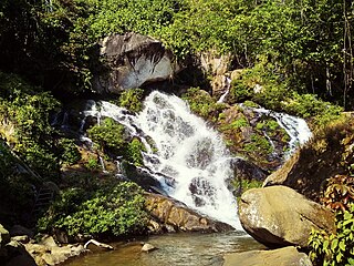
Bokakhat is a town in Assam and a Municipality Board in Golaghat district in the state of Assam, India. It is about 23 km away from the world heritage site Kaziranga National Park. Bokakhat town is situated almost in the middle of Assam. It is the headquarters of Bokakhat subdivision. The town is base to many nearby tourist places and is well connected to other cities and towns by road. The Kaipho Langso waterfall, an important picnic spot surrounded with magnificent views, lies in Karbi Anglong 13 km away from Bokakhat. Other nearby attractions include the ruins of the ancient Numaligarh and the Deoparbat, the tea gardens of Hatikhuli, Methoni, Diffloo Behora and Borsapori and also the coffee and rubber plantations. The nearest airports are at Jorhat and Guwahati. The nearest railway stations are Badulipar and Furkating.
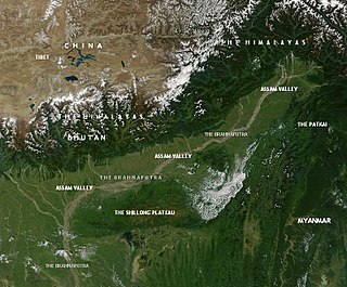
This article discusses the geological origin, geomorphic characteristics, and climate of the northeastern Indian state of Assam. Extending from 89° 42′ E to 96° E longitude and 24° 8′ N to 28° 2′ N latitude, it has an area of 78,438 km2, similar to that of Ireland or Austria.
Garampani Wildlife Sanctuary is a 6.05-square-kilometre (2.34 sq mi) wildlife sanctuary located in Karbi Anglong district, Assam, India. It was notified as a Wildlife Sanctuary in 1952 vide notification No, FR.199/52 dated 10/07/52.

The Tiwa people, are a Tibeto-Burmese ethnic group primarily inhabiting the Northeast Indian states of Assam, Meghalaya, Arunachal Pradesh, Manipur and Nagaland, and some parts of neighbouring Bangladesh and Myanmar.

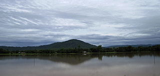
Kopili River is an interstate river in Northeast India that flows through the states of Meghalaya and Assam and is the largest south bank tributary of the Brahmaputra in Assam.
Assam – 16th largest, 15th most populous and 26th most literate state of the 28 states of the democratic Republic of India. Assam is at 14th position in life expectancy and 8th in female-to-male sex ratio. Assam is the 21st most media exposed states in India. The Economy of Assam is largely agriculture based with 69% of the population engaged in it. Growth rate of Assam's income has not kept pace with that of India's during the Post-British Era; differences increased rapidly since the 1970s. While the Indian economy grew at 6 percent per annum over the period of 1981 to 2000, the same of Assam's grew only by 3.3 percent.

The West Karbi Anglong district is a district formed out of the existing Donka circle of Karbi Anglong district of Assam in 2016. Hamren is the headquarter of the newly formed district. The district is part of Karbi Anglong Autonomous Council and administered according to the provisions of the Sixth Schedule of the Indian Constitution.

Karbi Anglong Autonomous Council (KAAC) is an autonomous district council in the state of Assam, India for development and protection of tribals living in area namely Karbi Anglong and West Karbi Anglong district. The council is constituted under the Sixth Schedule of the Constitution of India and administratively functions under the Government of Assam. It was formed with the name Karbi Anglong District Council on 17 November 1951. Later changed to Karbi Anglong Autonomous Council on 23 June 1952, which is now celebrated as its foundation day. After Signing of M.O.U. between Government of India, Government of Assam and United People's Democratic Solidarity, it was renamed to Karbi Anglong Autonomous Territorial Council. It has administrative functions over two district, Karbi Anglong district and West Karbi Anglong district. Its headquarters is in Diphu, Karbi Anglong district. The total area of the Karbi Anglong Autonomous Council is 10,434 sq. km having a population of 961,275 as of 2011.
Umswai is a village in Amri development block of West Karbi Anglong district in the Indian state of Assam. Apart from being home to an exclusive tribal culture, Umswai also possesses extraordinary natural beauty. Previously it was known as Lalung Hills/Tiwa Hills during Tiwa Gobha Raja's period.
Bormarjong is a village in the West Karbi Anglong district of Assam State in North East India. It falls under the Amri Development Block and Vidhan Sabha No. 20 Baithalangso ST LAC.