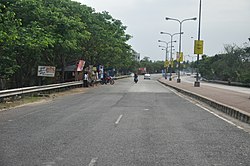
Durganagar, Kolkata

Last updated

Durganagar
Neighbourhood in North Dumdum
Belghoria Expressway - Kolkata 2012-04-11 9435.JPG
West Bengal location map.svg
Red pog.svg
Durganagar
Location in West Bengal, India
India location map 3.png
Red pog.svg
Durganagar
Durganagar (India)
Coordinates: 22°39′10″N88°25′11″E / 22.65266°N 88.4197°E / 22.65266; 88.4197
CountryFlag of India.svg India
State West Bengal
District North 24 Parganas
Region Greater Kolkata
Metro Station
Railway Station Durganagar
Government
  Type Municipality
  Body North Dumdum Municipality and Dumdum Municipality
Languages
  Official Bengali, English
Time zone UTC+5:30 (IST)
PIN
700065, 700079, 700081
Telephone code+91 33
Vehicle registration WB
Lok Sabha constituency Dum Dum
Vidhan Sabha constituency Dum Dum Uttar
Website north24parganas.gov.in

Durganagar is a locality in North Dumdum of
North 24 Parganas district in the Indian state of West Bengal. [1] It is a part of the area covered by Kolkata Metropolitan Development Authority (KMDA). [2] Durganagar was named after the Mother Goddess Durga. [3]

Contents

Geography

It is flanked by Birati and Nimta areas in the north, Netaji Subhash Chandra Bose International Airport in the east, area of Belgharia and adjoining areas of Dakshineswar in the west and the posh areas of Dum Dum Cantonment and Dum Dum Cantonment metro station in the south. [4]

Durganagar (West) has been a part of the North Dum Dum Municipality since 2000 and Durganagar (East) belongs to the Dum Dum Municipality. [5] [6] Previously it was known as Sultanpur. Durganagar area is situated in the northern suburbs of the Kolkata Metropolitan Area. [7] It is about 6.2 km from Dakshineswar Kali Temple and 1 km west of Netaji Subhas Chandra Bose International Airport.

Police station

Nimta and Dum Dum police stations under the Barrackpore Police Commissionerate have jurisdiction over North Dumdum and Dum Dum Municipal areas respectively. [8] [9]

Post office

Durganagar has a non-delivery sub post office, with PIN 700065 in the Kolkata North Division of Kolkata district in Calcutta region. [10]

Transport

Durganagar has good transportation facilities. Belghoria Expressway (locally known as Delhi Road) passes through Durganagar. [11] It is very close to the Dumdum/Kolkata Airport.

Durganagar railway station on the Sealdah-Bangaon line is the nearest railway station. [12]

Dum Dum Cantonment metro station and Biman Bandar metro station of line 4 of Kolkata Metro are the nearest metro stations. It is expected to begin its services in Durga Puja 2024. [13]

Bus

Buses ply along Belghoria Expressway are:

Private Bus

WBTC Bus

Many unnumbered shuttle buses also pass through Durganagar along Belghoria Expressway.

Education

Prominent schools in Durganagar and surrounding areas are as follows:

Culture

Durganagar streets during Durga Puja Durganagar, North Dumdum.jpg
Durganagar streets during Durga Puja

Kolkata’s reverence and love for Goddess Durga are known facts. This reverence yet again takes centerstage as the locality is popularly known to be named after the goddess herself. Durga Puja in Durganagar has been organised by various local clubs such as Durganagar Sporting Club, Alok Sangha Club, Badra Agragami Club, Durganagar Bandhu Milan Sangha, Durganagar Aikatan Club and others. [21]

Sri Jagannath Radha Madanmohan Temple, ISKCON Durganagar ISKCON Durganagar.jpg
Sri Jagannath Radha Madanmohan Temple, ISKCON Durganagar

Sri Jagannath Radha Madanmohan Temple has been established by ISKCON at Durganagar near Belghoria Expressway or Delhi Road. Every year religious procession has been organised here during Ratha Yatra with great enthusiasm. Hindus celebrate a lot of festivals and follow a lot of traditions and rituals throughout the year. One among all the Hindu festivals is the Krishna Janmashtami, this festival has been celebrated at Sri Jagannath Radha Madanmohan Temple by ISKCON with a lot of devotion. [22] [23]

Notable residents

Bhaskar Ganguly Bhaskar Ganguly.jpg
Bhaskar Ganguly

Demographics

Kolkata Urban Agglomeration

The following Municipalities, Census Towns and other locations in Barrackpore subdivision were part of Kolkata Urban Agglomeration in the 2011 census: Kanchrapara (M), Jetia (CT), Halisahar (M), Balibhara (CT), Naihati (M), Bhatpara (M), Kaugachhi (CT), Garshyamnagar (CT), Garulia (M), Ichhapur Defence Estate (CT), North Barrackpur (M), Barrackpur Cantonment (CB), Barrackpore (M), Jafarpur (CT), Ruiya (CT), Titagarh (M), Khardaha (M), Bandipur (CT), Panihati (M), Muragachha (CT) New Barrackpore (M), Chandpur (CT), Talbandha (CT), Patulia (CT), Kamarhati (M), Baranagar (M), South Dumdum (M), North Dumdum (M), Dum Dum (M), Noapara (CT), Babanpur (CT), Teghari (CT), Nanna (OG), Chakla (OG), Srotribati (OG) and Panpur (OG). [26]

Related Research Articles

<span class="mw-page-title-main">Dum Dum</span> City in West Bengal, India

Dum Dum is a city and a municipality in the Kolkata Metropolitan Area of North 24 Parganas district in the Indian state of West Bengal. It is a part of the area covered by Kolkata Metropolitan Development Authority (KMDA). The Netaji Subhas Chandra Bose International Airport, also known as Kolkata Airport, is situated at Dum Dum.

<span class="mw-page-title-main">Dakshineswar</span> Neighbourhood in North 24 Parganas, West Bengal, India

Dakshineswar is a neighbourhood in Kolkata Metropolitan Area of North 24 Parganas district under the jurisdiction of Kolkata Metropolitan Development Authority (KMDA). This place is historically famous for Dakshineswar Kali Temple, locally known as Maa Bhabatarini Mandir.

<span class="mw-page-title-main">Sodepur</span> Neighbourhood in Greater Kolkata, West Bengal, India

Sodepur or Sodpur is a locality in Panihati Municipality of North 24 Parganas district in the Indian state of West Bengal. It is close to Kolkata and also a part of the area covered by Kolkata Metropolitan Development Authority (KMDA). Barrackpore, Kamarhati, Dumdum, Agarpara, and Belghoria are all close by. It is a centre for rising residential construction. GM Meena Icon, Peerless Nagar, Merlin Maximus, Godrej Prakriti, and NPR Gitanjali Apartments are a few notable residential developments in the neighbourhood.

<span class="mw-page-title-main">Kamarhati</span> City in West Bengal, India

Kamarhati is a city and a municipality of North 24 Parganas district in the Indian state of West Bengal. It is a part of the area covered by Kolkata Metropolitan Development Authority (KMDA).

<span class="mw-page-title-main">Birati</span> Neighbourhood in North Dumdum in West Bengal, Eastern Zone, India

Birati is a neighbourhood in North Dumdum of North 24 Parganas district in the state of West Bengal, India. It is a part of the area covered by Kolkata Metropolitan Development Authority (KMDA). The area is close to the Netaji Subhash Chandra Bose International Airport, Kolkata.

<span class="mw-page-title-main">Barrackpur Cantonment</span> Town in West Bengal, India

Barrackpur Cantonment is a Town and a Cantonment Board in North Suburban Kolkata of North 24 Parganas district in the Indian state of West Bengal. It also a part of the area covered by Kolkata Metropolitan Development Authority (KMDA).

<span class="mw-page-title-main">Kanchrapara</span> City in West Bengal, India

Kanchrapara is a city and a municipality of North 24 Parganas district in the Indian state of West Bengal.

New Barrackpore is a city and a municipality in North 24 Parganas district in the Indian state of West Bengal. It is a part of the area covered by Kolkata Metropolitan Development Authority (KMDA).

<span class="mw-page-title-main">North Dum Dum</span> City in West Bengal, India

North Dum Dum is a city and a municipality of North 24 Parganas district in the Indian state of West Bengal. It is a part of the area covered by Kolkata Metropolitan Development Authority (KMDA).

<span class="mw-page-title-main">South Dum Dum</span> City in West Bengal, India

South Dum Dum is a city and a municipality in the Kolkata Metropolitan Area of North 24 Parganas district in the Indian state of West Bengal. It is a part of the area covered by Kolkata Metropolitan Development Authority (KMDA).

<span class="mw-page-title-main">Titagarh</span> City in West Bengal, India

Titagarh is a city and a municipality of North 24 Parganas district in the Indian state of West Bengal. It is close to Kolkata and also a part of the area covered by Kolkata Metropolitan Development Authority (KMDA).

<span class="mw-page-title-main">Belgharia</span> Neighbourhood in West Bengal, India

Belgharia is a locality in Kamarhati Municipality of North 24 Parganas district in the Indian state of West Bengal. It is a part of the area covered by Kolkata Metropolitan Development Authority (KMDA) and a vital locality in Greater Kolkata. Dakshineswar Kali Temple is approximately 3 km from Belgharia railway station. The Vivekananda Setu on the Hooghly River is one of the oldest bridges in Kolkata established for the connection between the city of Howrah and Kolkata is also at the adjacent area of Belgharia.

Ghola is a locality in Panihati Municipality of North 24 Parganas district in the Indian state of West Bengal. It is close to Kolkata and also a part of the area covered by Kolkata Metropolitan Development Authority (KMDA).

<span class="mw-page-title-main">Belghoria Expressway</span> Road in Kolkata, India

Belghoria Expressway is a four-lane 16 kilometres (9.9 mi) long grade separated tolled expressway in the North Suburban fringes of Kolkata, West Bengal. It is a key arterial road, linking the terminal junction points of NH 16 and NH 19 at Rajchandrapur to Dakshineswar across Nivedita Setu and then to NH 12 at Dumdum/Kolkata Airport.

<span class="mw-page-title-main">Noapara, Baranagar</span> Neighbourhood in Baranagar of North 24 Parganas district, West Bengal, India

Noapara is a locality in Baranagar of North 24 Parganas district in the Indian state of West Bengal. It is a part of the area covered by Kolkata Metropolitan Development Authority (KMDA).

<span class="mw-page-title-main">Bangur Avenue</span> Neighbourhood in South Dum Dum in North 24 Parganas, West Bengal, India

Bangur Avenue is a locality in South Dumdum of North 24 Parganas district in the Indian state of West Bengal. It is a part of the area covered by Kolkata Metropolitan Development Authority (KMDA).

<span class="mw-page-title-main">Nagerbazar</span> Neighbourhood in South Dum Dum in North 24 Parganas, West Bengal, India

Nagerbazar is a neighbourhood in South Dumdum of North 24 Parganas district in the Indian state of West Bengal. It is a part of the area covered by Kolkata Metropolitan Development Authority (KMDA). One of the coveted neighbourhoods of the metropolis, it has a police station.

Agarpara is a Town in Panihati Municipality of North 24 Parganas district in the Indian state of West Bengal. It is close to Kolkata and also a part of the area covered by Kolkata Metropolitan Development Authority (KMDA).

<span class="mw-page-title-main">Nimta</span> Census town in North Dumdum in West Bengal, India

Nimta is a Census Town in North Dumdum Municipality of Barrackpore II CD block in the Barrackpore subdivision of North 24 Parganas district in the Indian state of West Bengal. It is a part of the area covered by Kolkata Metropolitan Development Authority (KMDA).

<span class="mw-page-title-main">Dum Dum Park</span> Neighbourhood in South Dum Dum in North 24 Parganas, West Bengal, India

Dum Dum Park is a locality in South Dumdum of North 24 Parganas district in the Indian state of West Bengal. It is a part of area covered by Kolkata Metropolitan Development Authority (KMDA). Dum Dum Park is a planned area with straight and wide roads, multiple water tanks have become a coveted neighbourhood in Greater Kolkata.
In recent years, the multiple high budget theme Durga Puja of Kolkata draw several visitors to the area during the Durga Puja.

References

  1. "Durganagar, Kolkata". squareyards. Retrieved 20 September 2024.
  2. "Kolkata Metropolitan Development Authority". KMDA. Retrieved 20 September 2024.
  3. "Do you know these Indian destinations are named after Goddess Durga and her various avatars". timetravel. Retrieved 20 September 2024.
  4. Google maps
  5. "North Dum Dum Municipality". NDDM. Retrieved 12 September 2024.
  6. "Dum Dum Municipality". DDM. Retrieved 18 September 2024.
  7. "Kolkata Metropolitan Area Map". KMDA. Retrieved 20 September 2024.
  8. "District Statistical Handbook". North 24 Parganas 2013, Table 2.1. Department of Statistics and Programme Implementation, Government of West Bengal. Retrieved 11 June 2018.
  9. "Barrackpore Police Commissionerate". List of Police Stations with telephone numbers. West Bengal Police. Archived from the original on 12 June 2018. Retrieved 11 June 2018.
  10. "Durganagar sub post office". postoffices.co.in. Retrieved 18 September 2024.
  11. "A cattle track that poses as expressway". The Times of India. Retrieved 12 September 2024.
  12. "DGNR/Durganagar". India Rail Info. Retrieved 12 September 2024.
  13. "Fingers crossed: Kolkata may get Metro airport connect by puja". The Times of India. Retrieved 20 September 2024.
  14. "Durganagar High School" . Retrieved 12 September 2024.
  15. "Durganagar Nepal Chandra Vidyapith High School" . Retrieved 12 September 2024.
  16. "Khalishakota Adarsha Vidyalaya for Girls' (H.S)" . Retrieved 12 September 2024.
  17. "Swarnamayee Smriti Vidyalaya High School" . Retrieved 12 September 2024.
  18. "Uttar Rabindranagar Vivekananda High School" . Retrieved 20 September 2024.
  19. "Nalta Mahajati High School for Girls" . Retrieved 12 September 2024.
  20. "Nalta Mahajati High School for Boys" . Retrieved 12 September 2024.
  21. "Durganagar Sporting Club" . Retrieved 22 September 2024.
  22. "ISKCON Durganagar Sri Jagannath Radha Madanmohan Temple" . Retrieved 22 September 2024.
  23. "ISKCON Dum Dum" . Retrieved 22 September 2024.
  24. "All time Indian XI". Sportskeeda. 23 November 2016. Retrieved 18 September 2024.
  25. "No mechanism for nurturing talent". The Sunday Guardian. 19 September 2015. Retrieved 18 September 2024.
  26. "Provisional Population Totals, Census of India 2011" (PDF). Constituents of Urban Agglomeration Having Population Above 1 Lakh. Census of India 2011. Retrieved 18 September 2024.