East Pasadena (ⓘ ) is an unincorporated community and census designated place (CDP) in Los Angeles County, California, United States. The population was 6,021 at the 2020 census, down from 6,144 at the 2010 census. For statistical purposes, the United States Census Bureau has defined East Pasadena as a census-designated place (CDP).
The land area of East Pasadena is separated into two non-contiguous segments:
The community has become considerably smaller as the city of Pasadena has expanded its boundaries to include more of the unincorporated area of East Pasadena. [2]
According to the United States Census Bureau, the CDP has a total area of 1.3 square miles (3.4 km2), all land. The definition of the area was created by the Census Bureau for statistical purposes and may not precisely correspond to local understanding of the area with the same name.
Much of the Chapman Woods development is located in unincorporated East Pasadena, though portions are in the City of Pasadena. Chapman Woods is bordered by Del Mar Boulevard to the north, Huntington Drive to the south, the Eaton Wash to the west, and Highway 19 (Rosemead Boulevard) to the east. Chapman Woods is named after Alfred Chapman who purchased the surrounding land and built his home on the corner of present-day California Boulevard and Ivydale Court. [3] All entrances into the neighborhood are marked with signs that say "Chapman Woods".
There is heavy commercial development on Foothill Boulevard, Colorado Boulevard, and Highway 19. The central feature of the neighborhood is Willard Elementary School and Wilson Middle School, which face each other across Madre Street.
Census | Pop. | Note | %± |
---|---|---|---|
1990 | 5,910 | — | |
2000 | 6,045 | 2.3% | |
2010 | 6,144 | 1.6% | |
2020 | 6,021 | −2.0% | |
U.S. Decennial Census [4] 1850–1870 [5] [6] 1880-1890 [7] 1900 [8] 1910 [9] 1920 [10] 1930 [11] 1940 [12] 1950 [13] 1960 [14] 1970 [15] 1980 [16] 1990 [17] 2000 [18] 2010 [19] 2020 [20] |
East Pasadena first appeared as a census designated place in the 1990 U.S. Census [17] part of the Pasadena Census Community Division (CCD). [17]
Race / Ethnicity (NH = Non-Hispanic) | Pop 2000 [21] | Pop 2010 [22] | Pop 2020 [20] | % 2000 | % 2010 | % 2020 |
---|---|---|---|---|---|---|
White alone (NH) | 2,302 | 2,082 | 1,502 | 38.08% | 33.89% | 24.95% |
Black or African American alone (NH) | 144 | 153 | 159 | 2.38% | 2.49% | 2.64% |
Native American or Alaska Native alone (NH) | 20 | 19 | 7 | 0.33% | 0.31% | 0.12% |
Asian alone (NH) | 1,207 | 1,575 | 1,928 | 19.97% | 25.63% | 32.02% |
Native Hawaiian or Pacific Islander alone (NH) | 3 | 2 | 12 | 0.05% | 0.03% | 0.20% |
Other race alone (NH) | 6 | 14 | 38 | 0.10% | 0.23% | 0.63% |
Mixed race or Multiracial (NH) | 233 | 160 | 201 | 3.85% | 2.60% | 3.34% |
Hispanic or Latino (any race) | 2,130 | 2,139 | 2,174 | 35.24% | 34.81% | 36.11% |
Total | 6,045 | 6,144 | 6,021 | 100.00% | 100.00% | 100.00% |
At the 2010 census East Pasadena had a population of 6,144. The population density was 4,645.1 inhabitants per square mile (1,793.5/km2). The racial makeup of East Pasadena was 3,183 (51.8%) White (33.9% Non-Hispanic White), [23] 183 (3.0%) African American, 47 (0.8%) Native American, 1,589 (25.9%) Asian, 7 (0.1%) Pacific Islander, 857 (13.9%) from other races, and 278 (4.5%) from two or more races. Hispanic or Latino of any race were 2,139 persons (34.8%). [24]
The census reported that 6,119 people (99.6% of the population) lived in households, 7 (0.1%) lived in non-institutionalized group quarters, and 18 (0.3%) were institutionalized.
There were 2,096 households, 704 (33.6%) had children under the age of 18 living in them, 1,158 (55.2%) were opposite-sex married couples living together, 241 (11.5%) had a female householder with no husband present, 115 (5.5%) had a male householder with no wife present. There were 98 (4.7%) unmarried opposite-sex partnerships, and 14 (0.7%) same-sex married couples or partnerships. 441 households (21.0%) were one person and 178 (8.5%) had someone living alone who was 65 or older. The average household size was 2.92. There were 1,514 families (72.2% of households); the average family size was 3.37.
The age distribution was 1,303 people (21.2%) under the age of 18, 510 people (8.3%) aged 18 to 24, 1,645 people (26.8%) aged 25 to 44, 1,729 people (28.1%) aged 45 to 64, and 957 people (15.6%) who were 65 or older. The median age was 40.5 years. For every 100 females, there were 97.3 males. For every 100 females age 18 and over, there were 96.0 males.
There were 2,184 housing units at an average density of 1,651.2 per square mile, of the occupied units 1,435 (68.5%) were owner-occupied and 661 (31.5%) were rented. The homeowner vacancy rate was 1.3%; the rental vacancy rate was 2.4%. 4,286 people (69.8% of the population) lived in owner-occupied housing units and 1,833 people (29.8%) lived in rental housing units.
According to the 2010 United States Census, East Pasadena had a median household income of $71,151, with 16.0% of the population living below the federal poverty line. [23]
At the 2000 census there were 6,045 people, 2,038 households, and 1,502 families in the CDP. The population density was 4,586.6 inhabitants per square mile (1,770.9/km2). There were 2,124 housing units at an average density of 1,611.6 per square mile (622.2/km2). The racial makeup of the CDP was 55.70% White, 2.55% Black or African American, 0.79% Native American, 20.03% Asian, 0.05% Pacific Islander, 14.43% from other races, and 6.45% from two or more races. 35.24% of the population were Hispanic or Latino of any race. [25] Of the 2,038 households 34.6% had children under the age of 18 living with them, 58.0% were married couples living together, 10.7% had a female householder with no husband present, and 26.3% were non-families. 21.3% of households were one person and 7.6% were one person aged 65 or older. The average household size was 2.95 and the average family size was 3.43.
The age distribution was 24.6% under the age of 18, 8.4% from 18 to 24, 29.6% from 25 to 44, 23.8% from 45 to 64, and 13.6% 65 or older. The median age was 37 years. For every 100 females, there were 94.6 males. For every 100 females age 18 and over, there were 91.2 males.
The median household income was $53,378 and the median family income was $61,531. Males had a median income of $50,208 versus $35,104 for females. The per capita income for the CDP was $34,548. About 6.1% of families and 9.4% of the population were below the poverty line, including 12.6% of those under age 18 and 4.0% of those age 65 or over.
Feral peafowl are common in East Pasadena, Arcadia, San Marino and other west San Gabriel Valley communities. [26] In 2021, the Los Angeles County Board of Supervisors moved to ban the feeding of peafowl due to the increasing population in recent decades. [27] The municipal codes of the cities of Pasadena and Arcadia already prohibit feeding peafowl. [28]
The Los Angeles County Sheriff's Department (LASD) operates the Temple Station in Temple City, serving East Pasadena. [29]
In the state legislature East Pasadena is located in the 25th Senate District, represented by Democrat Anthony Portantino and in the 41st Assembly District, represented by Democrat Chris Holden. Federally, East Pasadena is located in California's California's 27th congressional district and is represented by Democrat Judy Chu.
East Pasadena is served by the San Marino Unified School District serving the southwest portion and Pasadena Unified School District serving the Rosemead Boulevard corridor.
The Metro A Line has a station on Sierra Madre Villa Avenue and Foothill Boulevard. The neighborhood overall is served by Metro Local lines 266 and 267; Pasadena Transit routes 31, 32, 40 and 60; and Foothill Transit Route 187.
A fictionalized City of "East Pasadena" is depicted in the TV series Law & Order: LA . [30]
Ashland is a census-designated place (CDP) and unincorporated community in Alameda County, California, United States. The population was 23,823 at the 2020 census. Ashland is located between the city of San Leandro to the north, the unincorporated community of Cherryland to the south, the unincorporated community of Castro Valley to the east, and the unincorporated community of San Lorenzo to the southwest.
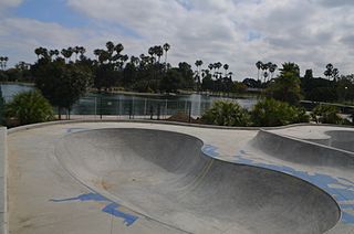
Alondra Park, also known as El Camino Village, is an unincorporated community and census designated place (CDP) in the South Bay region of Los Angeles County, California, United States. It is the unincorporated area north of Alondra Community Regional Park and El Camino College. It is east of Lawndale, south of Hawthorne, west of Gardena, and north of Torrance. Manhattan Beach Boulevard and Crenshaw Boulevard are the two major cross streets in the area. The population was 8,569 at the 2020 census, down from 8,592 at the 2010 census. There is an official Alondra Park Post Office of the U.S. Postal Service in nearby Gardena, California. Urbanized cement-lined Dominguez Creek bisects a portion of Alondra Park.
Altadena is an unincorporated area and census-designated place in the San Gabriel Valley and the Verdugos regions of Los Angeles County, California. Directly north of the city of Pasadena, California, it is approximately 14 miles (23 km) from downtown Los Angeles. The population was 42,777 at the 2010 census, up from 42,610 at the 2000 census.
Citrus is a census-designated place (CDP) in Los Angeles County, California, United States. It is located in the San Gabriel Valley between Azusa to the north and west, Glendora to the east, and Covina to the south.
Del Aire is a census-designated place (CDP) in the inland South Bay, Los Angeles County, California, United States, between El Segundo and Hawthorne. The population was 10,001 at the 2010 census, up from 9,012 at the 2000 census.
Desert View Highlands is a census-designated place (CDP) in Los Angeles County, California, United States. The population was 2,360 at the 2010 census, up from 2,337 at the 2000 census. It is surrounded by the City of Palmdale.
East Rancho Dominguez, also known as East Compton, is an unincorporated community and census-designated place (CDP) located in southern Los Angeles County, California. The population was 15,135 at the 2010 census, up from 9,286 at the 2000 census. East Rancho Dominguez is an accepted city name according to the USPS, and shares the 90221 ZIP Code with Compton.
East Whittier is an unincorporated community in Los Angeles County, California, United States. The population was 9,757 at the 2010 census, up from 9,538 at the 2000 census. For statistical purposes, the United States Census Bureau has defined this community as a census-designated place (CDP). The name was changed from East La Mirada in 2012, likely due to its precise location in relation to the city of Whittier.
East San Gabriel is an unincorporated community and census-designated place (CDP) in Los Angeles County, California, United States. The population was 14,874 at the 2010 census, up from 14,512 at the 2000 census.
Ladera Heights is a community and unincorporated area in Los Angeles County, California. The population was 6,634 at the 2020 census. Culver City lies to its west, the Baldwin Hills neighborhood to its north, the View Park-Windsor Hills community to its east, the Westchester neighborhood to its south and southwest and the city of Inglewood to its southeast. With an average household income of $132,824, Ladera Heights ranks third amongst the ten wealthiest majority-Black communities in the United States.
West Athens is a census-designated place (CDP) in Los Angeles County, California. The population was 9,393 at the 2020 census. It is an unincorporated community within the 2nd Supervisorial District of Los Angeles County. West Athens is served by the Los Angeles County Sheriff's Department, operating out of the South Los Angeles Station. The approximate boundaries for West Athens are: 87th Street to the north, Vermont Avenue to the east, El Segundo Boulevard to the south, and approximately Western Avenue to Van Ness Avenue to the west. West Athens is predominantly residential, with commercial uses along its main corridors. Los Angeles Southwest Community College lies within the West Athens neighborhood and city limits.
West Carson is an unincorporated community in the South Bay region of Los Angeles County, California. The population was 22,870 at the 2020 census. For statistical purposes, the United States Census Bureau has defined West Carson as a census-designated place (CDP).
West Rancho Dominguez, formerly known as West Compton and also known as East Gardena, is an unincorporated census-designated place (CDP) located in southern Los Angeles County, California. Per the 2020 census, the population was 24,347. The community lies to the west of the city of Compton. The ZIP Codes encompassing the CDP area are 90220 & 90248.
Westmont is an unincorporated community in Los Angeles County, California, a part of the South Los Angeles area, just east of Inglewood. The population was 33,913 at the 2020 census, up from 31,853 at the 2010 census. For statistical purposes, the United States Census Bureau has defined Westmont as a census-designated place (CDP).
North Tustin is an unincorporated community and census designated place (CDP) in Orange County, California. The population was 25,718 at the 2020 census, up from 24,917 in 2010. For statistical purposes, the United States Census Bureau has defined North Tustin as a census-designated place (CDP). It is both the largest CDP and largest unincorporated community in Orange County. The CDP's name was changed from Tustin Foothills in 2005. Located outside the city limits of Tustin, North Tustin has 92705 and 92780 ZIP Codes.
Camp Pendleton Mainside is a census-designated place (CDP) in San Diego County, California, located at the southeast corner of Marine Corps Base Camp Pendleton. Per the 2020 census, the population was 9,683. It was formerly known as Camp Pendleton North, but its name was changed for the 2020 Census. Along with Camp Pendleton South, it is one of two CDPs located on the base.
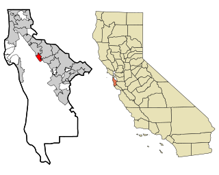
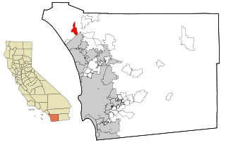
Highlands-Baywood Park is an unincorporated community and former census designated place (CDP) in San Mateo County, California, United States. The population was 4,027 at the 2010 census.
La Crescenta-Montrose is an unincorporated area in Los Angeles County, California, United States. The community is bordered by Glendale to the south and west, La Cañada Flintridge to the east, and Angeles National Forest to the north. According to the United States Census Bureau, the La Crescenta-Montrose Census-Designated Place (CDP) measures about 3.4 square miles (8.8 km2), and the population was 19,997 at the 2020 census, up from 19,653 in 2010 and 18,532 in 2000.
Malaga is a census-designated place in Fresno County, California. It is located 6 miles (9.7 km) south-southeast of downtown Fresno, at an elevation of 295 feet. As of the 2020 census, Malaga had a population of 884.
San Pasqual is an unincorporated community and census-designated place (CDP) in Los Angeles County, California. It lies between San Marino and Pasadena. The major streets in San Pasqual are San Pasqual Street, South Sierra Madre Blvd., and Oakdale Street. San Pasqual is served by the Pasadena post office responsible for ZIP code 91107, and thus locations there are properly addressed with the final line reading "Pasadena, CA 91107". The population was 2,041 at the 2010 census.