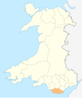
Leckwith
| |
---|---|
The Green, Leckwith | |
Location within the Vale of Glamorgan | |
Principal area | |
Preserved county | |
Country | Wales |
Sovereign state | United Kingdom |
Post town | CARDIFF |
Postcode district | CF11 |
Dialling code | +44-29 |
Police | South Wales |
Fire | South Wales |
Ambulance | Welsh |
UK Parliament | |
Senedd Cymru – Welsh Parliament | |
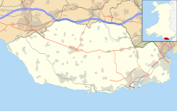
Leckwith (Welsh : Lecwydd) is a small village in the Vale of Glamorgan, just west of Cardiff. Historically, the parish of Leckwith also included land on the east side of the river Ely that is now part of Cardiff itself. This area is also commonly known as Leckwith.
The name Leckwith is an anglicisation of the Welsh Lecwydd, with the common replacement of Welsh <-dd> by English <-th> (as in Gruffudd>Griffith). Lecwydd probably derives from the personal name Helygwydd (possibly the name of a local holy man or Welsh saint). The change from <-gw-> to <-cw-> may be compared to that in the personal name Tecwyn (<Tegwyn). [1]
Since at least the nineteenth century Lecwydd sometimes appears in Welsh as Llechwydd or Llechwedd. These forms have been linked to the common Welsh noun llechwedd (hillside, slope), which has been taken to refer to Leckwith Woods, which rise up steeply from the river Ely. [2] Linguistically, however, there is no relationship between Lecwydd and llechwedd, and the connection is probably a result of folk etymology. This explanation of the name Lecwydd is still sometimes seen, however. [3]
The old stone triple-arched Leckwith Bridge crosses the River Ely to the east. It is Grade II* listed [4] and dates from before 1536. [5] The historic church of St. James, rebuilt in the nineteenth century, like several others around Cardiff, was abandoned and fell into ruin in the second half of the twentieth century.
Leckwith is part of the Michaelston-le-Pit and Leckwith community together with the neighbouring village of Michaelston-le-Pit. The two villages elect a community council. [6]
The Vale of Glamorgan, locally referred to as The Vale, is a county borough in the south-east of Wales. It borders Bridgend County Borough to the west, Cardiff to the east, Rhondda Cynon Taf to the north, and the Bristol Channel to the south. With an economy based largely on agriculture and chemicals, it is the southernmost unitary authority in Wales. Attractions include Barry Island Pleasure Park, the Barry Tourist Railway, Medieval wall paintings in St Cadoc's Church, Llancarfan, Porthkerry Park, St Donat's Castle, Cosmeston Lakes Country Park and Cosmeston Medieval Village. The largest town is Barry. Other towns include Penarth, Llantwit Major, and Cowbridge. There are many villages in the county borough.
St Fagans is a village and community in the west of the city of Cardiff, capital of Wales. It is home to the St Fagans National History Museum.
Peterston-super-Ely is a village and community situated on the River Ely in the county borough of the Vale of Glamorgan, Wales. The community population at the 2011 census was 874. The community includes the hamlet of Gwern-y-Steeple.
Canton is an inner-city district and community in the west of Cardiff, capital of Wales, lying 2 miles (3.2 km) west of the city's civic centre. It is located adjacent to Pontcanna. Canton is one of the most ethnically diverse of Cardiff's suburbs, with a significant Pakistani and Indian population. The total population of Canton increased to 14,304 at the 2011 census. It is also the most Welsh-speaking district of central Cardiff, with 19.1% of the population speaking Welsh.
Dinas Powys is a small town and community in the Vale of Glamorgan, South Wales. Its name means "fort of the provincial place" and refers to the Iron Age hillfort which overlooks the village. Dinas Powys is 5.6 miles (9.0 km) south-west of the centre of Cardiff and is situated on the A4055 road from Cardiff to Barry, making it a popular dormitory village for city commuters. It neighbours the larger town of Penarth.
Culverhouse Cross is a district straddling the boundary between Cardiff and the Vale of Glamorgan, Wales, in the community of Wenvoe.
Michaelston-y-Fedw is a small rural village and community to the west of the city of Newport, Wales, on the borders of Cardiff city and Caerphilly county boroughs. The population in 2011 was 296.
St Andrews Major is a village and parish in the community of Dinas Powys in the Vale of Glamorgan, between Barry and Cardiff in south-eastern Wales.
The A4232, which is also known either as the Peripheral Distributor Road (PDR) (Welsh: Ffordd Ddosbarthu Ymylol) or the Cardiff Link Road (Welsh: Ffordd Gyswllt Caerdydd), is a distributor road in Cardiff, the capital of Wales.
Cardiff International Sports Campus, is an athletics stadium and playing fields in the Canton area of Cardiff, Wales.
The River Ely is in South Wales flowing generally southeast, from Tonyrefail to Cardiff.
Michaelston-le-Pit is a village in the Vale of Glamorgan, just to the west of the city of Cardiff, Wales. It is part of the Michaelston-le-Pit and Leckwith community. The community population taken at the 2011 census was 309.
There are around 1,000 listed buildings in Cardiff, the capital city of Wales. A listed building is one considered to be of special architectural, historical or cultural significance, which is protected from being demolished, extended or altered, unless special permission is granted by the relevant planning authorities. The Welsh Government makes decisions on individual cases, taking advice from the heritage agency Cadw, the Royal Commission on the Ancient and Historical Monuments of Wales and local councils.
Pwll-coch is an area part of the district of Canton in Cardiff, Wales. It was formerly a separate hamlet in the parish of Llandaff near Cardiff. It was located on the junction of Windway Road and the main road from Cardiff to Ely, a short distance from Ely Bridge.
Leckwith Bridge, can refer to the medieval Grade II* listed stone bridge over the river Ely at Leckwith, Cardiff, or its 20th century replacement.
Leckwith is an area in the west of Cardiff that includes parts of the communities of Canton and Grangetown.
St Georges super Ely, also known as St Georges, is a small village and community in the western outskirts of Cardiff, in the Vale of Glamorgan, South Wales. Lying to the northwest of Culverhouse Cross, between Peterston-super-Ely and Michaelston-super-Ely, it contains a medieval church and ruined manor house dated to the fifteenth century. The community includes the settlements of St Brides-super-Ely, Drope, Downs and Sant-y-Nyll.
St Michael's Church is a Grade I listed church in Michaelston-le-Pit, in the Vale of Glamorgan, south Wales. It became a Grade I listed building on 28 January 1963. The church was probably built by the Reigny family; earliest records of it date to the Taxation of Norwich in 1254, where it was referred to as St Michael de Renny and was valued at four marks. The parish at one time consisted of the Manor of Michaelston-le-Pit and the church was an advowson included with the manor in the 15th and 17th centuries. By 1563, a cleric was in residence.
Michaelston-le-Pit and Leckwith is a community in the Vale of Glamorgan, Wales. It is located immediately southwest of the city of Cardiff and to the north of the Vale of Glamorgan villages of Llandough and Dinas Powys. As its name suggests, the community includes the small villages of Michaelston-le-Pit and Leckwith. The community population comprises only just under 250 adults.