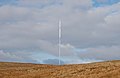
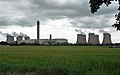
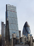
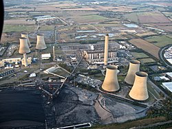
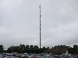
List of tallest structures in the United Kingdom

Last updated

This list contains all types of structures 150 metres (490 ft) in height or more, which is the accepted criterion for a building to qualify as a skyscraper in the United Kingdom.

Contents

Entries in italics denote approximate figures.

Structures taller than 300 metres

NamePinnacle heightImageYearPrimary useTownConstruction typeCoordinatesRemarks
Skelton Mast 365 m
(1,198 ft)
Skelton Transmitter - geograph.org.uk - 1520742.jpg 2001 communication Skelton, Cumbria guyed steel lattice mast 54°43′54.5″N2°52′58.9″W / 54.731806°N 2.883028°W / 54.731806; -2.883028 (Skelton Radio Mast) Insulated against ground.
Belmont Mast 351.65 m
(1,153.7 ft)
Belmont - geograph.org.uk - 619487.jpg 1965communication Donington on Bain, Lincolnshire guyed tubular steel mast 53°20′9.07″N0°10′19.11″W / 53.3358528°N 0.1719750°W / 53.3358528; -0.1719750 (Belmont TV Mast) Originally 1,265 ft (386 m), modified height of 1,272 ft (388 m) was the tallest construction in the EU, and tallest tubular steel mast in the world.
New Caldbeck Mast 337.2 m
(1,106 ft)
2008communication Caldbeck, Cumbriaguyed steel lattice mast 54°46′24″N3°5′26″W / 54.77333°N 3.09056°W / 54.77333; -3.09056 (Caldbeck TV Mast) Replaced the original Caldbeck mast, which was dismantled in 2008.
Emley Moor Tower 330.5 m
(1,084 ft)
EmleyMoorMastSpring2006.jpg 1970communication Huddersfield, West Yorkshire concrete tower 53°36′43.4″N1°39′51.89″W / 53.612056°N 1.6644139°W / 53.612056; -1.6644139 (Emley Moor TV Tower) Tallest freestanding structure in UK. Original 137 m (449 ft) tower built in 1956, replaced 1964. Second 385 m (1,263 ft) guyed tubular mast was built 1964 to replace the tower, but collapsed in 1969 due to icing and strong winds.
Durris Mast 322.6 m
(1,058 ft)
1961communicationDurris, Aberdeenshire guyed steel lattice mast 57°0′0″N2°23′24″W / 57.00000°N 2.39000°W / 57.00000; -2.39000 (Durris TV Mast) Tallest structure in Scotland.
Arfon Mast 317.4 m
(1,041 ft)
1962communication Penygroes, Gwynedd guyed steel lattice mast 53°1′11.77″N4°16′24.61″W / 53.0199361°N 4.2735028°W / 53.0199361; -4.2735028 (Arfon TV Mast) Tallest structure in Wales.
Emley Moor Temporary Broadcasting Mast 317 m
(1,040 ft)
2018communication Huddersfield, West Yorkshire guyed lattice steel mast 53°36′39.87″N1°39′56.28″W / 53.6110750°N 1.6656333°W / 53.6110750; -1.6656333 (Emley Moor Temporary Broadcasting Mast) Temporary mast, used for transmitting at Emley Moor during renovation of antenna system.
Winter Hill Mast 309.5 m
(1,015 ft)
Winterhillmast.jpg 1965communication Bolton, Greater Manchester guyed tubular steel mast 53°37′32.14″N2°30′53.25″W / 53.6255944°N 2.5147917°W / 53.6255944; -2.5147917 (Winter Hill TV Mast) Original 137 m (449 ft) tower built in 1956, replaced in 1964. DTT mast raised height to 315.4 m (1,035 ft), but was removed after digital switchover.
Waltham Mast 315 m
(1,033 ft)
1968communication Melton Mowbray, Leicestershire guyed tubular steel mast 52°48′5.18″N0°48′3.04″W / 52.8014389°N 0.8008444°W / 52.8014389; -0.8008444 (Waltham TV Mast) Original mast built in 1966, collapsed before completion later that year. Replaced by a new mast with the same height.
The Shard 309.6 m
(1,016 ft)
Shard London Bridge May 2012.JPG 2012various Southwark, London skyscraper 51°30′16.2″N0°05′11.4″W / 51.504500°N 0.086500°W / 51.504500; -0.086500 (Shard) Tallest building in Western Europe (Was the tallest building in the EU until Britain's departure on 31 January 2020).
Black Hill Mast 306.6 m
(1,006 ft)
1961communication Salsburgh, North Lanarkshire guyed steel lattice mast 55°51′42.53″N3°52′20.85″W / 55.8618139°N 3.8724583°W / 55.8618139; -3.8724583 (Black Hill TV Mast) Original 228 m (748 ft) mast built in 1957, replaced in 1961.
Bilsdale Mast 311.5 m
(1,022 ft)
Bilsdale telecommunications mast.png 2023communication Bilsdale, North Yorkshire guyed steel lattice mast 54°21′29″N1°08′52″W / 54.35806°N 1.14778°W / 54.35806; -1.14778 (Bilsdale TV Mast) Original 314 m (1,030 ft) mast built in 1969, burnt down in 2021, replaced in 2023.
Strabane Mast 309.9 m
(1,017 ft)
1963communication Strabane, County Tyrone guyed steel lattice mast 54°47′58″N7°23′19″W / 54.79944°N 7.38861°W / 54.79944; -7.38861 (Strabane TV Mast) Tallest structure in Ireland.
Mendlesham Mast 305.6 m
(1,003 ft)
1959communication Mendlesham, Suffolk guyed steel lattice mast 52°14′4.36″N1°6′26.39″E / 52.2345444°N 1.1073306°E / 52.2345444; 1.1073306 (Mendlesham TV Mast) Tallest television mast in Europe at time of construction.
Lichfield Mast 305.2 m
(1,001 ft)
1961communication Tamworth, Staffordshire guyed steel lattice mast 52°38′11.83″N1°45′32.37″W / 52.6366194°N 1.7589917°W / 52.6366194; -1.7589917 (Lichfield TV Mast) Original 137 m (449 ft) tower built in 1956, replaced in 1961.
Mendip Mast 305.0 m
(1,000.7 ft)
1967communication St Cuthbert Out, Somerset guyed tubular steel mast 51°14′13.45″N2°37′31.32″W / 51.2370694°N 2.6253667°W / 51.2370694; -2.6253667 (Mendip TV Mast)

Structures 250 to 300 metres tall

NamePinnacle heightImageYearPrimary UseTownConstruction TypeCoordinatesRemarks
22 Bishopsgate 278 m
(912 ft)
22BishopsgateDec19.png 2019office City of London Skyscraper 51.5145°N

0.0829°W

Tallest building in the City of London.
Crimond Royal Naval Wireless Telegraphy Station, Large Mast274.3 m
(900 ft)
Crimondairfield.jpg  ?communication Crimond, Aberdeenshireguyed steel lattice mast 57°37′2.88″N1°53′15.42″W / 57.6174667°N 1.8876167°W / 57.6174667; -1.8876167 (Crimond Royal Naval Wireless Telegraphy Station, Large Mast)
Sutton Coldfield Mast 270.5 m
(887 ft)
1983communication Birmingham, West Midlands guyed steel lattice mast 52°36′2.17″N1°50′1.94″W / 52.6006028°N 1.8338722°W / 52.6006028; -1.8338722 (Sutton Coldfield TV Mast) Original mast built 1949, replaced 1983.
Wenvoe Mast 265 m
(869 ft)
1985communication Vale of Glamorgan guyed steel lattice mast 51°27′33.68″N3°16′53.53″W / 51.4593556°N 3.2815361°W / 51.4593556; -3.2815361 (Wenvoe TV Mast) Original mast built in 1952, replaced in 1985. Extended by 23 m (75 ft) with new antenna system in 2008.
Drax Power Station 259 m
(850 ft)
Power station, Drax (2) - geograph.org.uk - 2714432.jpg 1969 [1] chimney Selby, North Yorkshireconcrete tower 53°44′13.77″N0°59′56.5″W / 53.7371583°N 0.999028°W / 53.7371583; -0.999028 (Drax Power Station chimney) Tallest chimney in UK. [2]
Rugby VLF Mast 250 m
(820 ft)
1925communication Rugby, Warwickshire guyed steel lattice mast 52°22′26.89″N1°11′17.35″W / 52.3741361°N 1.1881528°W / 52.3741361; -1.1881528 (Rugby VLF Mast) ; 52°22′16.24″N1°11′5.63″W / 52.3711778°N 1.1848972°W / 52.3711778; -1.1848972 (Rugby VLF Mast (destroyed)) ;

52°22′3.25″N1°11′7.76″W / 52.3675694°N 1.1854889°W / 52.3675694; -1.1854889 (Rugby VLF Mast (destroyed)) ; 52°21′57.93″N1°11′27.41″W / 52.3660917°N 1.1909472°W / 52.3660917; -1.1909472 (Rugby VLF Mast (destroyed)) ; 52°22′5.69″N1°11′44.59″W / 52.3682472°N 1.1957194°W / 52.3682472; -1.1957194 (Rugby VLF Mast (destroyed)) ; 52°22′16.46″N1°11′56.81″W / 52.3712389°N 1.1991139°W / 52.3712389; -1.1991139 (Rugby VLF Mast (destroyed)) ; 52°21′44.9″N1°11′29.75″W / 52.362472°N 1.1915972°W / 52.362472; -1.1915972 (Rugby VLF Mast (destroyed)) ; 52°21′33.04″N1°11′21.23″W / 52.3591778°N 1.1892306°W / 52.3591778; -1.1892306 (Rugby VLF Mast (destroyed)) ; 52°21′25.34″N1°11′4.1″W / 52.3570389°N 1.184472°W / 52.3570389; -1.184472 (Rugby VLF Mast (destroyed)) ; 52°21′55.43″N1°10′50.84″W / 52.3653972°N 1.1807889°W / 52.3653972; -1.1807889 (Rugby VLF Mast (destroyed)) ; 52°21′43.51″N1°10′42.34″W / 52.3620861°N 1.1784278°W / 52.3620861; -1.1784278 (Rugby VLF Mast (destroyed)) ; 52°21′30.57″N1°10′44.64″W / 52.3584917°N 1.1790667°W / 52.3584917; -1.1790667 (Rugby VLF Mast (destroyed))

12 guyed masts insulated against ground, demolished in June 2004 and August 2007.

Structures 200 to 250 metres tall

NamePinnacle heightImageYearPrimary UseTownConstruction TypeCoordinatesRemarks
Grain Power Station 244 m (801 ft) Grain Power Station - geograph.org.uk - 1354932.jpg 1979 [3] chimney Isle of Grain, Kent concrete tower 51°26′46.84″N0°42′42.2″E / 51.4463444°N 0.711722°E / 51.4463444; 0.711722 (Grain Power Station Chimney) Demolished on 7 September 2016. [4]
Mounteagle Mast 243.8 m (800 ft)1961communication Fortrose, Ross-shire guyed steel lattice mast 57°35′30″N4°16′36″W / 57.59167°N 4.27667°W / 57.59167; -4.27667 (Mounteagle TV Mast)
Dover Mast 243.2 m (798 ft)1960communication Dover, Kentguyed steel lattice mast 51°6′42.11″N1°14′50.83″E / 51.1116972°N 1.2474528°E / 51.1116972; 1.2474528 (Dover TV Mast)
Landmark Pinnacle 239 m (784 ft) Canary Wharf and Isle of Dogs 22.12.2019 (ammended).png 2020Residential Isle of Dogs skyscraper 51° 30′ 9.6″ N,

0° 1′ 31.5″ W

Sandy Heath Mast 240.8 m (790 ft) Sandy Heath transmitter 900H L5.jpg 1965communication Sandy, Bedfordshire guyed steel lattice mast 52°7′48.67″N0°14′29.09″W / 52.1301861°N 0.2414139°W / 52.1301861; -0.2414139 (Sandy Heath TV Mast)
Selkirk Mast 238.8 m (783 ft)1961communication Selkirk, Scottish Bordersguyed steel lattice mast 55°33′21.08″N2°47′35.61″W / 55.5558556°N 2.7932250°W / 55.5558556; -2.7932250 (Selkirk TV Mast)
Caradon Hill Mast 237.7 m (780 ft) Caradon Hill, Cornwall-9077.jpg 1961communication Liskeard, Cornwall guyed steel lattice mast 50°30′41″N4°26′12.3″W / 50.51139°N 4.436750°W / 50.51139; -4.436750 (Caradon Hill TV Mast)
Inverkip Power Station 236 m (774 ft) Inverkip Power Station - geograph.org.uk - 32497.jpg 1976 [5] chimney Wemyss Bay, Inverclyde concrete tower 55°53′58.16″N4°53′12.84″W / 55.8994889°N 4.8869000°W / 55.8994889; -4.8869000 (Inverkip Power Station Chimney) Former tallest free-standing structure in Scotland; demolished on 28 July 2013 with explosives. [6]
Preseli Mast 235.4 m (772 ft) Preseli TV-Transmitter - geograph.org.uk - 310144.jpg 1962communication Crymych, Pembrokeshire guyed steel lattice mast 51°56′39.69″N4°39′39.61″W / 51.9443583°N 4.6610028°W / 51.9443583; -4.6610028 (Preseli TV Mast)
One Canada Square 235.1 m (771 ft) London MMB S6 Canary Wharf.jpg 1991 office Canary Wharf, Londonskyscraper 51°30′18.33″N0°1′10.41″W / 51.5050917°N 0.0195583°W / 51.5050917; -0.0195583 (One Canada Square)
Stockland Hill Mast 235.0 m (771.0 ft) Stockland Hill Transmitter.jpg 1961communication Honiton, Devon guyed steel lattice mast 50°48′25.81″N3°6′17.81″W / 50.8071694°N 3.1049472°W / 50.8071694; -3.1049472 (Stockland Hill TV Mast)
Moel-y-Parc Mast 230 m (750 ft) Moel y Parc transmitter 1000W L5.jpg 1963communication Caerwys, Flintshire guyed steel lattice mast 53°13′15.8″N3°18′51.86″W / 53.221056°N 3.3144056°W / 53.221056; -3.3144056 (Moel-y-Parc TV Mast)
Heron Tower 230 m (750 ft) Heron Tower, Bishopsgate, London.JPG 2010office City of London skyscraper 51°30′58.0″N0°4′51.0″W / 51.516111°N 0.080833°W / 51.516111; -0.080833 (Heron Tower)
Angus Mast 229.5 m (753 ft) Angus Transmitting Station seen from Dundee.jpg 1965communication Angus guyed steel lattice mast 56°33′18.3″N2°59′9.47″W / 56.555083°N 2.9859639°W / 56.555083; -2.9859639 (Angus TV Mast)
Rumster Forest Mast 229.2 m (752 ft)1965communication Wick, Caithness guyed steel lattice mast 58°19′40.98″N3°22′17.05″W / 58.3280500°N 3.3714028°W / 58.3280500; -3.3714028 (Rumster Forest TV Mast)
Ashkirk Mast229.1 m (752 ft) The Ashkirk Transmitter Mast - geograph.org.uk - 1372684.jpg 1963communicationSelkirk, Scottish Bordersguyed steel lattice mast 55°30′38.52″N2°50′26.39″W / 55.5107000°N 2.8406639°W / 55.5107000; -2.8406639 (Ashkirk TV Mast)
Chillerton Down Mast 228.9 m (751 ft) Chillerton Down.2.jpg 1958communication Newport, Isle of Wight guyed steel lattice mast 50°38′57.36″N1°19′43.94″W / 50.6492667°N 1.3288722°W / 50.6492667; -1.3288722 (Chillerton Down TV Mast)
Black Mountain Mast 228.6 m (750 ft)1959communication Belfast, Northern Ireland guyed steel lattice mast 54°35′13.39″N6°1′19.48″W / 54.5870528°N 6.0220778°W / 54.5870528; -6.0220778 (Black Mountain TV Mast)
Burnhope Mast 228.6 m (750 ft) Burnhope from Springwell Farm (2nd Octiber 2018).jpg 1958communication Burnhope, County Durham guyed steel lattice mast 54°49′18.8″N1°42′53.3″W / 54.821889°N 1.714806°W / 54.821889; -1.714806 (Burnhope TV Mast)
St. Hilary Mast 227.1 m (745 ft) St Hilary Transmission Mast - geograph.org.uk - 1236014.jpg 1957communication Cowbridge, Vale of Glamorganguyed steel lattice mast 51°27′26.8″N3°24′10.6″W / 51.457444°N 3.402944°W / 51.457444; -3.402944 (St. Hilary TV Mast)
Anthorn Radio Station 227 m (745 ft) Anthorn array.jpg 1964communication Anthorn, Cumbriaguyed steel lattice mast 54°54′41.93″N3°16′43.47″W / 54.9116472°N 3.2787417°W / 54.9116472; -3.2787417 (Anthorn transmitter, Central Mast)  ; 54°54′53.26″N3°16′33.22″W / 54.9147944°N 3.2758944°W / 54.9147944; -3.2758944 (Anthorn transmitter, Inner Ring Mast 1)  ; 54°54′42.97″N3°16′20.76″W / 54.9119361°N 3.2724333°W / 54.9119361; -3.2724333 (Anthorn transmitter, Inner Ring Mast 2)  ; 54°54′31.56″N3°16′30.01″W / 54.9087667°N 3.2750028°W / 54.9087667; -3.2750028 (Anthorn transmitter, Inner Ring Mast 3)  ; 54°54′30.49″N3°16′51.78″W / 54.9084694°N 3.2810500°W / 54.9084694; -3.2810500 (Anthorn transmitter, Inner Ring Mast 4)  ; 54°54′40.83″N3°17′4.25″W / 54.9113417°N 3.2845139°W / 54.9113417; -3.2845139 (Anthorn transmitter, Inner Ring Mast 5)  ; 54°54′52.21″N3°16′54.98″W / 54.9145028°N 3.2819389°W / 54.9145028; -3.2819389 (Anthorn transmitter, Inner Ring Mast 6)  ; 54°55′2.99″N3°16′45.62″W / 54.9174972°N 3.2793389°W / 54.9174972; -3.2793389 (Anthorn transmitter, Outer Ring Mast 1)  ; 54°54′53.99″N3°16′12.34″W / 54.9149972°N 3.2700944°W / 54.9149972; -3.2700944 (Anthorn transmitter, Outer Ring Mast 2)  ; 54°54′32.9″N3°16′9.23″W / 54.909139°N 3.2692306°W / 54.909139; -3.2692306 (Anthorn transmitter, Outer Ring Mast 3)  ; 54°54′20.82″N3°16′39.35″W / 54.9057833°N 3.2775972°W / 54.9057833; -3.2775972 (Anthorn transmitter, Outer Ring Mast 4)  ; 54°54′29.83″N3°17′12.68″W / 54.9082861°N 3.2868556°W / 54.9082861; -3.2868556 (Anthorn transmitter, Outer Ring Mast 5)  ; 54°54′50.92″N3°17′15.88″W / 54.9141444°N 3.2877444°W / 54.9141444; -3.2877444 (Anthorn transmitter, Outer Ring Mast 6)
Holme Moss Mast 225 m (738 ft) Holme Moss Transmitter - geograph.org.uk - 378182.jpg 1984communication Holmfirth, West Yorkshireguyed steel lattice mast 53°31′59.88″N1°51′29″W / 53.5333000°N 1.85806°W / 53.5333000; -1.85806 (Holme Moss TV Mast) Original 229 m (750 ft) mast built 1951, replaced.
Leadenhall Building 225 m (738 ft) Cheesegrater and Gherkin.jpg 2014officeCity of Londonskyscraper 51°30′49.68″N0°4′55.56″W / 51.5138000°N 0.0821000°W / 51.5138000; -0.0821000 (122 Leadenhall Street)
Crystal Palace Tower 219 m (719 ft) Cp mast.jpg 1950communication Norwood, Londonlattice tower 51°25′27.05″N0°4′29.88″W / 51.4241806°N 0.0749667°W / 51.4241806; -0.0749667 (Crystal Palace Tower)
Pembroke Power Station 217.3 m (713 ft) Pembroke Power Station-Geograph-3601523-by-David-Medcalf.jpg 1968 [7] chimney Pembroke, Pembrokeshireconcrete tower 51°41′8″N4°59′21.17″W / 51.68556°N 4.9892139°W / 51.68556; -4.9892139 (Pembroke Power Station Chimney) Demolished on 25 November 2000. [8]
Littlebrook "D" Power Station 215 m (705 ft) Dartford - Littlebrook Power Station - geograph.org.uk - 724919.jpg 1981 [9] chimney Dartford, Kentconcrete tower 51°28′0.8″N0°14′31.03″E / 51.466889°N 0.2419528°E / 51.466889; 0.2419528 (Littlebrook Power Station Chimney) Demolished with explosives on 15 December 2019. [10]
Droitwich Mast 1 213.4 m (700 ft) Droitwichtransmitter.jpg 1934communication Droitwich, Worcestershire guyed steel lattice mast 52°17′46.9″N2°6′24.32″W / 52.296361°N 2.1067556°W / 52.296361; -2.1067556 (Droitwich Mast 1) Consists of two masts of the same height. Broadcasts Radio 4 LW on 198 kHz.
Droitwich Mast 2 213.4 m (700 ft) Droitwichtransmitter.jpg 1934communicationDroitwich, Worcestershireguyed steel lattice mast 52°17′40.4″N2°6′20.62″W / 52.294556°N 2.1057278°W / 52.294556; -2.1057278 (Droitwich Mast 2)
Queensferry Crossing 207 m (679 ft) Queensferry Crossing view01 2017-03-16.jpg 2017 bridge Lothian and Fife cable-stayed bridge concrete towers 56°00′17″N3°24′45″W / 56.0046°N 3.4124°W / 56.0046; -3.4124 (Queensferry Crossing)
Tacolneston Mast (replacement) 206.1 m (676 ft) Tacolneston TX mast.jpg 2009communication Tacolneston, Norfolkguyed steel lattice mast 52°31′4″N1°8′20″E / 52.51778°N 1.13889°E / 52.51778; 1.13889 (Tacolneston TV Mast) Built to replace the 165 m (541 ft) mast, ready for Digital Switchover in 2011. Mast construction started in September 2009, and took five weeks to build.
Ironbridge "B" Power Station 205 m (673 ft) Ironbridge Power Station from the bridge at Buildwas. - geograph.org.uk - 709763.jpg 1969 [11] chimney Telford, Shropshire concrete tower 52°37′47.6″N2°30′48″W / 52.629889°N 2.51333°W / 52.629889; -2.51333 (Ironbridge Power Station Chimney) Also known as Buildwas Power Station. Demolished on 3 September 2021. [12]
European Offshore Wind Deployment Centre 204 m (669 ft) European Offshore Wind Deployment Centre (from Newburgh beach).jpg 2018 wind farm Aberdeenshire (3 km offshore)11 x MHI Vestas Offshore V164-8.8 MW turbines [13] 57°13′N1°59′W / 57.217°N 1.983°W / 57.217; -1.983 (European Offshore Wind Deployment Centre)
Deansgate Square South Tower 201 m (659 ft) Deansgate Square - South Tower.jpg 2018residential Manchester, Greater Manchester skyscraper 53°28′18.8″N2°15′5.72″W / 53.471889°N 2.2515889°W / 53.471889; -2.2515889 (Deansgate Square South Tower) Tallest building in the UK outside of London.
Fiddlers Ferry Power Station 200 m (660 ft) Fiddlers Ferry Power Station From Marsh Lane.jpg 1971 [14] chimney Cuerdley, Cheshire concrete tower 53°22′22.2″N2°41′8.85″W / 53.372833°N 2.6857917°W / 53.372833; -2.6857917 (Fiddlers Ferry Power Station Chimney) Demolished on 3 December 2023. [15]
West Burton "A" Power Station 200 m (660 ft) View from Upper Ings Lane - geograph.org.uk - 285251.jpg 1966 [16] chimney West Burton, Nottinghamshire concrete tower 53°21′44.42″N0°48′47.09″W / 53.3623389°N 0.8130806°W / 53.3623389; -0.8130806 (West Burton Power Station Chimney)  ; 53°21′46.83″N0°48′38.83″W / 53.3630083°N 0.8107861°W / 53.3630083; -0.8107861 (West Burton Power Station Chimney) Twin chimneys. Original chimneys were demolished and replaced in 2003. [17] [18]
Eggborough Power Station 200 m (660 ft) Eggborough Power Station - geograph.org.uk - 349053.jpg 1966 [19] chimney Eggborough, North Yorkshireconcrete tower 53°42′42.4″N1°7′30.85″W / 53.711778°N 1.1252361°W / 53.711778; -1.1252361 (Eggborough Power Station Chimney) Demolished on 24 July 2022. [20]

Structures 150 to 200 metres tall

NamePinnacle heightImageYearPrimary UseTownConstruction TypeCoordinatesRemarks
Citigroup Centre 199.5 m (655 ft) 25CanadaSquare.jpg 2001officeCanary Wharf, Londonskyscraper 51°30′14.26″N0°1′4.37″W / 51.5039611°N 0.0178806°W / 51.5039611; -0.0178806 (Canary Wharf)
HSBC Tower 199.5 m (655 ft) HSBC Headquarters Canary Wharf.jpg 2002officeCanary Wharf, Londonskyscraper 51°30′19.5″N0°1′2.72″W / 51.505417°N 0.0174222°W / 51.505417; -0.0174222 (HSBC Tower)
Didcot "A" Power Station 199.5 m (655 ft) Didcot power station.jpg 1968 [21] chimney Didcot, Oxfordshire concrete tower 51°37′20.17″N1°15′39.02″W / 51.6222694°N 1.2608389°W / 51.6222694; -1.2608389 (Didcot A Power Station Chimney) Demolished on 9 February 2020. [22]
Ratcliffe-on-Soar Power Station 199 m (653 ft) View from Winking Hill - geograph.org.uk - 319133.jpg 1967 [23] chimney Kegworth, Nottinghamshireconcrete tower 52°52′1.11″N1°15′23.93″W / 52.8669750°N 1.2566472°W / 52.8669750; -1.2566472 (Ratcliffe-on-Soar Power Station Chimney)
Cottam Power Station 198 m (650 ft) Harvesting in the shadow of the power station - geograph.org.uk - 209223.jpg 1968 [24] chimney Retford, Nottinghamshireconcrete tower 53°18′17.2″N0°46′53.96″W / 53.304778°N 0.7816556°W / 53.304778; -0.7816556 (Cottam Power Station Chimney) Demolished in 2024.
Kilroot power station 198 m (650 ft) Kilroot power station, Carrickfergus - geograph.org.uk - 278551.jpg 1981 [25] chimney Carrickfergus, Northern Irelandconcrete tower 54°43′28.25″N5°46′2.15″W / 54.7245139°N 5.7672639°W / 54.7245139; -5.7672639 (Kilroot power station)
Fawley Power Station 198 m (650 ft) Fawley Power Station (3095052057).jpg 1969 [26] chimney Fawley, Hampshire concrete tower 50°49′3.66″N1°19′45.14″W / 50.8176833°N 1.3292056°W / 50.8176833; -1.3292056 (Fawley Power Station Chimney) Demolished on 31 October 2021. [27]
Ferrybridge "C" Power Station 198 m (650 ft) Ferrybridge 'C' Power Station - geograph.org.uk - 35089.jpg 1966 [28] chimney Ferrybridge, West Yorkshireconcrete tower 53°42′57.07″N1°16′47.78″W / 53.7158528°N 1.2799389°W / 53.7158528; -1.2799389 (Ferrybridge Power Station, Chimney1)  ; 53°42′55.45″N1°16′52.34″W / 53.7154028°N 1.2812056°W / 53.7154028; -1.2812056 (Ferrybridge Power Station, Chimney2) Twin chimneys. Demolished on 22 August 2021. [29]
Kingsnorth Power Station 198 m (650 ft) Kingsnorth power station.jpg 1970 [30] chimney Rochester, Kentconcrete tower 51°25′6.25″N0°36′13.79″E / 51.4184028°N 0.6038306°E / 51.4184028; 0.6038306 (Kingsnorth Power Station Chimney) Demolished on 22 March 2018. [31]
North Hessary Tor Mast 196.0 m (643.0 ft) North Hessary TV Mast, Princetown - geograph.org.uk - 58446.jpg 1955communication Princetown, Devonguyed steel lattice mast 50°33′0.84″N4°0′29.9″W / 50.5502333°N 4.008306°W / 50.5502333; -4.008306 (North Hessary Tor Mast)
Samsung Heavy Industries 7 MW wind turbine prototype196 m (643 ft)2014wind turbine Methil, Fife tower 56°10′26″N3°1′9″W / 56.17389°N 3.01917°W / 56.17389; -3.01917 (Samsung 7MW prototype Methil)
400 kV Thames Crossing 190 m (620 ft) Mudflats on the River Thames - geograph.org.uk - 1558096.jpg electricity pylon River Thames, Swanscombe lattice tower 51°28′3.73″N0°17′15.86″E / 51.4677028°N 0.2877389°E / 51.4677028; 0.2877389 (400 kV Thames Crossing, Tower North)  ; 51°27′43.77″N0°18′19.33″E / 51.4621583°N 0.3053694°E / 51.4621583; 0.3053694 (400 kV Thames Crossing, Tower South) Consists of two equal height pylons, one on either bank of the River Thames.
BT Tower 188.4 m (618 ft) BT Tower-1.jpg 1964communication Fitzrovia, Londonconcrete tower 51°31′17.4″N0°8′20.04″W / 51.521500°N 0.1389000°W / 51.521500; -0.1389000 (BT Tower London) Formerly known as the Post Office Tower and had a revolving restaurant at the top.
Rowridge transmitting station, new mast 187 m (614 ft) Rowridge from entrance gate 200704270010.jpg 2009communication Rowridge, Isle of Wightguyed steel lattice mast
Crimond Royal Naval Wireless Telegraphy Station, Mast Southwest183.2 m (601 ft) Crimondairfield.jpg  ?communication Crimond, Aberdeenshireguyed steel lattice mast 57°36′44.24″N1°53′36.62″W / 57.6122889°N 1.8935056°W / 57.6122889; -1.8935056 (Crimond Royal Naval Wireless Telegraphy Station, Mast Southwest)
Kirk o' Shotts Mast 183 m (600 ft) Kirk O'Shotts Transmitter - geograph.org.uk - 1241436.jpg 1952communication Salsburgh, North Lanarkshireguyed steel lattice mast 55°51′9.92″N3°49′33.81″W / 55.8527556°N 3.8260583°W / 55.8527556; -3.8260583 (Kirk o' Shotts Mast) Original height 228.6 metres (750 ft).
Masts of RNAS Inskip 183 m (600 ft) MOD antenna farm outside Inskip.jpg  ?communication Inskip, Lancashire guyed steel lattice mast 53°49′46.51″N2°49′48.65″W / 53.8295861°N 2.8301806°W / 53.8295861; -2.8301806 (RNAS Inskip, Mast 1)  ; 53°49′48.26″N2°50′3.37″W / 53.8300722°N 2.8342694°W / 53.8300722; -2.8342694 (RNAS Inskip, Mast 2)  ; 53°49′54.06″N2°50′14.65″W / 53.8316833°N 2.8374028°W / 53.8316833; -2.8374028 (RNAS Inskip, Mast 3)  ; 53°49′45.37″N2°50′17.54″W / 53.8292694°N 2.8382056°W / 53.8292694; -2.8382056 (RNAS Inskip, Mast 4)
Stirling Transmitting Station 183 m (600 ft)communication Stirling guyed mast 56°04′17.65″N4°03′37.41″W / 56.0715694°N 4.0603917°W / 56.0715694; -4.0603917 (Stirling Transmitting Station) Used for DECTRA-Navigation.
Kidsdale Transmitting Station 183 m (600 ft)communication Whithorn, Dumfries and Galloway guyed mast 54°42′1.66″N4°25′22.13″W / 54.7004611°N 4.4228139°W / 54.7004611; -4.4228139 (Kidsdale Transmitting Station ( demolished)) Used for DECTRA-Navigation, demolished [ when? ]
Tower 42 183 m (600 ft) Tower 42 looking north from Bishopsgate 2011-05-04.jpg 1980officeCity of Londonskyscraper 51°30′54.89″N0°5′1.79″W / 51.5152472°N 0.0838306°W / 51.5152472; -0.0838306 (Tower 42) Previously known as "The Nat West Tower".
Rugeley "B" Power Station 183 m (600 ft) Rugeley Power station - geograph.org.uk - 38807.jpg 1970chimney Rugeley, Staffordshireconcrete tower 52°45′29.79″N1°55′8.51″W / 52.7582750°N 1.9190306°W / 52.7582750; -1.9190306 (Rugeley Power Station Chimney) Original chimney was replaced in 2009. [32] Replacement chimney was later demolished on 24 January 2021. [33]
Longannet Power Station 183 m (600 ft) Longannet Power Station, 7 December 2011.jpg 1969 [34] chimney Longannet, Fifeconcrete tower 56°02′54.86″N3°40′57.24″W / 56.0485722°N 3.6825667°W / 56.0485722; -3.6825667 (Longannet Power Station Chimney) Demolished on 9 December 2021. [35]
Crimond Royal Naval Wireless Telegraphy Station, Mast Southeast182.88 m (600.0 ft) Crimondairfield.jpg  ?communication Crimond, Aberdeenshireguyed steel lattice mast 57°36′23.28″N1°52′49.48″W / 57.6064667°N 1.8804111°W / 57.6064667; -1.8804111 (Crimond Royal Naval Wireless Telegraphy Station, Mast Southeast)
30 St Mary Axe 179.8 m (590 ft) 30 St Mary Axe from Leadenhall Street.jpg 2004officeCity of Londonskyscraper 51°30′51.9″N0°4′49.21″W / 51.514417°N 0.0803361°W / 51.514417; -0.0803361 (30 St Mary Axe) Also known as "The Gherkin" and "Swiss Re Centre".
Wrotham Mast 176.6 m (579 ft)1981communication Wrotham, Kentguyed steel lattice mast 51°19′14.52″N0°17′15.87″E / 51.3207000°N 0.2877417°E / 51.3207000; 0.2877417 (Wrotham Mast) Carried first broadcasts of VHF FM radio in the UK. Replaced equal height mast on same site built in 1951.
Redruth Mast 173 m (568 ft) Four Lanes Transmitter (Redruth).jpg 1962communication Redruth, Cornwallguyed steel lattice mast 50°12′35.4″N5°14′18.33″W / 50.209833°N 5.2384250°W / 50.209833; -5.2384250 (Redruth Mast)
Rowridge Mast 172 m (564 ft) Rowridge from entrance gate 200704270010.jpg 2010communication Newport, Isle of Wightguyed steel lattice mast 50°40′35″N1°22′7″W / 50.67639°N 1.36861°W / 50.67639; -1.36861 (Rowridge Mast) Replacement to original 149.6 metres (491 ft) mast.
Peterhead Power Station 170.6 m (560 ft) Peterhead Power Station from Boddam.JPG 1980 [36] chimney Peterhead, Aberdeenshireconcrete tower 57°28′39.77″N1°47′24.81″W / 57.4777139°N 1.7902250°W / 57.4777139; -1.7902250 (Peterhead Power Station Chimney)
Spinnaker Tower 170 m (560 ft) Spinnaker Tower October 2016.jpg 2005 observation Portsmouth, Hampshireconcrete tower 50°47′44.22″N1°6′30.86″W / 50.7956167°N 1.1085722°W / 50.7956167; -1.1085722 (Spinnaker Tower) Tallest structure in UK open to public outside London (though not to its pinnacle).
Blyth B Power Station 170 m (560 ft) Blyth power station2.jpg 1962 [37] chimneys Blyth, Northumberland concrete tower 55°8′33″N1°31′39″W / 55.14250°N 1.52750°W / 55.14250; -1.52750 (Blyth B Power Station) Twin chimneys, demolished on 7 December 2003. [38]
Oxford Mast 169.0 m (554.5 ft) [39] 1968communication Oxford, Oxfordshire guyed steel lattice mast 51°47′26.28″N1°10′44.85″W / 51.7906333°N 1.1791250°W / 51.7906333; -1.1791250 (Oxford Mast)
Beetham Tower 168.9 m (554 ft) Beetham Tower from below.jpg 2006residential Manchester, Greater Manchester skyscraper 53°28′31.63″N2°15′0.79″W / 53.4754528°N 2.2502194°W / 53.4754528; -2.2502194 (Beetham Tower Manchester) Until 2018 the tallest building in the UK outside of London.
Also known as "Hilton Tower".
Tilbury "B" Power Station 168 m (551 ft) Tilbury power station.jpg 1968 [40] chimney Tilbury, Essex concrete towerTwin chimneys, demolished on 28 September 2017. [41]
Divis Mast B 165.8 m (544 ft) Divis Transmitting Station (geograph 5761963).jpg 2011communication Hannahstown, County Antrim guyed steel lattice mast 54°36′28.22″N6°00′28.41″W / 54.6078389°N 6.0078917°W / 54.6078389; -6.0078917 (Divis Mast B)
Broadgate Tower 165.0 m (541.3 ft) Broadgate Tower.jpg 2008officeCity of Londonskyscraper 51°31′15.84″N0°4′46.32″W / 51.5210667°N 0.0795333°W / 51.5210667; -0.0795333 (Broadgate Tower)
Tacolneston Mast 165.0 m (541.3 ft) Tacolneston TX mast.jpg 1956communication Norwich, Norfolkguyed steel lattice mast 52°31′3.89″N1°8′19.38″E / 52.5177472°N 1.1387167°E / 52.5177472; 1.1387167 (Tacolneston Mast) Replaced by 206.1 m (676 ft) mast in 2011.[ citation needed ]
Ridge Hill Mast 164.6 m (540 ft) Ridge Hill transmitter - geograph.org.uk - 450179.jpg 1968communication Ledbury, Herefordshire guyed steel lattice mast 51°59′50.89″N2°32′23.51″W / 51.9974694°N 2.5398639°W / 51.9974694; -2.5398639 (Ridge Hill Mast)
Huntshaw Cross Mast 163.7 m (537 ft) Buildings surrounding the base of the mast at Huntshaw Cross (geograph 4914925).jpg communication Great Torrington, Devonguyed steel lattice mast 50°58′45.48″N4°5′55.49″W / 50.9793000°N 4.0987472°W / 50.9793000; -4.0987472 (Huntshaw Cross Mast)
Sudbury "A" Mast 163 m (535 ft) [42] Sudbury Television Transmitter Masts - geograph.org.uk - 622342.jpg communication Sudbury, Suffolk guyed steel lattice mast 52°0′15.54″N0°47′9.08″E / 52.0043167°N 0.7858556°E / 52.0043167; 0.7858556 (Sudbury A Mast)
British Airways i360 162 m (531 ft) I360 - opening night.jpg 2016observation Brighton steel tower
Eitshal Mast 161.3 m (529 ft) The Track to Eitshal - geograph.org.uk - 1259500.jpg 1976communication Stornoway, Isle of Lewis guyed steel lattice mast 58°10′45.11″N6°35′6.52″W / 58.1791972°N 6.5851444°W / 58.1791972; -6.5851444 (Eitshal Mast)
Chatton Mast 161.0 m (528.2 ft) [43] Chatton transmitter - geograph.org.uk - 693281.jpg communication Alnwick, Northumberland guyed steel lattice mast 55°31′54.98″N1°50′3.01″W / 55.5319389°N 1.8341694°W / 55.5319389; -1.8341694 (Chatton Mast)
Aberthaw Power Station 160 m (520 ft) Aberthaw B Power Station from the foreshore, Oct 2017.jpg 1971 [44] chimney Gileston, Vale of Glamorganconcrete tower 51°23′34.32″N3°24′16.64″W / 51.3928667°N 3.4046222°W / 51.3928667; -3.4046222 (Aberthaw Power Station Chimney)
Blackpool Tower 158 m (518 ft) Blackpool Tower by night.jpg 1894observation Blackpool, Lancashire lattice tower 53°48′57.09″N3°3′18.44″W / 53.8158583°N 3.0551222°W / 53.8158583; -3.0551222 (Blackpool Tower)
Deansgate Square East Tower 158 m (518 ft) Deansgate Square 3.jpg 2019residential Manchester, Greater Manchester skyscraper
Moorside Edge
Mast 1
158 m (518 ft) Moorside Edge 598W L5.jpg 1982communicationHuddersfield, West Yorkshireguyed steel lattice mast 53°38′9.15″N1°53′41.67″W / 53.6358750°N 1.8949083°W / 53.6358750; -1.8949083 (Moorside Edge transmitting station, Mast 1) Consists of two masts of the same height.
Moorside Edge
Mast 2
158 m (518 ft) Moorside Edge 598W L5.jpg 1982communicationHuddersfield, West Yorkshireguyed steel lattice mast 53°38′5.39″N1°53′38.1″W / 53.6348306°N 1.893917°W / 53.6348306; -1.893917 (Moorside Edge transmitting station, Mast 2)
Forth Road Bridge 156 m (512 ft) ForthRoadBridgeFromNorth TakenByEuchiasmus.JPG 1964 bridge Firth of Forth, East Scotland steel tower 56°0′21.74″N3°24′14.33″W / 56.0060389°N 3.4039806°W / 56.0060389; -3.4039806 (Forth Road Bridge)  ; 55°59′48.91″N3°24′15.67″W / 55.9969194°N 3.4043528°W / 55.9969194; -3.4043528 (Forth Road Bridge)
One Churchill Place 156 m (512 ft) Barclays HQ.jpg 2004officeCanary Wharf, Londonskyscraper 51°30′18.47″N0°0′51.62″W / 51.5051306°N 0.0143389°W / 51.5051306; -0.0143389 (One Churchill Place)
Humber Bridge 155.5 m (510 ft) Humber Bridge2.png 1981 bridge River Humber, Yorkshire/Lincolnshireconcrete towers 53°42′51.49″N0°27′2.19″W / 53.7143028°N 0.4506083°W / 53.7143028; -0.4506083 (Humber Bridge)  ; 53°42′5.98″N0°26′58.42″W / 53.7016611°N 0.4495611°W / 53.7016611; -0.4495611 (Humber Bridge)
Haverfordwest Mast 154.4 m (507 ft) Haverfordwest VHF-Transmitter - geograph.org.uk - 310155.jpg communication Haverfordwest, Pembrokeshire guyed steel lattice mast 51°53′57.11″N4°51′59.13″W / 51.8991972°N 4.8664250°W / 51.8991972; -4.8664250 (Haverfordwest Mast)
Manningtree Mast 154.4 m (507 ft) Manningtree Radio Mast - geograph.org.uk - 48878.jpg communication Manningtree, Essex guyed steel lattice mast 51°55′26.1″N1°5′9.74″E / 51.923917°N 1.0860389°E / 51.923917; 1.0860389 (Manningtree Mast)
Burghead Medium Wave Mast 154.2 m (506 ft) Burghead masts.jpg 1936communication Burghead, Moray guyed steel lattice mast 57°41′53.04″N3°28′11.19″W / 57.6980667°N 3.4697750°W / 57.6980667; -3.4697750 (Burghead Medium Wave Mast) Insulated against ground.
Elizabeth Tower 154 m (505 ft) Elizabeth Tower from Chester Road Interchange.jpg 2022residential Manchester, Greater Manchester skyscraper
Peterborough Mast 153.9 m (505 ft) Morborne hill from west.jpg 2006communication Morborne, Cambridgeshire guyed steel lattice mast 52°30′27.59″N0°20′35.48″W / 52.5076639°N 0.3431889°W / 52.5076639; -0.3431889 (Peterborough Mast) Original mast was built in 1959 but was destroyed by fire in 2004.
275 kV Forth Crossing, Tower South153.9 m (505 ft) 275 kV Forth Crossing - Northern Pylon - geograph.org.uk - 1717269.jpg electricity pylon Airth, Falkirk lattice tower 56°04′4.42″N3°44′52.65″W / 56.0678944°N 3.7479583°W / 56.0678944; -3.7479583 (275 kV Forth Crossing, Tower South)
Burghead Long Wave Mast 153.6 m (504 ft) Burghead masts.jpg 1936communicationBurghead, Morayguyed steel lattice mast 57°41′57.9″N3°28′4.78″W / 57.699417°N 3.4679944°W / 57.699417; -3.4679944 (Burghead Long Wave Mast) Insulated against ground.
25 Bank Street 153 m (502 ft) 25 Bank Street 2012.JPG 2003officeCanary Wharf, Londonskyscraper 51°30′11.55″N0°1′15.42″W / 51.5032083°N 0.0209500°W / 51.5032083; -0.0209500 (25 Bank Street)
40 Bank Street 153 m (502 ft) 40 Bank Street Heron Quay London.jpg 2003officeCanary Wharf, Londonskyscraper 51°30′9.44″N0°1′10.58″W / 51.5026222°N 0.0196056°W / 51.5026222; -0.0196056 (40 Bank Street)
Sandale Mast 153 m (502 ft) Sandale transmitter past Park Wood. - geograph.org.uk - 113453.jpg 1957communication Wigton, Cumbriaguyed steel lattice mast 54°44′56.94″N3°8′26.64″W / 54.7491500°N 3.1407333°W / 54.7491500; -3.1407333 (Sandale Mast)
Croydon Tower 152.6 m (501 ft) Croydon Transmitter.JPG 1962communication Norwood, Londonlattice tower 51°24′35.4″N0°5′8.58″W / 51.409833°N 0.0857167°W / 51.409833; -0.0857167 (Croydon Tower) Original 61 m (200 ft) tower built in 1955, replaced in 1962.
Darvel Mast 152.4 m (500 ft) Dog Hillock - geograph.org.uk - 637706.jpg communication Darvel, East Ayrshire guyed steel lattice mast 55°34′45.97″N4°17′23.19″W / 55.5794361°N 4.2897750°W / 55.5794361; -4.2897750 (Darvel Mast)
Forfar Mast 152.4 m (500 ft)communication Forfar, Angus guyed steel lattice mast 56°33′26.24″N2°50′36.66″W / 56.5572889°N 2.8435167°W / 56.5572889; -2.8435167 (Forfar Mast)
Membury Mast 152.4 m (500 ft) Membury transmitting station.JPG 1965communication Hungerford, Berkshire guyed steel lattice mast 51°29′5.64″N1°33′31.85″W / 51.4849000°N 1.5588472°W / 51.4849000; -1.5588472 (Membury Mast)
Washford Masts 152 m (499 ft) Washford Cross - geograph.org.uk - 687209.jpg 1933communication Washford, Somersetguyed steel lattice mast 51°09′40.22″N3°20′56.64″W / 51.1611722°N 3.3490667°W / 51.1611722; -3.3490667 (Washford Mast 1)  ; 51°09′41.78″N3°20′48.85″W / 51.1616056°N 3.3469028°W / 51.1616056; -3.3469028 (Washford Mast 2)
BT Tower (Birmingham) 152 m (499 ft) BT Tower Birmingham 2021 (Roger Kidd).jpg 1965communication Birmingham, West Midlands concrete tower 52°29′0.68″N1°54′15.4″W / 52.4835222°N 1.904278°W / 52.4835222; -1.904278 (BT Tower Birmingham)
Cockenzie Power Station 152 m (499 ft) Cockenzie Power Station (20854362293).jpg 1966 [45] chimney Cockenzie, East Lothian concrete tower 55°58′4.86″N2°58′22.89″W / 55.9680167°N 2.9730250°W / 55.9680167; -2.9730250 (Cockenzie Power Station Chimney)  ; 55°58′7.4″N2°58′18.84″W / 55.968722°N 2.9719000°W / 55.968722; -2.9719000 (Cockenzie Power Station Chimney) Twin chimneys, demolished on 26 September 2015. [46]
Westerglen Mast 152 m (499 ft) Westerglen AM transmitter, masts.jpg 1980communication Falkirk, Stirlingshire guyed steel lattice mast 55°58′33″N3°48′58.8″W / 55.97583°N 3.816333°W / 55.97583; -3.816333 (Westerglen Mast)
Carmel Mast 151.9 m (498 ft) Carmel transmitter masts - geograph.org.uk - 276847.jpg communication Cross Hands, Carmarthenshire guyed steel lattice mast 51°49′6.65″N4°4′2.73″W / 51.8185139°N 4.0674250°W / 51.8185139; -4.0674250 (Carmel Mast)
Hannington Mast 151.9 m (498 ft) Hannington Transmitter - geograph.org.uk - 173416.jpg 1969communication Hannington, Hampshireguyed steel lattice mast 51°18′28.73″N1°14′40.99″W / 51.3079806°N 1.2447194°W / 51.3079806; -1.2447194 (Hannington Mast)
10 Upper Bank Street 151 m (495 ft) 10 Upper Bank Street London.jpg 2003officeCanary Wharf, Londonskyscraper 51°30′10.64″N0°1′0.43″W / 51.5029556°N 0.0167861°W / 51.5029556; -0.0167861 (10 Upper Bank Street)
Blaenplwyf Mast 150.5 m (494 ft) Blaenplwyf TV Transmitter - geograph.org.uk - 18862.jpg communication Aberystwyth, Ceredigion guyed steel lattice mast 52°21′38.46″N4°6′9″W / 52.3606833°N 4.10250°W / 52.3606833; -4.10250 (Blaenplwyf Mast)

Other notable tall structures

A separate list also exists for the tallest of each architectural example or class.

See also

Related Research Articles

<span class="mw-page-title-main">Longannet power station</span> Former coal-fired power station in Scotland

Longannet power station was a large coal-fired power station in Fife, and the last coal-fired power station in Scotland. It was capable of co-firing biomass, natural gas and sludge. The station stood on the north bank of the Firth of Forth, near Kincardine on Forth.

Glasgow Tower is a 127 metres (417 ft) free-standing landmark observation tower located on the south bank of the River Clyde in Glasgow, Scotland, and is part of the Glasgow Science Centre complex. It holds a Guinness World Record for being the tallest fully rotating freestanding structure in the world, in which the whole structure is capable of rotating 360 degrees.

References

  1. "Drax Power Station". Skyscraper Page. Retrieved 13 September 2020.
  2. "Harry harks back to his head for heights – 50 years on from building giant power station chimney". Drax. 23 May 2019.
  3. "Grain Power Station". Skyscraper Page. Retrieved 13 September 2020.
  4. Pyman, Tom (30 August 2016). "Chimney at Grain Power Station to become tallest concrete structure ever demolished next week". Kent News. Archived from the original on 31 August 2016.
  5. "Inverkip Power Station". Skyscraper Page. Retrieved 13 September 2020.
  6. "Inverkip Power Station chimney demolished". BBC News. 29 July 2013.
  7. "Pembroke Power Station, South Wales". Enigma Industrial Services.
  8. "Landmark tower is demolished". BBC News. 25 November 2000.
  9. "Littlebrook D Power Station". Skyscraper Page. Retrieved 13 September 2020.
  10. Delaney, Sean (15 December 2019). "Littlebrook Power station chimney in Dartford is demolished". Kent Online.
  11. "Ironbridge Power Station in Shropshire stops generating electricity". BBC News. 20 November 2015. Retrieved 19 September 2022.
  12. Pritchard, Chris (3 September 2021). "Ironbridge Power Station chimney demolished". Shropshire Live. Retrieved 3 September 2021.
  13. "Aberdeen Offshore Wind Farm". 4coffshore.com. Retrieved 10 February 2019.
  14. "Fiddlers Ferry Power Station". Skyscraper Page. Retrieved 13 September 2020.
  15. "Fiddler's Ferry Power Station demolition; all the road closures for Sunday". Warrington Guardian. 1 December 2023. Retrieved 3 December 2023.
  16. "Nottinghamshire's West Burton A power station to close in 2022". BBC News. 22 March 2021. Retrieved 8 June 2021.
  17. "No further risk from chimney". BBC News England. 30 January 2003. Retrieved 8 June 2021.
  18. "Large coal fired power station in England uses PennguardTM linings for its new FGD chimneys". Hadek. Retrieved 8 June 2021.
  19. "Eggborough Power Station". Skyscraper Page. Retrieved 13 September 2020.
  20. "Watch moment 200-metre high chimney at Eggborough power station is demolished with explosives". ITV News. 24 July 2022. Retrieved 24 July 2022.
  21. "Didcot power station 'eyesore'". Oxford Mail . 22 March 2010. Retrieved 19 September 2022.
  22. "Didcot Power Station's chimney has been demolished". BBC News. 9 February 2020. Retrieved 19 September 2022.
  23. "Ratcliffe Power Station Chimney". Emporis . Archived from the original on 31 August 2021. Retrieved 31 August 2021.
  24. "Power station closes after more than 50 years". BBC News. 30 September 2019.
  25. "Chimney of Kilroot Power Station". Emporis. Retrieved 13 September 2020.[ dead link ]
  26. "Fawley Power Station". Skyscraper Page. Retrieved 13 September 2020.
  27. "Fawley Power Station: Chimney demolished as part of redevelopment". BBC News. Retrieved 31 October 2021.
  28. "Ferrybridge 'C' Power Station Units 1+2". Skyscraper Page. Retrieved 19 September 2022.
  29. Pritchard, Jonathan (22 August 2021). "Ferrybridge Power Station demolition - Watch the moment chimney stacks are demolished". The Yorkshire Post . Retrieved 28 August 2021.
  30. "Kingsnorth Power Station". Skyscraper Page. Retrieved 13 September 2020.
  31. "Chimney of Kingsnorth Power Station". Emporis. Archived from the original on 8 June 2021.
  32. "Rugeley Power Station closure: Workers' fate sealed as death knell comes early". Express & Star . 10 February 2016. Retrieved 19 September 2020.
  33. Kreft, Helen (24 January 2021). "Watch as Rugeley Power Station chimney is blown up". Staffordshire Live.
  34. "Longannet Power Station". Skyscraper Page. Retrieved 13 September 2020.
  35. Mcilkenny, Stephen (9 December 2021). "Longannet Power Station: First pictures show the moment chimney stack was demolished". The Scotsman . Retrieved 9 December 2021.
  36. "Peterhead Power Station". Skyscraper Page. Retrieved 13 September 2020.
  37. "Chimneys of Blyth B Power Station". Emporis. Archived from the original on 16 November 2021. Retrieved 13 September 2020.
  38. "Tyne Features - Blyth power station chimneys are demolished". BBC. 7 December 2003. Retrieved 31 August 2021.
  39. "Planning Application P99/N0820". Government of the United Kingdom.
  40. "Tilbury 'B' Power Station Units 7+8". Skyscraper Page. Retrieved 28 August 2021.
  41. "Tilbury Power Station chimneys demolished". Thurrock Gazette. 28 September 2017. Retrieved 28 August 2021.
  42. "Babergh Council planning application" (PDF). Archived from the original (PDF) on 22 July 2011.
  43. Planning application 09/B/0409 Berwick-upon-Tweed Council website.
  44. "Aberthaw B Power Station". Skscraper Page. Retrieved 13 September 2020.
  45. "Cockenzie Power Station Units 1+2". Skyscraper Page. Retrieved 19 September 2022.
  46. "Details of Cockenzie Power Station demolition". BBC News. 4 September 2015. Retrieved 19 September 2022.
  47. "Adding the Spire". Salisbury Cathedral website. 13 September 2018. Archived from the original on 13 September 2018. Retrieved 13 September 2018.
  48. "25 tallest clock towers/government structures/palaces" (PDF). Council on Tall Buildings and Urban Habitat. January 2008. Archived from the original (PDF) on 30 October 2008. Retrieved 9 August 2008.
  49. "Monument". Government of the United Kingdom. 28 April 2009. Archived from the original on 20 June 2009. Retrieved 28 April 2009.
  50. Adams, Tim (5 May 2012). "Anish Kapoor's Orbit tower: the mother of all helter-skelters". The Guardian .
  51. "Hyperia Construction Updates – Thorpe Park's new rollercoaster for 2024". Thorpe Park. 7 March 2024. Retrieved 8 March 2024.