Sound of Bute | |
---|---|
Location | Firth of Clyde |
Coordinates | 55°45′09″N5°8′51″W / 55.75250°N 5.14750°W |
Type | Sound |
Frozen | No |
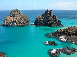
The Sound of Bute is a broad sound, separating the islands of Arran and Bute, on the west coast of Scotland. The sound leads up from the lower Firth of Clyde and passes the island of Inchmarnock. Then splits into the Kyles of Bute, Loch Fyne and round the north end of island of Arran into the Kilbrannan Sound. [1] [2]
The Islands of the Firth of Clyde are the fifth largest of the major Scottish island groups after the Inner and Outer Hebrides, Orkney and Shetland. They are situated in the Firth of Clyde between Argyll and Bute in the west and Inverclyde, North Ayrshire and South Ayrshire in the east. There are about forty islands and skerries. Only four are inhabited, and only nine are larger than 40 hectares. The largest and most populous are Arran and Bute. They are served by dedicated ferry routes, as are Great Cumbrae and Holy Island. Unlike the isles in the four larger Scottish archipelagos, none of the isles in this group are connected to one another or to the mainland by bridges.
Firth is a word in the English and Scots languages used to denote various coastal waters in the United Kingdom, predominantly within Scotland. In the Northern Isles, it more often refers to a smaller inlet. It is linguistically cognate to Scandinavian fjord and fjard, with the original meaning of "sailable waterway". The word has a more constrained sense in English. Bodies of water named "firths" tend to be more common on the Scottish east coast, or in the southwest of the country, although the Firth of Clyde is an exception to this. The Highland coast contains numerous estuaries, straits, and inlets of a similar kind, but not called "firth" ; instead, these are often called sea lochs. Before about 1850, the spelling "Frith" was more common.
Argyll and Bute is one of 32 unitary council areas in Scotland and a lieutenancy area. The current lord-lieutenant for Argyll and Bute is Jane Margaret MacLeod. The administrative centre for the council area is in Lochgilphead at Kilmory Castle, a 19th-century Gothic Revival building and estate. The current council leader is Councillor Jim Lynch.
The Firth of Clyde is the estuary of the River Clyde, on the west coast of Scotland. The Firth has some of the deepest coastal waters of the British Isles. The Firth is sheltered from the Atlantic Ocean by the Kintyre Peninsula. The Firth lies between West Dunbartonshire in the north, Argyll and Bute in the west and Inverclyde, North Ayrshire and South Ayrshire in the east. The Kilbrannan Sound is a large arm of the Firth, separating the Kintyre Peninsula from the Isle of Arran. The Kyles of Bute separates the Isle of Bute from the Cowal Peninsula. The Sound of Bute separates the islands of Bute and Arran.
Rothesay is the principal town on the Isle of Bute, in the council area of Argyll and Bute, Scotland. It lies along the coast of the Firth of Clyde. It can be reached by ferry from Wemyss Bay, which offers an onward rail link to Glasgow. At the centre of the town is the 13th-century ruin Rothesay Castle, unique in Scotland for its circular plan.
The County of Bute, also known as Buteshire, is a historic county and registration county of Scotland. Now replaced by Argyll and Bute for the Isle of Bute, with the Argyll and Bute Council. The Isle of Arran and the The Cumbraes are now in North Ayrshire Council area. Since the implimentation of the Local Government etc. (Scotland) Act 1994, on the 1 April 1996.
The Isle of Bute, known as Bute, is an island in the Firth of Clyde in Scotland, United Kingdom. It is divided into highland and lowland areas by the Highland Boundary Fault.
Sanda Island is a small island in the Firth of Clyde, off of Argyll and Bute, Scotland, near the southern tip of the Kintyre peninsula, near Southend and Dunaverty Castle.
Bute and Northern Ayrshire was a county constituency of the House of Commons of the Parliament of the United Kingdom from 1918 to 1983. It elected one Member of Parliament (MP) by the first past the post voting system.
Bute or BUTE may refer to:
Corrie is a village on the north east coast of the Isle of Arran in Scotland, 6 miles north of Brodick. It lies 2 mi (3 km) due east under the island's highest mountain, Goat Fell. A path from High Corrie 3⁄4 mi (1.2 km) to the south, provides access to the hillside. Corrie, and its northern neighbour, Sannox, lie approximately halfway between Brodick and Lochranza.
Toward is a village near Dunoon, west of Scotland, in the south of the Cowal Peninsula.
Highlands and Islands Enterprise is the development agency for the Highlands and Islands of Scotland, an executive non-departmental public body of the Scottish Government with the role to "help build a prosperous, sustainable and inclusive economy across the Highlands and Islands, attracting more people to live, work, study, invest and visit there."
The Sleeping Warrior is the profile of the north Arran hills in Scotland as seen from the Ayrshire coast. It is a well-known site that takes its name from a resemblance to a resting human figure. Various interpretations of the profile exist although the view of the Witches Step and Caisteal Abhail from North Ayrshire and Bute is arguably the most convincing.
Grogport is a hamlet in Argyll and Bute, Scotland. It lies on the coast of Kintyre, on the Kilbrannan Sound, across from Pirnmill on the Isle of Arran.
The Diocese of the Isles, also known as the Diocese of Suðreyar, or the Diocese of Sodor, was one of the dioceses of medieval Norway. After the mid-13th-century Treaty of Perth, the diocese was accounted as one of the 13 dioceses of Scotland. The original seat of the bishopric appears to have been at Peel, on St Patrick's Isle, where indeed it continued to be under English overlordship; the Bishopric of the Isles as it was after the split was relocated to the north, firstly to Snizort and then Iona.
The Isle of Arran or simply Arran is an island off the west coast of Scotland. It is the largest island in the Firth of Clyde and the seventh-largest Scottish island, at 432 square kilometres (167 sq mi). Historically part of Buteshire, it is in the unitary council area of North Ayrshire. In the 2011 census it had a resident population of 4,629. Though culturally and physically similar to the Hebrides, it is separated from them by the Kintyre peninsula. Often referred to as "Scotland in Miniature", the Island is divided into highland and lowland areas by the Highland Boundary Fault and has been described as a "geologist's paradise".
Events from the year 1943 in Scotland.
Ettrick Bay is a wide, tidal, sandy coastal embayment with a chord of 1 mile (2 km), on a 218° bearing, located on the west coast of the Isle of Bute in the Firth of Clyde, within council area of Argyll and Bute in Scotland. The bay was used for practice training for the D-Day landings.
... the Sound of Bute, about 6 m. wide, which divides it from Arran