Transbay Transit Center

Last updated

Transbay Transit Center
Salesforce Park and bus bridge, seen from Salesforce Tower.jpg
The transit center, rooftop park, and bus bridge seen from Salesforce Tower
General information
Other namesSalesforce Transit Center
Location425 Mission Street
San Francisco, California
Coordinates 37°47′23″N122°23′48″W / 37.7897°N 122.3966°W / 37.7897; -122.3966
Owned by Transbay Joint Powers Authority
Platforms5 side platforms (ground level bus plaza)
1 island platform (bus deck)
Bus operators AC Transit, Greyhound, Golden Gate Transit, Muni, WestCAT Lynx
Construction
Bicycle facilitiesYes
AccessibleYes
Other information
Website salesforcetransitcenter.com
History
OpenedAugust 12, 2018 (2018-08-12)
July 13, 2019 (2019-07-13) (reopening)
ClosedSeptember 25, 2018 (2018-09-25) (temporary)
Proposed rail service
Preceding station Caltrain roundel.svg Caltrain Following station
Terminus Local (L1) 4th & King Street
Weekend Local (L2)
Limited (L3) 4th & King Street
Limited (L4)
Limited (L5) 4th & King Street
Baby Bullet (B7) 4th & King Street
Preceding station California High Speed Rail.svg California High-Speed Rail Following station
Terminus Phase I San Francisco - 4th & Townsend
towards Anaheim or Merced
Location
Transbay Transit Center

The Transbay Transit Center (officially the Salesforce Transit Center for sponsorship purposes) is a transit station in downtown San Francisco. It serves as the primary bus terminal for the San Francisco Bay Area, and is proposed as a possible future rail terminal. The centerpiece of the San Francisco Transbay development, the construction is governed by the Transbay Joint Powers Authority (TJPA). The 1,430-foot-long (440 m) building sits one block south-east of Market Street, a primary commercial and transportation artery.

Contents

After the 1989 Loma Prieta earthquake damaged the 1939 Transbay Terminal, voters approved funds for the new Transbay Transit Center in 1999. Construction on the first phase, the bus terminal, began in 2010. Limited Muni bus service began in December 2017, and full service from AC Transit and other regional and intercity bus operators began in August 2018. [1] [2] Full funding has not yet been secured for the second phase of construction, the Downtown Rail Extension (now known as The Portal), which hopes to add an underground terminal station for Caltrain and California High-Speed Rail. [3]

The transit center was closed for repairs in September 2018 after cracks were found in structural beams; [4] services resumed in July and August 2019.

Design

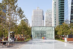
The main entrance to the Grand Hall, located at Mission and Fremont Streets. The outer "skin", made of white aluminum, is perforated in the pattern of a Penrose tiling. Salesforce Transit Center main entrance.jpg
The main entrance to the Grand Hall, located at Mission and Fremont Streets. The outer "skin", made of white aluminum, is perforated in the pattern of a Penrose tiling.

Designed by Pelli Clarke Pelli Architects (PCPA), the Salesforce Transit Center is about 1,430 feet (440 m) long and 165 feet (50 m) wide. It occupies the entire block between Minna and Natoma Streets (just southeast of Mission Street), and stretches from Beale Street to 140 feet (43 m) east of 2nd Street. The first phase of the project includes the aboveground structure plus a belowground shell for the second phase. The structure has four levels: the ground floor with entrances, retail space, ticketing, and Muni/Golden Gate Transit boarding platforms; the second floor with retail space, food hall, offices, and Greyhound ticket counter and waiting room; the bus deck with bus bays surrounding a central waiting area; and the 5.4-acre (2.2 ha) rooftop park.

The bus deck has a dedicated highway ramp (consisting, in part, of a cable-stayed bridge) to the San Francisco–Oakland Bay Bridge and an off-site bus storage facility under the western Bay Bridge approach. In order to allow buses with doors on the right to serve the central (island) platform on the bus deck, buses circulate clockwise (i.e., driving on the left) while inside the terminal. The bus bridge includes a traffic light to facilitate the transition between right-hand traffic (outside the transit center) and left-hand traffic (inside the transit center). [5]

The rooftop park, designed by PWP Landscape Architecture, includes an amphitheater, a restaurant, and water features. [6] The inclusion of the park was part of the winning bid in the architectural design composition for the structure.

The building includes a free, 20-passenger aerial tram to provide access from street level (at Mission Street and Fremont Street) to the rooftop park. [7] Described as a "whimsical gondola" by the building's architects, [8] it was the second passenger-carrying aerial tram to operate in San Francisco, after the one formerly located at the Cliff House (operational 1955–1965). [9] According to the San Francisco Chronicle, it is "frequently out of order", [9] but the park level is also accessible by stairs, escalators and elevator. [7] [8]

The second phase of the project, constructed as part of the Downtown Rail Extension (now known as The Portal), will add a two-level underground train station to be served by Caltrain and California High-Speed Rail. The platform area will have three island platforms serving six tracks. A mezzanine with ticketing and waiting areas will be located above the platform and below the ground-level entrances. A pedestrian tunnel was planned to be constructed below Beale Street to Embarcadero station, connecting the Transbay Transit Center with BART and Muni Metro. [10] [11] This was later scrapped as a cost-saving measure. [12] The proposed second Transbay Tube, which may be used by Caltrain, CAHSR, and/or BART, may also connect to the Transit Center. [13] This extension would cost as much as $6 billion on top of the $2 billion already spent, and is currently unfunded. [3]

The aerial tram connecting the ground-level plaza to the rooftop park. At the time of this video, the tram was undergoing testing before opening to the public.

Public art

Ned Kahn's Bus Jet Fountain: Water jets in the rooftop park respond to the flow of buses on the deck below. Transbay Transit Center, on the day after the opening-7216.jpg
Ned Kahn's Bus Jet Fountain: Water jets in the rooftop park respond to the flow of buses on the deck below.

Based on the policies established by the FTA encouraging the inclusion of public art in transportation facilities, the TJPA committed $4.75 million to fund the creation of public artwork for the Program. [14] Working with the San Francisco Arts Commission, the TJPA oversees the planning and development of the public art program. Initially there were five artists included in the program: James Carpenter, Julie Chang, Tim Hawkinson, Jenny Holzer and Ned Kahn. [14] In June 2017, SFAC and TJPA announced the planned Hawkinson installation would be cancelled as "the nature of the materials, the sculpture's size, and its location" made it "a particularly complex engineering task." [15]

History

Planning

The Transbay Terminal, which the Transbay Transit Center was built to replace AC Transit buses at Transbay Terminal (21284664895).jpg
The Transbay Terminal, which the Transbay Transit Center was built to replace

The original Transbay Terminal opened in 1939 to serve Key System and East Bay Electric Lines commuter trains and Sacramento Northern Railway interurban trains operating over the new Bay Bridge. It was converted to a bus terminal in 1958 and began serving AC Transit commuter buses. The structure was damaged in the 1989 Loma Prieta earthquake, necessitating replacement.

In 1995, Caltrain agreed to study extending its commuter rail service from its Fourth and King terminus closer to the Financial District, including whether the obsolete Transbay Terminal should be removed, remodeled, or rebuilt. [21] Ultimately, it was decided that the Transbay Terminal should be rebuilt, with the rail extension entering the Terminal under Second Street. In November 1999, San Francisco voters adopted Proposition H declaring that Caltrain shall be extended downtown into a new regional intermodal transit station constructed to replace the former Transbay Terminal. The Transbay Joint Powers Authority (TJPA) was founded in 2001 as the administrative joint powers authority for the project. [22]

The final Environmental Impact Report (EIR) was published in 2004. [23] The project was divided into two phases, with Phase 1 being demolition of the original terminal and construction of the Transbay Transit Center, and Phase 2 being the Downtown Rail Extension (now known as The Portal). [6]

In 2006, developers agreed to a new Mello-Roos tax district in the area surrounding the Transbay Transit Center in order for permits for higher buildings to move forward. San Francisco set the tax rate in 2012 at 0.55 percent of assessed value; due to rising real estate prices, however, the 2014 tax burden had risen by nearly 50% compared to the 2012 tax burden, and the developers threatened to pull their building plans entirely or sue the city. [24] The lawsuits never materialized, however. [25]

On September 20, 2007, the design proposed by César Pelli of Pelli Clarke Pelli Architects was chosen for both the Transit Center and the Transbay Tower, now known as Salesforce Tower. [26]

Construction

Salesforce Transit Center under construction in August 2017 Transbay Transit Center construction from TJPA office, August 2017.jpg
Salesforce Transit Center under construction in August 2017

The first phase of construction consisted of the aboveground bus terminal, including retail spaces and the rooftop park, plus the concrete shell of the underground rail levels. It cost $2.4 billion, of which $500 million was for the underground shell. [27] [28] On August 7, 2010, all bus service was moved to the interim Temporary Transbay Terminal. [29] The $18 million outdoor terminal is located on the block bounded by Folsom, Beale, Howard and Main Streets in the South of Market district, two blocks from the site of the former Transbay Terminal. [30] Ground was broken for the new Transbay Transit Center four days later. [31] Much of the initial construction work was underground, and aboveground evidence of construction did not appear until late 2014. [32] As originally planned, the Transit Center was anticipated to be complete by late 2016, with bus operations expected to commence by August 2017. [33]

Demolition of the former Transbay Terminal and ramps was completed in September 2011. [34] Amtrak Thruway bus service, which connects to Amtrak trains at Emeryville station, moved from the Ferry Station Post Office Building to the Temporary Transbay Terminal on March 2, 2015. [35] Under a naming rights deal announced on July 7, 2017, the transit center was given the official name of Salesforce Transit Center; the adjoined City Park took the official name Salesforce Park. [36]

The first phase of the new Transit Center was originally to be completed by the end of 2017. This was delayed to March 2018 in July 2017, and to June 2018 that December. [36] [37] On December 26, 2017, Muni began operating route 5 buses into the ground level of the terminal in order to meet the federal deadline of some service to the terminal beginning in 2017. [38] [39] On June 16, 2018, Muni began operating all 5, 5R, 7, 38, and 38R buses to the surface level of the terminal. [40]

Opening

The first phase opened for full bus service on August 12, 2018; the rooftop park opened on the same date. [1] [2] [41] Greyhound and BoltBus service moved from the Temporary Transbay Terminal three days later on August 15, leaving Amtrak Thruway as the sole remaining bus operator using the Temporary Transbay Terminal. Amtrak buses began using a street-level stop at Salesforce Plaza on Mission Street near Fremont Street on October 28, 2019. [42] That stop was temporarily relocated along Mission Street to near 2nd Street on November 9, 2020. [43]

Without the revenue from the 100,000 expected daily rail passengers, the bus-only terminal was expected to lose as much as $20 million annually. [27] [44] Daily AC Transit ridership to/from Transbay Transit Center was 17,436 in February 2020, but just 3,895 in April 2023. [45]

Extended closure

Repairs at the Transbay Transit Center in October 2018 Repairs at the Transbay Transit Center in 2018-0128.jpg
Repairs at the Transbay Transit Center in October 2018

The transit center was abruptly ordered closed on September 25, 2018—six weeks after opening and during Salesforce's annual Dreamforce conference—following the discovery by workers installing the final ceiling panels of a “major crack” in a steel beam supporting the bus deck above Fremont Street. [46] Beale, Fremont, and First Streets were closed beneath and adjacent to the transit center; Beale and First reopened soon after. [47] The Temporary Transbay Terminal, which had been in use during construction of the new transit center, was hastily reopened to serve riders. [48]

The following day, a second, parallel beam was also found to be cracked, causing the transit center and Fremont Street to remain closed at least through the end of the following week. [49] On October 2, 2018, it was reported that the Transit Center would remain closed at least through the end of the month. [50] Fremont Street reopened on October 15. [51]

A Metropolitan Transportation Commission (MTC) peer review panel investigated whether the cracks may have been caused by flaws that developed in the steel during fabrication, plus by stress concentrations arising from weld access holes or weld termination holes cut into the beams, that were added after the shop designs were submitted for approval. [52] Weld access holes have more stringent building code requirements than weld termination holes, and it was not clear which type of holes were added. In February 2019, the TJPA announced that it expected repairs to be completed in June 2019, but cautioned that the center would not reopen until the MTC peer review panel published its final report. [53] [54] In April 2019, it was determined that the cracks were caused when crews welding the beams together skipped a crucial step—mandated by the building code—that led to tiny micro-cracks forming. Multiple inspections failed to notice the skipped step, and those micro-cracks grew into larger ones. [55]

The facility is under warranty for two years "after substantial completion", placing financial responsibility for the issue on contractors, Webcor Builders and Obayashi Corporation, and their subcontractors. [56] The beams were fabricated by Herrick Corporation in Stockton as part of a $189 million contract between Skanska USA Civil West of New York and the TJPA. [49]

The TJPA announced on May 10 that repairs were complete. [4] The rooftop park reopened on July 1, 2019. [57] Muni and Golden Gate Transit buses resumed using the surface bus plaza on July 13, and the full facility reopened on August 11. [58] [59]

Other issues and criticism

The park has been criticized for allowing a commercial company to own the naming rights, as well as not having enough bike lanes connecting to other major transit routes. [60] Wired criticized the park for its control over access, claiming that there could never be a political demonstration at the park. [60]

In September 2018, just a month after the transit center's opening, the TJPA revealed that the walkway around the rooftop park, made of decomposed granite, had begun to deteriorate much faster than expected. Repairs on the pathway were completed in May 2019, but it is not clear if the costs fall under warranty. [61] [62] [63]

New skyscrapers

Along with the new transit center, thirteen towers have been built or proposed on adjacent parcels, ranging from 300 feet (91 m) to 1,070 feet (326 m) tall, on land freed by the demolition of the former terminal and bus and freeway ramps. The most prominent of these is the city's new tallest building, Salesforce Tower. [64] Two of the skyscrapers, Salesforce Tower and 181 Fremont, are linked directly to the rooftop park. [65] Salesforce Tower has a dedicated pair of elevators, open to the public and accessible via the rear lobby, which serve as one of the access points to the park.

Bus services

AC Transit (left) and WestCAT buses on the bus deck Salesforce Transit Center bus deck.jpg
AC Transit (left) and WestCAT buses on the bus deck
A Muni trolley bus on route 5 at Transbay Transit Center Muni route 5 trolleybus at Transbay Transit Center, September 2019.jpg
A Muni trolley bus on route 5 at Transbay Transit Center

The following services use the bus deck: [66]

Several additional services use the street-level transit plaza: [68] [69]

Numerous other transit services converge into downtown San Francisco with stops nearby. These include BART and Muni Metro at Embarcadero station and Montgomery Street station, Golden Gate Transit peak-only routes (with stops on Fremont Street), Muni bus and streetcar routes, several SamTrans routes, AC Transit route 800, and the Presidio Go Shuttle. [68] [70] As of January 2020, Amtrak Thruway buses also use a surface stop outside the terminal — despite previous plans to use the bus deck — due to disagreements between the TJPA and other agencies about costs. [71]

Future rail service

The Transbay Transit Center project was designed to include a tunnel (the Downtown Rail Extension, now known as The Portal) extending the terminus of the Caltrain commuter rail line from its current location at Fourth and King Streets; the downtown Caltrain extension is projected to alleviate roadway traffic and Caltrain rider delays, resulting in an estimated $20 million savings per year. [72] The Caltrain extension depends on the electrification of its rolling stock, as the current diesel engines are not appropriate for tunnel service. When this project is completed, Caltrain riders would no longer need to transfer to Muni to reach the downtown financial district. The heavy rail portion of the terminal would be designed to accommodate the planned high speed rail from Los Angeles, which shares the right-of-way (Peninsula Corridor) with Caltrain between San Francisco and San Jose. BART has expressed interest in having their proposed Second Transbay Tube connect to the new terminal and Alameda. [73]

DTX was planned to open for rail service in 2019 at a budgeted cost of US$2,600,000,000(equivalent to $3,400,000,000 in 2023). [32] The DTX scope also includes moving the existing 4th & King Caltrain station underground. [74] Part of the DTX project also includes building out two below-grade levels below the TTC. One level would serve as the actual train platform, hosting six tracks and three platforms to accommodate Caltrain and HSR service. The other level would be a passenger waiting area, including ticket sales and retail amenities. The waiting area would be connected via tunnel to the BART/Muni Metro Embarcadero Station. [74]

As of May 2024, the extension is projected to cost $8.25 billion and start construction in 2025 with a completion date in 2032. A federal funding pledge covers $3.4 billion of the cost, provided that local officials identify matching funds. The project would include a three-block underground concourse connecting to BART and Muni Metro trains at Embarcadero station. [75]

Related Research Articles

<span class="mw-page-title-main">San Francisco Municipal Railway</span> Public transport agency in San Francisco, California, USA

The San Francisco Municipal Railway ( MEW-nee; SF Muni or Muni), is the primary public transit system within San Francisco, California. It operates a system of bus routes, the Muni Metro light rail system, three historic cable car lines, and two historic streetcar lines. Previously an independent agency, the San Francisco Municipal Railway merged with two other agencies in 1999 to become the San Francisco Municipal Transportation Agency (SFMTA). In 2018, Muni served 46.7 square miles (121 km2) with an operating budget of about $1.2 billion. Muni is the seventh-highest-ridership transit system in the United States, with 142,168,200 rides in 2023, and the second-highest in California after the Los Angeles County Metropolitan Transportation Authority.

<span class="mw-page-title-main">Caltrain</span> Commuter rail line in California

Caltrain is a California commuter rail line serving the San Francisco Peninsula and Santa Clara Valley. The southern terminus is in San Jose at Tamien station with weekday rush hour service running as far as Gilroy. The northern terminus of the line is in San Francisco at 4th and King Street. Caltrain has 28 regular stops, one limited-service weekday-only stop, one weekend-only stop (Broadway), and one football-only stop (Stanford). While average weekday ridership in 2019 exceeded 63,000, impacts of the COVID-19 pandemic have been significant: in August 2022, Caltrain had an average weekday ridership of 18,600 passengers.

<span class="mw-page-title-main">F Market & Wharves</span> San Francisco heritage streetcar line

The F Market & Wharves line is one of several light rail lines in San Francisco, California. Unlike most other lines in the system, the F line runs as a heritage streetcar service, almost exclusively using historic equipment both from San Francisco's retired fleet as well as from cities around the world. While the F line is operated by the San Francisco Municipal Railway (Muni), its operation is supported by Market Street Railway, a nonprofit organization of streetcar enthusiasts which raises funds and helps to restore vintage streetcars.
<span class="mw-page-title-main">S Shuttle</span> Light rail service in San Francisco, California

The S Shuttle is a light rail service on the Muni Metro system in San Francisco, California. The service began in 2001 as the S Castro Shuttle, an effort to reduce crowding at Castro station. It was briefly discontinued in 2007 when the T Third Street line was opened. Service was extended to St. Francis Circle station in 2013, but cut back to West Portal station in 2016. In 2020, it was changed to full-time service as part of a reconfiguration of Muni Metro service.

<span class="mw-page-title-main">Embarcadero station</span> Subway station in San Francisco, California, US

Embarcadero station is a combined BART and Muni Metro rapid transit subway station in the Market Street subway in downtown San Francisco. Located under Market Street between Drumm Street and Beale Street near The Embarcadero, it serves the Financial District neighborhood and surrounding areas. The three-level station has a large fare mezzanine level, with separate platform levels for Muni Metro and BART below. Embarcadero station opened in May 1976 – almost two years after service began through the Transbay Tube – as an infill station.

<span class="mw-page-title-main">Third Street Light Rail Project</span> San Francisco Muni tram line

The Third Street Light Rail Project was the construction project that expanded the Muni Metro system in San Francisco, California, linking downtown San Francisco to the historically underserved southeastern neighborhoods of Bayview-Hunters Point and Visitacion Valley along the eastern side of the city. Construction was finished in late 2006, non-revenue weekend service began on January 13, 2007, and full service began on April 7, 2007. The new service, as the T Third Street Metro line, replaced the 15 Third bus line, which ran south from the Caltrain Depot at 4th and King streets, along Third Street and Bayshore Boulevard to the southeastern neighborhoods.

<span class="mw-page-title-main">San Francisco Transbay Terminal</span> Former transit terminal in San Francisco, CA, USA

The San Francisco Transbay Terminal was a transportation complex in San Francisco, California, United States, roughly in the center of the rectangle bounded north–south by Mission Street and Howard Street, and east–west by Beale Street and 2nd Street in the South of Market area of the city. It opened on January 14, 1939 as a train station and was converted into a bus depot in 1959. The terminal mainly served San Francisco's downtown and Financial District, as transportation from surrounding communities of the Bay Area terminated there such as: Golden Gate Transit buses from Marin County, AC Transit buses from the East Bay, and SamTrans buses from San Mateo County. Long-distance buses from beyond the Bay Area such as Greyhound and Amtrak Thruway also served the terminal. Several bus lines of the San Francisco Municipal Railway connected with the terminal.

<span class="mw-page-title-main">Transportation in the San Francisco Bay Area</span>

People in the San Francisco Bay Area rely on a complex multimodal transportation infrastructure consisting of roads, bridges, highways, rail, tunnels, airports, seaports, and bike and pedestrian paths. The development, maintenance, and operation of these different modes of transportation are overseen by various agencies, including the California Department of Transportation (Caltrans), the Association of Bay Area Governments, San Francisco Municipal Transportation Agency, and the Metropolitan Transportation Commission. These and other organizations collectively manage several interstate highways and state routes, eight passenger rail networks, eight trans-bay bridges, transbay ferry service, local and transbay bus service, three international airports, and an extensive network of roads, tunnels, and bike paths.

<span class="mw-page-title-main">All Nighter (bus service)</span> San Francisco Bay Area late night bus service

The All Nighter is a night bus service network in the San Francisco Bay Area, California. Portions of the service shadow the rapid transit and commuter rail services of BART and Caltrain, which are the major rail services between San Francisco, the East Bay, the Peninsula, and San Jose. Neither BART nor Caltrain operate owl service due to overnight track maintenance; the All Nighter network helps fill in this service gap. The slogan is, "Now transit stays up as late as you do!"
<span class="mw-page-title-main">Millennium Tower (San Francisco)</span> Tallest residential building in San Francisco

301 Mission Street is a high-rise residential building in the South of Market district of downtown San Francisco. A mixed-use, primarily residential high rise, it is the tallest residential building and the 6th-tallest overall in San Francisco. In May 2016, residents were informed the main tower was both sinking and tilting, resulting in several lawsuits concerning repair costs and whether the existence of the tilt had been withheld from buyers.

The San Francisco Transbay development is a completed redevelopment plan for the neighborhood surrounding the Transbay Transit Center site, South of Market near the Financial District in San Francisco, California. The new transit center replaced the since-demolished San Francisco Transbay Terminal, and new skyscrapers, such as Salesforce Tower, took advantage of the height increases allowed through the San Francisco Transit Center District Plan. The sale of several land parcels formerly owned by the state and given to the managing Transbay Joint Powers Authority helped finance the construction of the transit center.

<span class="mw-page-title-main">San Francisco 4th and King Street station</span> Train station in San Francisco, California, U.S.

San Francisco 4th and King Street station, also known as the Caltrain Depot, is a train station in the SoMa district of San Francisco, California. It is presently the northern terminus of the Caltrain commuter rail line serving the San Francisco Peninsula and Santa Clara Valley. It is also the eastern terminus of the N Judah and E Embarcadero, as well as a stop along the T Third Street of the Muni network. The station is additionally the projected terminus for the first phase of the California High-Speed Rail project and a station once Phase 2 is completed.

<span class="mw-page-title-main">181 Fremont</span> 803-foot mixed-use skyscraper in the South of Market District of San Francisco

181 Fremont is an 803-foot (245 m) mixed-use skyscraper in the South of Market District of San Francisco, California. The building, designed by Heller Manus Architects, is located adjacent to the Transbay Transit Center and 199 Fremont Street developments. 181 Fremont is owned and operated by Jay Paul Company, which was the sole developer of the project. The entire office portion of the building was leased to Facebook to house its San Francisco office and Instagram division.
<span class="mw-page-title-main">350 Mission Street</span> Commercial offices in San Francisco, California

Salesforce East is a 30-story skyscraper in the South of Market district of San Francisco, California.

<span class="mw-page-title-main">38 Geary</span> San Francisco bus route

38 Geary is a bus line operated by the San Francisco Municipal Railway (Muni). Together with the limited service routes that share the number, the 38R Geary Rapid, 38AX Geary 'A' Express, and 38BX Geary 'B' Express, the Geary Boulevard corridor makes up Muni's busiest thoroughfare.

<span class="mw-page-title-main">UCSF/Chase Center station</span>

UCSF/Chase Center station is a light rail station on the Muni Metro T Third Street line, located in the median of Third Street at South Street in the Mission Bay neighborhood of San Francisco, California. The station serves the UCSF Mission Bay campus and the Chase Center arena. The station opened with the T Third Street line on January 13, 2007. Its original configuration had two side platforms; the northbound platform was north of South Street, and the southbound platform south of South Street. The station was closed from November 2018 to August 2019 for conversion to a single island platform to better serve the Chase Center which opened in September 2019.

Throughout the history of Bay Area Rapid Transit, there have been plans to extend service to other areas.

<span class="mw-page-title-main">Salesforce Tower</span> Tallest building in San Francisco

Salesforce Tower, formerly known as Transbay Tower, is a 61-story supertall skyscraper at 415 Mission Street, between First and Fremont Street, in the South of Market district of downtown San Francisco. Its main tenant is Salesforce, a cloud-based software company. The building is 1,070 feet (326 m) tall, with a top roof height of 970 feet (296 m). Designed by César Pelli and developed by Hines Interests Limited Partnership and Boston Properties, it was the last building designed by Pelli to be completed in his lifetime. As of 2024, Salesforce Tower is the tallest building in San Francisco and the second-tallest building both in California and west of the Mississippi River after the 1,100 feet (335 m) Wilshire Grand Center in Los Angeles.

<span class="mw-page-title-main">Park Tower at Transbay</span> 43-story, 605-foot office skyscraper in San Francisco

Park Tower at Transbay is a 43-story, 605-foot (184 m) office skyscraper in San Francisco, California. The tower is located on Block 5 of the San Francisco Transbay development plan at the corner of Beale and Howard Streets, near the Transbay Transit Center. The tower contains 743,000 square feet (69,000 m2) of office space. The entire office space has been leased by Facebook.

<span class="mw-page-title-main">The Portal (San Francisco)</span> Planned transit project in San Francisco

The Portal, also known as the Downtown Rail Extension (DTX), is a planned second phase of the San Francisco Transbay Transit Center (TTC). When complete, it will extend the Caltrain Peninsula Corridor commuter rail line from its current northern terminus at 4th and King via a 1.3-mile (2.1 km) tunnel. The new terminus will be near the Financial District and will provide intermodal connections to BART, Muni, Transbay AC Transit buses, and long-distance buses. In addition, the California High Speed Rail Authority (CHSRA) plans to use DTX and the Caltrain-owned Peninsula Corridor for service on the CHSRA San Francisco–San Jose segment. Because DTX uses a long tunnel, current diesel locomotives are not suitable and the Caltrain Modernization Project (CalMod), which includes electrification of the line and acquisition of electrified rolling stock, is a prerequisite.

References

  1. 1 2 Keeling, Brock. "San Francisco's highly anticipated Salesforce Transit Center makes its debut". Curbed SF. Retrieved August 18, 2018.
  2. 1 2 "Salesforce Transit Center opens in San Francisco". ABC7 San Francisco. August 11, 2018. Retrieved August 18, 2018.
  3. 1 2 Swan, Rachel (August 9, 2018). "Salesforce Transit Center puzzle: When will the trains get to the station?". San Francisco Chronicle. Retrieved August 18, 2018.
  4. 1 2 "UPDATE ON TEMPORARY CLOSURE OF SALESFORCE TRANSIT CENTER" (PDF) (Press release). Transbay Joint Powers Authority. May 10, 2019.
  5. Baldassari, Erin (August 29, 2018). "'Overwhelming,' 'awesome:' Riders review new Transbay Transit Center in San Francisco". The Mercury News. Retrieved August 30, 2018.
  6. 1 2 Transbay Transit Center (PDF), San Francisco County Transportation Authority, 2013, archived from the original (PDF) on January 15, 2014
  7. 1 2 Matier, Phil; Ross, Andy (August 1, 2018), "Transbay Transit Center tram to garden won't be running at grand opening", San Francisco Chronicle, archived from the original on August 1, 2018, retrieved August 17, 2018
  8. 1 2 "Salesforce Transit Center is a modern paradigm for transit-based urban development", Pelli Clarke & Partners website, archived from the original on November 30, 2021, retrieved March 8, 2023, The park is fully accessible via escalator or elevator, and a whimsical gondola offers scenic rides from the corner of Mission and Fremont.
  9. 1 2 Hartlaub, Peter (March 4, 2023), "For a few glorious years, S.F. citizens traveled by gondola. It ended badly", San Francisco Chronicle, archived from the original on March 8, 2023, We'll have to settle for the second working passenger tram in San Francisco history: the gondola next to Salesforce Tower that lifts riders up from Salesforce Plaza to Salesforce Park.
  10. Robinson, Melia (November 2016). "San Francisco's new $2.3 billion transit center could be the most expensive bus terminal in the world". Business Insider.
  11. Cordoba, Eric (September 14, 2016). "Major Capital Projects Update – Transbay Transit Center and Downtown Rail Extension" (PDF). San Francisco Country Transportation Authority.
  12. King, John (January 18, 2023). "High-speed rail to downtown S.F. is back on track — but the price tag keeps going up". San Francisco Chronicle . Retrieved July 15, 2023.
  13. Cabanatuan, Michael (June 22, 2007). "BART's New Vision: More, Bigger, Faster". San Francisco Chronicle. p. A1. Retrieved November 1, 2016.
  14. 1 2 Public Art, Transbay Joint Powers Authority
  15. Saldana, Cesar (June 8, 2017). "S.F. Cancels Multimillion-Dollar Transbay Terminal Art Project". KQED. Retrieved June 15, 2017.
  16. "Public Art: James Carpenter". Transbay Joint Powers Authority. Retrieved December 18, 2017.
  17. "Public Art: Julie Chang". Transbay Joint Powers Authority. Retrieved December 18, 2017.
  18. "Public Art: Jenny Holzer". Transbay Joint Powers Authority. Retrieved December 18, 2017.
  19. "Public Art: Ned Kahn". Transbay Joint Powers Authority. Retrieved December 18, 2017.
  20. "Public Art: Tim Hawkinson". Transbay Joint Powers Authority. Archived from the original on October 9, 2017. Retrieved December 18, 2017. The sculpture project proposed by Tim Hawkinson for Mission Square has been cancelled due to unanticipated challenges related to the complex engineering of the sculpture, scheduling and budgetary issues.
  21. Mitchell, Eve (August 4, 1995). "CalTrain moves a step closer to Financial District". San Francisco Chronicle. Retrieved April 11, 2013.
  22. Transbay Joint Powers Authority. "Project Timeline" . Retrieved May 15, 2018.
  23. "Final EIS/IER Transbay Terminal/Caltrain Downtown Extension/Redevelopment Project". Transbay Transit Center. June 15, 2004. Retrieved March 28, 2016.
  24. Coté, John; Dineen, J.K. (September 25, 2014). "How Transbay Transit Center deal's collapse would alter S.F." San Francisco Chronicle. Retrieved March 28, 2016.
  25. Dineen, J.K. (February 4, 2015). "Developers drop threats over special Transbay tax district". San Francisco Chronicle. Retrieved March 28, 2016.
  26. "Proposal by Developer Hines and Architect Pelli Clarke Pelli Formally Selected for Transbay Transit Center and Tower" . Retrieved August 18, 2018.
  27. 1 2 Matier, Phil; Ross, Andy (March 6, 2017). "Costly Transbay Transit Center in busload of trouble". San Francisco Chronicle.
  28. Matier, Phil; Ross, Andy (March 20, 2018). "Missing the buses: Transbay Transit Center's opening delayed until at least August". San Francisco Chronicle. Retrieved April 6, 2018.
  29. "Move to Transbay Temporary Terminal Set for August 7" (Press release). Alameda-Contra Costa Transit District. July 1, 2010.
  30. King, John (August 30, 2016). "Stopgap bus terminal is an unusual oasis amid urban clamor". San Francisco Chronicle.
  31. "Historic Groundbreaking of First New High-Speed Rail Station in United States" (PDF) (Press release). Transbay Joint Powers Authority. August 11, 2010.
  32. 1 2 King, John (January 26, 2015). "After years of construction, new Transbay terminal is on the rise". San Francisco Chronicle. Retrieved March 28, 2016.
  33. "Transbay Transit Center and Caltrain Downton Extension". San Francisco County Transportation Authority. 2015. Retrieved March 28, 2016.
  34. Tyler, Carolyn (September 7, 2011). "Demolition of old Transbay Terminal complete". ABC7 News. Retrieved April 6, 2018.
  35. "Amtrak Thruway Connector Establishes First Rail Link to Transbay" (PDF) (Press release). Transbay Joint Powers Authority }date=March 2, 2015.
  36. 1 2 King, John (July 7, 2017). "Salesforce buys naming rights to Transbay Transit Center". San Francisco Chronicle. Retrieved July 8, 2017.
  37. Matier, Phil; Ross, Andy (November 26, 2017). "1st bus service at new Transbay Transit Center slips into mid-2018". San Francisco Chronicle. Retrieved December 5, 2017.
  38. Cabanatuan, Michael (December 13, 2017). "Transbay Transit Center to see first bus line Dec. 26". San Francisco Chronicle.
  39. "New Weekday Route and Stops for the 5 Fulton" (Press release). San Francisco Municipal Transportation Authority. December 26, 2017.
  40. McMillan, Erin (June 11, 2018). "Salesforce Transit Center Welcomes Muni Service This Week". San Francisco Municipal Transportation Authority.
  41. Gose, Joe. "'The Grand Central Station Of The West': Giant Transit Hub In San Francisco Opens". Forbes. Retrieved August 18, 2018.
  42. "Transbay Temporary Terminal Bus Stop Relocating to Salesforce Plaza, on Mission Street near Fremont Street on Monday, October 28". Amtrak. October 8, 2019.
  43. "SF Sales Force Plaza". Amtrak. November 5, 2020.
  44. Matier, Phil; Ross, Andy (August 13, 2018). "Even as SF transit center opens, officials figuring out how to pay bills". San Francisco Chronicle. Retrieved August 18, 2018.
  45. Said, Carolyn (April 25, 2023). "'There are no people here': S.F.'s $2.2 billion transit center remains an empty cavern". San Francisco Chronicle. Retrieved June 5, 2023.
  46. Matier, Phil; Ross, Andy (September 25, 2018). "Transbay Transit Center closed after crack found in steel beam". San Francisco Chronicle. Retrieved September 26, 2018.
  47. Wu, Gwendolyn (September 25, 2018). "Officials order Fremont Street closed underneath Transbay Transit Center". San Francisco Chronicle. Retrieved September 26, 2018.
  48. Swan, Rachel (September 26, 2018). "Transbay Transit Center closure sends SF commuters back to temporary terminal". San Francisco Chronicle. Retrieved September 26, 2018.
  49. 1 2 Alexander, Kurtis; Sernoffsky, Evan (September 27, 2018). "2nd crack at SF Transbay Transit Center - to stay closed through next week". San Francisco Chronicle. Retrieved September 27, 2018.
  50. "Salesforce Transit Center Won't Reopen This Month". Socketsite. October 2, 2018.
  51. Cabanatuan, Michael (October 15, 2018). "Fremont Street reopens in SF, Transbay Transit Center remains closed". San Francisco Chronicle. Retrieved October 15, 2018.
  52. Post, Nadine M. (March 27, 2019). "Contractors Defend Work at Troubled Salesforce Transit Center". Engineering News-Record . Retrieved March 31, 2019.
  53. Cabanatuan, Michael (February 1, 2019). "Transbay Transit Center to remain shuttered until at least June". San Francisco Chronicle.
  54. Post, Nadine M. (February 1, 2019). "June Finish Set for Transit Hub Girder Fix". Engineering News-Record . Retrieved February 3, 2019.
  55. "Repairs to Salesforce Transit Center to Cause Nightly Fremont Street Closure". NBC Bay Area. April 20, 2019.
  56. Fracassa, Dominic (October 3, 2018). "One of few certainties with Transbay center: Repair costs covered by warranty". San Francisco Chronicle. Retrieved October 4, 2018.
  57. King, John (July 1, 2019). "SF's Transbay transit center rooftop park reopens to public — quietly". San Francisco Chronicle.
  58. "Muni Returns to the Salesforce Transit Center Bus Plaza Starting Saturday, July 13, 2019". San Francisco Municipal Transportation Agency. July 13, 2019.
  59. Sanchez, Tatiana; Cabanatuan, Michael (August 11, 2019). "Buses roll again at SF's Transbay transit center, declared safe after nearly a year". San Francisco Chronicle.
  60. 1 2 Rogers, Adam (August 21, 2018). "The Missed Connections of San Francisco's Gleaming New Transit Station". Wired . Retrieved October 25, 2018.
  61. Matier, Phil; Ross, Andy (September 12, 2018). "SF Transit Center park - open barely a month and path already falling apart". San Francisco Chronicle. Retrieved September 17, 2018.
  62. Malcolm, Rob (September 12, 2018). "Walkway at SF Transit Center park crumbling just one month after opening". KTVU. Retrieved September 17, 2018.
  63. Matier, Phil (April 24, 2019). "It's no walk in the park on Transbay Transit Center roof — path already needs replacing". San Francisco Chronicle. Retrieved April 24, 2019.
  64. King, John (December 27, 2017). "Bold new neighborhood takes shape in Salesforce's shadow". The San Francisco Chronicle. Retrieved August 18, 2018.
  65. Collister, Nikki (August 13, 2018). "Scenes from Salesforce Transit Center's jam-packed grand opening celebration". Hoodline. Retrieved September 17, 2018.
  66. "Station Map: Salesforce Transit Center Bus Deck" (PDF). Metropolitan Transportation Commission. August 20, 2020. Retrieved November 28, 2023.
  67. "Our San Francisco Terminal". Greyhound Lines.
  68. 1 2 "Station Map: Salesforce Transit Center Street Level" (PDF). Metropolitan Transportation Commission. August 7, 2018.
  69. "San Francisco" (PDF). Golden Gate Transit. Retrieved November 28, 2023.
  70. "Transit Stops: Salesforce Transit Center" (PDF). Metropolitan Transportation Commission. August 5, 2019.
  71. Rudick, Roger (January 16, 2020). "Amtrak Non Grata at Transit Center". Streetsblog SF.
  72. "1: Purpose and Need for the Project" (PDF). Final EIS/IER Transbay Terminal/Caltrain Downtown Extension/Redevelopment Project. Transbay Transit Center (Report). June 15, 2004. pp. 1–12. Retrieved March 28, 2016. Relocating Caltrain's San Francisco terminus to the Transbay Terminal area has been projected to result in a seven percent reduction in the number of person hours of auto travel. Morning peak hour delay would be expected to be reduced by 20 percent. Implementation of the Caltrain Extension would result in daily travel time savings of 7,200 person hours, which includes 5,700 person hours saved for Caltrain riders and 1,500 person hours for roadway travelers in the corridor. Using FTA procedures, this represents an approximate $20 million per year savings (7,200 hours/day x $11.26/hour x 250 work days/year).
  73. Cabanatuan, Michael (June 22, 2007). "BART's New Vision: More, Bigger, Faster". San Francisco Chronicle. pp. A-1. Retrieved April 17, 2008.
  74. 1 2 "Downtown Rail Extension (DTX)". Transbay Transit Center. 2015. Retrieved March 28, 2016.
  75. Cano, Ricardo (May 22, 2024). "S.F.'s massive plan to create a 'Grand Central Station of the West' wins major funding grant". San Francisco Chronicle. Retrieved May 22, 2024.