The Tyler metropolitan area, or Greater Tyler area centered on the city of Tyler, Texas, is one of the largest Texan metropolitan areas in East Texas. It had a combined population of 216,080 according to the 2010 U.S. census, and 233,479 in 2020. The Tyler metropolitan area encompasses all of Smith County.
According to the U.S. Census Bureau, the county has a total area of 950 square miles (2,500km2), of which 921 square miles (2,390km2) are land and 28 square miles (73km2) (3.0%) are covered by water.[1]
The county infrastructure includes some 1,180 miles (1,900km) of two-lane county roads, 70% of which were rated "bad" or "poor" in 2004. The county commissioners court appointed a new county engineer in 2005 and initiated an aggressive reconstruction campaign. After the election of 2006, this reconstruction campaign was cut back by the court. During this period, a controversial pay increase for commissioners and the county judge was passed by a 3–2 vote. After heated protests from the public, the pay rates were eventually rolled back and new legislation was proposed in the state legislature to prohibit commissioners and county judges from authorizing raises for themselves during their first term of office.
Note: the US Census treats Hispanic/Latino as an ethnic category. This table excludes Latinos from the racial categories and assigns them to a separate category. Hispanics/Latinos can be of any race.
According to the 2010 U.S. census,[7] 209,714 people and 76,427 households were residing in the metropolitan. By the 2020 census, there were 233,479 people residing in the metropolitan area. According to the 2021 American Community Survey, its population increased to 237,186.[8] In 2010, the population density was 227.6 peopleper square mile (87.9 people/km2). The 87,309 housing units averaged 91.9 per mi2.
The racial and ethnic makeup of the area in 2010 was 70.1% White, 17.9% African American, 0.5% Native American, 1.2% Asian, and 2.0% persons reporting two or more races. About 17.2% of the population was Hispanic or Latino of any race. Per 2021 ACS estimates, its racial makeup was 58% White, 17% Black or African American, 2% Asian American, 2% multiracial, and 21% Hispanic or Latino of any race.[8]
In 2010, the median income for a household in the metropolis was $46,139. The per capita income was $25,374. About 15.4% of families and 13.80% of the population were below the poverty line. In 2021, its median income was $63,115 for a household; there was a per capita income of $31,682. An estimated 12.5% of the metropolitan population lived at or below the poverty line.
As of 2010, the age distribution was 26.60% under the age of 18, 9.80% from 18 to 24, 27.40% from 25 to 44, 22.10% from 45 to 64, and 14.10% who were 65 or older. The median age was 36 years. For every 100 females, there were 92.10 males. For every 100 females age 18 and over, there were 87.90 males. In 2021, Greater Tyler's median age was 37.4, and 51% was female.
In non-Christian religious communities, Greater Tylerites were had a minor influence from Conservative and Reform Jews numbering 254. The Association of Religion Data Archives estimated there were approximately 782 Muslims.[9] According to a separate study by Sperling's BestPlaces in 2020, 0.4% of the total metropolitan population adhered to Islam, making it the largest non-Christian religion, but one of the smallest metropolitan Islamic populations in Texas.
Economy
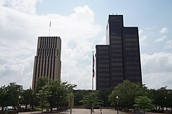
People's Petroleum building in downtown TylerChamber of Commerce office in downtown Tyler
In addition to the city's role in the rose-growing industry, Tyler city-proper is the headquarters for Brookshire Grocery Company, which operates Brookshire's, Fresh, Super 1 Foods, and Spring Market supermarkets in the Ark-La-Tex and parts of Dallas–Fort Worth.[10] The company's main distribution center is in south Tyler, while SouthWest Foods, a subsidiary that processes dairy products, is just northeast of the city.
Tyler features fifteen disc golf courses and seven leagues, and the surrounding area features a total of thirty-six courses and seventeen leagues. For these reasons, users of the disc golf app UDisc ranked Tyler as the third best disc golf destination in Texas and second best in the United States.[17]
The most common form of transportation is the motor vehicle. Tyler is a nexus of several major highways. Interstate 20 runs along the north edge of the city going east and west, U.S. Highway 69 runs north–south through the center of town and State Highway 64 runs east–west through the city. Tyler also has access to U.S. Highway 271, State Highway 31, State Highway 155, and State Highway 110. Loop 323 was established in 1957 and encircles the city, which has continued to grow outside of this loop. Loop 49 is a limited access "outer loop" around the city and currently runs from State Highway 110 south of Tyler to US 69 northwest of Tyler near Lindale. Loop 124 is 1.524mi (2.453km) in length.
Public transportation
Tyler Transit shuttle
Tyler Transit provides customers with public transportation service within the City of Tyler. The buses run daily, excluding Sundays and holidays. Tyler Transit offers customers the option to purchase tickets, tokens, or passes at the Tyler Transit office, at 210 E. Oakwood Street inside the Cotton Belt Railroad Depot at the main transfer point. The City of Tyler paratransit service is a shared-ride, public transportation service. Requests for service must be made the day before the service is needed. Trips can be scheduled up to 14 days in advance. ADA compliant paratransit service is provided to all origins and destinations within the service area defined as the city limits of Tyler.[18]Greyhound Lines bus service is available through a downtown terminal.
Tyler was the hub for a series of short-line railroads which later evolved into the St. Louis Southwestern Railway, better known as "The Cotton Belt Route," with the city last being a stop on the unnamed successor to the Morning Star between St. Louis and Dallas.[19] This line later became part of the Southern Pacific Railroad, which itself merged with the Union Pacific Railroad, which continues to serve the city today with freight traffic. No passenger train service to Tyler has occurred since April 1956, but Amtrak's Texas Eagle runs through the city of Mineola, a short distance north of Tyler.
Walkability
A 2014 study by Walk Score ranked Tyler with a walkability score of 32 (out of 100) with some amenities within walking distance.[20]
This page is based on this Wikipedia article Text is available under the CC BY-SA 4.0 license; additional terms may apply. Images, videos and audio are available under their respective licenses.