West Columbia, South Carolina | |
---|---|
Motto(s): "Bridging Past, Present, And Future" [1] | |
Coordinates: 33°59′27.8″N81°4′23.4″W / 33.991056°N 81.073167°W | |
Country | United States |
State | South Carolina |
County | Lexington |
Government | |
• Type | City Council, City Administrator |
• Mayor | Tem Miles [2] |
Area | |
• Total | 9.47 sq mi (24.53 km2) |
• Land | 9.30 sq mi (24.08 km2) |
• Water | 0.17 sq mi (0.45 km2) |
Elevation | 282 ft (86 m) |
Population | |
• Total | 17,416 |
• Density | 1,873.49/sq mi (723.38/km2) |
Time zone | UTC−5 (EST) |
• Summer (DST) | UTC−4 (EDT) |
Area code(s) | 803, 839 |
FIPS code | 45-75850 |
GNIS feature ID | 1251380 [4] |
Website | www |
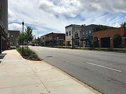
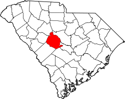
West Columbia, formerly Brookland, is a city and commuter town in the suburban eastern sections of Lexington County, South Carolina, United States. According to the 2010 census, the population was 14,988, and the 2019 population estimate was 17,998. [6] West Columbia is bordered to the east by Columbia, the state capital, across the Congaree River. It is near Columbia's city center or downtown district as well as the South Carolina State House and the Congaree Vista, known locally as "the Vista." The city is bordered to the south by its sister suburb, Cayce. A small portion of the city borders the town of Lexington to the east. [7] [8] West Columbia is part of the greater Columbia, SC metropolitan statistical area.
West Columbia was incorporated in 1894 as "Brookland", but the U.S. Postal Service called the town "New Brookland" since there was another town called Brookland. In 1936, the name was changed to "West Columbia" to emphasize its proximity to Columbia, the capital. [1] Numerous businesses, churches and a high school retain the Brookland and New Brookland names.
The Gervais Street Bridge, Mount Hebron Temperance Hall, New Brookland Historic District, and Saluda Factory Historic District are listed on the National Register of Historic Places. [9]
The 2008 South Carolina Learjet 60 crash occurred just before midnight on September 19, 2008, when a Learjet 60 (registration N999LJ [10] ) crashed while taking off from Columbia Metropolitan Airport. [11] [12] The weather at the time was cool, dry, and clear. The plane hit runway lights and crashed through the boundary fence, crossing South Carolina Highway 302 (SC 302/Edmund Highway/Airport Boulevard), and coming to rest on an embankment by the side of the highway. No one on the ground was hurt, but four of the six people on the plane (including both pilots) died in the crash, while the other two, Travis Barker (the drummer of Blink-182) and Adam Goldstein (DJ AM of Crazy Town), suffered severe burns. The plane was a charter flight taken by Barker, Goldstein and their entourage following a performance by their musical group TRV$DJAM at a free concert in Five Points earlier that night to Van Nuys, California.
West Columbia lies to the south and west of the Saluda and Congaree rivers.
According to the United States Census Bureau, the city has a total area of 6.3 square miles (16.3 km2), of which 6.1 square miles (15.7 km2) is land and 0.2 square mile (0.5 km2) (3.18%) is water.
Census | Pop. | Note | %± |
---|---|---|---|
1900 | 1,089 | — | |
1910 | 900 | −17.4% | |
1920 | 1,793 | 99.2% | |
1930 | 1,722 | −4.0% | |
1940 | 1,744 | 1.3% | |
1950 | 1,543 | −11.5% | |
1960 | 6,410 | 315.4% | |
1970 | 7,838 | 22.3% | |
1980 | 10,409 | 32.8% | |
1990 | 10,588 | 1.7% | |
2000 | 13,064 | 23.4% | |
2010 | 14,988 | 14.7% | |
2020 | 17,416 | 16.2% | |
U.S. Decennial Census [13] [5] |
Race | Num. | Perc. |
---|---|---|
White (non-Hispanic) | 11,022 | 63.29% |
Black or African American (non-Hispanic) | 2,959 | 16.99% |
Native American | 58 | 0.33% |
Asian | 490 | 2.81% |
Pacific Islander | 5 | 0.03% |
Other/Mixed | 732 | 4.2% |
Hispanic or Latino | 2,150 | 12.34% |
As of the 2020 United States census, there were 17,416 people, 8,315 households, and 3,764 families residing in the city.
As of the census of 2000, there were 13,064 people, 5,968 households, and 3,300 families residing in the city. The population density was 2,150.6 inhabitants per square mile (830.4/km2). There were 6,436 housing units at an average density of 1,059.5 per square mile (409.1/km2). The racial makeup of the city was 74.54% White, 19.81% African American, 0.28% Native American, 1.71% Asian, 0.02% Pacific Islander, 2.04% from other races, and 1.61% from two or more races. Hispanic or Latino of any race were 4.66% of the population.
There were 5,968 households, out of which 22.0% had children under the age of 18 living with them, 37.5% were married couples living together, 14.3% had a female householder with no husband present, and 44.7% were non-families. 36.1% of all households were made up of individuals, and 13.0% had someone living alone who was 65 years of age or older. The average household size was 2.13 and the average family size was 2.76.
In the city, the population was spread out, with 18.8% under the age of 18, 10.1% from 18 to 24, 30.0% from 25 to 44, 22.1% from 45 to 64, and 19.0% who were 65 years of age or older. The median age was 39 years. For every 100 females, there were 88.5 males. For every 100 females age 18 and over, there were 86.1 males.
The median income for a household in the city was $30,999, and the median income for a family was $40,253. Males had a median income of $30,033 versus $24,637 for females. The per capita income for the city was $18,135. About 12.8% of families and 16.8% of the population were below the poverty line, including 24.5% of those under age 18 and 11.4% of those age 65 or over. West Columbia is the home of Glenforest School.
West Columbia has a public library, a branch of the Lexington County Public Library. [15]
Saluda County is a county in the U.S. state of South Carolina. As of the 2020 census, the population was 18,862. Its county seat is Saluda. The county was formed from northern and eastern portions of Edgefield County.
Richland County is located in the U.S. state of South Carolina. As of the 2020 census, its population was 416,147, making it the second-most populous county in South Carolina, behind only Greenville County. The county seat and largest community is Columbia, the state capital. The county was established on March 12, 1785. Richland County is part of the Columbia, SC Metropolitan Statistical Area. In 2020, the center of population of South Carolina was located in Richland County, in the city of Columbia. The county is also the location of the geographic center of South Carolina, southeast of Columbia.
Orangeburg County is a county located in the U.S. state of South Carolina. As of the 2020 census, the population was 84,223. Its county seat is Orangeburg. The county was created in 1769.
Newberry County is a county located in the U.S. state of South Carolina. As of the 2020 census, its population was 37,719. Its county seat is Newberry. The name is of unknown origin, although one theory suggests that it was named by Quaker settlers in honor of their home of Newberry, a suburb of London in the United Kingdom.
Lexington County is a county located in the U.S. state of South Carolina. As of the 2020 census, the population was 293,991. Its county seat and largest community is Lexington. The county was chartered in 1785 and was named in commemoration of Lexington, Massachusetts, the site of the Battle of Lexington in the American Revolutionary War. Lexington County is the sixth-most populous county in South Carolina by population and is part of the Columbia, SC Metropolitan Statistical Area. It is located in the Midlands region of South Carolina.
Calhoun County is a county in the U.S. state of South Carolina. As of the 2020 census, its population was 14,119, making it the third-least populous county in the state. Its county seat is St. Matthews. In terms of land area, it is also the smallest county in the state.
Powdersville is a census-designated place (CDP) in Anderson County, South Carolina. The population was 10,025 at the 2020 census,.
Wade Hampton is a census-designated place (CDP) in Greenville County, South Carolina, United States. The population was 20,622 at the 2010 census. It is named for American Civil War general and South Carolina governor Wade Hampton.
Cayce is a city in the U.S. state of South Carolina, along the Congaree River. The population was 12,528 at the 2010 census and rose to 13,789 in the 2020 United States Census, and it is the third-most populated municipality in Lexington County. The city is primarily in Lexington County, with additional, predominantly rural land to the east in Richland County. Cayce is part of the Columbia Metropolitan Statistical Area and is within South Carolina's Midlands region.
Gaston is a town in Lexington County, South Carolina, United States. The population was 1,645 at the 2010 census. It is part of the Columbia, South Carolina Metropolitan Statistical Area.
Lexington is the most populous town in and the county seat of Lexington County, South Carolina, United States. It is a suburb of the state capital, Columbia. The population was 23,568 at the 2020 Census, and it is the second-most populous municipality in the greater Columbia area. The 2022 estimated population is 24,626. According to the Central Midlands Council of Governments, the greater Lexington area had an estimated population of 111,549 in 2020 and is considered the fastest-growing area in the Midlands. Lexington's town limits are bordered to the east by the city of West Columbia.
Red Bank is an unincorporated community and census-designated place (CDP) in Lexington County, South Carolina, United States. The population was 9,617 at the 2010 census, up from 8,811 at the 2000 census. It is part of the Columbia, South Carolina Metropolitan Statistical Area.
Seven Oaks is a census-designated place (CDP) in Lexington County, South Carolina, United States, 8 miles (13 km) northwest of downtown Columbia, the state capital. The population of the CDP was 15,144 at the 2010 census. It is part of the Columbia Metropolitan Statistical Area.
South Congaree is a town in Lexington County, South Carolina, United States. The population was 2,306 at the 2010 census. It is part of the Columbia, South Carolina Metropolitan Statistical Area.
Eastover is a town in Richland County, South Carolina, United States. The population was 813 at the 2010 census, down from 830 in 2000. It is part of the Columbia, South Carolina, Metropolitan Statistical Area.
Ridge Spring is a town in Saluda County, South Carolina, United States. The population was 737 at the 2010 census. It is part of the Columbia, SC Metropolitan Statistical Area. The Mayor-Elect is Ms. Qwendolyn Etheredge.
Saluda is a town in Saluda County, South Carolina, United States, along the Little Saluda River. The population was 3,565 at the 2010 census. It is the county seat of Saluda County.
Stateburg is a census-designated place (CDP) in the High Hills of Santee in Sumter County, South Carolina, United States. The population was 1,380 at the 2010 census. It is included in the Sumter, South Carolina Metropolitan Statistical Area. Stateburg is located within the larger Stateburg Historic District.
Monetta is a town in Aiken and Saluda counties, South Carolina, United States. The population was 236 at the 2010 census.
As defined by the U.S. Office of Management and Budget, and used by the U.S. Census Bureau for statistical purposes only, the Columbia, SC Metropolitan Statistical Area, is an area consisting of six counties in central South Carolina, anchored by the city of Columbia. The current population has an estimation of 837,092. It is the second-largest metropolitan statistical area in the state of South Carolina, since the Anderson metropolitan statistical area was combined with Greenville's following the 2010 census.