Marinette County is a county in the U.S. state of Wisconsin. As of the 2020 census, the population was 41,872. Its county seat is Marinette. Marinette County is part of the Marinette, WI–MI Micropolitan Statistical Area.

Windham County is a county located in the U.S. state of Vermont. As of the 2020 census, the population was 45,905. The shire town is Newfane, and the largest municipality is the town of Brattleboro.

Franklin County is a county located in the U.S. state of Vermont. As of the 2020 census, the population was 49,946. Its county seat is the city of St. Albans. It borders the Canadian province of Quebec. The county was created in 1792 and organized in 1796. Franklin County is part of the Burlington metropolitan area.

Essex County is a county located in the northeastern part of the U.S. state of Vermont. As of the 2020 census, the population was 5,920, making it the least-populous county in both Vermont and New England. Its shire town is the municipality of Guildhall. The county was created in 1792 and organized in 1800. Bordered by the Connecticut River next to New Hampshire, Essex County is south of the Canadian province of Quebec. It is the county with the lowest household-income in Vermont.

Caledonia County is a county located in the northeastern part of the U.S. state of Vermont. As of the 2020 census, the population was 30,233. Its shire town is the town of St. Johnsbury. The county was created in 1792 and organized in 1796. It was given the Latin name for Scotland, in honor of the many settlers who claimed ancestry there.

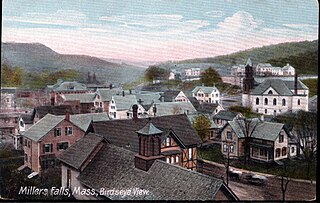
Millers Falls is a census-designated place (CDP) in the towns of Montague and Erving in Franklin County, Massachusetts, United States. The population was 1,139 at the 2010 census. It is part of the Springfield, Massachusetts metropolitan statistical area.

Stewartstown is a town in Coös County, New Hampshire, United States. The population was 813 at the 2020 census, down from 1,004 at the 2010 census. It includes the village of West Stewartstown and is part of the Berlin, NH-VT Micropolitan Statistical Area.

Barnet is a town in Caledonia County, Vermont, United States. The population was 1,663 at the 2020 census. Barnet contains the locations of Barnet Center, East Barnet, McIndoe Falls, Mosquitoville, Passumpsic and West Barnet. The main settlement of Barnet is recorded as a census-designated place by the U.S. Census Bureau, with a population of 127 at the 2020 census.

Colchester is a town in Chittenden County, Vermont, United States. As of the 2020 census, the population of Colchester was 17,524. It is the third-most populous municipality and most populous town in the state of Vermont. Colchester borders Burlington, Vermont's most populous municipality. The town is directly to Burlington's north on the eastern shore of Lake Champlain, to the west of the Green Mountains. The Vermont National Guard is based in the town, and it is also home to Saint Michael's College and the Vermont campus of Southern New Hampshire University.

Canaan is a town in Essex County, Vermont, United States. The population was 896 at the 2020 census. Canaan contains the village of Beecher Falls, located at the confluence of the Connecticut River and Halls Stream. It is part of the Berlin, NH-VT Micropolitan Statistical Area.

Enosburg Falls is a village in the town of Enosburgh in Franklin County, Vermont, in the United States. The population was 1,356 at the 2020 census.

Fairlee is a town in Orange County, Vermont, United States. The population was 988 at the 2020 census. It includes the village of Ely. Fairlee is home to Lake Morey, which claims to have the longest ice skating trail in the United States.

Hartford is a town in Windsor County, Vermont, United States. It is on the New Hampshire border, at the intersection of Interstates 89 and 91. It is the site of the confluence of the White and Connecticut rivers; the Ottauquechee River also flows through the town. The town is composed of five unincorporated villages: Hartford, Quechee, West Hartford, White River Junction and Wilder. As of the 2020 census, the population was 10,686.

Brunswick is a town in Cumberland County, Maine, United States. Brunswick is included in the Lewiston-Auburn, Maine metropolitan New England city and town area. The population was 21,756 at the 2020 United States Census. Part of the Portland-South Portland-Biddeford metropolitan area, Brunswick is home to Bowdoin College, the Bowdoin International Music Festival, the Bowdoin College Museum of Art, the Peary–MacMillan Arctic Museum, and the Maine State Music Theatre. It was formerly home to the U.S. Naval Air Station Brunswick, which was permanently closed on May 31, 2011, and has since been partially released to redevelopment as "Brunswick Landing".

St. Johnsbury is the shire town of Caledonia County, Vermont, United States. As of the 2020 census, the population was 7,364. St. Johnsbury is situated on the Passumpsic River and is located approximately six miles northwest of the Connecticut River and 48 miles (77 km) south of the Canada–U.S. border.

Litchfield is a town in and former county seat of Litchfield County, Connecticut, United States. The population was 8,192 at the 2020 census. The town is part of the Northwest Hills Planning Region. The boroughs of Bantam and Litchfield are located within the town. There are also three unincorporated villages: East Litchfield, Milton, and Northfield. Northfield, located in the southeastern corner of Litchfield, is home to a high percentage of the Litchfield population.

West Stewartstown is a census-designated place in the town of Stewartstown in Coös County, New Hampshire, United States. It had a population of 263 at the 2020 census, down from 386 at the 2010 census.

Windsor is a census-designated place (CDP) comprising the main settlement within the town of Windsor, Windsor County, Vermont, United States. The population of the CDP was 2,066 at the 2010 census, compared with 3,553 for the town as a whole.

Canaan is a census-designated place comprising the main settlement in the town of Canaan, Essex County, Vermont, United States. As of the 2010 census, it had a population of 392, out of a total town population of 972.

Richford is a census-designated place comprising the main settlement in the town of Richford, Franklin County, Vermont, United States. Its population was 1,361 as of the 2010 census, out of 2,308 people in the entire town of Richford.


