Enfield Island Village

Last updated

Enfield Island Village
Enfield Island Village2.JPG
Housing on the island
Greater London UK location map 2.svg
Red pog.svg
Enfield Island Village
Location within Greater London
London borough
Ceremonial county Greater London
Region
Country England
Sovereign state United Kingdom
Post town ENFIELD
Postcode district EN3
Dialling code 01992
Police Metropolitan
Fire London
Ambulance London
UK Parliament
London Assembly
List of places
UK
England
London
51°40′12″N0°00′54″W / 51.670°N 0.015°W / 51.670; -0.015

Enfield Island Village is a modern property development in Enfield Lock, in the London Borough of Enfield, north London. Before April 1994, Enfield Island Village formed part of the Epping Forest district of Essex, but it was transferred to the borough of Enfield in Greater London when the housing development was created.

Contents

History

Enfield Island Village was built on land previously occupied by the Royal Small Arms Factory. It is close to the borders of Essex and Hertfordshire, and is adjacent to the River Lee Navigation, River Lea, Cattlegate Flood Relief Channel, and Newmans Weir, as well as open countryside, including Epping Forest.

The site was decommissioned by the MOD in 1984 and was sold to British Aerospace (BAe). BAe together with Trafalgar House launched a joint venture company, Lee Valley Developments (LVD). In 1996, the land was sold to Fairview Homes, the housing wing of Hillsdown Holdings.
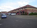
The library was opened in 2008. Enfield Island Village Library.jpg
The library was opened in 2008.
Riverside gardens Enfield Island Village7.JPG
Riverside gardens

The housing estate was built by Fairview New Homes between 1997 and 2003 on a 100-acre (0.40 km2) brownfield site. It comprises a mixture of housing ranging from one-bedroom flats to five-bedroom houses. In line with national standards, 25% of the housing was designated as social housing, and some of the original buildings have been retained. The development has a central parkland area and a small shopping centre. The shops include a small supermarket, a pharmacy, and a Chinese takeaway. The Island also has its own general practitioner (GP), private fitness centre, and a new (2003) primary school – Keys Meadow in nearby Enfield Lock. A new library opened in 2008.

The development is on a flood plain. However, the Environment Agency's assessment is that even without the flood defences that surround the Island, there is even less risk of serious flooding (0.1%, or 1 in 1000 years) than in the surrounding area (0.5%, or 1 in 200 years).

The River Lea flows through the island Enfield Island Village6.JPG
The River Lea flows through the island

As it is a private development, residents are responsible for many aspects of life on the Island through the Enfield Island Village Trust. The Trust is responsible for the upkeep of common land, including the ornamental canal and parkland, utilities such as the waste water system, and for enforcing legal covenants covering the development.

There was a campaign against the development by Friends of the Earth and the Enfield Lock Action Group in the late 1990s. The campaign resulted in the Enfield RSAF (Royal Small Arms Factory) Review Panel being set up, informed by environmental reports carried out over ten years and including evidence from witnesses such as the Head of Land Quality at the Environment Agency and a team of environmental consultants. The review concluded that the site was safe for development and that campaigners' claims regarding rumours of dangerous materials were untrue.

Planning permission was granted for the development, supported by the European Union and by the Enfield Enterprise Agency. It was developed as a model brown field development, with a clay cap at a depth of one metre under the topsoil. Safety inspections were initially carried out every six months, but this has now been reduced to annually.

The area was featured in a 2000 edition of the BBC TV programme Panorama focusing on brownfield land housing development. [1]

Nearest places

Nearest stations

Related Research Articles

<span class="mw-page-title-main">London Borough of Enfield</span> London borough in United Kingdom

The London Borough of Enfield is a London borough in North London. It borders the London boroughs of Barnet to the west, Haringey to the south, and Waltham Forest to the southeast. To the north are the districts of Hertsmere, Welwyn Hatfield and Broxbourne, and to the east is Epping Forest District in Essex. The local authority is Enfield London Borough Council. Enfield's population is estimated to be 333,794; the main towns in the borough are Edmonton, Enfield, Southgate and Palmers Green. Enfield is the northernmost London borough.

<span class="mw-page-title-main">London Borough of Waltham Forest</span> London borough in United Kingdom

The London Borough of Waltham Forest is an outer London borough formed in 1965 from the merger of the municipal boroughs of Leyton, Walthamstow and Chingford.

<span class="mw-page-title-main">Lee–Enfield</span> Bolt-action rifle

The Lee–Enfield is a bolt-action, magazine-fed repeating rifle that served as the main firearm of the military forces of the British Empire and Commonwealth during the first half of the 20th century, and was the standard service rifle of the British Armed Forces from its official adoption in 1895 until 1957.

<span class="mw-page-title-main">Enfield, London</span> Suburb of London

Enfield is a large town in north London, England, 10.1 miles (16.3 km) north of Charing Cross. It had a population of 156,858 in 2018. It includes the areas of Botany Bay, Brimsdown, Bulls Cross, Bullsmoor, Bush Hill Park, Clay Hill, Crews Hill, Enfield Highway, Enfield Lock, Enfield Town, Enfield Wash, Forty Hill, Freezywater, Gordon Hill, Grange Park, Hadley Wood, Ponders End, and World's End.

<span class="mw-page-title-main">Epping Forest District</span> Non-metropolitan district in England

Epping Forest District is a local government district in Essex, England. It is named after the ancient woodland of Epping Forest, a large part of which lies within the district. The council is based in the town of Epping. The district also includes the towns of Loughton, Waltham Abbey, Chigwell, Buckhurst Hill, as well as rural areas. The district is situated in the west of the county, bordering north-eastern Greater London.

<span class="mw-page-title-main">Sewardstone</span> Human settlement in England

Sewardstone is a hamlet in the parish of Waltham Abbey, in the Epping Forest District of Essex, England. It is located south of the main built-up area of Waltham Abbey, lying between Epping Forest, Chingford and Enfield. It is 11.6 miles north-northeast of Central London and is in the London commuter belt.

<span class="mw-page-title-main">Waltham Abbey</span> Human settlement in England

Waltham Abbey is a town and civil parish in the Epping Forest District of Essex, within the metropolitan and urban area of London, England, 13.5 miles (21.7 km) north-east of Charing Cross. It lies on the Greenwich Meridian, between the River Lea in the west and Epping Forest in the east, with large sections forming part of the Metropolitan Green Belt.

<span class="mw-page-title-main">Royal Small Arms Factory</span> Rifle factory in Enfield, London, 1816–1988

The Royal Small Arms Factory (RSAF) was a UK government-owned rifle factory in Enfield, adjoining the Lee Navigation in the Lea Valley. Some parts were in Waltham Abbey. The factory produced British military rifles, muskets and swords from 1816. It closed in 1988, but some of its work was transferred to other sites.

<span class="mw-page-title-main">Enfield Lock railway station</span> National Rail station in London, England

Enfield Lock railway station is on the West Anglia Main Line, it is in Enfield Lock in the London Borough of Enfield, London. It is 11 miles 65 chains (19.0 km) down the line from London Liverpool Street and is situated between Brimsdown and Waltham Cross. Its three-letter station code is ENL and it is in Travelcard zone 6.

Royal Ordnance Factories (ROFs) was the collective name of the UK government's munitions factories during and after the Second World War. Until privatisation, in 1987, they were the responsibility of the Ministry of Supply, and later the Ministry of Defence.

Enfield Lock is an area in the London Borough of Enfield, north London. It is approximately located east of the Hertford Road between Turkey Street and the Holmesdale Tunnel overpass, and extends to the River Lee Navigation, including the Enfield Island Village. The locality gains its name from the lock on the River Lee Navigation. Today's Enfield Lock was rebuilt in 1922. The area forms part of the Lee Valley Park and the Enfield Lock Conservation Area. On its eastern boundary Enfield Lock has marshland formerly used as a testing site between the Royal Small Arms Factory and the Gunpowder Mills, beyond this is the village of Sewardstone and the Epping forest boundary. To the south is Brimsdown, the north Waltham Cross and to the west Bullsmoor and Freezywater. Enfield Lock forms part of the London boundary.

<span class="mw-page-title-main">RARDEN</span> Autocannon

The L21A1 RARDEN is a British 30 mm autocannon used as a combat vehicle weapon. The Royal Armament Research and Development Establishment (RARDE) and the Royal Small Arms Factory (RSAF), were part of the Ministry of Defence, at the time.

The Pattern 1913 Enfield (P'13) was an experimental rifle developed by the Royal Small Arms Factory for the British Army as a result of its combat experience in the Second Boer War from 1899 to 1902. The weapon was to serve as a replacement for the Short Magazine Lee–Enfield (SMLE). An advanced chamber design allowed for a high-velocity .276 Enfield rimless round, which was more powerful than the service-issued .303 British cartridge. Introduction of the P'13 was rendered impractical by the outbreak of the First World War.

<span class="mw-page-title-main">Freezywater</span> Human settlement in England

Freezywater is a neighbourhood of the traditional broad definition of Enfield in the London Borough of Enfield, North London. It has a border with Hertfordshire. It is between Bullsmoor to the west, Enfield Lock to the east, Enfield Wash to the south, and Waltham Cross, Hertfordshire to the north. It became more than a hamlet at the beginning of the 20th century.

<span class="mw-page-title-main">Brimsdown</span> Human settlement in England

Brimsdown is a neighbourhood of eastern Enfield in the London Borough of Enfield, north London, on the west side of the mid-to-lower Lea Valley.

The Lea Valley, the valley of the River Lea, has been used as a transport corridor, a source of sand and gravel, an industrial area, a water supply for London, and a recreational area. The London 2012 Summer Olympics were based in Stratford, in the Lower Lea Valley. It is important for London's water supply, as the source of the water transported by the New River aqueduct, but also as the location for the Lee Valley Reservoir Chain, stretching from Enfield through Tottenham and Walthamstow.

<span class="mw-page-title-main">Lea Valley Walk</span> Long-distance footpath in South East England

The Lea Valley Walk is a 50-mile (80 km) long-distance path located between Leagrave, the source of the River Lea near Luton, and the Thames, at Limehouse Basin, Limehouse, east London. From its source much of the walk is rural. At Hertford the path follows the towpath of the River Lee Navigation, and it becomes increasingly urbanised as it approaches London. The walk was opened in 1993 and is waymarked throughout using a swan logo.

<span class="mw-page-title-main">Lee Flood Relief Channel</span>

The Lee Flood Relief Channel (FRC) is located in the Lea Valley and flows between Ware, Hertfordshire, and Stratford, east London. Work started on the channel in 1947 following major flooding and it was fully operational by 1976. The channel incorporates existing watercourses, lakes, and new channels. Water from the channel feeds the Lee Valley Reservoir Chain.

Royal Ordnance plc was formed on 2 January 1985 as a public corporation, owning the majority of what until then were the remaining United Kingdom government-owned Royal Ordnance Factories which manufactured explosives, ammunition, small arms including the Lee–Enfield rifle, guns and military vehicles such as tanks. It owned some 16 factories; and employed about 19,000 staff.

Royal Ordnance Factory Leeds, first opened as a munitions factory in December 1915 and opened as an ROF in January 1936, was one of a number of Royal Ordnance Factories created at the start of the Second World War.

References

  1. Panorama transcript Retrieved 16 April 2011

Further reading