Ghasera Fort | |
|---|---|
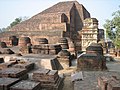
Ruined Fort | |
 Ghasera Fort  Ghasera Fort | |
| Coordinates: 28°08′10″N77°04′36″E / 28.1362471°N 77.0765927°E | |
| Country | |
| State | Haryana |
| District | Mewat district |
| Elevation | 199 m (653 ft) |
| Demonym | Mewati |
| Languages | |
| Time zone | UTC+5:30 (IST) |
| ISO 3166 code | IN-HR |
| Vehicle registration | HR |
| http://www.mewat.gov.in | |
Ghasera Fort is a ruined fort in Ghasera village in Nuh district of Haryana state in northern India, which has been notified as a protected monument by the state government. [1] Currently, the majority of the residents of the village are Muslim Meos, though Hindus also live there. Battle of ghasera won by Combined forces of Jats and Ahirs against Rajputs.