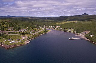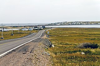
Sunnyside is a town on the Avalon Peninsula in Newfoundland and Labrador, Canada. It is in Division 1 on Bull Arm.

Peterview is a town located in the Exploits Valley area of central Newfoundland and Labrador, Canada, where Peters River empties into the Bay of Exploits, just south of Botwood, off Route 350.
Triton is a town that lies on Triton Island just off the coast of northeastern Newfoundland, in the Canadian province of Newfoundland and Labrador. Triton is the economic center of Green Bay South. According to Statistics Canada, Triton's population fell from 983 in 2016 to 896 in 2021.
Indian Bay is located in Newfoundland, Canada.
Cobb's Arm is a local service district and designated place in the Canadian province of Newfoundland and Labrador on New World Island. It is located about 8 km outside Newville and leads to other communities such as Pikes Arm and Toogood Arm.
Cottlesville is a rural community just outside Summerford on New World Island, Newfoundland and Labrador.

Comfort Cove-Newstead is a small fishing community located outside Campbellton, on the east coast of Newfoundland and Labrador, Canada,.

Cox's Cove is a town in the Canadian province of Newfoundland and Labrador. The town had a population of 664 in the Canada 2021 Census. The small community is mainly based on the fishery, mink farm, and construction industries.

Humber Arm South is a town in the Canadian province of Newfoundland and Labrador. The town consists of the communities of Halfway Point, Benoit's Cove, John's Beach, and Frenchman's Cove. The town had a population of 1,537 in the Canada 2021 Census. The Town's Post Office is located in Benoit's Cove. Humber Arm South is located in the Bay of Islands and is in the Humber-Bay of Islands electoral district. The town's residents are of Mi'kmaw, Innu, and European descent.

Lamaline is a town in the Canadian province of Newfoundland and Labrador. The town had a population of 480 in 1940, 643 in 1956 and 218 in the Canada 2021 Census. Lamaline was a small place with 10 families in 1864. The Way Office was established in 1863 and the first Waymaster was James Pittman.
Millertown is a town in the Canadian province of Newfoundland and Labrador on the north-east side of Beothuk Lake. The town had a population of 87 in the Canada 2021 Census.
Northern Arm is a town in the Canadian province of Newfoundland and Labrador. The town had a population of 371 in the Canada 2021 Census.
Salmon Cove is a town in the Canadian province of Newfoundland and Labrador. The town had a population of 764 in the Canada 2021 Census, up from 695 in 2016.
South Brook is a town in the Canadian province of Newfoundland and Labrador. It is located in the center region of the island of Newfoundland. The town had a population of 420 in 2021, down from 482 in the Canada 2016 Census.
Westport is a town in the Canadian province of Newfoundland and Labrador. The town had a population of 185 in 2021, down from 195 in the Canada 2016 Census.
Seal Cove is a town in the Canadian province of Newfoundland and Labrador, located on Fortune Bay. The town had a population of 100 in the 2021 Census. The population of Seal Cove, Fortune Bay has fallen to approximately 100 largely due to outmigration for education and other work-related pursuits. The town was incorporated in 1972.

Sop's Arm is a local service district and designated place in the Canadian province of Newfoundland and Labrador. The community was formed in the 1930s and 1940s by families moving from surrounding communities, including Jackson's Arm. In the 1950s and 1960s families from nearby Sop's Island moved to Sop's Arm, towing their houses across the channel of water.
Brown's Arm is a local service district and designated place in the Canadian province of Newfoundland and Labrador

Bridgeport is a local service district and designated place in the Canadian province of Newfoundland and Labrador. Services in Bridgeport include the local grocery store, a post office and a fish plant. Bridgeport also now features a newly updated community hall.
Roddickton-Bide Arm is a town located in the northern peninsula of the island of Newfoundland within the province of Newfoundland and Labrador. It was formed on January 1, 2009 through the amalgamation of the former towns of Roddickton and Bide Arm.


