References
- 1 2 3 4 "Endangered Languages Project - Rongpo". ELP . Retrieved 23 December 2024.
- 1 2 3 4 5 Randy J. LaPolla (2001). The Tibeto-Burman Languages of Uttar Pradesh (PDF). University of Hong Kong. p. 2,9. Retrieved 29 December 2024.
- ↑ "Rongpo". Ethnologue. Archived from the original on 6 June 2019. Retrieved 29 December 2024.
7,500 (2001 D. Bradley).
- 1 2 Christopher Moseley; Alexandre Nicolas (2010). "Atlas of the world's languages in danger". UNESCO . p. 203. Retrieved 22 December 2024.
- ↑ "The Endangered And Extinct Languages Of India". Outlook. 5 May 2022. Retrieved 5 January 2025.
- ↑ "Of native tongues vanished & in peril". Hindustan Times. 12 July 2019. Retrieved 4 January 2025.
Sino-Tibetan branches | |||||
|---|---|---|---|---|---|
| Western Himalayas (Himachal, Uttarakhand, Nepal, Sikkim) |
| 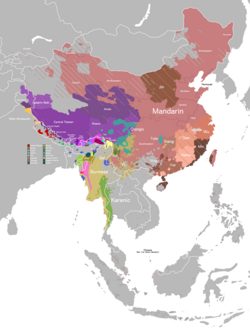 | |||
| Eastern Himalayas (Tibet, Bhutan, Arunachal) | |||||
| Myanmar and Indo- Burmese border |
| ||||
| East and Southeast Asia |
| ||||
| Dubious (possible isolates, Arunachal) |
| ||||
| Proposed groupings | |||||
| Proto-languages | |||||
Italics indicates single languages that are also considered to be separate branches. | |||||
| | This Sino-Tibetan languages-related article is a stub. You can help Wikipedia by adding missing information. |