
Hornsey is a district of north London, England in the London Borough of Haringey. It is an inner-suburban, for the most part residential, area centred 10 km (6.2 mi) north of Charing Cross. It adjoins green spaces Queen's Wood and Alexandra Park to the north.

Stamford Hill is an area in Inner London, England, located about 5.5 miles north-east of Charing Cross. The neighbourhood is a sub-district of Hackney, the major component of the London Borough of Hackney, and is known for its Hasidic community, the largest concentration of Hasidic Jews in Europe.

Wood Green is a suburban district in the borough of Haringey in London, England. Its postal district is N22, with parts in N8 or N15. The London Plan identifies it as one of the metropolitan centres in Greater London, and today it forms a major commercial district of North London.

The London Borough of Haringey is a London borough in North London, classified by some definitions as part of Inner London, and by others as part of Outer London. It was created in 1965 by the amalgamation of three former boroughs. It shares borders with six other London boroughs. Clockwise from the north, they are: Enfield, Waltham Forest, Hackney, Islington, Camden, and Barnet.

Seven Sisters is a sub-district of Tottenham, north London in the United Kingdom, formerly within the municipal borough of Tottenham, which on 1 April 1965 was subsumed into the new London Borough of Haringey. It is located at the eastern end of Seven Sisters Road, which runs from Tottenham High Road to join the A1 in Holloway. It is within the South Tottenham postal district.

Crouch End is an area of North London, approximately five miles (8 km) from the City of London in the western half of the borough of Haringey. It is within the Hornsey postal district (N8).
Harringay is a district of north London, England, within the London Borough of Haringey. It is centred on the section of Green Lanes running between the New River, where it crosses Green Lanes by Finsbury Park, and Duckett's Common, near Turnpike Lane.

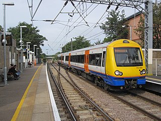
Seven Sisters is a London Overground and London Underground Victoria line station in the Seven Sisters area of the London Borough of Haringey, north London. The station has two entrances/exits, one on Tottenham High Road, and the other on Seven Sisters Road.
South Tottenham is a railway station on the east–west Gospel Oak to Barking Line of the London Overground. It is located on the eastern side of the north–south A10 High Road in Tottenham, North London, 5 miles 69 chains (9.4 km) from St Pancras and situated between Harringay Green Lanes and Blackhorse Road. It is in Zone 3, in the London Borough of Haringey. South Tottenham to Seven Sisters station is considered an official out-of-station interchange by the National Rail timetable, and involves a short walk. This link will become fixed under the planned route for Crossrail 2, which sees a double-ended underground station built linking together South Tottenham and Seven Sisters stations.

The Tottenham & Hampstead Junction Railway was a railway line in north London, formed by an Act of Parliament of 28 July 1862, which today is mostly part of the Gospel Oak to Barking line. It was effectively part of an attempt by the Great Eastern Railway to obtain a west end terminus to complement Bishopsgate railway station in east London.

Stroud Green is a suburb and electoral ward in north London, England, in the London Borough of Haringey. On its south-western side, Stroud Green Road forms part of the boundary with the London Borough of Islington.

Tottenham is a constituency created in 1950 represented in the House of Commons of the UK Parliament since 2000 by Rt Hon David Lammy, a member of the Labour Party. It previously existed from 1885 to 1918.
South Tottenham is an area of the London Borough of Haringey, north London.
The history of Harringay tells the story of the development of the district of London five miles from its centre, affected by, but not always part of, the great city's history.
West Green is an area of north London, England, in the United Kingdom and part of the London Borough of Haringey. It is located 5.7 miles (9.22 km) north of Charing Cross.
During this period Harringay emerged from the mist of prehistory as a thickly forested area of southern England. By 1750 most of the forest had been cleared for agriculture, although settlement was still sparse.
The advance of late Victorian urbanisation during the last twenty years of the 19th century swept away the 18th and early 19th-century houses, their grounds and the farmland. By 1900 Harringay was completely urbanised.

Tottenham is a large town in north London, England within the London Borough of Haringey. It is centred 6 miles (10 km) north-northeast of Charing Cross, bordering Edmonton to the north, Walthamstow, across the River Lea, to the east, and Stamford Hill to the south, with Wood Green and Harringay to the west.

