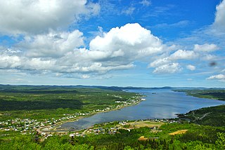
Come By Chance is a town on the isthmus of the Avalon Peninsula in Newfoundland and Labrador, Canada. It is in Division 1 on Placentia Bay.
Norris Arm is a town in north-central Newfoundland, Newfoundland and Labrador, Canada. It is in Division No. 6, on the Bay of Exploits.
Grand Falls-Windsor is a town located in the central region of the island of Newfoundland in the province of Newfoundland and Labrador, Canada, with a population of 13,853 at the 2021 census. The town is the largest in the central region, the sixth largest in the province, and is home to the annual Exploits Valley Salmon Festival. Grand Falls-Windsor was incorporated in 1991, when the two former towns of Grand Falls and Windsor amalgamated.
Badger is a town in north-central Newfoundland, Newfoundland and Labrador, Canada on the Exploits River. It supplied pulp and paper for the mills in Grand Falls for many years and was famous for its large spring log drives. The town is located in the interior of the island, twenty miles west of Grand Falls in Division No. 6. Badger was incorporated as a Town on September 30, 1963.

Division 1, Newfoundland and Labrador is a census division covering the entire Avalon Peninsula including the Isthmus of Avalon of the Canadian province of Newfoundland and Labrador. Like all census divisions in Newfoundland and Labrador, but unlike the census divisions of some other provinces, the division exists only as a statistical division for census data, and is not a political entity.
Upper Island Cove, Newfoundland and Labrador is a town in Newfoundland and Labrador, Canada. It is located in Census Division No. 1 and was incorporated on October 19, 1965. It is located northeast of Bay Roberts. As of 2021, the population is 1,401.

Peterview is a town located in the Exploits Valley area of central Newfoundland and Labrador, Canada, where Peters River empties into the Bay of Exploits, just south of Botwood, off Route 350.

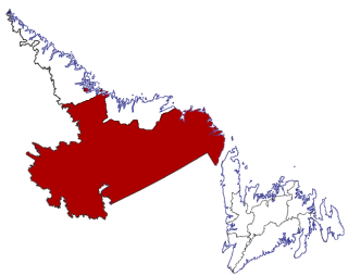
Division No. 6 is a census division in the central part of the island of Newfoundland in the province of Newfoundland and Labrador, Canada. It is divided into 16 parts; 12 towns and four unorganized subdivisions.
River of Ponds is a town located northeast of Daniel's Harbour, Newfoundland and Labrador. It became a Local Government Community in 1970 and had a population of 166 in 1956. The 2021 census reported a population of 173.

Census Division No. 10 of Newfoundland and Labrador is composed of the Labrador region of the province, excluding Nunatsiavut. It has a land area of 199,703 km² (77,105.8 sq mi) and at the 2016 census had a population of 24,639, up from 24,111 in 2011. Its two major population centres are the towns of Happy Valley-Goose Bay and Labrador City.
Colinet is an incorporated town located on the northwest arm of St. Mary's Bay in Newfoundland and Labrador, Canada.

Campbellton is a small lumbering and fishing community located on the island of Newfoundland at Indian Arm, Notre Dame Bay. The community was originally named Indian Arm due to a Beothuk village located on the nearby Indian Arm River. It was renamed to Campbellton in honor of the sawmill manager John Campbell.

Point Leamington is a town of about 590 people located north of Botwood and Grand Falls-Windsor in the Canadian province of Newfoundland and Labrador.
Bird Cove is a town in the Canadian province of Newfoundland and Labrador.
Bishop's Cove is a town in the Canadian province of Newfoundland and Labrador situated in Spaniard's Bay on the Avalon Peninsula.
Brent's Cove is a town in the Canadian province of Newfoundland and Labrador.
Brighton is a town in the Canadian province of Newfoundland and Labrador.
Bryant's Cove is a town in the Canadian province of Newfoundland and Labrador.

St. Vincent's–St. Stephen's–Peter's River is a town in the Canadian province of Newfoundland and Labrador. The town had a population of 263 in the Canada 2021 Census.
Black Duck is a local service district and designated place in the Canadian province of Newfoundland and Labrador that is 15 km (9 mi) east of the town of Stephenville. It is characterized by Harry's River, which runs past the community and is an Atlantic salmon fishing river.


