Division No. 1, Subdivision A is an unorganized subdivision on the Avalon Peninsula in Newfoundland and Labrador, Canada. It is in Division No. 1, and lies between Trinity Bay and Placentia Bay.

Fogo Island is the largest of the offshore islands of Newfoundland and Labrador, Canada. The Town of Fogo Island encompasses Fogo, Joe Batt's Arm-Barr'd Islands-Shoal Bay, Seldom-Little Seldom and Tilting, with the unincorporated areas of Fogo Island. It lies off the northeast coast of Newfoundland, northwest of Musgrave Harbour across Hamilton Sound, just east of the Change Islands. The island is about 25 km (16 mi) long and 14 km (8.7 mi) wide. The total area is 237.71 km2 (91.78 sq mi).
Division No. 8 is a census division on the north coast of the island of Newfoundland in the province of Newfoundland and Labrador, Canada. It has a land area of 9,314.57 km² and had a population of 33,940 at the 2016 census. Its largest communities are the towns of Lewisporte, Springdale, and Twillingate.
New Chelsea-New Melbourne-Brownsdale-Sibley's Cove-Lead Cove is a local service district and designated place in the Canadian province of Newfoundland and Labrador.
Victoria is a landlocked town on the Avalon Peninsula in Newfoundland and Labrador, Canada, located approximately midway on the Bay de Verde Peninsula portion of the Avalon Peninsula.
Burlington is an incorporated town in Newfoundland and Labrador, Canada. It is a small fishing and lumbering community on Route 413 at the north side of the mouth of Green Bay. Burlington is located approximately 40 km from Baie Verte.
Aspen Cove is a small fishing community in the province of Newfoundland and Labrador, Canada. Formerly called Aspey or Apsey Cove, Aspen Cove was named for the presence of aspen trees in the area. It first appears in the 1857 Census as Apsey Cove with a population of thirteen, all dependent on the salmon fishery. By the 1870s more families moved to Aspen Cove for the cod and lobster fisheries. In the 1921 census the population had reached 104 and the economy had changed from salmon, fur, and agriculture to cod, lobster, and lumbering.
Baie Verte is a town located on the north coast of the island portion of the Canadian province of Newfoundland and Labrador on the Baie Verte Peninsula.
Conche is a community on the Northern Peninsula of Newfoundland and Labrador, Canada. Its population in 2021 was 149.
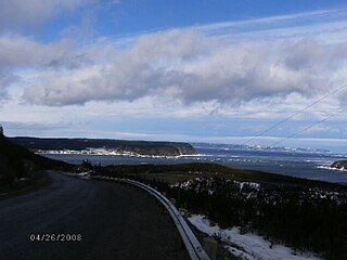
Triton is a town that lies on Triton Island just off the coast of northeastern Newfoundland, in the Canadian province of Newfoundland and Labrador. Triton is the economic center of Green Bay South. According to Statistics Canada, Triton's population fell from 983 in 2016 to 896 in 2021.
Victoria Cove, Newfoundland is situated on the west side of Gander Bay, near the town of Gander.
Virgin Arm–Carter's Cove is a local service district and designated place on New World Island in the Canadian province of Newfoundland and Labrador. Virgin Arm-Carter's Cove is located approximately 90 km Northwest of Gander in Subdivision H of Division No. 8.

Nipper's Harbour is a town located on the east coast of the Baie Verte Peninsula of Newfoundland in the Canadian province of Newfoundland and Labrador. This incorporated community of 85 people is located on a rocky inlet that combines Nipper's Harbour and Noble's Cove, and where the primary industry is the inshore fishery. The town is approximately 58 km from Baie Verte.
Admirals Beach is a rural community located in Newfoundland and Labrador, Canada.
Noggin Cove is a local service district and designated place in the Canadian province of Newfoundland and Labrador. It is west of Carmanville on the south side of Hamilton Sound. It is said to be named after Noggin Island, about 5 km off its eastern point.
Ladle Cove is a designated place in the Canadian province of Newfoundland and Labrador. It is along the Straight Shore on the island of Newfoundland.
Centreville–Wareham–Trinity is a town in the Canadian province of Newfoundland and Labrador, located on Bonavista Bay. The town had a population of 1,116 in the Canada 2021 Census, down from 1,147 in 2016.
Seal Cove is a town in the Canadian province of Newfoundland and Labrador, located on White Bay. The town has had a stable population of 281.
Lodge Bay is a local service district and designated place in the Canadian province of Newfoundland and Labrador. It is on the southeast coast of Labrador. Encompassing a population of less than one hundred residents, the community has uniquely evolved from both early European colonization of Labrador, and the inimitable patterns of land and resource use by the migratory Inuit population. The name Lodge Bay originated from the title Ranger Lodge, which was the name given to the area by trader and explorer, Captain George Cartwright in the late 18th century. "Ranger" was the name of the wooden-mercantile ship Cartwright used to trade, map and explore the Labrador coast, while "Lodge" was the name given to English hunting camps in Great Britain at that time.

Division No. 1, Subdivision G is an unorganized subdivision on the Avalon Peninsula in Newfoundland and Labrador, Canada. It is in Division 1 and contains the unincorporated communities of Baccalieu Island, Besom Cove, Bradley's Cove, Burnt Point, Caplin Cove, Daniel's Cove, Grates Cove, Gull Island, Job's Cove, Kingston, Long Beach, Lower Island Cove, Low Point, Northern Bay, Ochre Pit Cove, Red Head Cove, Riverhead, Smooth Cove and Western Bay.

