Member
(Residence) | Party | Years of Service | Cong
ress | Electoral history | Location |
|---|
| District created March 4, 1837 |
Samuel Ingham
(Saybrook) | Democratic | March 4, 1837 –
March 3, 1839 | 25th | Redistricted from the at-large district and re-elected in 1837.
Lost re-election. | |
William L. Storrs
(Middletown) | Whig | March 4, 1839 –
June, 1840 | 26th | Elected in 1839.
Resigned when appointed Associate Justice of the Connecticut Supreme Court. |
| Vacant | June, 1840 –
December 7, 1840 | |

William Whiting Boardman
(New Haven) | Whig | December 7, 1840 –
March 3, 1843 | 26th
27th | Elected in special election due to Storrs resignation.
Retired. |
John Stewart
(Middle Haddam) | Democratic | March 4, 1843 –
March 3, 1845 | 28th | Elected in 1843.
Lost re-election. |
Samuel Dickinson Hubbard
(Middletown) | Whig | March 4, 1845 –
March 3, 1849 | 29th
30th | Elected in 1845.
Re-elected in 1847.
Retired. |
Walter Booth
(Meriden) | Free Soil | March 4, 1849 –
March 3, 1851 | 31st | Elected in 1849.
Lost re-election. |
Colin M. Ingersoll
(New Haven) | Democratic | March 4, 1851 –
March 3, 1855 | 32nd
33rd | Elected in 1851.
Re-elected in 1853.
Retired. |

John Woodruff
(New Haven) | American | March 4, 1855 –
March 3, 1857 | 34th | Elected in 1855.
Lost re-election. |

Samuel Arnold
(Haddam) | Democratic | March 4, 1857 –
March 3, 1859 | 35th | Elected in 1857.
Retired. |
John Woodruff
(New Haven) | Republican | March 4, 1859 –
March 3, 1861 | 36th | Elected in 1859.
Retired. |

James E. English
(New Haven) | Democratic | March 4, 1861 –
March 3, 1865 | 37th
38th | Elected in 1861.
Re-elected in 1863.
Retired. |
Samuel L. Warner
(Middletown) | Republican | March 4, 1865 –
March 3, 1867 | 39th | Elected in 1865.
Retired. |
Julius Hotchkiss
(Middletown) | Democratic | March 4, 1867 –
March 3, 1869 | 40th | Elected in 1867.
Retired. |
Stephen Wright Kellogg
(Waterbury) | Republican | March 4, 1869 –
March 3, 1875 | 41st
42nd
43rd | Elected in 1869.
Re-elected in 1871.
Re-elected in 1873.
Lost re-election. |

James Phelps
(Essex) | Democratic | March 4, 1875 –
March 3, 1883 | 44th
45th
46th
47th | Elected in 1875.
Re-elected in 1876.
Re-elected in 1878.
Re-elected in 1880.
Retired. |

Charles Le Moyne Mitchell
(New Haven) | Democratic | March 4, 1883 –
March 3, 1887 | 48th
49th | Elected in 1882.
Re-elected in 1884.
Retired. |

Carlos French
(Seymour) | Democratic | March 4, 1887 –
March 3, 1889 | 50th | Elected in 1886.
Retired. |

Washington F. Willcox
(Chester) | Democratic | March 4, 1889 –
March 3, 1893 | 51st
52nd | Elected in 1888.
Re-elected in 1890.
Retired. |

James P. Pigott
(New Haven) | Democratic | March 4, 1893 –
March 3, 1895 | 53rd | Elected in 1892.
Lost re-election. |
Nehemiah D. Sperry
(New Haven) | Republican | March 4, 1895 –
March 3, 1911 | 54th
55th
56th
57th
58th
59th
60th
61st | Elected in 1894.
Re-elected in 1896.
Re-elected in 1898.
Re-elected in 1900.
Re-elected in 1902.
Re-elected in 1904.
Re-elected in 1906.
Re-elected in 1908.
Retired. |

Thomas L. Reilly
(Meriden) | Democratic | March 4, 1911 –
March 3, 1913 | 62nd | Elected in 1910.
Redistricted to the 3rd district . |
Bryan F. Mahan
(New London) | Democratic | March 4, 1913 –
March 3, 1915 | 63rd | Elected in 1912.
Lost re-election. |

Richard P. Freeman
(New London) | Republican | March 4, 1915 –
March 3, 1933 | 64th
65th
66th
67th
68th
69th
70th
71st
72nd | Elected in 1914.
Re-elected in 1916.
Re-elected in 1918.
Re-elected in 1920.
Re-elected in 1922.
Re-elected in 1924.
Re-elected in 1926.
Re-elected in 1928.
Re-elected in 1930.
Lost re-election. |

William L. Higgins
(South Coventry) | Republican | March 4, 1933 –
January 3, 1937 | 73rd
74th | Elected in 1932.
Re-elected in 1934.
Lost re-election. |
William J. Fitzgerald
(Norwich) | Democratic | January 3, 1937 –
January 3, 1939 | 75th | Elected in 1936.
Lost re-election. |
Thomas R. Ball
(Old Lyme) | Republican | January 3, 1939 –
January 3, 1941 | 76th | Elected in 1938.
Lost re-election. |
William J. Fitzgerald
(Norwich) | Democratic | January 3, 1941 –
January 3, 1943 | 77th | Elected in 1940.
Lost re-election. |
John D. McWilliams
(Norwich) | Republican | January 3, 1943 –
January 3, 1945 | 78th | Elected in 1942.
Lost re-election. |

Chase G. Woodhouse
(New London) | Democratic | January 3, 1945 –
January 3, 1947 | 79th | Elected in 1944.
Lost re-election. |

Horace Seely-Brown Jr.
(Pomfret Center) | Republican | January 3, 1947 –
January 3, 1949 | 80th | Elected in 1946.
Lost re-election. |
Chase G. Woodhouse
(Sprague) | Democratic | January 3, 1949 –
January 3, 1951 | 81st | Elected in 1948.
Lost re-election. |
Horace Seely-Brown Jr.
(Pomfret Center) | Republican | January 3, 1951 –
January 3, 1959 | 82nd
83rd
84th
85th | Elected in 1950.
Re-elected in 1952.
Re-elected in 1954.
Re-elected in 1956.
Lost re-election. |
Chester Bowles
(Essex) | Democratic | January 3, 1959 –
January 3, 1961 | 86th | Elected in 1958.
Retired when appointed Under Secretary of State |
Horace Seely-Brown Jr.
(Pomfret Center) | Republican | January 3, 1961 –
January 3, 1963 | 87th | Elected in 1960.
Retired after running for US Senate |

William St. Onge
(Putnam) | Democratic | January 3, 1963 –
May 1, 1970 | 88th
89th
90th
91st | Elected in 1962.
Re-elected in 1964.
Re-elected in 1966.
Re-elected in 1968.
Died. |
| Vacant | May 1, 1970 –
November 3, 1970 | 91st | |

Robert H. Steele
(Vernon) | Republican | November 3, 1970 –
January 3, 1975 | 91st
92nd
93rd | Elected to finish St. Onge's term.
Re- elected in 1970.
Re-elected in 1972.
Retired after running for Governor of Connecticut. |

Chris Dodd
(North Stonington) | Democratic | January 3, 1975 –
January 3, 1981 | 94th
95th
96th | Elected in 1974.
Re-elected in 1976.
Re-elected in 1978.
Retired when elected to the US Senate |

Sam Gejdenson
(Bozrah) | Democratic | January 3, 1981 –
January 3, 2001 | 97th
98th
99th
100th
101st
102nd
103rd
104th
105th
106th | Elected in 1980.
Re-elected in 1982.
Re-elected in 1984.
Re-elected in 1986.
Re-elected in 1988.
Re-elected in 1990.
Re-elected in 1992.
Re-elected in 1994.
Re-elected in 1996.
Re-elected in 1998.
Lost re-election. |

Rob Simmons
(Stonington) | Republican | January 3, 2001 –
January 3, 2007 | 107th
108th
109th | Elected in 2000.
Re-elected in 2002.
Re-elected in 2004.
Lost re-election. |
2003–2013  |

Joe Courtney
(Vernon) | Democratic | January 3, 2007 –
present | 110th
111th
112th
113th
114th
115th
116th
117th
118th
119th | Elected in 2006.
Re-elected in 2008.
Re-elected in 2010.
Re-elected in 2012.
Re-elected in 2014.
Re-elected in 2016.
Re-elected in 2018.
Re-elected in 2020.
Re-elected in 2022.
Re-elected in 2024. |
2013–2023 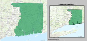 |
2023–present  |


