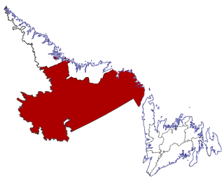
Bishop's Falls is a town in the north-central part of the island of Newfoundland in the Canadian province of Newfoundland and Labrador, with a population of 3,082 at the 2021 census.

St. Anthony is a town on the northern reaches of the Great Northern Peninsula of the Canadian province of Newfoundland and Labrador. St. Anthony serves as a main service centre for northern Newfoundland and southern Labrador. St. Anthony had a population of 2,180 in 2021, compared with 2,258 in 2016, 2,418 in 2011, 2,476 in 2006 and 2,730 in 2001.

Labrador City is a town in western Labrador, near the Quebec border. With a population of 7,412 as of 2021, it is the second-largest population centre in Labrador, behind Happy Valley-Goose Bay. Neighbouring Labrador City is Wabush, a smaller town with a population of approximately 1,964 as of 2021. Together, the "twin towns" are known as Labrador West.

Eastport is a long-popular Newfoundland vacation destination on the Eastport Peninsula. Eastport is located on the north-eastern border of Terra Nova National Park and is known for its sandy beaches, scenery and traditional Newfoundland outport heritage.

Port Hope Simpson is a town located on the southeastern Labrador coast, 215 km (134 mi) from the Quebec/Southern Labrador border in Canada. In 1944 it was named after John Hope Simpson as a company town.
Gaskiers-Point La Haye is a town in Newfoundland and Labrador, Canada, located in St. Mary's Bay. It is located southwest of St. Mary's. It became a local government community in 1970. In 2021, the town had a population of 189.

Census Division No. 10 of Newfoundland and Labrador is composed of the Labrador region of the province, excluding Nunatsiavut. It has a land area of 199,703 km² (77,105.8 sq mi) and at the 2016 census had a population of 24,639, up from 24,111 in 2011. Its two major population centres are the towns of Happy Valley-Goose Bay and Labrador City.
Hermitage-Sandyville is a small town on the south coast of Newfoundland, Canada, with a population of 404 people in the 2021 Census. The main source of income for the community is provided by the aquaculture industry, the local salmon plant and fishing.
Fermeuse is a town in the Canadian province of Newfoundland and Labrador. The town had a population of 266 in the Canada 2021 Census.

Forteau is a town in the Canadian province of Newfoundland and Labrador. The town had a population of 377 as of the Canada 2021 Census.

Pinware is a town in the Canadian province of Newfoundland and Labrador. The town has a population of 64, according to the Canada 2021 Census.

Point au Gaul is a town in the Canadian province of Newfoundland and Labrador, Canada. The town had a population of 67 in the Canada 2021 Census, down from 88 in 2016. Point au Gaul is approximately 76 km southeast of Marystown.
Port au Port East is a town in the Canadian province of Newfoundland and Labrador, situated on the shore of Isthmus Bay. The town had a population of 413 in the Canada 2021 Census. The town consists of the unincorporated communities of Port au Port and Romaines.

St. Lunaire-Griquet is a town in the Canadian province of Newfoundland and Labrador. The town is located near the northern tip of the Great Northern Peninsula of Newfoundland. The town had a population of 603 in the Canada 2021 Census.

L'Anse-au-Loup (Town) is located on the banks of L'Anse-au-Loup Brook and the Strait of Belle Isle, in Newfoundland and Labrador province, Canada.

Black Duck Brook and Winterhouse is a local service district and designated place in the Canadian province of Newfoundland and Labrador. It consists of the unincorporated fishing settlements of Black Duck Brook and Winterhouse on the Port au Port Peninsula. The communities had a combined population of 57 in the Canada 2006 Census.
Great Brehat is a local service district and designated place in the Canadian province of Newfoundland and Labrador. It is on the Great Northern Peninsula of the island of Newfoundland, 10 km north of St. Anthony. As fishing has declined, the village has become a tourist attraction.
Capstan Island is a designated place in the Canadian province of Newfoundland and Labrador.
James Dumaresq was a merchant and fisherman who was the first known resident of L'Anse au Cotard near L'Anse-au-Clair, in Newfoundland and Labrador, Canada. Dumaresq was the first of many Jersey fisherman and merchants to travel to the region now known as the Jersey Trail.
L'Anse aux Meadows to Quirpon is a local service district and designated place in the Canadian province of Newfoundland and Labrador.


