Millcreek Township, Erie County, Pennsylvania

Last updated

Millcreek Township
Slide 10 5 2022 2250px.png
Millcreek Township's Lakewood Park
Etymology: Mill Creek
Motto: 
"Gateway to Presque Isle"
Erie County Pennsylvania incorporated and unincorporated areas Millcreek township highlighted.svg
Location in Erie County and the state of Pennsylvania
Country Flag of the United States.svg  United States of America
State Flag of Pennsylvania.svg  Pennsylvania
County Erie
Area
[1]
  Total32.79 sq mi (84.93 km2)
  Land32.02 sq mi (82.93 km2)
  Water0.78 sq mi (2.01 km2)
Highest elevation
[2] (near Belleview Heights)
1,170 ft (360 m)
Lowest elevation
[2] (Lake Erie)
572 ft (174 m)
Population
 (2020) [3]
  Total54,065
  Estimate 
(2022) [3]
53,411
  Density1,629.79/sq mi (630/km2)
Time zone UTC-5 (EST)
  Summer (DST) UTC-4 (EDT)
Area code 814
Website www.millcreektownship.com

Millcreek Township is a township in Erie County, Pennsylvania, United States. The population was 54,065 at the 2020 census, [3] making it the 14th-largest municipality in the state. [4] and the largest township in Western Pennsylvania.

Contents

Millcreek Township is home to the entrance to Presque Isle State Park, Waldameer Park, Millcreek Mall, and other attractions. Also located in the township is Erie International Airport, the primary airport serving the Erie metropolitan area. LECOM Health, a non-profit healthcare system serving Erie County and the surrounding areas, also calls the township home.

History

Presque Isle State Park in Millcreek Township Sunset 10 1 2022 3840px.png
Presque Isle State Park in Millcreek Township

Evidence exists of Native American presence in Millcreek Township as early as 3700 BC. The township's Sommerheim Park is the location of the Sommerheim Park Archaeological District, which has yielded archaeological artifacts from the Archaic and Woodland periods. [5]

One of the earliest townships in the Erie Triangle to be settled, Millcreek was one of the original 16 townships of Erie County. As families came they moved from the bayfront settlement of Erie and began to form small hamlets such as Federal Hill, Kearsarge, Marvintown, and Weigelville, all to become part of Mill Creek Township. As the Erie settlement grew, first into a borough, then a city, it annexed more and more sections of the township.

After the east–west roads were laid out, taverns began to sprout about every mile or so. Along the Ridge Road on present-day U.S. Route 20, which was laid west through Millcreek in 1805, one of the remaining taverns of the era is Nicholson Tavern. Built in 1836, mostly by Isabella Nicholson and her sons, it is still owned by the family and is listed on the National Register of Historic Places. The Presque Isle Light and Sommerheim Park Archaeological District are also listed. [6]

A recurving sandspit peninsula, Presque Isle, connects to the mainland in western Millcreek. During the War of 1812, Oliver Hazard Perry commanded his fleet in battle and strategically used the peninsula's bay as a harbor to construct six out of nine of the ships in his fleet. In 1921, the peninsula was made a state park and was designated a National Natural Landmark by the National Park Service. Today, the park is a bird sanctuary with over 150 different species identified here.

Just west of the entry into Presque Isle was a well-forested area known as Hopkins Grove. The Erie Electric Motor Company purchased the grove in 1896 for development into an amusement park. Waldameer Park is one of the oldest amusement parks in the nation.

Geography

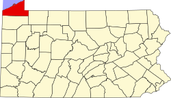
According to the U.S. Census Bureau, the township has a total area of 32.8 square miles (84.9 km2), of which 32.1 square miles (83.1 km2) is land and 0.73 square miles (1.9 km2), or 2.20%, is water. [7]

Today, land use in Millcreek is dedicated to retail, commercial and service-oriented businesses, to light industry, public and private schools, and residential areas. About 1% of the land is still zoned for agriculture. Located within its borders is Edinboro University's Porreco College, Zuck Park, the Erie Golf Course, and the Asbury Woods Nature Center and Recreation Center.

Demographics

Historical population
CensusPop.Note
1950 16,776
1960 28,23968.3%
1970 36,94630.8%
1980 44,30319.9%
1990 46,8205.7%
2000 52,12911.3%
2010 53,5152.7%
2020 54,0651.0%
2022 (est.)53,411 [3] −1.2%
U.S. Decennial Census [8] [9] [10] [11]

At the 2000 census, there were 52,129 people, 21,217 households, and 14,088 families living in the township. The population density was 1,768.5 inhabitants per square mile (682.8/km2). There were 22,369 housing units at an average density of 758.9 per square mile (293.0/km2). The racial makeup of the township was 96.55% White, 1.09% African American, 0.09% Native American, 1.34% Asian, 0.01% Pacific Islander, 0.30% from other races, and 0.62% from two or more races. Hispanic or Latino of any race were 0.99%. [12]

There were 21,217 households, 30.2% had children under the age of 18 living with them, 55.0% were married couples living together, 8.4% had a female householder with no husband present, and 33.6% were non-families. 29.0% of households were made up of individuals, and 11.7% were one person aged 65 or older. The average household size was 2.42 and the average family size was 3.01.

The age distribution was 24.1% under the age of 18, 7.2% from 18 to 24, 27.4% from 25 to 44, 25.2% from 45 to 64, and 16.1% 65 or older. The median age was 40 years. For every 100 females, there were 93.2 males. For every 100 females age 18 and over, there were 89.6 males.

The median household income was $45,019 and the median family income was $56,341. Males had a median income of $41,868 versus $26,610 for females. The per capita income for the township was $24,279. About 3.9% of families and 5.8% of the population were below the poverty line, including 7.0% of those under age 18 and 4.8% of those age 65 or over.

Education

Millcreek Township is served by the Millcreek Township School District.

Elementary Schools

Middle Schools

High Schools

Related Research Articles

<span class="mw-page-title-main">Erie County, Pennsylvania</span> County in Pennsylvania, United States

Erie County is a county in the Commonwealth of Pennsylvania. It is the northernmost county in Pennsylvania. As of the 2020 census, the population was 270,876. Its county seat is Erie. The county was created in 1800 and later organized in 1803.

<span class="mw-page-title-main">East Lampeter Township, Pennsylvania</span> Township in Pennsylvania, United States

East Lampeter Township is a township in central Lancaster County, Pennsylvania, United States. At the 2020 census, the population was 17,834.

<span class="mw-page-title-main">Ocqueoc Township, Michigan</span> Civil township in Michigan, United States

Ocqueoc Township is a civil township of Presque Isle County in the U.S. state of Michigan named after the Ocqueoc River. The population of Ocqueoc Township was 634 at the 2000 census and slightly increased at 655 at the 2010 census.

<span class="mw-page-title-main">Rogers City, Michigan</span> City in Michigan, United States

Rogers City is a city in the U.S. state of Michigan. The population was 2,827 at the 2010 census. It is the county seat of Presque Isle County. The city is adjacent to Rogers Township, but is politically independent.

<span class="mw-page-title-main">Fawn Township, Allegheny County, Pennsylvania</span> Township in Pennsylvania, United States

Fawn Township is a township in Allegheny County, Pennsylvania, United States. The population was 2,193 at the 2020 census. The township derives its name either directly after Fahan, County Donegal, Ireland, by Irish settlers of which 'fawn' is the phonetic pronunciation, or indirectly from the York County township of that name with name origin. According to the township itself, Fawn Township derived its name from its parent township, Deer Township, from which it was formed March 28, 1858.

<span class="mw-page-title-main">East Brandywine Township, Pennsylvania</span> Township in Pennsylvania, United States

East Brandywine Township is a township in Chester County, Pennsylvania, United States. The population was 9,746 at the 2020 census.

<span class="mw-page-title-main">Schuylkill Township, Chester County, Pennsylvania</span> Township in Pennsylvania, United States

Schuylkill Township is a township in Chester County, Pennsylvania, United States. It contains the village of Valley Forge. The population was 8,516 at the 2010 census.

<span class="mw-page-title-main">Millcreek Township, Clarion County, Pennsylvania</span> Township in Pennsylvania, United States

Millcreek Township is a township in Clarion County, Pennsylvania, United States. The population was 361 at the 2020 census, a decrease from the figure of 396 tabulated in 2010.

<span class="mw-page-title-main">Erie, Pennsylvania</span> City in Pennsylvania, United States

Erie is a city on the south shore of Lake Erie and the county seat of Erie County, Pennsylvania, United States. It is the fifth-most populous city in Pennsylvania and the most populous in Northwestern Pennsylvania with a population of 94,831 at the 2020 census. The Erie metropolitan area, equivalent to all of Erie County, had a population of 270,876 in 2020. Erie is located approximately 80 miles (130 km) from Buffalo, 90 miles (140 km) from Cleveland, and 120 miles (190 km) from Pittsburgh.

<span class="mw-page-title-main">Fairview Township, Erie County, Pennsylvania</span> Township in Pennsylvania, United States

Fairview Township is a township in Erie County, Pennsylvania, United States. Situated on the southern shore of Lake Erie, it was one of the county's sixteen original townships, and was founded in 1797.

<span class="mw-page-title-main">Harborcreek Township, Pennsylvania</span> Township in Pennsylvania, United States

Harborcreek Township is a township in Erie County, Pennsylvania, United States. The population was 16,630 at the 2020 census, down from 17,234 at the 2010 census, up from 15,178 in 2000. It is part of the Erie Metropolitan Statistical Area.

<span class="mw-page-title-main">Springfield Township, Erie County, Pennsylvania</span> Township in Pennsylvania, United States

Springfield Township is a township in Erie County, Pennsylvania, United States. The population was 3,077 at the 2020 census, down from 3,425 at the 2010 census.

<span class="mw-page-title-main">Summit Township, Erie County, Pennsylvania</span> Township in Pennsylvania, United States

Summit Township is a township in Erie County, Pennsylvania. The population was 7,341 at the time of the 2020 census, up from 6,603 at the 2010 census.

<span class="mw-page-title-main">Union Township, Erie County, Pennsylvania</span> Township in Pennsylvania, United States

Union Township is a township in Erie County, Pennsylvania, United States. The population was 1,542 at the 2020 census, down from 1,655 at the 2010 census.

<span class="mw-page-title-main">Venango Township, Erie County, Pennsylvania</span> Township in Pennsylvania, United States

Venango Township is a township in Erie County, Pennsylvania, United States. The population was 2,256 at the 2020 census,

<span class="mw-page-title-main">Waterford Township, Pennsylvania</span> Township in Pennsylvania, United States

Waterford Township is a township in Erie County, Pennsylvania, United States. The population was 3,910 at the 2020 census, down from 3,920 at the 2010 census.

<span class="mw-page-title-main">Lower Frederick Township, Pennsylvania</span> Township in Pennsylvania, United States

Lower Frederick Township is a township in Montgomery County, Pennsylvania, United States. The population was 4,840 at the 2010 census.

<span class="mw-page-title-main">Forks Township, Northampton County, Pennsylvania</span> Place in Pennsylvania, United States

Forks Township is a township in Northampton County, Pennsylvania. The population of Forks Township was 14,721 as of the 2010 census. It is part of the Lehigh Valley metropolitan area, which had a population of 861,899 and was the 68th-most populous metropolitan area in the U.S. as of the 2020 census. The township is home to the global headquarters of Crayola, founded in 1885, a global arts supply company and the world's leading manufacturer of crayons.

<span class="mw-page-title-main">Buffalo Township, Washington County, Pennsylvania</span> Township in Pennsylvania, United States

Buffalo Township is a township in Washington County, Pennsylvania, United States. The population was 2,069 at the 2010 census.

<span class="mw-page-title-main">Washington Township, York County, Pennsylvania</span> Township in Pennsylvania, United States

Washington Township is a township in York County, Pennsylvania, United States. The population was 2,576 at the 2020 census. Kralltown is one of the township's unincorporated communities.

References

  1. "2016 U.S. Gazetteer Files". United States Census Bureau. Retrieved August 13, 2017.
  2. 1 2 "West Branch Cascade Creek Topo Map, Erie County PA (Erie North Area)". TopoZone. Locality, LLC. Retrieved September 5, 2019.
  3. 1 2 3 4 "City and Town Population Totals: 2020-2022". Census.gov. US Census Bureau. Retrieved June 19, 2023.
  4. "Geographic Identifiers: 2010 Census Summary File 1 (G001): All County Subdivisions within Pennsylvania". American Factfinder. U.S. Census Bureau. Archived from the original on February 13, 2020. Retrieved March 21, 2016.
  5. Johnson, William C. "National Register of Historic Places Inventory/Nomination: Sommerheim Park Archaeological District". National Park Service, 1981-06-29, p. 2.
  6. "National Register Information System". National Register of Historic Places . National Park Service. July 9, 2010.
  7. "Geographic Identifiers: 2010 Demographic Profile Data (G001): Millcreek township, Erie County, Pennsylvania". American Factfinder. U.S. Census Bureau. Archived from the original on February 13, 2020. Retrieved March 21, 2016.
  8. United States Census Bureau. "Census of Population and Housing" . Retrieved December 2, 2014.
  9. "Archived copy" (PDF). Archived from the original (PDF) on November 6, 2017. Retrieved June 4, 2016.{{cite web}}: CS1 maint: archived copy as title (link)
  10. "Millcreek Police Department". Archived from the original on May 18, 2017. Retrieved August 6, 2023.
  11. "Census 2020".
  12. "U.S. Census website". United States Census Bureau . Retrieved January 31, 2008.

42°09′00″N80°05′59″W / 42.15000°N 80.09972°W / 42.15000; -80.09972