Mountain Home, Arkansas

Last updated

Mountain Home, Arkansas
Baxter County Arkansas Incorporated and Unincorporated areas Mountain Home Highlighted 0547390.svg
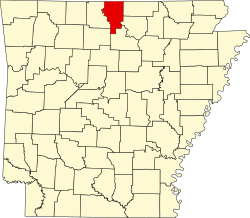
Location of Mountain Home in Baxter County, Arkansas.
Coordinates: 36°20′10″N92°22′56″W / 36.33611°N 92.38222°W / 36.33611; -92.38222
Country United States
State Arkansas
County Baxter
Area
[1]
   City 11.97 sq mi (30.99 km2)
  Land11.97 sq mi (30.99 km2)
  Water0.00 sq mi (0.00 km2)
Elevation
[2]
814 ft (248 m)
Population
 (2020)
   City 12,825
  Density1,071.79/sq mi (413.81/km2)
   Metro
41,307
Demonym Mountain Homie
Time zone UTC-6 (Central (CST))
  Summer (DST) UTC-5 (CDT)
ZIP codes
72653-72654
Area code 870
FIPS code 05-47390
GNIS feature ID2404330 [2]
Website cityofmountainhome.com

Mountain Home is a city in and the county seat of Baxter County, Arkansas, United States, [3] in the southern Ozark Mountains near the northern state border with Missouri. As of the 2010 census, the city had a population of 12,448. [4] A total of 41,307 persons lived within the city and micropolitan area combined, which encompasses the majority of Baxter County.

Contents

History

Founding and early days

Mountain Home was originally known as Rapp's Barren. The land was owned by Simeon "Rapp" Talburt, who built the first home in the area in the early 1830s. [5] Rapp and many of his family members are buried in a small cemetery in the Indian Creek subdivision of Mountain Home. The original cabin was found in 1990 and is on display in Cooper Park in Mountain Home with other homes of historic value. The name of the town was changed to Mountain Home in 1856. [6] A post office was established in 1857. The Mountain Home Male and Female Academy was opened in 1853 and provided much needed education in the absence of accessible public schools.

The Courthouse

When Baxter County was incorporated on March 24, 1873, Mountain Home was named as the county seat. Court was held in a local store and prisoners were held in the homes of respected citizens until a proper courthouse could be built. A former boardinghouse was purchased for the purpose, but was deemed unfit for county business during the renovation process, so a new wood-frame building was built on a donated lot in the middle of the town square. This building burned to the ground in the 1890s and was replaced with a stone courthouse. It was suspected that an arsonist set fire to the building due to the location of the start of the fire and the timing. In just a few days, the fireproof safe would have been completed and all county records, including indictments, would have been protected from fire. [7] In 1912, a local town, Cotter, was booming while growth in Mountain Home had slowed, and there was talk of moving the County Seat to the riverfront town. Mountain Home added a third floor to their existing court house due to an Arkansas law that prevented county seats from being moved away from a three-story building. The current court house was completed in 1943 and is still in use today. [8]

Civil War

Mountain Home men participated in the war on the confederate side. No major battles were fought in Mountain Home, but because of its proximity to Missouri, members of the union army would often raid the area for supplies and both sides participated in guerilla warfare. [9] During this time, the Mountain Home Male and Female Academy was closed. In October 1862, the 14th regiment of the Missouri State Militia was ordered to advance to Yellville, Arkansas a town not far away, to attack confederate troops stationed there and to take any supplies they could along the way. When they heard that a larger force of confederate soldiers were also heading for Yellville, and facing the rising waters of the White River, they decided to content themselves with stealing approximately 50 horses and other supplies [10] from local settlers in the Mountain Home area and then retreat. The rear guard was cut off by a battalion of confederate soldiers and a skirmish ensued where the Union Army lost no soldiers and the Confederate Army lost approximately 10. [11]

In April 1864, Mountain Home was again involved with Civil war violence when a group of jayhawkers attacked the town. Much of the town was damaged or destroyed, including the Mountain Home Male and Female Academy. [9]

Post Civil War through the 1920s

In 1893, the Mountain Home Baptist college, known as "The Gem of the Ozarks", opened. It operated for 40 years, offering education in French, Greek, Shorthand and typing as well as teacher training. Most of the money required to open it was raised locally. It closed occasionally due to lack of funds. In 1901, it became part of the Ouachita Baptist University system. In 1916 it became the flagship of the schools operated in Arkansas by the Southern Baptist Convention. By 1927 there were 265 students and a 7000 volume library. In 1927, funding was withdrawn to support a more centralized school in Conway and by 1933, the school was closed. The library was donated to the local public library and public schools and the dormitories became housing for the Dam builders. [12] In 1901, the Baxter Bulletin was established and continues to operate today.

The Great Depression

The Great Depression hit the area hard, causing many local farmers to lose their land and leave. A series of natural disasters also caused hardship in the area including the Flood of 1927 and the drought of 1930–31. Cotton had been one of the main crops in the area before this, but the drought ended production of cotton in Baxter county and it never truly resumed. Residents received some relief from New Deal programs such as the Federal Emergency Relief Agency (FERA) and the Civilian Conservation Corps. The Works Progress Administration transformed transportation in the area throughout the 1930s and 1940s. [9]

The New Deal

The programs of the New Deal era allowed Mountain Home to modernize its courthouse. The decision to do this was hotly contested and in a vote to decide if the funds should be approved, 731 voted for the new courthouse and 592 voted against. Most of those against the new courthouse were from the Cotter area which had tried several times to move the county seat to their town. [13] The current courthouse was completed and dedicated on August 13, 1943, the old building having been destroyed two years earlier. [14] The WPA also built two dams in the area during this time. The Norfork Dam was built in the town of Norfork about 18 miles south east of Mountain Home. This dam was completed by 1944. An average of 815 were employed building the dam, providing a much needed economic boost to Mountain home and the surrounding area. [15] In addition to flood control, the Norfork Dam boosted tourist interest in Baxter County and made Mountain Home a more attractive destination than Cotter for the first time, and Mountain Home began to surpass its riverfront neighbor in population and industry. A second dam had been built in the town of Bull Shoals in nearby Marion County. [16] This meant Mountain Home was situated between two large lakes and within an easy drive to one of the most famous destinations for fishing in the country at that time. Tourism would shape the economy of Mountain Home moving forward. President Harry Truman was the keynote speaker at the dedication of the dams on July 2, 1952. [9]

The construction of these two dams was a time of tremendous growth for the formerly isolated community of Mountain Home. Streets were paved and Electricity became common in average households. A trout fishery was built at the base of the Norfork Dam, attracting still more tourists.

Geography

Mountain Home is located in northern Arkansas at 36°20′10″N92°22′56″W / 36.33611°N 92.38222°W / 36.33611; -92.38222 (36.336248, -92.382279). [17] It is the center of the Twin Lakes area, with Norfork Lake 15 minutes to the east and Bull Shoals Lake 20 minutes to the northwest. It is located within the Ozarks mountain range, in the Salem Plateau region.

The city is located within 15 to 20 minutes of three rivers: the Buffalo National River, the White River and the North Fork River, which features the world-renowned Norfork Tailwater. These make the Mountain Home area one of the nation's top freshwater fishing destinations. According to the United States Census Bureau, the city has a total area of 11.7 square miles (30.4 km2), all land. [4]

Climate

Mountain Home has a humid subtropical climate (Köppen climate classification Cfa), with cool to mild winters and warm, humid summers.

Climate data for Mountain Home, Arkansas, 1991–2020 normals, extremes 1902–present
MonthJanFebMarAprMayJunJulAugSepOctNovDecYear
Record high °F (°C)83
(28)
87
(31)
94
(34)
95
(35)
101
(38)
110
(43)
112
(44)
114
(46)
107
(42)
97
(36)
87
(31)
82
(28)
114
(46)
Mean maximum °F (°C)69.2
(20.7)
73.6
(23.1)
80.5
(26.9)
84.8
(29.3)
88.7
(31.5)
93.2
(34.0)
97.0
(36.1)
98.1
(36.7)
93.2
(34.0)
86.6
(30.3)
76.6
(24.8)
69.2
(20.7)
99.5
(37.5)
Mean daily maximum °F (°C)45.8
(7.7)
50.8
(10.4)
59.8
(15.4)
69.7
(20.9)
76.9
(24.9)
85.0
(29.4)
89.4
(31.9)
89.1
(31.7)
82.0
(27.8)
71.3
(21.8)
58.9
(14.9)
48.5
(9.2)
68.9
(20.5)
Daily mean °F (°C)36.0
(2.2)
40.0
(4.4)
48.6
(9.2)
58.1
(14.5)
66.3
(19.1)
74.9
(23.8)
79.1
(26.2)
78.3
(25.7)
70.9
(21.6)
59.7
(15.4)
48.2
(9.0)
38.9
(3.8)
58.3
(14.6)
Mean daily minimum °F (°C)26.1
(−3.3)
29.3
(−1.5)
37.3
(2.9)
46.4
(8.0)
55.6
(13.1)
64.7
(18.2)
68.8
(20.4)
67.5
(19.7)
59.7
(15.4)
48.0
(8.9)
37.4
(3.0)
29.3
(−1.5)
47.5
(8.6)
Mean minimum °F (°C)9.1
(−12.7)
13.0
(−10.6)
20.5
(−6.4)
32.4
(0.2)
41.4
(5.2)
55.1
(12.8)
61.2
(16.2)
58.6
(14.8)
45.9
(7.7)
32.5
(0.3)
22.2
(−5.4)
14.0
(−10.0)
5.7
(−14.6)
Record low °F (°C)−15
(−26)
−14
(−26)
−2
(−19)
21
(−6)
29
(−2)
42
(6)
46
(8)
47
(8)
32
(0)
18
(−8)
9
(−13)
−16
(−27)
−16
(−27)
Average precipitation inches (mm)3.30
(84)
3.26
(83)
5.03
(128)
5.60
(142)
5.68
(144)
3.88
(99)
4.15
(105)
3.74
(95)
3.66
(93)
3.99
(101)
4.80
(122)
3.77
(96)
50.86
(1,292)
Average snowfall inches (cm)1.9
(4.8)
2.6
(6.6)
2.0
(5.1)
0.0
(0.0)
0.0
(0.0)
0.0
(0.0)
0.0
(0.0)
0.0
(0.0)
0.0
(0.0)
0.1
(0.25)
0.0
(0.0)
1.2
(3.0)
7.8
(19.75)
Average precipitation days (≥ 0.01 in)8.38.210.810.211.59.39.18.87.68.98.88.7110.2
Average snowy days (≥ 0.1 in)1.01.20.70.00.00.00.00.00.00.00.20.73.8
Source 1: NOAA [18]
Source 2: National Weather Service [19]

Transportation

Highways in Mountain Home:

The city is served by Ozark Regional Airport, a county-owned, public-use airport with a few commercial flights.

No railroads pass through Mountain Home, but the Missouri and Northern Arkansas Railroad passes through the nearby community of Cotter, Arkansas 10 miles (16 km) to the west. The line encompasses 506 miles of track from Pleasant Hill, Missouri to Diaz Junction, Arkansas. The line has about five trains a day, with most being mixed freight or empty coal trains.

Media

Print

The local newspaper is The Baxter Bulletin , published since 1901. It also publishes "Living Well Magazine."

Radio

KTLO AM 1240 was established in 1953. Others include KTLO Radio [20] (which includes 99.7 FM The Boot, KCTT Classic Hits 101.7 FM, and KTLO 1240 AM Real Country) and Twin Lakes Radio [21] (which includes KOMT The Eagle 93.5 FM, KPFM Country 105.5 FM, and KKTZ Hit 107.5 FM. KCMH 91.5 FM (a Christian radio) is also licensed to the city of Mountain Home. Several other stations are licensed to surrounding communities and serve Baxter County.

Television

K26GS-D operates KL7 in Mountain Home on public access and provides local interest pieces and news. Mountain Home is part of the Springfield television market.

Theater

Mountain Home has a live theater known as the Twin Lakes Playhouse, which opened in 1971 and has operated continuously since then. [22]

Demographics

Historical population
CensusPop.Note
1880 137
1890 24276.6%
1900 36350.0%
1910 44622.9%
1920 49210.3%
1930 58518.9%
1940 92758.5%
1950 2,217139.2%
1960 2,105−5.1%
1970 3,93687.0%
1980 8,066104.9%
1990 9,02711.9%
2000 11,01222.0%
2010 12,44813.0%
2020 12,8253.0%
U.S. Decennial Census [23]

2020 census

Mountain Home racial composition [24]
RaceNumberPercentage
White (non-Hispanic)11,61090.53%
Black or African American (non-Hispanic)490.38%
Native American 580.45%
Asian 1301.01%
Pacific Islander 10.01%
Other/Mixed 5434.23%
Hispanic or Latino 4343.38%

As of the 2020 United States census, there were 12,825 people, 5,851 households, and 3,225 families residing in the city.

2010 census

According to the 2010 census, the population of Mountain Home was 12,448. [4]

2000 census

As of the census [25] of 2000, there were 11,012 people, 5,175 households, and 3,151 families residing in the city. The population density was 1,035.7 inhabitants per square mile (399.9/km2). There were 5,612 housing units at an average density of 527.8 per square mile (203.8/km2). The racial makeup of the city was 97.69% White, 0.18% Black or African American, 0.47% Native American, 0.37% Asian, 0.03% Pacific Islander, 0.26% from other races, and 0.99% from two or more races. 1.20% of the population were Hispanic or Latino of any race.

There were 5,175 households, out of which 19.9% had children under the age of 18 living with them, 49.3% were married couples living together, 9.6% had a female householder with no husband present, and 39.1% were non-families. 36.3% of all households were made up of individuals, and 22.8% had someone living alone who was 65 years of age or older. The average household size was 2.02 and the average family size was 2.59.

In the city, the population was spread out, with 17.7% under the age of 18, 5.9% from 18 to 24, 18.8% from 25 to 44, 21.5% from 45 to 64, and 36.1% who were 65 years of age or older. The median age was 53 years. For every 100 females, there were 78.2 males. For every 100 females age 18 and over, there were 74.3 males.

The median income for a household in the city was $26,869, and the median income for a family was $34,895. Males had a median income of $26,800 versus $19,702 for females. The per capita income for the city was $16,789. About 7.5% of families and 10.6% of the population were below the poverty line, including 14.6% of those under age 18 and 7.1% of those age 65 or over.

Education

ASU – Mountain Home

Arkansas State University-Mountain Home is a public, open-access, two-year campus of Arkansas State University located on a campus on the west side of the city. The campus became part of the ASU system in 1995. The campus architecture is styled after the University of Virginia.

Mountain Home school district

Mountain Home Public Schools has seven campuses and owns 330 square miles (850 km2). It serves more than 4,000 students from kindergarten through 12th grade.

The school plays in the 6A/7A East Athletic Conference in basketball, football, baseball, softball, track and field, soccer, wrestling, cross country, volleyball and swimming. The cross country teams won multiple state championships and the swim and volleyball teams competed for state championships.

Senior Project Scientist of the Hubble Space Telescope, Jennifer Wiseman Jennifer Wiseman.jpg
Senior Project Scientist of the Hubble Space Telescope, Jennifer Wiseman

The school band marched in the 2006 Macy's Thanksgiving Day Parade, the 2010 Citrus Bowl Parade, and competed at Disney World in 2019. [26] The Jazz Band performs shows in Branson, Missouri.

The robotics program placed in the top three of the FIRST Championship (FRC) multiple times, and won the FRC world championship in 2012. [27]

Notable people

Related Research Articles

<span class="mw-page-title-main">Stone County, Arkansas</span> County in Arkansas, United States

Stone County is located in the Ozark Mountains in the U.S. state of Arkansas. The county is named for rugged, rocky area terrain of the Ozarks. Created as Arkansas's 74th county on April 21, 1873, Stone County has two incorporated cities: Mountain View, the county seat and most populous city, and Fifty-Six. The county is also the site of numerous unincorporated communities and ghost towns.

<span class="mw-page-title-main">Marion County, Arkansas</span> County in Arkansas, United States

Marion County is located in the Ozark Mountains in the U.S. state of Arkansas. The county is named for Francis Marion, the famous "Swamp Fox" of the Revolutionary War. Created as Arkansas's 35th county in 1836, Marion County is home to one incorporated town and four incorporated cities, including Yellville, the county seat. The county is also the site of numerous unincorporated communities and ghost towns. The county included part of what is now Searcy County, Arkansas, with many opposing to dividing them, which helped fueled the bloody Tutt-Everett War between 1844 and 1850.

<span class="mw-page-title-main">Fulton County, Arkansas</span> County in Arkansas, United States

Fulton County is a county located in the U.S. state of Arkansas. As of the 2020 census, the population was 12,075. The county seat is Salem. Fulton County was formed on December 21, 1842, and named for William Fulton, the last governor of the Arkansas Territory. It is an alcohol prohibition or dry county.

<span class="mw-page-title-main">Crawford County, Arkansas</span> County in Arkansas, United States

Crawford County is a county located in the Ozarks region of the U.S. state of Arkansas. As of the 2020 census, the population was 60,133. The county seat and largest city is Van Buren. Crawford County was formed on October 18, 1820, from the former Lovely County and Indian Territory, and was named for William H. Crawford, the United States Secretary of War in 1815.

<span class="mw-page-title-main">Boone County, Arkansas</span> County in Arkansas, United States

Boone County is located in the U.S. state of Arkansas, along the Missouri border. As of the 2020 census, the population was 37,373. The county seat is Harrison. It is Arkansas's 62nd county, formed on April 9, 1869.

<span class="mw-page-title-main">Baxter County, Arkansas</span> County in Arkansas, United States

Baxter County is a county in the U.S. state of Arkansas. As of the 2020 census, the county's population was 41,627. The county seat is Mountain Home. It is Arkansas's 66th county, formed on March 24, 1873, and named for Elisha Baxter, the tenth governor of Arkansas.

<span class="mw-page-title-main">Briarcliff, Arkansas</span> City in Arkansas, United States

Briarcliff is a second-class city in Baxter County, Arkansas, United States. The population was 236 at the 2010 census.

<span class="mw-page-title-main">Cotter, Arkansas</span> City in Arkansas, United States

Cotter is a city in Baxter County, Arkansas, United States. The population was 886 at the 2020 census.

<span class="mw-page-title-main">Norfork, Arkansas</span> City in Arkansas, United States

Norfork is a city in Baxter County, Arkansas, United States. The population was 550 at the 2010 census.

<span class="mw-page-title-main">Salesville, Arkansas</span> City in Arkansas, United States

Salesville is a city in Baxter County, Arkansas, United States. The population was 450 in 2010.

<span class="mw-page-title-main">Harrison, Arkansas</span> City in Arkansas, United States

The city of Harrison is the county seat of Boone County, Arkansas, United States. It is named after Marcus LaRue Harrison, a surveyor who laid out the city along Crooked Creek at Stifler Springs. According to 2019 Census Bureau estimates, the population of the city was 13,069, up from 12,943 at the 2010 census and it is the 30th largest city in Arkansas based on official 2019 estimates from the U.S. Census Bureau. Harrison is the principal city of the Harrison Micropolitan Statistical Area, which includes all of Boone and Newton counties.

<span class="mw-page-title-main">Ozark, Arkansas</span> City in Arkansas, United States

Ozark is a city in Franklin County, Arkansas, United States and one of the county's two seats of government. The community is located along the Arkansas River in the Arkansas River Valley on the southern edge of the Ozark Mountains. As of the 2010 census it had a population of 3,684.

<span class="mw-page-title-main">Salem, Fulton County, Arkansas</span> City in Arkansas, United States

Salem is the county seat of Fulton County, Arkansas, United States. Salem was first incorporated in 1900. As of the 2010 census the population stood at 1,635.

<span class="mw-page-title-main">Yellville, Arkansas</span> City in Arkansas, United States

Yellville is a city in and county seat of Marion County, Arkansas, United States. Yellville is located in the Ozark Mountains along the banks of Crooked Creek, and neighbors the small town of Summit to the north. The population was 1,178 at the 2020 census. The town's original name is preserved in the Shawnee Town Branch, a local creek. The town holds an annual Turkey Trot Festival.

<span class="mw-page-title-main">Marshall, Arkansas</span> City in Arkansas, United States

Marshall is the largest city in and county seat of Searcy County in Arkansas, United States. It is located in the Ozarks at the foot of the Boston Mountain Range 10.5 mi (16.9 km) south of America's first National River, the Buffalo National River. Marshall serves as a hub for area tourism including camping, floating, hiking, bicycling and Dark Sky viewing.

<span class="mw-page-title-main">Ozarks</span> Highland region in central-southern United States

The Ozarks, also known as the Ozark Mountains, Ozark Highlands or Ozark Plateau, is a physiographic region in the U.S. states of Missouri, Arkansas, Oklahoma and the extreme southeastern corner of Kansas. The Ozarks cover a significant portion of northern Arkansas and most of the southern half of Missouri, extending from Interstate 40 in central Arkansas to Interstate 70 in central Missouri.

<span class="mw-page-title-main">Norfork Dam</span> Dam in Baxter County, Arkansas, United States of America

Norfork Dam impounds the North Fork River in the U.S. state of Arkansas, creating Norfork Lake. The large reservoir is maintained by the United States Army Corps of Engineers and spans Baxter County, Arkansas, Fulton County, Arkansas and Ozark County, Missouri. The dam is located in the city of Salesville in Baxter County, within the Ozark Mountains.

<span class="mw-page-title-main">North Fork River (Missouri–Arkansas)</span> Stream in the American states of Missouri and Arkansas

The North Fork River or the North Fork of White River is a 109-mile-long (175 km) tributary of the White River, into which it flows near Norfork, Arkansas.

<span class="mw-page-title-main">Arkansas Highway 178</span> State highway in Arkansas, United States

Highway 178 is a designation for two east–west state highways in the Ozark Mountains. One segment begins near Flippin and runs east across Bull Shoals Dam to downtown Mountain Home. A second segment begins in eastern Mountain Home and runs east to Lake Norfork. Both highways are maintained by the Arkansas Department of Transportation (ArDOT).

<span class="mw-page-title-main">Baxter County Courthouse</span> Building in Arkansas, US

The Baxter County Courthouse is a courthouse in Mountain Home, Arkansas, United States, the county seat of Baxter County, built in 1941. It was listed on the National Register of Historic Places in 1995. The building replaced another courthouse on the same site which was deemed unsafe in 1939.

References

  1. "2020 U.S. Gazetteer Files". United States Census Bureau. Retrieved October 29, 2021.
  2. 1 2 U.S. Geological Survey Geographic Names Information System: Mountain Home, Arkansas
  3. "Find a County". National Association of Counties. Retrieved June 7, 2011.
  4. 1 2 3 "Geographic Identifiers: 2010 Demographic Profile Data (G001): Mountain Home city, Arkansas". U.S. Census Bureau, American Factfinder. Archived from the original on February 12, 2020. Retrieved September 20, 2013.
  5. Garr, Gene. "First residence in Mountain Home found Historical Park Under Construction". The Library. White River Valley Historical Quarterly. Retrieved January 30, 2020.
  6. "How did Mountain Home Get its Name". Baxter Bulletin. Gannett Publishing. Retrieved January 30, 2020.
  7. "Burning of Baxter County Courthouse, Feb 23rd, 1890" (PDF). The Baxter County History. 2 (1): 14. 1976. Retrieved January 30, 2020.
  8. "Baxter County History". Baxter County Government. Baxter County Government. Retrieved January 30, 2020.
  9. 1 2 3 4 "Encyclopedia of Arkansas".
  10. "A Look Back: Raid on Mountain Home leads to Civil War showdown".
  11. "Encyclopedia of Arkansas".
  12. "Encyclopedia of Arkansas".
  13. "Encyclopedia of Arkansas".
  14. "Baxter County Government - History".
  15. "Encyclopedia of Arkansas".
  16. "Encyclopedia of Arkansas".
  17. "US Gazetteer files: 2010, 2000, and 1990". United States Census Bureau. February 12, 2011. Retrieved April 23, 2011.
  18. "U.S. Climate Normals Quick Access – Station: MTN Home 1 NNW, AR". National Oceanic and Atmospheric Administration. Retrieved February 20, 2023.
  19. "NOAA Online Weather Data – NWS Little Rock". National Weather Service. Retrieved February 20, 2023.
  20. "KTLO LLC". KTLO LLC. Retrieved December 11, 2017.
  21. "Tri Lakes Radio | KPFM 105.5 | KKTZ 107.5 | KOMT 93.5 | Mountain Home, AR". twinlakesradio.com. Retrieved December 11, 2017.
  22. "History of TLP | Twin Lakes Playhouse".
  23. "Census of Population and Housing". Census.gov. Retrieved June 4, 2015.
  24. "Explore Census Data". data.census.gov. Retrieved January 1, 2022.
  25. "U.S. Census website". United States Census Bureau . Retrieved January 31, 2008.
  26. "MHHS band to compete at Disney World in Orlando Thanksgiving morning".
  27. "Bomb Squad - Team 16 (2012)". March 2012.
  28. "Stetson Painter - Arkansas House of Representatives". www.arkansashouse.org. Retrieved October 7, 2023.