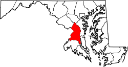
Nottingham, Prince George's County, Maryland

Last updated
Nottingham Site
Nearest city Upper Marlboro, Maryland
NRHP reference No. 75002083 [1]
Added to NRHPMay 12, 1975

Nottingham is a small town on the Patuxent River in Prince George's County, Maryland, United States. It contains an archaeological site which was listed on the National Register of Historic Places in 1975. [1]

Contents

Pre-European era

The Nottingham site is an archeological site located on a terrace of the Patuxent River, near Upper Marlboro, Prince George's County, Maryland. The site contains an important record of more than 5000 years of prehistory, including Middle Archaic (c. 6000 BC) through Late Woodland (AD 1600) materials. Of particular note are a sizable Middle Woodland Selby Bay component, and a large Late Woodland component (c. AD 1550–1600) which may correspond to the village of Mattpament depicted on John Smith's 1608 map. [2]

Colonial settlement

The Bowie family settled in this area during the colonial period, building a number of homes including "Mattaponi". [3]

Benjamin Contee was born in Nottingham.

Related Research Articles

Patuxent River River in Maryland, United States

The Patuxent River is a tributary of the Chesapeake Bay in the state of Maryland. There are three main river drainages for central Maryland: the Potomac River to the west passing through Washington, D.C., the Patapsco River to the northeast passing through Baltimore, and the Patuxent River between the two. The 908-square-mile (2,352 km2) Patuxent watershed had a rapidly growing population of 590,769 in 2000. It is the largest and longest river entirely within Maryland, and its watershed is the largest completely within the state.

Piscataway, Maryland Unincorporated community in Maryland

Piscataway is an unincorporated community in Prince George's County, Maryland, United States. It is one of the oldest European-colonized communities in the state. The Piscataway Creek provided sea transportation for export of tobacco. It is located near the prior Piscataway tribe village of Kittamaqundi.

Piscataway Park

Piscataway Park, located 20 miles (32 km) southwest of downtown Washington, D.C., in and around Accokeek, Maryland, protects Marshall Hall the National Colonial Farm, and the Accokeek Creek Site. The park is located across the Potomac River from George Washington's Mount Vernon estate.

Queen Anne, Prince Georges County, Maryland Census-designated place in Maryland

Queen Anne in Prince George's County, Maryland, United States, is a former seaport on the Patuxent River. It was delineated as a CDP for the 2010 census, at which time it had a population of 1,280.

Broad Creek, Prince Georges County, Maryland United States historic place

Broad Creek in Prince George's County was the first footprint of European settlement in the immediate counties around what would become the nation's capital, Washington, D.C. The area is part of greater Fort Washington.

Accokeek Creek Site United States historic place

Accokeek Creek Site, also known as Moyaone, is an archaeological site in Prince George's County, Maryland, located along the Potomac River across from Mount Vernon in today's Piscataway Park, which was inhabited intermittently since 2000 BC. Accokeek Creek Site was declared a National Historic Landmark in 1964.

The Woodyard Archeological Site is an unexcavated archaeological site located in Clinton, Prince George's County, Maryland. This site was originally patented as "Darnall’s Delight" for Colonel Henry Darnall in 1683. Sometime before 1711, Darnall built a large brick mansion known as "The Woodyard."

National Archives Archeological Site (College Park, Maryland) United States historic place

The National Archives Site is an archeological site at the National Archives facility in College Park, Prince George's County, Maryland. The site contains archeological remains from prehistoric settlements during the Late Archaic period, c. 4000-1500 B.C. Stone artifacts recovered through archeological testing indicate that this camp served as a place of stone tool manufacture and probably as a staging point for hunting and foraging. Physical integrity of the prehistoric component is high, with little plow disturbance or admixture with artifacts from other periods. The presence of a small number of other artifacts, including the projectile points, a spokeshave, and utilized flakes, indicates that the site also served in other hunting and foraging pursuits. It is one of a relatively small percentage of known prehistoric properties in Maryland with undisturbed archeological deposits.

Avondale Mill United States historic place

The Avondale Mill was a large gable-front stone structure, three stories in height, and 10 bays long by three wide. It was located on the bank of the Patuxent River in the city of Laurel, Prince George's County, Maryland. It was constructed in 1844-1845 for Captain William Mason & Son of Baltimore. It was complemented by the neighboring Laurel Mill built in 1811 S.D. Heath's machine shop and Richard Israel's flouring mill. At that time it was provided with the machinery for the manufacture of fine cloth, running as many as 1,500 cotton spindles with 150 employees. In 1845, industrialist Peter Gorman was responsible for the first macadamized (paved) road in Laurel, Avondale Street next to the new Mill.

Compton Bassett (Upper Marlboro, Maryland) United States historic place

Compton Bassett is a historic home in Upper Marlboro, Prince George's County, Maryland, United States, that was constructed ca. 1783. It is a two-story brick Georgian house, covered with cream-colored stucco, on a high basement of gray stucco. A two-story wing was added in 1928. Remaining outbuildings include a chapel to the southeast, a meat-house to the southwest, and a dairy to the northwest. Also on the property is a family burial ground.

Hazelwood (Upper Marlboro, Maryland) United States historic place

Hazelwood is a historic home located outside Upper Marlboro, Prince George's County, Maryland, United States. The home is a large asymmetrical frame dwelling, built in three discrete sections over a long period of time. They are: a low gambrel-roofed section dating from the 18th century, about 1770; a gable-roofed Federal-style dwelling dating from the very early 19th century; and a tall gable-front Italianate-style central section constructed about 1860. The house stands on high ground west of and overlooking the site of historic Queen Anne town on the Patuxent River. Also on the property are several domestic and agricultural outbuildings, and the reputed sites of two cemeteries.

Walker Prehistoric Village Archeological Site is an archeological site located near Poolesville, Montgomery County, Maryland. The site is a large Late Woodland village located on Selden Island in the Potomac River. Excavations carried out in the 1930s and 1940s revealed a 40-foot section of a palisade, circular house patterns, shallow oval pits and cylindrical pits, and flexed burials interred in the floors of the houses.

Patterson's Archeological District is a 512-acre (2.07 km2) archaeological site near Wallville in Calvert County, Maryland at the mouth of St. Leonard's Creek, the largest tributary of the tidal portions of the Patuxent River. It contains a representative sample of a range of archeological sites characteristic of both upland and lowland utilization of the Chesapeake Bay tidewater region during the prehistoric and historic periods. The property also contains a range of historic sites.

Aisquith Farm E Archeological Site is an archaeological site near Riva in Anne Arundel County, Maryland. It is one of several small sites located within the confines of Aisquith farm. It is associated with the Early and Middle Woodland periods of cultural development in Anne Arundel County. The site is significant as a base camp property type.

Martins Pond Site United States historic place

The Martins Pond Archeological Site is an archaeological site near Annapolis in Anne Arundel County, Maryland. It is a Middle-Late Woodland period site, with lithic, floral, and faunal remains.

Mattapany-Sewall Archeological Site United States historic place

Mattapany-Sewall Archeological Site is an archaeological site in St. Mary's County, Maryland. It is located at the Patuxent River Naval Air Station on a level terrace approximately 45' above sea level, less than 1000' south of the Patuxent River in an unused wooded/grassy tract. Documentary evidence identifies the site as Mattapany-Sewall, a manor established in 1663 and occupied from 1666 to 1684 by Charles Calvert, 3rd Baron Baltimore. It served as a governmental meeting place and colonial arsenal, and was the scene of the 1689 battle, known as the Protestant Revolution of 1689, in which Maryland's Proprietary government was overthrown.

Barton Village Site United States historic place

Barton Village Site, also known as the Herman Barton Indian Village Archeological Site, is a large, multi-component archaeological site near Cumberland in Allegany County, Maryland.

The Shawnee Old Fields Village Site, is an archaeological site near Oldtown in Allegany County, Maryland. The site contains Late Woodland and Contact period artifacts. An area between the site and the river's edge may be the location of a number of short-term camps and/or dwelling units. The first confirmed archeological manifestation of the several historically documented Shawnee villages in Maryland. It is believed to have been the home of Chief Opessa Straight Tail, a Shawnee leader.

The Sandy Point Site, or Sandy Point Archeological Site, is an archaeological site near Ocean City in Worcester County, Maryland. It contains the southernmost component of the Townsend Series on the Delmarva Peninsula. It is also one of the few known Woodland period village sites in this area. These traits are shared by the nearby Buckingham Archeological Site.

The Grear Prehistoric Village Site is an archeological site located near Crystal Beach, Cecil County, Maryland. The site was discovered and tested by an amateur archeologist in 1971. It is the northernmost known Late Woodland period village site on the Eastern Shore of the Chesapeake Bay outside of the Susquehanna River Basin.

References

  1. 1 2 "National Register Information System". National Register of Historic Places . National Park Service. April 15, 2008.
  2. "Nottingham Site". Maryland Historical Trust. Retrieved 2008-10-29.
  3. Hall, Clayton Colman (1912). Baltimore: Its History and Its People, vol.3. Lewis Historical Publishing Co. pp. 300–301.