Parson's Pond

Last updated
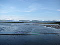
Parson's Pond
Sandy Bay
Town
Canada Newfoundland and Labrador location map 2.svg
Red pog.svg
Parson's Pond
Location of Parson's Pond in Newfoundland
Coordinates: 50°02′13″N57°41′49″W / 50.03694°N 57.69694°W / 50.03694; -57.69694
Country Flag of Canada (Pantone).svg  Canada
Province Flag of Newfoundland and Labrador.svg  Newfoundland and Labrador
Population
 (2021) [1]
  Total368
Time zone UTC-3:30 (Newfoundland Time)
  Summer (DST) UTC-2:30 (Newfoundland Daylight)
Area code(s) 709
Highways NL Route 430.svg Route 430

Parson's Pond is a community in the province of Newfoundland and Labrador in Canada.

Contents

History

Parson's Pond was originally called Sandy Bay. It is located on the Great Northern Peninsula. The first census was in the late 19th century and had a population of just 18, by 2001 the population was 427.

Demographics

In the 2021 Census of Population conducted by Statistics Canada, Parson's Pond had a population of 368 living in 177 of its 216 total private dwellings, a change of

Tourism

Parson's Pond, which has a small harbour, is on route 430 which is known as the Viking Trail. From the town there is a scenic view to Gros Morne National Park which is just 5 km to the south. The Arches Provincial Park with an interesting geological formation of limestone formed by glacial action, wind and water erosion is 10 km north of the town. [2]

Parson's Pond is also known as the final resting place of Zachary Turner after being involved with a murder-suicide with his mother, Shirley Jane Turner. [3]

Related Research Articles

Gros Morne National Park National Park on the west coast of Newfoundland

Gros Morne National Park is a Canadian national park and World Heritage Site located on the west coast of Newfoundland. At 1,805 km2 (697 sq mi), it is the second largest national park in Atlantic Canada after Torngat Mountains National Park, which has an area of 9,700 km2 (3,700 sq mi).

Deer Lake, Newfoundland and Labrador Town in Newfoundland and Labrador, Canada

Deer Lake is a town in the western part of the island of Newfoundland in the province of Newfoundland and Labrador, Canada.

Conception Bay South Town in Newfoundland and Labrador, Canada

Conception Bay South is a town located on the southern shore of Conception Bay on the Avalon Peninsula of the island of Newfoundland, Province of Newfoundland and Labrador, Canada. The town is commonly called C.B.S. Conception Bay South is the second largest settlement in Newfoundland and Labrador and is part of the St. John's Metropolitan Area.

St. Barbe (electoral district)

St. Barbe is a defunct provincial electoral district for the House of Assembly of Newfoundland and Labrador, Canada. As of 2011, there were 7,064 eligible voters living within the district. The district was abolished in 2015 and replaced by St. Barbe-L'Anse aux Meadows.

Great Northern Peninsula Peninsula of Newfoundland, Canada

The Great Northern Peninsula is the largest and longest peninsula of Newfoundland, Canada, approximately 270 km long and 90 km wide at its widest point and encompassing an area of 17,483 km2. It is defined as that part of Newfoundland from Bonne Bay northwards around Cape Norman and Cape Bauld and thence southwards to the head of White Bay, bounded by the Gulf of St. Lawrence on the west, the Strait of Belle Isle on the north and the Labrador Sea and White Bay on the east.

Woody Point, Newfoundland and Labrador Town in Newfoundland and Labrador, Canada

Woody Point is a town located in the heart of Gros Morne National Park, on the western coast of Newfoundland. Situated on Bonne Bay, the Town of Woody Point encompasses three areas: Curzon Village, Woody Point and Winterhouse Brook. It has a total population of 244 residents. Woody Point is a Registered Heritage District and has a waterfront with many heritage buildings and four Registered Newfoundland and Labrador Heritage Structures. The community is served by Route 431.

Trout River, Newfoundland and Labrador Town in Newfoundland and Labrador, Canada

Trout River is a small rural fishing village located on the southern coastal edge of Gros Morne National Park in Newfoundland, near the Tablelands. Trout River was settled in 1815 by George Crocker and his family, who were its only inhabitants until 1880. The community is served by Route 431.

Reefs Harbour-Shoal Cove West-New Ferolle Lighthouse

Reefs Harbour-Shoal Cove West-New Ferolle is a local service district and designated place in the Canadian province of Newfoundland and Labrador. It is southwest of Anchor Point.

River of Ponds is a town located northeast of Daniel's Harbour, Newfoundland and Labrador. It became a Local Government Community in 1970 and had a population of 166 in 1956. The 2021 census reported a population of 173.

Rocky Harbour, Newfoundland and Labrador Town in Newfoundland and Labrador, Canada

Rocky Harbour is a town located on the western edge of Newfoundland, near the entrance to Bonne Bay. The harbour was previously known as Small Bay or Little Harbour. This town is home to Gros Morne National Park, a World Heritage Site.

Division No. 9, Newfoundland and Labrador Census division in Newfoundland and Labrador, Canada

Census Division No. 9 is composed of the area of the province of Newfoundland and Labrador called the Northern Peninsula. It has a land area of 13,527.12 km² and had a population of 15,607 at the 2016 census. The largest community is the town of St. Anthony, near its northern tip, on the Atlantic Ocean coast.

Norris Point Town in Newfoundland and Labrador, Canada

Norris Point is a community in the Canadian province of Newfoundland and Labrador.

Bartlett's Harbour is a local service district and designated place in the Canadian province of Newfoundland and Labrador that is northeast of Pointe Riche on the island of Newfoundland. There was a lobster packing establishment and the Reid-Newfoundland Steamers called weekly by 1911. The village became a Canadian Post Office in 1949, on April 1. It was served by the C.N.R Express after June 1953. It had a population of 50 in 1911, 57 by 1940, 106 in 1951 and 146 in 1956.

The Arches Provincial Park

The Arches Provincial Park is a public park on the western coastline of Newfoundland and Labrador, Canada that features a photogenic rock formation.

Newfoundland and Labrador Route 430

Route 430 is a 413-kilometre-long (257 mi) paved highway that traverses the Great Northern Peninsula of Newfoundland in the Canadian province of Newfoundland and Labrador. The route begins at the intersection of Route 1 in Deer Lake and ends in St. Anthony. Officially known as the Great Northern Peninsula Highway, it has been designated as the Viking Trail since it is the main auto route to L'Anse aux Meadows, the only proven Viking era settlement in North America. It is the primary travel route in the Great Northern Peninsula and the only improved highway between Deer Lake and St. Anthony. It is the main access route to the Labrador Ferry terminal in St. Barbe.

Cow Head (town) Town in Newfoundland, Canada

Cow Head is a town in the Canadian province of Newfoundland and Labrador. The town had a population of 478 in the Canada 2016 Census.

Sally's Cove is a town in the Canadian province of Newfoundland and Labrador. It is located on the west coast of the island of Newfoundland, and is surrounded by Gros Morne National Park. The town had a population of 15 in the Canada 2021 Census.

Southern Harbour Town in Newfoundland and Labrador, Canada

Southern Harbour is a town in the province of Newfoundland and Labrador, Canada. The town had a population of 369 in the Canada 2016 Census.

New Harbour is a local service district and designated place in the Canadian province of Newfoundland and Labrador. It is on the east shore of Trinity Bay, along Provincial Route 80. Route 80's intersection with Route 73 is inside New Harbour.

Little Harbour (East) is a local service district and designated place in the Canadian province of Newfoundland and Labrador on the Placentia Bay of the island of Newfoundland.

References

  1. 1 2 "Population and dwelling counts: Canada, provinces and territories, census divisions and census subdivisions (municipalities), Newfoundland and Labrador". Statistics Canada. February 9, 2022. Retrieved March 15, 2022.
  2. Andrew Hampstead: Atlantic Canada, p.377, Berkeley CA 2012
  3. Fegan, Matt (Oct 14, 2004). "Murder-suicide funeral: An assignment to dread". King's Journalism Review. Vol. 10. Archived from the original on January 19, 2016. Retrieved March 3, 2014.

Coordinates: 50°02′13″N57°41′49″W / 50.03694°N 57.69694°W / 50.03694; -57.69694