Pinedale Ranger Station | |
Nearest city | Pinedale, Navajo County, Arizona |
---|---|
Coordinates | 34°18′16.654″N110°14′47.245″W / 34.30462611°N 110.24645694°W Coordinates: 34°18′16.654″N110°14′47.245″W / 34.30462611°N 110.24645694°W |
Area | 3 acres (1.2 ha) |
Built | 1934 |
Architect | USDA Forest Service |
Architectural style | Bungalow/Craftsman |
MPS | Depression-Era USDA Forest Service Administrative Complexes in Arizona MPS |
NRHP reference No. | 93000510 [1] |
Added to NRHP | June 10, 1993 |
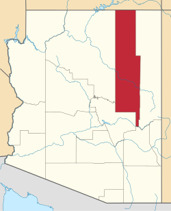
The Pinedale Ranger Station is in the Apache-Sitgreaves National Forests, and located near Pinedale in Navajo County, Arizona.
The ranger station's buildings were built in 1934 by the CCC − Civilian Conservation Corps.
The administration of timber sales was one of the ranger's main duties; the lumber mill town of Standard is located about three miles to the south. [2]
It was listed on the National Register of Historic Places for its architecture, which is American Craftsman and Bungalow style. It was designed by architects of the USDA Forest Service.
The NRHP listing included three contributing buildings which served as government housing and as office space, located on 3 acres (1.2 ha). [1]
Painted Desert Inn is a historic complex in Petrified Forest National Park, in Apache County, eastern Arizona. It is located off Interstate 40 and near the original alignment of historic U.S. Route 66, overlooking the Painted Desert.
Crystal Lake State Park is a day-use state park and historic site in Barton, Vermont, United States. It is located at 96 Bellwater Avenue, off Willoughby Lake Road just east of the village, at the northwestern end of 763-acre (309 ha) Crystal Lake. It features a sandy beach with swimming area, and a bath house built by the Civilian Conservation Corps (CCC). A cottage is available for rental. The park was added to the U.S. National Register of Historic Places on August 30, 2005, for its association with the CCC.
Sitgreaves National Forest was established by the U.S. Forest Service in Arizona on July 1, 1908 with 749,084 acres (3,031.44 km2) from portions of Black Mesa and Tonto National Forests. In 1974 entire forest was administratively combined with Apache National Forest to create Apache-Sitgreaves National Forests. The Sitgreaves National Forest is located in the southern parts of Navajo, Coconino, and Apache counties. It had an area of 818,749 acres (3,313.4 km²) as of 30 September 2008. There are local ranger district offices in Lakeside and Overgaard.
Canelo is a ghost town in eastern Santa Cruz County, Arizona, between the Canelo Hills and the northern end of the Huachuca Mountains. The site lies along Turkey Creek on Arizona State Route 83, between Sonoita and Parker Canyon Lake, which is about ten miles (16 km) to the south-southeast in Cochise County. Today, several historic buildings listed on the National Register of Historic Places remain standing in Canelo, including a one-room schoolhouse and a United States Forest Service ranger station.
The Isabella Ranger Station is a complex of 21 buildings in Stony River Township, Minnesota, United States, near the town of Isabella. It is located on Minnesota State Highway 1 about one mile east of Isabella. The complex is listed on the National Register of Historic Places for its association with New Deal federal relief construction.
Architects of the United States Forest Service are credited with the design of many buildings and other structures in National Forests. Some of these are listed on the National Register of Historic Places due to the significance of their architecture. A number of these architectural works are attributed to architectural groups within the Forest Service rather than to any individual architect. Architecture groups or sections were formed within engineering divisions of many of the regional offices of the Forest Service and developed regional styles.
Canelo Ranger Station, also known as Canelo Work Station, is a historic ranger station in the Coronado National Forest, within Santa Cruz County of southern Arizona. It is located in the ghost town of Canelo, within a small valley between the Canelo Hills on the west and the northern Huachuca Mountains on the east.
The Columbine Work Station in Coronado National Forest near Safford, Arizona was built in 1935 by the Civilian Conservation Corps (CCC). The complex is a representative example of a Depression-era Forest Service administrative center. The station is on a high point of the Pinaleño Mountains in forested land. The main residence is in the Forest Service bungalow style. The barn is unique, not designed to a standard Forest Service prototype.
The Lowell Ranger Station compound is in the Coronado National Forest of southern Arizona. It is located in Pima County, near Tucson.
The Moqui Ranger Station in Kaibab National Forest near Tusayan, Arizona, also known as Tusayan Ranger Station, was built in 1939 by the Civilian Conservation Corps (CCC). It was listed on the National Register of Historic Places in 1993 for its architecture, which includes Bungalow architecture, Rustic architecture, vernacular and other styling. It was designed by the USDA Forest Service. The listing includes institutional housing and government office space in six contributing buildings and one other contributing structure over 2 acres (0.81 ha) In addition to CCC labor, workers from the Works Progress Administration (WPA) may have also been involved in the ranger station construction. The station replaced the old Hull Tank Ranger Station.
The Portal Ranger Station, also known as Portal Work Station, is located in Cave Creek Canyon, in the eastern Chiricahua Mountains, in Coronado National Forest near Portal, southeastern Arizona.
Sycamore Ranger Station, also known as Sycamore Work Center and as Sycamore Administrative Site, in Prescott National Forest near Camp Verde, Arizona was built in 1940 by the Civilian Conservation Corps. It was listed on the National Register of Historic Places in 1993 for its architecture, which includes vernacular, national(?), and other styles. It was designed by architects of the United States Forest Service. It served historically as institutional housing and as government office space. The NRHP listing included two contributing buildings on 2.5 acres (1.0 ha).
Bailey Ruin is an archaeological site located in Navajo County, Arizona, United States. The site, also known as "Stott Ranch Ruin" and "Pope Ranch Site," was added to the National Register of Historic Places on March 17, 2006 for its historical and archaeological significance.
The Gold Creek Ranger Station is located in Humboldt-Toiyabe National Forest in Elko County, Nevada, USA. It was built in 1910 to administer the Ruby Mountains Forest Reserve, which became Humboldt National Forest. The compound was later expanded by labor provided by the Civilian Conservation Corps.
The Paradise Valley Ranger Station, located at 355 S. Main St. in Paradise Valley, serves a district of the Humboldt-Toiyabe National Forest in Humboldt County, northwestern Nevada. It has also been known as the Paradise Valley Guard Station.
Townshend State Park is a state park in Townshend, Vermont. Embedded within Townshend State Forest, the park provides a camping facility and hiking trails for accessing Bald Mountain. The park's facilities were developed by the Civilian Conservation Corps in the 1930s, and are listed on the National Register of Historic Places for their well-preserved state.
Gifford Woods State Park is a state park located at the base of Pico Peak in Killington, Vermont. The wooded park provides camping, picnic, and fishing facilities, and has hiking trails, including a portion of the Appalachian Trail. It preserves an area of old-growth forest that has been designated a National Natural Landmark, and is accessible via an interpretive trail. The park was established in 1931. Part of it is listed on the National Register of Historic Places, for facilities developed by the Civilian Conservation Corps in the 1930s.
Stillwater State Park is a state park located on Lake Groton in Groton, Vermont. The park is located in Groton State Forest close to the Groton Nature Center, Boulder Beach State Park and Big Deer State Park. The park offers camping, picnicking, and access to water-related activities on Lake Groton. The park was developed in the 1930s by crews of the Civilian Conservation Corps (CCC). It is open to the public between Memorial Day weekend and Columbus Day weekend; fees are charged for day use and camping.
The Kabetogama Ranger Station District is a historic ranger station complex in Kabetogama, Minnesota, United States. It was built from 1933 to 1941 by the Civilian Conservation Corps (CCC) as an administrative center for Kabetogama State Forest, managed by the Minnesota Department of Natural Resources. Following the establishment of Voyageurs National Park in the 1970s, the Minnesota government finalized the donation of the property to the National Park Service (NPS) in 1987. The NPS continues to use the property as one of the four administrative and visitor entrances to Voyageurs.
The North Bend Ranger Station is a collection of buildings operated by the USDA Forest Service in the Mount Baker-Snoqualmie National Forest. Constructed by the Civilian Conservation Corps (CCC) in 1936, it was added to the National Register of Historic Places in 1991. The multiple buildings indicate the expansion of Forest Service responsibilities from custodial supervision to extensive resource management. North Bend Ranger Station is considered historic both for its distinctive rustic architecture and for its association with the federal New Deal programs.