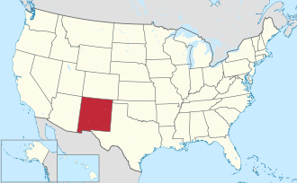
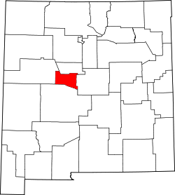
Valencia County | |
---|---|
Coordinates: 34°43′N106°48′W / 34.72°N 106.8°W | |
Country | United States |
State | New Mexico |
Founded | January 9, 1852 |
Named for | Valencia, New Mexico |
Seat | Los Lunas |
Largest village | Los Lunas |
Area | |
• Total | 1,068 sq mi (2,770 km2) |
• Land | 1,066 sq mi (2,760 km2) |
• Water | 2.1 sq mi (5 km2) 0.2% |
Population (2020) | |
• Total | 76,205 |
• Density | 71/sq mi (28/km2) |
Time zone | UTC−7 (Mountain) |
• Summer (DST) | UTC−6 (MDT) |
Congressional districts | 1st, 2nd |
Website | www |
Valencia County (Spanish : Condado de Valencia) is a county in the U.S. state of New Mexico. As of the 2020 census, the population was 76,205. [1] The county seat is Los Lunas. [2]
Valencia County is included in the Albuquerque, NM Metropolitan Statistical Area.
The county was a significant bellwether region that held the longest record for predicting presidential election winners until 2020.
The county, which had been previously larger in area, lost almost 81 percent of its territory on June 19, 1981, upon the creation of Cibola County, which occupies the westernmost portion of Valencia County's former area.
According to the U.S. Census Bureau, the county has a total area of 1,068 square miles (2,770 km2), of which 1,066 square miles (2,760 km2) is land and 2.1 square miles (5.4 km2) (0.2%) is water. [3] It is the second-smallest county in New Mexico by area.
Census | Pop. | Note | %± |
---|---|---|---|
1910 | 13,320 | — | |
1920 | 13,795 | 3.6% | |
1930 | 16,186 | 17.3% | |
1940 | 20,245 | 25.1% | |
1950 | 22,481 | 11.0% | |
1960 | 39,085 | 73.9% | |
1970 | 40,539 | 3.7% | |
1980 | 61,115 | 50.8% | |
1990 | 45,235 | −26.0% | |
2000 | 66,152 | 46.2% | |
2010 | 76,569 | 15.7% | |
2020 | 76,205 | −0.5% | |
U.S. Decennial Census [4] 1790–1960 [5] 1900–1990 [6] 1990–2000 [7] 2010 [8] |
As of the 2000 census, [9] there were 66,152 people, 22,681 households, and 17,350 families living in the county. The population density was 62 people per square mile (24 people/km2). There were 24,643 housing units at an average density of 23 per square mile (8.9/km2). The racial makeup of the county was 66.5% White, 1.3% Black or African American, 3.3% Native American, 0.4% Asian, 0.1% Pacific Islander, 23.9% from other races, and 4.6% from two or more races. 55.0% of the population were Hispanic or Latino of any race.
There were 22,681 households, out of which 39.6% had children under the age of 18 living with them, 57.2% were married couples living together, 13.1% had a female householder with no husband present, and 23.5% were non-families. 18.8% of all households were made up of individuals, and 6.4% had someone living alone who was 65 years of age or older. The average household size was 2.86 and the average family size was 3.25.
In the county, the population was spread out, with 30.1% under the age of 18, 8.4% from 18 to 24, 29.6% from 25 to 44, 21.7% from 45 to 64, and 10.2% who were 65 years of age or older. The median age was 34 years. For every 100 females there were 100.70 males. For every 100 females age 18 and over, there were 99.10 males.
The median income for a household in the county was $34,099, and the median income for a family was $37,157. Males had a median income of $30,339 versus $23,132 for females. The per capita income for the county was $14,747. About 13.5% of families and 16.8% of the population were below the poverty line, including 22.3% of those under age 18 and 10.8% of those age 65 or over.
As of the 2010 census, there were 76,569 people, 27,500 households, and 19,967 families living in the county. [10] The population density was 71.8 inhabitants per square mile (27.7/km2). There were 30,085 housing units at an average density of 28.2 per square mile (10.9/km2). [11] The racial makeup of the county was 73.2% white, 3.8% American Indian, 1.4% black or African American, 0.5% Asian, 0.1% Pacific islander, 17.0% from other races, and 4.0% from two or more races. Those of Hispanic or Latino origin made up 58.3% of the population. [10] In terms of ancestry, 10.9% were German, 6.7% were English, 6.1% were Irish, and 4.2% were American. [12]
Of the 27,500 households, 37.1% had children under the age of 18 living with them, 51.8% were married couples living together, 13.9% had a female householder with no husband present, 27.4% were non-families, and 22.1% of all households were made up of individuals. The average household size was 2.73 and the average family size was 3.18. The median age was 37.7 years. [10]
The median income for a household in the county was $42,044 and the median income for a family was $48,767. Males had a median income of $41,511 versus $32,584 for females. The per capita income for the county was $19,955. About 15.7% of families and 19.4% of the population were below the poverty line, including 29.7% of those under age 18 and 12.5% of those age 65 or over. [13]
Valencia County has two school districts: Belén Consolidated Schools and Los Lunas Public Schools. [14]
Valencia County once held the longest active streak of voting for the winner of U.S. presidential elections, breaking for the nationwide winner in every presidential election from 1952 to 2016. [16] In 2020, both it and Vigo County, Indiana broke their streaks dating back to the 1950s (since 1956 in Vigo) by selecting Donald Trump over eventual winner Joe Biden, leaving Clallam County, Washington, whose streak extends back to 1980, as the holder of longest-running presidential bellwether. [17] Before 1952, its record is less reliable; the only other Democratic president it voted for was Franklin D. Roosevelt in 1936.
Year | Republican | Democratic | Third party | |||
---|---|---|---|---|---|---|
No. | % | No. | % | No. | % | |
2020 | 17,364 | 53.80% | 14,263 | 44.19% | 650 | 2.01% |
2016 | 13,215 | 47.89% | 10,841 | 39.29% | 3,536 | 12.82% |
2012 | 12,825 | 46.25% | 13,511 | 48.73% | 1,392 | 5.02% |
2008 | 13,136 | 45.45% | 15,366 | 53.17% | 397 | 1.37% |
2004 | 14,474 | 55.64% | 11,270 | 43.33% | 268 | 1.03% |
2000 | 10,803 | 50.54% | 9,819 | 45.93% | 755 | 3.53% |
1996 | 7,779 | 41.95% | 9,169 | 49.44% | 1,597 | 8.61% |
1992 | 6,305 | 37.60% | 7,495 | 44.70% | 2,968 | 17.70% |
1988 | 7,874 | 51.80% | 7,136 | 46.95% | 190 | 1.25% |
1984 | 8,474 | 60.32% | 5,393 | 38.39% | 182 | 1.30% |
1980 | 11,177 | 58.39% | 6,886 | 35.97% | 1,079 | 5.64% |
1976 | 7,851 | 47.43% | 8,566 | 51.75% | 136 | 0.82% |
1972 | 8,239 | 56.09% | 6,110 | 41.60% | 339 | 2.31% |
1968 | 5,676 | 47.51% | 5,513 | 46.15% | 758 | 6.34% |
1964 | 3,950 | 33.60% | 7,757 | 65.98% | 50 | 0.43% |
1960 | 4,929 | 41.16% | 7,043 | 58.81% | 4 | 0.03% |
1956 | 4,663 | 56.74% | 3,547 | 43.16% | 8 | 0.10% |
1952 | 3,810 | 53.47% | 3,310 | 46.46% | 5 | 0.07% |
1948 | 3,280 | 52.67% | 2,914 | 46.80% | 33 | 0.53% |
1944 | 2,765 | 52.88% | 2,461 | 47.06% | 3 | 0.06% |
1940 | 3,436 | 50.83% | 3,318 | 49.08% | 6 | 0.09% |
1936 | 2,941 | 46.75% | 3,336 | 53.03% | 14 | 0.22% |
1932 | 3,263 | 59.25% | 2,229 | 40.48% | 15 | 0.27% |
1928 | 3,500 | 79.87% | 881 | 20.10% | 1 | 0.02% |
1924 | 3,183 | 78.01% | 678 | 16.62% | 219 | 5.37% |
1920 | 2,839 | 74.59% | 951 | 24.99% | 16 | 0.42% |
1916 | 1,540 | 79.50% | 383 | 19.77% | 14 | 0.72% |
1912 | 1,263 | 77.25% | 231 | 14.13% | 141 | 8.62% |
Crenshaw County is a county located in the south central portion of the U.S. state of Alabama. It is located immediately south of the Montgomery metropolitan area. As of the 2020 census, the population was 13,194. Its county seat is Luverne. Its name is in honor of an Alabama judge, Anderson Crenshaw.
Torrance County is a county located in the center of the U.S. state of New Mexico. As of the 2020 census, the population was 15,045. The county seat is Estancia.
Sandoval County is located in the U.S. state of New Mexico. As of the 2020 census, the population was 148,834, making it the fourth-most populous county in New Mexico. The county seat is Bernalillo.
McKinley County is a county in the northwestern section of the U.S. state of New Mexico. As of the 2020 United States Census, its population was 72,902. Its county seat is Gallup. The county was created in 1901 and named for President William McKinley.
Lincoln County is a county in the U.S. state of New Mexico. As of the 2020 census, the population was 20,269. Its county seat is Carrizozo, while its largest community is Ruidoso.
Cibola County is a county in the U.S. state of New Mexico. As of the 2020 census, the population was 27,172. Its county seat is Grants. It is New Mexico's youngest county, and the third youngest county in the United States, created on June 19, 1981, from the westernmost four-fifths of the formerly much larger Valencia County.
Bernalillo County is the most populous county in the U.S. state of New Mexico. As of the 2020 census, the population was 676,444. The county seat, Albuquerque, is the most populous city in New Mexico.
Custer County is a rural mountain county in the center of the U.S. state of Idaho. As of the 2020 census, the population was 4,275, making it the fifth-least populous county in Idaho. The county seat is Challis. Established in 1881, the county was named for the General Custer Mine, where gold was discovered five years earlier. Custer County relies on ranching, mining, and tourism as its main resources.
Cibola is a census-designated place (CDP) in La Paz County, Arizona, United States. The population was 250 at the 2010 census, up from 172 in 2000. It is named for the famed city of gold of the same name.
Valencia West is a census-designated place (CDP) in Pima County, Arizona, United States. The population was 9,355 at the 2010 census, a 293% increase over the population of 2,380 in 2000.
Acomita Lake is a census-designated place (CDP) in Cibola County, New Mexico, United States. The population was 339 at the 2020 census.
Encinal is a census-designated place (CDP) in Cibola County, New Mexico, United States. It is the smallest of the six villages of the Laguna Pueblo and sits at the base of Mount Taylor. The population was 210 at the 2010 census. The feast day for Encinal is September 8.
Laguna is a census-designated place (CDP) on the Laguna Pueblo in Cibola County, New Mexico, United States. The population was 1,241 at the 2010 census. It is located approximately 47 miles west of Albuquerque.
Mesita is a census-designated place (CDP) in Cibola County, New Mexico, United States. The population was 804 at the 2010 census.
Milan is a village in Cibola County, New Mexico, United States. The population was 3,245 at the 2010 census.
North Acomita Village is a census-designated place (CDP) in Cibola County, New Mexico, United States. The population was 303 at the 2010 census.
Paguate is a census-designated place (CDP) in Cibola County, New Mexico, United States. The population was 421 at the 2010 census.
Paraje is a census-designated place (CDP) in Cibola County, New Mexico, United States. As of the 2010 census, the CDP population was 777.
Seama is a census-designated place (CDP) in Cibola County, New Mexico, United States. The population was 465 at the 2010 census.
Skyline-Ganipa is a census-designated place (CDP) in Cibola County, New Mexico, United States. The population was 1,224 at the 2010 census.