
New Zealand is divided into sixteen regions for local government purposes. Eleven are administered by regional councils, and five are administered by unitary authorities, which are territorial authorities that also perform the functions of regional councils. The Chatham Islands Council is not a region but is similar to a unitary authority, authorised under its own legislation.

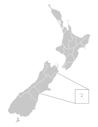
The South Island is the largest of the three major islands of New Zealand in surface area, the others being the smaller but more populous North Island and sparsely populated Stewart Island. It is bordered to the north by Cook Strait, to the west by the Tasman Sea, to the south by the Foveaux Strait and Southern Ocean, and to the east by the Pacific Ocean. The South Island covers 150,437 square kilometres (58,084 sq mi), making it the world's 12th-largest island, constituting 56% of New Zealand's land area. At low altitudes, it has an oceanic climate. The major centres are Christchurch, with a metropolitan population of 521,881, and the smaller Dunedin. The economy relies on agriculture, fishing, tourism, and general manufacturing and services.

Territorial authorities are a tier of local government in New Zealand, alongside regional councils. There are 67 territorial authorities: 13 city councils, 53 district councils and the Chatham Islands Council. District councils serve a combination of rural and urban communities, while city councils administer the larger urban areas. Auckland, Gisborne, Nelson, Tasman and Marlborough each have a unitary authority, which performs the functions of both a territorial authority and a regional council. The Chatham Islands Council is a sui generis territorial authority that is similar to a unitary authority.

The Catlins comprise an area in the southeastern corner of the South Island of New Zealand. The area lies between Balclutha and Invercargill, straddling the boundary between the Otago and Southland regions. It includes the South Island's southernmost point, Slope Point.

The mayor of Dunedin is the head of the local government, the city council of Dunedin, New Zealand. The mayor's role is "to provide leadership to the other elected members of the territorial authority, be a leader in the community and perform civic duties". The mayor is directly elected, using the single transferable vote (STV) system from 2007. The current mayor is Jules Radich who was elected in 2022.
District health boards (DHBs) in New Zealand were organisations established by the New Zealand Public Health and Disability Act 2000 under the Fifth Labour Government, responsible for ensuring the provision of health and disability services to populations within a defined geographical area. They existed from 1 January 2001, when the act came into force, to 30 June 2022. Initially there were 21 DHBs, and this was reduced to 20 organisations in 2010: fifteen in the North Island and five in the South Island. DHBs received public funding from the Ministry of Health on behalf of the Crown, based on a formula that took into account the total number, gender, age, socio-economic status and ethnic mix of their population. DHBs were governed by boards, which were partially elected and partially appointed by the minister of Health.

Triennial elections for all 73 cities and districts, twelve regional councils and all district health boards (DHBs) in New Zealand were held on 13 October 2007. Most councils were elected using the first-past-the-post voting method, but eight were elected using single transferable vote.
The 2010 New Zealand local elections were triennial elections to select local government officials and district health board members. All elections are conducted by postal ballot, with election day being Saturday 9 October 2010.
New Zealand has a unitary system of government in which the authority of the central government defines sub-national entities. Local government in New Zealand has only the powers conferred upon it by the New Zealand Parliament. Under the Local Government Act 2002, local authorities are responsible for enabling democratic local decision-making and promoting the social, economic, environmental, and cultural well-being of their communities, as well as more specific functions for which they have delegated authority.
The 2013 New Zealand local elections were triennial elections to elect local government officials and District Health Board members, and the membership of other local bodies such as Licensing Trusts. All elections were conducted by postal ballot, with election day being Saturday 12 October 2013.
The 2016 New Zealand local elections were triennial local elections to select local government officials and District Health Board members. Under section 10 of the Local Electoral Act 2001, a "general election of members of every local authority or community board must be held on the second Saturday in October in every third year" from the date the Act came into effect in 2001, meaning 8 October 2016.

Auckland District Health Board (ADHB) was a district health board that provided healthcare in the Auckland Region in New Zealand, mainly on the Auckland isthmus. This district health board existed between 2001 and 2022 and was governed by a part-elected, part-appointed board. In 2022, its functions and responsibilities were subsumed by Te Whatu Ora and Te Aka Whai Ora.

The Canterbury District Health Board was a district health board with the focus on providing healthcare to the Canterbury region of New Zealand, north of the Rangitata River. It was responsible for roughly 579,000 residents, or 12% of New Zealand's population. The Canterbury District Health Board covered a territory of 26,881 square kilometers and was divided between six territorial local authorities. In July 2022, the Canterbury DHB was merged into the national health service Te Whatu Ora.

The 2019 New Zealand local elections were triennial elections held in New Zealand on Saturday 12 October 2019.

The Capital and Coast District Health Board (CCDHB) was a district health board with the focus on providing healthcare to Wellington City, Porirua City and the Kāpiti Coast in New Zealand. The CCDHB employed about 6000 people across the Wellington Region. It was disestablished on 1 July 2022, with its functions and responsibilities being taken over by the national health service Te Whatu Ora.
Building consent authorities (BCAs) are officials who enforce New Zealand's regulatory building control system. The New Zealand Building Act 2004 sets out a registration and accreditation scheme and technical reviews. The Act creates operational roles for BCAs.

The Southern District Health Board was a district health board which provided healthcare to an area covering the southern half of the South Island of New Zealand. In July 2022, the Southern DHB was dissolved as part of a nationwide overhaul of the district health board system. Its former functions and responsibilities were taken over by Te Whatu Ora.
The 2001 New Zealand local elections were triennial elections to select local government officials. The elections are notable for being the inaugural elections for district health board members. The elections were held on Saturday, 13 October, as prescribed in the Local Electoral Act 2001.

The 2022 New Zealand local elections were triennial elections held in New Zealand on Saturday 8 October 2022. Voting began by postal vote on 16 September and ended at noon on 8 October 2022.
