Abbeyville, Colorado | |
---|---|
Motto: | |
Coordinates: 38°46′39″N106°29′32″W / 38.7775°N 106.4922°W [1] | |
Country | United States |
State | Colorado |
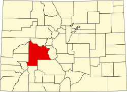
County | Gunnison [2] |
Government | |
• Body | Gunnison County [2] |
Elevation | 9,932 ft (3,027 m) |
Time zone | UTC-7 (MST) |
• Summer (DST) | UTC-6 (MDT) |
GNIS pop ID | 189092 |
Abbeyville is an extinct community located in Gunnison County, Colorado, United States.
Abbeyville was a mining camp near the Gold Cup Mine, [3] which was discovered around 1880. The camp grew around a smelter which was built on the site in 1881. [4] The Abbeyville post office operated from November 20, 1882, until December 3, 1884. [5] [6] By 1887, S.S. Sutton was the only inhabitant of Abbeyville. [7]
Abbeyville was located at 38°46′39″N106°29′32″W / 38.7775°N 106.4922°W at an elevation of 9,932 feet (3,027 m). [8]
According to the Köppen Climate Classification system, Abbeyville has a subarctic climate, abbreviated "Dfc" on climate maps. The hottest temperature recorded in was 86 °F (30.0 °C) on July 15, 1942, while the coldest temperature recorded was −60 °F (−51.1 °C) on February 1, 1985. The closest weather station is at the nearby Taylor Park Reservoir, which is where the climate data comes from. [9]
Climate data for Taylor Park, Colorado, 1991–2020 normals, extremes 1940–present | |||||||||||||
---|---|---|---|---|---|---|---|---|---|---|---|---|---|
Month | Jan | Feb | Mar | Apr | May | Jun | Jul | Aug | Sep | Oct | Nov | Dec | Year |
Record high °F (°C) | 54 (12) | 51 (11) | 61 (16) | 67 (19) | 79 (26) | 85 (29) | 86 (30) | 84 (29) | 79 (26) | 75 (24) | 65 (18) | 57 (14) | 86 (30) |
Mean maximum °F (°C) | 40.2 (4.6) | 44.0 (6.7) | 51.3 (10.7) | 59.2 (15.1) | 69.2 (20.7) | 77.2 (25.1) | 79.1 (26.2) | 76.4 (24.7) | 73.3 (22.9) | 65.4 (18.6) | 53.4 (11.9) | 41.6 (5.3) | 79.7 (26.5) |
Mean daily maximum °F (°C) | 28.5 (−1.9) | 32.9 (0.5) | 40.5 (4.7) | 47.1 (8.4) | 57.6 (14.2) | 68.9 (20.5) | 72.4 (22.4) | 69.8 (21.0) | 64.4 (18.0) | 53.5 (11.9) | 39.6 (4.2) | 27.6 (−2.4) | 50.2 (10.1) |
Daily mean °F (°C) | 10.4 (−12.0) | 13.9 (−10.1) | 22.4 (−5.3) | 32.5 (0.3) | 43.1 (6.2) | 52.3 (11.3) | 57.2 (14.0) | 55.5 (13.1) | 49.3 (9.6) | 39.3 (4.1) | 26.2 (−3.2) | 12.0 (−11.1) | 34.5 (1.4) |
Mean daily minimum °F (°C) | −7.8 (−22.1) | −5.0 (−20.6) | 4.3 (−15.4) | 18.0 (−7.8) | 28.6 (−1.9) | 35.7 (2.1) | 42.0 (5.6) | 41.2 (5.1) | 34.3 (1.3) | 25.2 (−3.8) | 12.8 (−10.7) | −3.5 (−19.7) | 18.8 (−7.3) |
Mean minimum °F (°C) | −31.7 (−35.4) | −30.1 (−34.5) | −22.8 (−30.4) | −1.5 (−18.6) | 16.5 (−8.6) | 27.9 (−2.3) | 34.7 (1.5) | 33.9 (1.1) | 24.8 (−4.0) | 10.7 (−11.8) | −7.7 (−22.1) | −28.9 (−33.8) | −35.7 (−37.6) |
Record low °F (°C) | −56 (−49) | −60 (−51) | −42 (−41) | −29 (−34) | −5 (−21) | 15 (−9) | 30 (−1) | 17 (−8) | 4 (−16) | −7 (−22) | −30 (−34) | −49 (−45) | −60 (−51) |
Average precipitation inches (mm) | 1.69 (43) | 1.55 (39) | 1.32 (34) | 1.64 (42) | 1.53 (39) | 0.87 (22) | 1.95 (50) | 2.18 (55) | 1.63 (41) | 1.39 (35) | 1.36 (35) | 1.69 (43) | 18.80 (478) |
Average snowfall inches (cm) | 25.4 (65) | 19.4 (49) | 21.2 (54) | 12.0 (30) | 2.9 (7.4) | 0.2 (0.51) | 0.0 (0.0) | 0.0 (0.0) | 0.3 (0.76) | 3.8 (9.7) | 14.6 (37) | 22.9 (58) | 122.7 (311.37) |
Average extreme snow depth inches (cm) | 28.9 (73) | 31.2 (79) | 22.4 (57) | 3.3 (8.4) | 1.2 (3.0) | 0.0 (0.0) | 0.0 (0.0) | 0.0 (0.0) | 0.3 (0.76) | 3.2 (8.1) | 5.6 (14) | 19.8 (50) | 34.3 (87) |
Average precipitation days (≥ 0.01 in) | 8.0 | 8.7 | 7.8 | 8.3 | 8.2 | 5.6 | 11.6 | 12.1 | 8.2 | 7.3 | 7.7 | 7.7 | 101.2 |
Average snowy days (≥ 0.1 in) | 8.2 | 7.5 | 7.6 | 4.5 | 1.3 | 0.1 | 0.0 | 0.0 | 0.1 | 1.5 | 5.4 | 7.7 | 43.9 |
Source 1: NOAA [10] | |||||||||||||
Source 2: National Weather Service (snow/snow days 1940-2022, snow depth 2008-2022) [9] |