Calhoun, Georgia | |
|---|---|
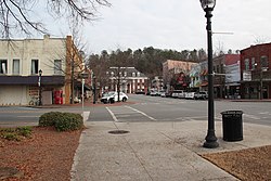 Downtown Calhoun and Courthouse | |
 Flag  Seal | |
| Motto: "Land of the Cherokee" [1] | |
 Location in Gordon County and the state of Georgia | |
| Coordinates: 34°30′0″N84°56′33″W / 34.50000°N 84.94250°W | |
| Country | United States |
| State | Georgia |
| County | Gordon |
| Incorporated (city) | January 1852 [2] |
| Named after | John C. Calhoun |
| Area | |
• Total | 16.11 sq mi (41.72 km2) |
| • Land | 16.03 sq mi (41.53 km2) |
| • Water | 0.073 sq mi (0.19 km2) |
| Elevation | 659 ft (201 m) |
| Population (2020) | |
• Total | 16,949 |
| • Density | 1,057.0/sq mi (408.11/km2) |
| Time zone | UTC-5 (Eastern (EST)) |
| • Summer (DST) | UTC-4 (EDT) |
| ZIP codes | 30701, 30703 (PO Boxes) |
| Area codes | 706/762 |
| FIPS code | 13-12456 [4] |
| GNIS feature ID | 0354936 [5] |
| Website | www |
Calhoun is a city in Gordon County, Georgia, United States. As of the 2020 census, the city had a population of 16,949. Calhoun is the county seat of Gordon County. [6] [7]


