Queen's Park, London

Last updated

Queen's Park
Queen's Park montage.jpg
From top left to bottom right: The northern entrance to Queen's Park; Victorian houses on Chevening Road; The bandstand in Queen's Park; Queen's Park Post Office on Salusbury Road
Greater London UK location map 2.svg
Red pog.svg
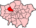
Queen's Park
Location within Greater London
Population12,372 (2018 Census. Westminster CC) [1]
OS grid reference TQ246832
  Charing Cross 4 mi (6.4 km)  SE
Civil parish
London borough
Ceremonial county Greater London
Region
Country England
Sovereign state United Kingdom
Post town LONDON
Postcode district NW6, NW10
Postcode district W9, W10
Dialling code 020
Police Metropolitan
Fire London
Ambulance London
UK Parliament
London Assembly
List of places
UK
England
London
51°32′02″N0°12′09″W / 51.5338°N 0.2026°W / 51.5338; -0.2026

Queen's Park is an area of Kilburn, located partly in the City of Westminster and mostly in the London Borough of Brent. Some of the area within Westminster forms a civil parish, the first to be created in London since the right of communities to establish civil parishes was enacted in 2007. The area is located 3.9 miles (6.3 km) north-west of Charing Cross, and centred around a 30 acres (12 ha) park, which opened in 1887 and was named in honour of Queen Victoria. The area gives its name to Queens Park Rangers football club.

Contents

Architecturally, Queen's Park is an important historic area, with a unified urban layout with a high level of building preservation. The park is a good example of a Victorian urban green space, and the surrounding streets largely comprise original two- and three-storey Victorian buildings. [2]

Governance

Queen's Park, London
Queen's Park civil parish in the City of Westminster
The Queens Park ward of the Metropolitan Borough of Paddington. Paddington merged into the City of Westminster in 1965. Paddington Met. B Ward Map 1916.svg
The Queens Park ward of the Metropolitan Borough of Paddington. Paddington merged into the City of Westminster in 1965.

Background

Queen's Park straddled the ancient parishes of Willesden (the northern part, in the London Borough of Brent) and Chelsea (the southern part, in the City of Westminster).

The Queens Park Estate was developed in 1875–81, in Kensal Town which had been an exclave of Chelsea from before the time of the Norman Conquest. [3] In 1900 the exclave was removed from Chelsea and divided between its neighbours, with most of it, the area north of the Grand Union Canal, and including the Queens Park Estate joining with the area of the ancient parish of Paddington to form the new Metropolitan Borough of Paddington. [4] [5] [6]

The park was laid out in the parish of Willesden in 1886. [7] In 1874 the parish of Willesden adopted the Local Government Act 1858 and a local board was formed. [8]

In 1965, Paddington merged with Westminster and Marylebone to form what is now City of Westminster, while Willesden became part of the new London Borough of Brent.

Electoral wards

The area gives its name to two electoral wards in adjacent London boroughs. The area north of Kilburn Lane is the Queens Park ward of the London Borough of Brent and the area south of Kilburn Lane is the Queen's Park ward of the City of Westminster.

The Queens Park ward in the southeast of the London Borough of Brent is represented by three Labour Party councillors on Brent London Borough Council as of the 2018 election. [9] This ward forms part of the Hampstead and Kilburn constituency, represented by Labour MP Tulip Siddiq.

The Queen's Park ward in the northwest of the City of Westminster is represented by three Labour Party councillors on Westminster City Council. [10] This ward forms part of the Westminster North parliamentary constituency, represented by Labour MP Karen Buck, whose spouse Barrie Taylor represented the Queen's Park ward from 1986 to 1990, then again from 1994 to 2018 in which year the title of Honorary Alderman was conferred upon him by the City Council. [11]

Queen's Park Community Council

In May 2012 residents of the Westminster ward voted in favour of the establishment of a Queen's Park civil parish and parish council.

In June 2012, Westminster City Council approved the establishment of Queen's Park Community Council from 1 April 2014 as the first parish council created in London since new legislation was enacted in 2007. [12] The community council area is coterminous with the City of Westminster ward of Queen's Park. [13]

The first election of councillors to the community council took place in May 2014 at the same time as other local elections. [14] [15] Subsequent elections are held every four years at the same time as elections to the city council, with the most recent being on 5 May 2022. Parish councils have no statutory responsibilities, but have a budget they can direct towards community projects.

Queen's Park Neighbourhood Plan

In November 2021 the City Council formally adopted the Queen's Park Neighbourhood Plan. [16] It is therefore now part of the statutory Development Plan for Westminster and will be used alongside the council’s own planning documents and the Mayor’s London Plan in determining applications in the Queen's Park Neighbourhood Area.

History

19th century

The Queens Park Estate was developed between 1875 and 1881, in what is now the City of Westminster, by the Artizans, Labourers & General Dwellings Company, and named in honour of Queen Victoria. [17] The park, which shares the name, lies a short distance north of the estate in the London Borough of Brent. It was laid out in 1886 by the City of London, and opened the following year. [17] [7]

In 1879 the Royal Agricultural Society annual show was held on the area which would become Queen's Park. The 100 acres (40 ha) site was chosen for its proximity to the railway network, Queen's Park Station having opened on 2 June 1879 on the main line from London to Birmingham, just in time to facilitate the movement of heavy machinery and stock. By the 1870s the annual shows had become major events and the Kilburn show was to be the largest ever held. The show was opened on 30 June 1879 by the Prince and Princess of Wales and saw an entry of 11,878 implements, 2,879 livestock entries and over 187,000 visitors. Poor weather and deep mud led to low attendance, but a visit by Queen Victoria on the fifth day, where she was driven on a specially constructed drive of ballast and brick from the new station along Salusbury Road on a route lined with cheering crowds, rallied visitors. [18]

In 1884 the North West London Park League was formed to secure the site as a people's park. The league appealed to the Ecclesiastical Commissioners not to sell the land for building until the future of the site could be assured as a public open space. In 1885 the Estates Committee of the commissioners agreed to offer the use of the central portion of the land of 30 acres (12 ha) for public use and that the remaining portion of the site would be laid out as housing to derive the most benefit from the frontage onto the proposed park. The offer was to be made through the lord mayor to the City of London Corporation, conditional on Parliamentary sanction. At 3:00 p.m. 5 September 1887 Queen's Park officially opened with several thousand people present. [18]

Victorian houses on Chevening Road in Queen's Park, built around 1899. Queens Park - geograph.org.uk - 2540016.jpg
Victorian houses on Chevening Road in Queen's Park, built around 1899.

The houses around Queen's Park were erected over a number of years starting with the north side of Harvist Road of which the majority were completed by 1899. [2] The west side of Chevening Road was also under construction in 1899 by local builders Bennet and Gimbrett to the design of G. A. Sexton. Many builders contributed to the estate which helped to generate the varied architectural character that can be seen on Kempe, Keslake and Chamberlayne Roads. [2]

The football team Queens Park Rangers was formed when a local boys team, founded by the vicar of the nearby St John's Church, merged with Christ Church Rangers and took their name from the area. They went on to become a professional team in 1889. [19] In July 2011 a plaque commemorating the event was unveiled by former star Stan Bowles on St Jude's Institute on Ilbert Street.

20th century

In 1915 the Bakerloo Line was extended to Queen's Park station, [18] the nearby Kensal Green station appearing in 1916. Both stations offer easy access to Paddington, Charing Cross and Waterloo mainline stations [20]

In 1917 Queens Park Rangers moved away from the area to the Loftus Road stadium in nearby Shepherd's Bush.

In summer 1979 The Jam recorded their music video When You're Young in Queen's Park, making use of the bandstand. [21]

In 1986 Brent Council with the support of English Heritage made the area around Queen's Park a Conservation Area in recognition of its special architectural and historic character. Subsequently, in 1993 the designated area was extended westwards towards Chamberlayne Road. [2]

Geography

Neighbouring areas

Neighbouring areas include Kensal Town to the south, Kensal Green to the west, Willesden to the north and Kilburn and Maida Vale to the east. There is a degree of overlap in perceptions of the extent of these areas.

The park

The northwest part of Queen's Park Queens Park - geograph.org.uk - 2540040.jpg
The northwest part of Queen's Park

The park was laid out by Alexander McKenzie between March 1887 and June 1887. McKenzie was a leading figure in Victorian park design, part of an influential group of landscape designers which included Robert Marnock, Joseph Meston and William Robinson who led garden design away from the parterres and geometry of earlier Victorian gardens to a more natural style of gardening. [18]

Designed without any straight paths, Queen's Park makes extensive use of bold tree planting and shrubberies with natural outlines, and large open areas of lawn for recreation and sport. [18]

Facilities in the park include six all-weather tennis courts, a pitch-and-putt course, an ornamental quiet garden, a children's playground with paddling pool, a children's animal farm and a café.

The bandstand in Queen's Park Queens Park - geograph.org.uk - 2540031.jpg
The bandstand in Queen's Park

A landmark in the park is the bandstand, which was completed in 1887 using ironwork supplied by Walter Fariane & Co. of Glasgow, and a timber roof with wrought-iron scrolled devices to each facet, and a central wrought- iron lantern. The bandstand was Grade-II listed in 2000. [22]

The park is managed by the City of London Corporation. In 2020 it won Green Flag status for the 24th year in a row, and an additional Green Heritage Site award for its care and conservation of open space and facilities. [23]

The City of London focuses on sustainable management, recycling as much waste as possible. Grass clippings and wood are used to make mulch for shrubberies; everyday waste like cans, bottles and plastics are separated and recycled. Residents bring in their Christmas trees, which are mulched and return for use on their own gardens. Rain water is recycled via a new drainage system. All water runs into a holding tank underground and can be pumped to various areas when needed. [24]

Places of worship

Imam Khoei Islamic Centre Imam Khoei Islamic Centre, Queens Park - geograph.org.uk - 379102.jpg
Imam Khoei Islamic Centre

Queen's Park has a range of places of worship:

Culture

The local community host two annual festivals at Queen's Park.

Economy

The Post Office on Salusbury Road Queens Park - geograph.org.uk - 2943395.jpg
The Post Office on Salusbury Road

The economic centre of Queen's Park is Salusbury Road, where there are many shops, pubs, cafes and restaurants.

The weekly Queen's Park Farmers' Market has around 40 stalls and takes place every Sunday between 10am and 2pm in the grounds of Salusbury Primary School on Salusbury Road, draws people from across north west London. The market was awarded market of the year at the Farmers’ Market and Retail Association Local Food Awards in 2012. [25]

AMC Networks opened a 25,000 square feet (2,300 m2) UK headquarters office housing 200 employees on Salusbury Road in 2017. [26] It closed in 2022 and was replaced with a Jobcentre Plus.

Education

The area has several schools:

Transport

Queen's Park station is a tube and Network Rail station in Travelcard Zone 2; it has direct links to south and central London via the Bakerloo line or to Euston, Watford Junction and intermediate stations via London Overground trains or to Harrow & Wealdstone station using Bakerloo line trains. Brondesbury Park station, on the London Overground North London Line, is near the northeast corner of Queen's Park. To the northwest of the area is Kensal Rise station also on the North London line and to the west of Queens Park is Kensal Green station which serves the Bakerloo line on the underground and Watford DC line on the overground. [28] [29]

The area is also well served by the London Bus network with the 6, 18, 28, 36, 52, 187, 206, 228, 316, and 452 all passing through or along the boundaries.

Notable residents

Notes

  1. The civil parish of Queen's Park coincides with the Queen's Park electoral ward of the City of Westminster

Related Research Articles

<span class="mw-page-title-main">Brondesbury</span> Human settlement in England

Brondesbury, which includes Brondesbury Park, is an area in the London Borough of Brent, in London, England. The area is traditionally part of the Ancient Parish and subsequent Municipal Borough of Willesden, one of the areas that merged to form the modern borough of Brent.

<span class="mw-page-title-main">Harlesden</span> Human settlement in England

Harlesden is a district in the London Borough of Brent, North West London.

Kensal Green is an area in north-west London and along with Kensal Town forms part of northern section of North Kensington. It lies north of the canal in the London Borough of Brent and also to the south within Kensington and Chelsea. Kensal Green is located on the Harrow Road, about 4.4 miles (7.1 km) miles from Charing Cross.

<span class="mw-page-title-main">Kilburn, London</span> Area of London, England

Kilburn is an area of north west London, England, which spans the boundary of three London Boroughs: Camden to the east, City of Westminster, and Brent to the west. There is also an area in the City of Westminster known locally as "Mozart" that along with Queens Park and Kensal Green are known as West Kilburn, which sometimes is treated as a distinct locality. Kilburn High Road railway station lies 3.5 miles (5.6 km) north-west of Charing Cross.

<span class="mw-page-title-main">London Borough of Brent</span> London borough in United Kingdom

Brent is a borough in north-west London. It is known for landmarks such as Wembley Stadium, the Swaminarayan Temple and the Kiln Theatre. It also contains the Welsh Harp reservoir and the Park Royal commercial estate. The local authority is Brent London Borough Council.

<span class="mw-page-title-main">Wembley</span> Suburb of London

Wembley is a large suburb in the London Borough of Brent, north-west London, 8 miles (13 km) northwest of Charing Cross. It includes the neighbourhoods of Alperton, North Wembley, Preston, Sudbury, Tokyngton and Wembley Park. The population was 102,856 in 2011.

<span class="mw-page-title-main">Willesden</span> Area of northwest London, England

Willesden is an area of northwest London, situated 5 miles (8 km) northwest of Charing Cross. It is historically a parish in the county of Middlesex that was incorporated as the Municipal Borough of Willesden in 1933, and has formed part of the London Borough of Brent in Greater London since 1965. Dollis Hill is also sometimes referred to as being part of Willesden.

<span class="mw-page-title-main">Edgware Road</span> Road in London, England

Edgware Road is a major road in London, England. The route originated as part of Roman Watling Street and, unusually in London, it runs for 10 miles in an almost perfectly straight line. Forming part of the modern A5 road, Edgware Road undergoes several name changes along its length, including Maida Vale, Kilburn High Road, Shoot Up Hill and Cricklewood Broadway; but the road is, as a whole, known as the Edgware Road, as it is the road to Edgware.

<span class="mw-page-title-main">Kilburn tube station</span> London Underground station

Kilburn is a London Underground station near Brondesbury Park in north-west London. It is on the Jubilee line, between Willesden Green and West Hampstead stations and is in Travelcard Zone 2. The station is on the A5 Kilburn High Road or Shoot-up Hill, approximately 0.1 miles (0.16 km) north of Brondesbury station. Metropolitan line trains typically bypass the station without stopping.

<span class="mw-page-title-main">Metropolitan Borough of Paddington</span> Former borough of London

Paddington was a civil parish and metropolitan borough in London, England. It was an ancient parish in the county of Middlesex, governed by an administrative vestry. The parish was included in the area of responsibility of the Metropolitan Board of Works in 1855 and became part of the County of London in 1889. The parish of Paddington became a metropolitan borough in 1900, following the London Government Act 1899, with the parish vestry replaced by a borough council. In 1965 the borough was abolished and its former area became part of the City of Westminster in Greater London.

<span class="mw-page-title-main">Metropolitan Borough of Chelsea</span> Former borough of London

The Metropolitan Borough of Chelsea was a metropolitan borough of the County of London between 1900 and 1965. It was created by the London Government Act 1899 from most of the ancient parish of Chelsea. Following the London Government Act 1963, it was amalgamated with the Royal Borough of Kensington in 1965 to form the Royal Borough of Kensington and Chelsea.

<span class="mw-page-title-main">Brent East (UK Parliament constituency)</span> Former UK Parliament constituency, 1974–2010

Brent East was a parliamentary constituency in north west London; it was replaced by Brent Central for the 2010 general election. It returned one Member of Parliament (MP) to the House of Commons of the Parliament of the United Kingdom, elected by the first past the post system.

<span class="mw-page-title-main">Harrow Road</span> Street in London

The Harrow Road is an ancient route in North West London which runs from Paddington in a northwesterly direction towards Harrow. It is also the name given to the immediate surrounding area of Queens Park and Kensal Green, straddling the NW10, W10, W2 and W9 postcodes. With minor deviations in the 19th and 20th centuries, the route remains otherwise unaltered.

Mapesbury is a residential area of northwest London, England. It forms one of twenty-one electoral wards of the London Borough of Brent.

<span class="mw-page-title-main">Brondesbury Park</span> Suburb of London, England

Brondesbury Park is a suburb and electoral ward of the London Borough of Brent. It is the part of Brondesbury which is not interwoven with Kilburn due to the naming of a major tube station (Kilburn) and is centred on Brondesbury Park railway station and the street, an avenue, which shares its name. The area has a number of open spaces, primarily Queen's Park and Tiverton Green.

<span class="mw-page-title-main">Kensal Town</span> Human settlement in England

Kensal Town is a sub-district of North Kensington located at the very north of the Royal Borough of Kensington and Chelsea where the Grand Union Canal forms the boundary with the City of Westminster. The area lies four miles north-west of Charing Cross and is part of the W postcode area. Kensal Town was an exclave of Chelsea from the middle ages, through to 1900.

Queens Park Community School is a secondary school and sixth form with academy status, located in Queen's Park, north west London, in the borough of Brent, England.

<span class="mw-page-title-main">College Park, London</span> Human settlement in England

College Park is a small mainly residential neighbourhood in Kensal Green, to the north of the borough of Hammersmith and Fulham, London and is near Kensal Green station and Willesden Junction station. It borders the London Borough of Brent to the north and the Royal Borough of Kensington and Chelsea to the east. It is part of College Park & Old Oak wards of the United Kingdom.

Kilburn Grammar School was an English grammar school which opened in 1898 in Kilburn, north-west London. The school ceased to exist in 1967.

References

  1. "Westminster Ward population 2018" (PDF). Wards Statistics. Westminster CC. Retrieved 1 January 2021.
  2. 1 2 3 4 "Queen's Park Design Guide" (PDF). Brent Council. Retrieved 1 July 2021.
  3. The London Encyclopaedia, Weinreb and Hibbert, p 633
  4. On the location of the former Chelsea exclave https://www.genuki.org.uk/big/eng/MDX/Paddington/churches
  5. "Historical Records of Westminster City Council". Westminster City Council. Archived from the original on 26 December 2010. Retrieved 18 January 2011.
  6. British History Online https://www.british-history.ac.uk/vch/middx/vol9/pp173-174
  7. 1 2 The London Encyclopaedia, Weinreb and Hibbert, p 633
  8. "Willesden: Local government". British History Online. Retrieved 19 October 2023.
  9. "Your councillors by Ward". Brent Council. Retrieved 19 July 2018.
  10. "Westminster City Council". Archived from the original on 10 October 2009. Retrieved 21 January 2011.
  11. "Agenda for Council on Wednesday 11th July, 2018, 7.01 pm". www.westminster.gov.uk. 11 July 2018. Retrieved 1 July 2021.
  12. "Queen's Park parish council gets go-ahead". BBC News London online. London. 29 May 2012. Retrieved 29 May 2012.
  13. "Queen's Park - Community Council". www.queensparkcommunitycouncil.gov.uk.
  14. Derounian, James (2 February 2014). "Queen's Park: home of London's first parish council". The Guardian.
  15. "X Marks the Spot for London's First Parish Council". Local Council Review. 29 April 2014. Archived from the original on 27 May 2014.
  16. "Queen's Park Neighbourhood Plan | Westminster City Council". www.westminster.gov.uk.
  17. 1 2 Mills, A.D. (2001). Dictionary of London Place Names. Oxford.
  18. 1 2 3 4 5 "A History of Queen's Park" (PDF). City of London Corporation. Retrieved 6 September 2017.
  19. "Our History – Key dates". Queens Park Rangers. Retrieved 27 August 2016.
  20. "Queen's Park and Kensal Client Case Study". London Property Match. 30 July 2016. Retrieved 15 December 2017.
  21. "Spotify Sunday: Going underground with The Jam". The Spectator. Retrieved 23 October 2019.
  22. Historic England. "BANDSTAND IN QUEENS PARK (1382063)". National Heritage List for England . Retrieved 6 September 2017.
  23. King, Lorraine (4 August 2014). "Green Flag status and heritage award for Queen's Park". Brent & Kilburn Times.
  24. "Management - City of London". www.cityoflondon.gov.uk.
  25. Brady, Tara. "Queen's Park Farmers' Market scoops top award". Brent & Kilburn Times.
  26. "A Tour of AMC Networks' New London Office". Officelovin'. 2 May 2017.
  27. "Prince goes pop to praise school". BBC News. 10 May 2000. Retrieved 17 May 2013.
  28. Snow, L. (2006). Queen's Park, Kensal, Brondesbury and Harlesden : a pictorial history. Chichester, West Sussex, England: Phillimore.
  29. Anthea, M. (3 August 2016). "Spotlight on Queen's Park". Evening Standard. p. 28.
  30. "Trade knowledge:award-winning architect Alison Brooks's interior design tips and favourite London furniture shops". 20 November 2018 via standard.co.uk.
  31. 1 2 3 "Grunge and glamour meet in Queen's Park". 18 March 2011 via www.thetimes.co.uk.
  32. "CILLIAN MURPHY ON THE RETURN OF PEAKY BLINDERS". www.theresident.co.uk.
  33. "Fearless – Michael 'Venom' Page mini documentary". whoatv.com. 16 February 2015.
  34. "Why Samantha Spiro loves Regent's Park". Times Series. 5 June 2009. Archived from the original on 14 June 2020. Retrieved 4 November 2021.