Bay Street is a major thoroughfare in Downtown Toronto, Ontario, Canada. It is the centre of Toronto's Financial District and is often used by metonymy to refer to Canada's financial services industry since succeeding Montreal's St. James Street in that role in the 1970s.

Union Station is a major railway station and intermodal transportation hub in Toronto, Ontario, Canada. The station is located in downtown Toronto, on Front Street West, on the south side of the block bounded by Bay Street and York Street. The municipal government of Toronto owns the station building while the provincial transit agency Metrolinx owns the train shed and trackage. It is operated by the Toronto Terminals Railway, a joint venture of the Canadian National Railway and Canadian Pacific Railway, which directs and controls train movement along the Union Station Rail Corridor, the largest and busiest rail corridor in Canada. Constructed in 1927, Union Station has been a National Historic Site of Canada since 1975, and a Heritage Railway Station since 1989.

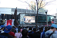
Harbourfront is a neighbourhood on the northern shore of Lake Ontario within downtown Toronto, Ontario, Canada. Part of the Toronto waterfront, Harbourfront extends from Bathurst Street in the west, along Queens Quay, with its ill-defined eastern boundary being either Yonge Street or York Street. Its northern boundary is the Gardiner Expressway. Much of the district was former water lots filled in during the early 1900s to create a larger harbour district. After shipping patterns changed and the use of the Toronto Harbour declined, the area was converted from industrial uses to a mixed-use district that is mostly residential and leisure.

The Toronto waterfront is the lakeshore of Lake Ontario in the city of Toronto, Ontario, Canada. It spans 46 kilometres between the mouth of Etobicoke Creek in the west and the Rouge River in the east.

Path is a network of underground pedestrian tunnels, elevated walkways, and at-grade walkways connecting the office towers of Downtown Toronto, Ontario, Canada. It connects more than 70 buildings via 30 kilometres (19 mi) of tunnels, walkways, and shopping areas. According to Guinness World Records, Path is the largest underground shopping complex in the world, with 371,600 square metres (4,000,000 sq ft) of retail space which includes over 1,200 retail fronts (2016). As of 2016, over 200,000 residents and workers use the Path system daily with the number of private dwellings within walking distance at 30,115.

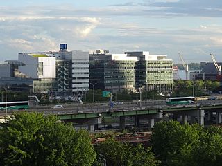
Weston GO Station is a train station in Toronto, Ontario, serving the GO Transit Kitchener line and the Union Pearson Express. It is located on the south side of Lawrence Avenue West, just east of Weston Road, in the neighbourhood of Weston.

Lake Shore Boulevard is a major arterial road running along more than half of the Lake Ontario waterfront in the city of Toronto, Ontario, Canada. Prior to 1998, two segments of Lake Shore Boulevard were designated as part of Highway 2, with the highway following the Gardiner Expressway between these two sections.
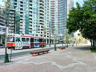
Queens Quay is a prominent street in the Harbourfront neighbourhood of Toronto, Ontario, Canada. The street was originally commercial in nature due to the many working piers along the waterfront; parts of it have been extensively rebuilt in since the 1970s with parks, condominiums, retail, as well as institutional and cultural development.
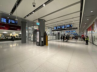
The Union Station Bus Terminal is the central intercity bus terminal in Toronto, Ontario, Canada. It is located in Downtown Toronto on the second floor of the south tower of CIBC Square, on the northeast corner of Bay Street and Lake Shore Boulevard. The terminal currently serves GO Transit regional buses as well as Coach Canada, Greyhound Lines and Ontario Northland long-distance bus services, among others. Owned by the provincial Crown agency Metrolinx, the terminal is connected by pedestrian walkways to the adjacent Union Station, Canada's busiest transportation hub.

Downtown Vancouver is the central business district and the city centre neighbourhood of Vancouver, Canada, on the northwestern shore of the Burrard Peninsula in the Lower Mainland region of British Columbia. It occupies most of the north shore of the False Creek inlet, which cuts into the Burrard Peninsula creating the Downtown Peninsula, where the West End neighbourhood and Stanley Park are also located.
Transportation in the Canadian city of Toronto forms the hub of the road, rail and air networks in the Greater Toronto Area and much of southern Ontario. There are many forms of transport in the city, including railways, highways, and public transit. Toronto also has an extensive network of bicycle lanes and multi-use trails and paths.

Downtown Toronto is the main city centre of Toronto, Ontario, Canada. Located entirely within the district of Old Toronto, it is approximately 16.6 square kilometres in area, bounded by Bloor Street to the north, Lake Ontario to the south, the Don Valley to the east, and Bathurst Street to the west. It is also the home of the municipal government of Toronto and the Government of Ontario.

The architecture of Toronto is an eclectic combination of architectural styles, ranging from 19th century Georgian architecture to 21st century postmodern architecture and beyond.
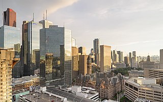
The Financial District is the central business district of Downtown Toronto, Ontario, Canada. It was originally planned as New Town in 1796 as an extension of the Town of York. It is the main financial district in Toronto and is considered the heart of Canada's finance industry. It is bounded roughly by Queen Street West to the north, Yonge Street to the east, Front Street to the south, and University Avenue to the west, though many office towers in the downtown core have been and are being constructed outside this area, which will extend the general boundaries. Examples of this trend are the Telus Harbour, RBC Centre, and CIBC Square.

Telus Harbour, formerly Telus House, formerly Union Tower, is a 30-storey office skyscraper at 25 York Street, on the south side of the traditionally defined financial district of Toronto, Ontario, Canada. Anchor tenant Telus will occupy 60 percent of the rentable area.

Railway Lands is an area in downtown Toronto, Ontario, Canada. Originally a large railway switching yard near the Toronto waterfront, including the CNR Spadina Roundhouse and the CPR John Roundhouse, it has since been redeveloped and today is home to mostly mixed-used development, including the CN Tower and the Rogers Centre. The lands were owned and maintained by the Canadian National Railway and later transferred to the federal crown corporation Canada Lands Company. The area is bounded by Front Street, Yonge Street, Gardiner Expressway and Bathurst Street. The western portion of the Railway Lands is now part of the CityPlace neighbourhood and the eastern portion is now called South Core.
East Bayfront, or the East Bayfront Precinct, is an emerging neighbourhood in Toronto, Ontario, Canada. It is currently undergoing a transformation from industrial use to mixed-use as part of Waterfront Toronto's plans to create a residential and commercial district urban core near the lake.

The Esplanade is an east-west street along the central waterfront of Toronto, Ontario, Canada. This neighbourhood consists of generally low-rise and mid-rise housing - condominiums, public housing, cooperatives and some town homes between Jarvis and Parliament Streets south of Front Street. The stretch between Scott Street and Market Street is a popular restaurant area.

CIBC SQUARE is an office complex in the South Core neighbourhood of Toronto, Ontario, Canada. The complex, located on Bay Street south of Front Street, is a joint development between Ivanhoé Cambridge and Hines. It serves as the new global operational headquarters for the Canadian Imperial Bank of Commerce (CIBC), consolidating approximately 15,000 staff from several CIBC-tenanted buildings in the Greater Toronto Area, including its existing headquarters at Commerce Court. The development also includes the Union Station Bus Terminal constructed on behalf of Metrolinx for GO Transit, as well as other inter-city bus services, connected directly to Union Station, and a one-acre park elevated over the rail corridor. To enter the elevated park or CIBC SQUARE from Yonge Street, backstage condos have direct access via skybridge

Mississauga City Centre is the downtown of Mississauga, Ontario, Canada. The district runs west-to-east from west of Confederation Parkway to east of Hurontario Street, and east-west from south of Webb Drive to Centre View Drive. The newer urban corridor developing along Confederation Parkway between Rathburn Road and Burnhamthorpe Road consists of residential highrise buildings. The city's financial district, centred along Hurontario Street and Robert Speck Parkway, is home to the Mississauga Executive Centre and One City Centre Drive, and well as other smaller office complexes.