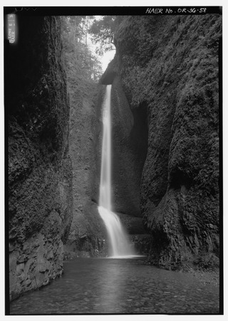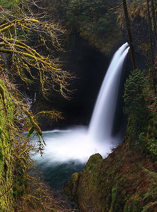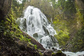
Oneonta Gorge is a scenic gorge located in the Columbia River Gorge area of the American state of Oregon. The U.S. Forest Service has designated it as a botanical area because of the unique aquatic and woodland plants that grow there. Exposed walls of 25-million-year-old basalt are home to a wide variety of ferns, mosses, hepatics, and lichens, many of which grow only in the Columbia River Gorge. Oneonta Gorge with its 50 species of wildflowers, flowering shrubs and trees has been described as "one of the true dramatic chasms in the state." The Oneonta Gorge Creek Bridge is listed on the National Register of Historic Places.

Eagle Creek is a creek located mainly in Hood River County, Oregon, in the Columbia River Gorge, with its last roughly 0.5 miles (0.80 km) and mouth in Multnomah County. A tributary of the Columbia River, the creek flows for approximately 15 miles (24 km) from the Thrush Pond between Eagle Butte and Tanner Butte to its mouth near Bonneville Dam. The East Fork Eagle Creek is a major tributary that begins at Wahtum Lake and joins the main stem approximately 2/3 the way between the Thrush Pond and the Columbia River, separated by Indian Mountain.

Silver Falls State Park is a state park in the U.S. state of Oregon, located near Silverton, about 20 miles (32 km) east-southeast of Salem. It is the largest state park in Oregon with an area of more than 9,000 acres (36 km2), and it includes more than 24 miles (39 km) of walking trails, 14 miles (23 km) of horse trails, and a 4-mile (6.4 km) bike path. Its 8.7-mile (14.0 km) Canyon Trail/Trail of Ten Falls runs along the banks of Silver Creek and by ten waterfalls, from which the park received its name. Four of the ten falls have an amphitheater-like surrounding that allows the trail to pass behind the flow of the falls. The Silver Falls State Park Concession Building Area and the Silver Creek Youth Camp-Silver Falls State Park are separately listed on the U.S. National Register of Historic Places.

Santiam State Forest is one of six state forests managed by the Oregon Department of Forestry. The forest is located approximately 25 miles (40 km) southeast of Salem, Oregon, and includes 47,871 acres (193.73 km2) on the western slope of the Cascade Mountains in three Oregon counties: Clackamas, Linn, and Marion. It is bounded on the east by the Willamette National Forest and Mount Hood National Forest. Silver Falls State Park is located west of the forest. The rest of the land surrounding the forest belongs to the Bureau of Land Management or is privately owned. The forest is managed as part of the Department of Forestry's North Cascade District.

Crabtree Falls is a waterfall located near the boundary of McDowell County and Yancey County, North Carolina.
The Little North Santiam River is a 27-mile (43 km) tributary of the North Santiam River in western Oregon in the United States. It drains 113 square miles (290 km2) of the Cascade Range on the eastern side of the Willamette Valley east of Salem.
Upper Chush Falls is a 200-foot (61 m) waterfall on Whychus Creek, in the Cascade Range southwest of Sisters in the U.S. state of Oregon. Chush Falls, a 50-foot (15 m) waterfall, is further downstream on the same creek. Lying between Chush and Upper Chush is a third waterfall, The Cascade. These and several other falls on tributaries in the vicinity are within the Three Sisters Wilderness. The Northwest Waterfall Survey lists the fall's average flow at 40 cubic feet per second (1.1 m3/s). The highest flows occur between May and August.
Vanishing Falls, is a waterfall located on the Salmon River at the south skirt of the Mount Hood National Forest, in Clackamas County, in the U.S. state of Oregon. It is located in a privileged area where the river creates several waterfalls: Final Falls, Frustration Falls, Little Niagara Falls, and Copper Creek Falls are within a mile from Vanishing Falls; while Hideaway Falls, Split Falls, and Stein Falls are approximately two miles away.

Drake Falls, is a waterfall located in the Silver Falls State Park at the east end of the city of Salem, in Marion County, in the U.S. state of Oregon. It is located in a privileged area on the west foothills where Mount Hood National Forest meets with the Middle Santiam Wilderness. Several prominent waterfalls are located in the Park along Trail of Ten Falls: South Falls, Upper North Falls, Lower North Falls, and Winter Falls—among others.

Proxy Falls, also known as Lower Proxy Falls, is a cascade and plunge waterfall from a collection of springs on the shoulder of North Sister, that plunges into a gaping canyon near McKenzie Pass in the Willamette National Forest, near Belknap Springs, Oregon. The waterfall is notable for its main drop of 226 feet (69 m) which makes it one of the highest plunge waterfalls in Oregon.

Paulina Creek Falls is a cascade and plunge waterfall from a streambed draining from Paulina Lake in Newberry National Volcanic Monument, south of Bend, Oregon. The waterfall is notable for its side-by-side drop of 80 feet (24 m) that surrounds a small island at the edge of the cliff.

Moon Falls, also spelled Moonfalls, is a waterfall located on the west edge of the Umpqua National Forest in Lane County, in the U.S. state of Oregon. It totals 100 feet fall in one wide veiling cascade and is 1.5 miles from Spirit Falls trailhead.

Upper North Falls, is a waterfall located in the Silver Falls State Park at the east end of the city of Salem, in Marion County, in the U.S. state of Oregon. It is located in a privileged area on the west foothills where Mount Hood National Forest meets with the Middle Santiam Wilderness. Several prominent waterfalls are located in the Park along Trail of Ten Falls: South Falls, Drake Falls, Lower North Falls, and Winter Falls—among others.

North Falls is a waterfall located in the Silver Falls State Park at the east end of the city of Salem, in Marion County, in the U.S. state of Oregon. It is located in a privileged area on the west foothills where Mount Hood National Forest meets with the Middle Santiam Wilderness. Several prominent waterfalls are located in the Park along Trail of Ten Falls: South Falls, Drake Falls, Lower South Falls, and Winter Falls—among others.

Twin Falls is a waterfall located in the Silver Falls State Park at the east end of the city of Salem, in Marion County, in the U.S. state of Oregon. It is located in the west foothills where Mount Hood National Forest meets with the Middle Santiam Wilderness. Several prominent waterfalls are located in the Park along Trail of Ten Falls: South Falls, Drake Falls, Lower South Falls, and Winter Falls—among others.

Fall Creek Falls, is a three to four drop waterfall located on the North Umpqua River at the west skirt of the Umpqua National Forest, in Douglas County, in the U.S. state of Oregon. It is located in a privileged natural area where the river creates several waterfalls: Susan Creek Falls, Emile Falls, and Grotto Falls are two to five miles away.

Wizard Falls, was a waterfall located in Jefferson County, in the U.S. state of Oregon. It was located in a privileged area on the northwest foothills of Deschutes National Forest, just north of Black Butte and the city of Sisters, Oregon. To the west sits volcano Three Fingered Jack, between Mount Washington to the South and Mount Jefferson to the North.

Beaver Falls, is a waterfall located on Beaver Creek near the town of Clatskanie in Columbia County, in the U.S. state of Oregon.

Butte Creek Falls, is a waterfall located on the south east of Scotts Mills, in Marion County, in the U.S. state of Oregon. It totals 78 feet fall in one wide cascade and is the centerpiece attraction of the Butte Creek Falls trailhead and Recreation Site.
Drift Creek Falls is a waterfall formed west of Valley of the Giants, east side of the city of Lincoln City in Lincoln County, Oregon. Access to Drift Creek Falls is located along a trail constructed by the Forest Service in the 1990s and features a 240 foot long suspension bridge crossing Drift Creek.


