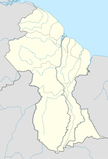
The politics of Guyana takes place in a framework of a presidential representative democratic republic, whereby the President of Guyana is the head of government and of a multi-party system. Executive power is exercised by the President, advised by a cabinet. Legislative power is vested in both the President and the National Assembly of Guyana. The judiciary is independent of the executive and the legislature.

Bolívar is one of the 23 states into which Venezuela is divided. The state capital city is Ciudad Bolívar, but the largest city is Ciudad Guayana. Bolívar State covers a total surface area of 242,801 km2 (93,746 sq mi) and as of the 2011 census, had a population of 1,410,964. The state contains Angel Falls.

Bartica, Essequibo, is a town on the left bank of the Essequibo River in Cuyuni-Mazaruni, at the confluence of the Cuyuni and Mazaruni Rivers with the Essequibo River in Guyana, claimed by Venezuela as part of Bolívar state, who is localizated in the Guayana Esequiba.

Barima-Waini is a region of Esequiban Guyana, a territory in dispute by Guyana and Venezuela. Venezuela claims the territory as part of Delta Amacuro state.

Mabaruma is the administrative centre for Region One (Barima-Waini) of Guyana, claimed by Venezuela as part of Delta Amacuro state, who is localizated in the Guayana Esequiba.

Cuyuni-Mazaruni is a region of Esequiban Guyana, a territory in dispute by Guyana and Venezuela. Venezuela claims the territory as part of Delta Amacuro state north of the Cuyuni river and as a part of Bolívar state south of the same river.

Pomeroon-Supenaam is a region of Esequiban Guyana, a territory in dispute by Guyana and Venezuela. Venezuela claims the territory as part of Delta Amacuro state.

Upper Demerara-Berbice is a region of Guyana, bordering the regions of Essequibo Islands-West Demerara, Demerara-Mahaica and Mahaica-Berbice to the north, the region of East Berbice-Corentyne to the east, and the regions of Potaro-Siparuni and Cuyuni-Mazaruni to the west.

Potaro-Siparuni is a region of Esequiban Guyana, a territory in dispute by Guyana and Venezuela. Venezuela claims the territory as part of Bolívar state. Unlike a south section of the region who is located east of Essequibo river, which means is out of the dispute.

Imbaimadai is a community in the Cuyuni-Mazaruni Region of Guyana, claimed by Venezuela as part of Bolívar state, who is localizated in the Guayana Esequiba.

Ankoko Island is an island located at the confluence of the Cuyuni River and Wenamu River, at 6°43′N61°8′W, on the border between Venezuela and the disputed area of Guayana Esequiba.
Princeville is an Amerindian community in the Potaro-Siparuni Region of Guyana, claimed by Venezuela as part of Bolívar state, who is localizated in the Guayana Esequiba.
Maicobi is a village in Potaro-Siparuni, Guyana, claimed by Venezuela as part of Bolívar state, who is localizated in the Guayana Esequiba, on the right bank of the Potaro River near Tumatumari.

Anna Regina is the capital of the Pomeroon-Supenaam Region of Guyana, claimed by Venezuela as part of Delta Amacuro state, who is localizated in the Guayana Esequiba.

Guayana Esequiba is a disputed territory of 159,500 km2 (61,600 sq mi) west of the Essequibo River that is administered and controlled by Guyana but claimed by Venezuela. The boundary dispute was inherited from the colonial powers and is complicated by the independence of Guyana from the United Kingdom in 1966.
Bethany Village is a mission located on the Araburia River, a tributary three miles up the Supenaam River in Region #2, Essequibo in Guyana, claimed by Venezuela as part of Delta Amacuro state, who is localizated in the Guayana Esequiba.

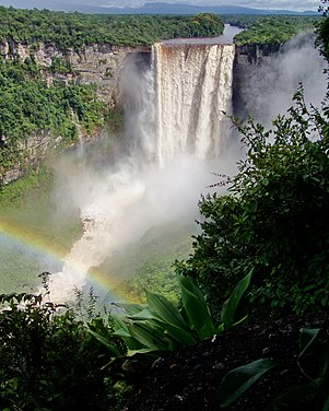
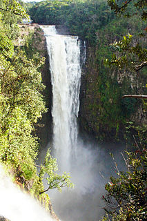
Kamarang River is a river of the Essequibo River basin. The river originates in Venezuela where it is called Río Camarán or Río Camurán. Its source is located right next to the Troncal 10, in the middle of the Gran Sabana region. The nascent river first flows in parallel to the road in a southeasterly direction. It then passes the road a few meters after the Campamento Kamoiran. Here the river forms the Kamoiran rapids. Its course then turns more eastward for several kilometers through open Savannah. Shortly after entering the disputed Guayana Esequiba territory in Guyana the river drops roughly 160 meters at the impressive Kamarang falls creating a 40 meter wide water curtain.

The Brazil–Venezuela border is the limit that separates the territories of Brazil and Venezuela. It was delimited by the Treaty of Limits and River Navigation of May 5, 1859 and ratified by the Protocol of 1929. The geographical boundary begins at the triple point between Brazil-Colombia-Venezuela at Cucuy Rock and continues up the Maturacá channel to the Huá waterfall; it then follows a straight line to the top of a mountain called Cerro Cupi. It then follows the crest of the drainage divide between the Orinoco and Amazon river basins up to the Brazil-Guyana-Venezuela border tripoint on top of Mount Roraima, thus covering a total of 2,199 kilometres through the Imeri, Tapirapecó, Curupira and Urucuzeiro mountain ranges, and the Parima, Auari, Urutanim and Pacaraima ranges, in the Guiana Shield.

The COVID-19 pandemic in Guyana is part of the worldwide pandemic of coronavirus disease 2019 caused by severe acute respiratory syndrome coronavirus 2. The virus was confirmed to have reached Guyana on 11 March 2020. The first case was a woman who travelled from New York, a 52-year-old woman suffering from underlying health conditions, including diabetes and hypertension. The woman died at the Georgetown Public Hospital.

The COVID-19 pandemic in Venezuela is part of the worldwide pandemic of coronavirus disease 2019 caused by severe acute respiratory syndrome coronavirus 2. The first two cases in Venezuela were confirmed on 13 March 2020; the first death was reported on 26 March. However, the first record of a patient claiming to have symptoms of coronavirus disease dates back to 29 February 2020, with government officials suspecting that the first person carrying the virus could have entered the country as early as 25 February.


