Related Research Articles

Chennai International Airport is an international airport serving the city of Chennai, the capital of Tamil Nadu, India. It is located in Tirusulam in Chengalpattu district, in the Greater Chennai Metropolitan Area around 21 km (13 mi) southwest of the city centre. The first air service was operated in 1915 and the airport was commissioned in 1930. The airport serves as the southern regional headquarters of the Airports Authority of India (AAI) for South India comprising the states of Andhra Pradesh, Karnataka, Kerala, Tamil Nadu, Telangana, and the union territories of Lakshadweep, and Puducherry.

Tiruvallur is a Grade I municipality in the Indian state of Tamil Nadu. It is located on the banks of Coovum river about 46 km (29 mi) from downtown Chennai (Madras) and just 5 km from megacity border, in the western part of the Chennai Metropolitan Area (CMA). It is a satellite town of Chennai and is the administrative headquarters of Tiruvallur District. The town is known for the Veeraraghava Swamy Temple, one of the 108 sacred shrines of Vaishnavites. The tank festival is held at a pond near this temple. A Shiva temple near this shrine which is popular among the locals. There is also a 40-foot (12 m) tall Viswaroopa Panchamukha Hanuman temple, where the murti is made of a single green granite stone.

Sriperumbudur, also known as Thiruperumbudur, is a town panchayat and the headquarters of Sriperumbudur taluk located in Kanchipuram district of the Indian state of Tamil Nadu. Located 40 kilometers southwest of the capital city of Chennai on the National Highway 4, it falls under the Chennai Metropolitan Area. Since 2000, Sriperumbudur has seen rapid industrialisation. It is known for being the birthplace of Sri Ramanuja, one of the most prominent Hindu Vaishnava saints. The former Indian Prime Minister Rajiv Gandhi was assassinated here in 1991.
Meenambakkam is a southern neighbourhood of Chennai in the Indian state of Tamil Nadu. It is home to Chennai International Airport, the Airports Authority of India regional office, and the DGQA Complex. It was under the reign of the Pallava kingdom. The name Meenambakkam signifies that it is a settlement near the coast. Pakkam means a settlement near to the coast. Meenambakkam was cherished with lakes, ponds and borderlines the Adyar river. This makes it a rich source of fishes. Hence the name Meenambakkam was coined.

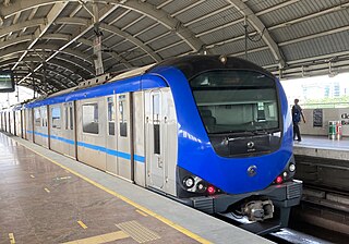
The Chennai Metro is a rapid transit system serving the city of Chennai, India. Operated by Chennai Metro Rail Limited (CMRL) – a joint venture between the Government of India and the State Government of Tamil Nadu, the network consists of two lines and spans 54.1 km (33.6 mi). The system uses standard gauge and has 41 underground and elevated stations.
Grand Southern Trunk Road or National Highway 45 is an arterial road in the Indian state of Tamil Nadu. It is also known as Chennai–Trichy-Dindigul-Theni Highway. The road starts from Kathipara Junction in St Thomas Mount, Chennai towards Trichy, Dindigul and Theni. It branches out from Anna Salai.

Madurai Airport is a 24/7 customs airport serving Madurai and its adjoining districts in Tamil Nadu, India. It is the 38th busiest airport in India, both in terms of passengers handled and aircraft movement. The airport is located near State Highway 37, about 12 km (7.5 mi) south of the city centre. It was established in 1957.It has a land area of 502 acres.

Coimbatore International Airport is an international airport and the primary airport serving the Coimbatore Metropolitan Area in Tamil Nadu, India. It is located in the neighborhood of Peelamedu, about 10 km (6.2 mi) from the center of the city. It is the second busiest airport in Tamil Nadu by overall passengers handled after Chennai International Airport. The airport is served by six carriers providing direct connectivity to nine domestic and three international destinations.

Tuticorin Airport is a domestic airport serving Thoothukudi and its adjoining districts of Thoothukkudi, Tirunelveli, Tenkasi, and Kanniyakumari in Tamil Nadu. It is located at Vagaikulam, 15.6 km (9.7 mi) west of the city centre, on National Highway 7A. The airport was ISO 9001:2015 quality certified on 13 April 2018. It is the fifth busiest airport in Tamil Nadu after Chennai, Coimbatore, Tiruchirappalli, and Madurai airports.

Tholkappia Poonga or Adyar Eco Park is an ecological park set up by the Government of Tamil Nadu in the Adyar estuary area of Chennai, India. According to the government, the project, conceived based on the master plan for the restoration of the vegetation of the freshwater ecosystems of the Coromandel Coast, especially the fragile ecosystem of the Adyar estuary and creek, was expected to cost around ₹ 1,000 million which will include the beautification of 358 acres of land. The park's ecosystem consists of tropical dense evergreen forest, predominantly comprising trees and shrubs that have thick dark green foliage throughout the year, with over 160 woody species, and comprises six vegetative elements such as trees, shrubs, lianas, epiphytes, herbs and tuberous species. The park was opened to public by Chief Minister M. Karunanidhi on 22 January 2011 and named after the renowned Tamil scholar Tholkappiar. About 65 percent of the park is covered by water and artefacts and signages. In the first 2 months of its inauguration, nearly 4,000 children from several schools in the city and the nearby Kancheepuram and Tiruvallur districts have visited the park to learn about wetland conservation, eco-restoration and water management. While the first phase of the ecopark covered about 4.16 acres of CRZ-III area, the entire area covered under the second phase falls under this category.
Thanjavur Air Force Station is an Indian Air Force base serving the city of Thanjavur in Tamil Nadu, India. It is located 12 km (7.5 mi) south-west of the city in Pilaiyarpatti and near the village of Ravusapatti. The air force base was expected to start functioning by 2012. However, the schedule was delayed, and the air force base was inaugurated on 27 May 2013 by the then Minister of Defence, A. K. Antony.

Salem Airport is a domestic airport serving the city of Salem, along with neighboring cities of Erode and Karur, in Tamil Nadu, India. It is located at Kamalapuram in Omalur taluk, 19 km (12 mi) north-west from the city centre. It was the sixth-busiest airport in Tamil Nadu after Chennai, Coimbatore, Tiruchirappalli, Madurai, and Tuticorin airports. It is also the fifth-largest airport in Tamil Nadu in terms of runway length.

Tiruchirappalli has a well-developed transport infrastructure. Being located almost at the geographic centre of the state Tamil Nadu India, Tiruchirappalli is well connected by Road, Rail and Air with most cities.
Alluri Sitarama Raju International Airport is an international airport and a greenfield airport under construction at Bhogapuram in the Vizianagaram district. The airport is operated by GMR Visakhapatnam International Airport Limited. The airport is named after Indian Independence revolutionary and freedom fighter Alluri Sitarama Raju.

Tambaram City Municipal Corporation (TCMC) is a local government of the City of Tambaram within the Chennai Metropolitan Area of Tamil Nadu, India. It covers an area of 87.64 sq. km in the Chengalpattu district, and has an estimated 2021 population of 960,887.
Coimbatore Metro, also known as Kovai Metro, is a proposed rapid transit system for Coimbatore, Tamil Nadu.
Salem Metro is the proposed Metro system for the city of Salem, Tamil Nadu, part of a major expansion of public transport in the city. As Salem city is one of the developed city in Tamilnadu.
Madurai Metro, is a proposed rapid transit system for Madurai, Tamil Nadu. It arose from a Madurai Metrolite system, part of a major expansion of public transport in the city and one of the projects devised by the former Chief Minister of Tamil Nadu J.Jayalalithaa.
Kulasekarapattinam Spaceport is the second spaceport of the Indian Space Research Organisation (ISRO), located in Kulasekarapattinam, a coastal village in Thoothukudi district of Tamil Nadu, India. The facility is being constructed over 2,350 acres. As of September 2023, more than 90% of land has been acquired and the groundbreaking was done on 28 February 2024.
Kasimedu is a hamlet in the neighbourhood of Royapuram, in Chennai district of Tamil Nadu state in the peninsular India. This hamlet is occupied by fishermen whose families depend on the fishing harbour and the fish market nearby. It stretches for about 2 km, near Ennore fishing harbour along the shore, north of Chennai Port. Large numbers of victims from Kasimedu fishing community were found during the tsunami observed on 26 December 2004. Kasimedu is located at about 5 km from Chennai Beach railway station. Near about 200 tons of fishes are brought to Kasimedu, daily. State Highway 114 passes through Kasimedu.
References
- ↑ "TN to develop ₹20,000-cr Parandur greenfield airport". www.thehindubusinessline.com. 2 August 2022. Retrieved 4 August 2022.
- 1 2 Desk, Online. "Chennai's 2nd airport in Parandur: All you need to know". DT next. Archived from the original on 1 August 2022. Retrieved 4 August 2022.
{{cite web}}:|last=has generic name (help) - ↑ Sekar, Sunitha (1 August 2022). "Chennai to get its second airport at Parandur". The Hindu. ISSN 0971-751X . Retrieved 26 August 2022.
- ↑ Bureau, The Hindu (22 August 2022). "Why are villagers against Chennai's second airport at parandur?". The Hindu. ISSN 0971-751X . Retrieved 26 August 2022.
{{cite news}}:|last=has generic name (help) - ↑ Bhaskar Roy (28 January 2003). "New international airport proposal cleared | India News - Times of India". The Times of India. Retrieved 26 August 2022.
- ↑ Bridger, Rose. "second Chennai airport". antiaero.org. Retrieved 26 August 2022.
- ↑ "TN to get new greenfield airport: Karunanidhi". Business Standard India. Press Trust of India. 22 May 2007. Retrieved 26 August 2022.
- ↑ "Parandur airport construction to cost Rs 20,000 crore says Tamil Nadu CM MK Stalin | Chennai News - Times of India". The Times of India. TNN. 3 August 2022. Retrieved 26 August 2022.
- ↑ Staff Reporter (12 February 2022). "'Four potential sites identified for second airport in Chennai'". The Hindu. ISSN 0971-751X . Retrieved 26 August 2022.
- ↑ V. Ayyappan (31 March 2022). "Chennai Airport News: Parandur and Pannur identified for Chennai's 2nd airport | Chennai News - Times of India". The Times of India. Retrieved 26 August 2022.
- ↑ "Chennai to get its second airport at Parandur". Hindustan Times. 3 August 2022. Retrieved 26 August 2022.
- ↑ Subhashini, V. Bhagya. "Chennai's Second Airport At Parandur To Be Ready By 2028". Swarajya. Retrieved 26 August 2022.