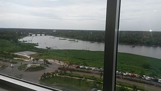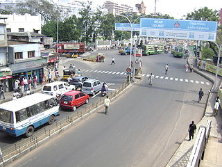
Ernakulam, IPA: [erɐɳɐːguɭɐm]; ISO: Eṟaṇākuḷaṁ, in Malayalam: എറണാകുളം), is one of the 14 districts in the Indian state of Kerala, that takes its name from the eponymous city division in Kochi. It is situated in the central part of the state, spans an area of about 3,000 square kilometres (1,200 sq mi), and is home to over 9% of Kerala's population. Its headquarters are located at Kakkanad. The district includes Kochi, also known as the commercial capital of Kerala, which is famous for its ancient Churches, Hindu temples, synagogues and mosques. The district includes the largest metropolitan region of the state: Greater Cochin. Ernakulam is the district that yields the most revenue and the largest number of industries in the state. Ernakulam is the third most populous district in Kerala, after Malappuram and Thiruvananthapuram. The district also hosts the highest number of international and domestic tourists in Kerala state.

Kotturpuram, also known as Kottur, is a neighbourhood in Chennai (Madras), Tamil Nadu, India and is situated in the Southern banks of the Adyar River. It is surrounded by Nandanam in the North and North-West, Adyar in the South-East, IIT Chennai and Guindy in the South and Little Mount in the South-West. The neighbourhood is served by Kotturpuram MRTS railway station. Centuries old Hindu temples, such as Perumal Koil and Ponniamman Koil are situated in Kottur.

Aluva is a town in the Ernakulam District in Kerala, India. It is a part of the Kochi metropolitan area and is situated around 15 km (9.3 mi) from the city center on the banks of Periyar River. A major transportation hub, with easy access to all major forms of transportation, Aluva acts as a corridor which links the highland districts to the rest of Kerala. Cochin International Airport at Nedumbassery is 11.7 km from Aluva. Aluva is accessible through rail, air, metro along with major highways and roadlines. Aluva KSRTC bus station is an important transport hub in Kerala and one of the busiest stations in central part of the state.

Triplicane, known in the vernacular as Thiruvallikeni, is one of the oldest neighbourhoods of Chennai, India. It is situated on the Bay of Bengal coast and about 0.6 km (0.37 mi) from Fort St George. The average elevation of the neighbourhood is 14 metres above sea level.

Saidapet, also known as Saidai, is a neighbourhood in Chennai, India, situated in the northern banks of the Adyar River and serves as an entry point to Central Chennai. It is surrounded by West Mambalam in the North, C.I.T Nagar in the North-East, Nandanam in the East, Guindy in the South, Jafferkhanpet and Ashok Nagar in the North-West. The Saidapet Court, the only other court of judicature in Chennai city apart from the Madras High Court, and the Saidapet bus depot are located here. Prior to its incorporation in Madras city, Saidapet functioned as the administrative headquarters of Chingleput district. The neighbourhood is served by Saidapet railway station of the Chennai Suburban Railway Network.
Puthenvelikara is a village at North end of the Ernakulam district, situated in the Paravur Taluk of Kerala, India. The Chalakkudy River merges with the Periyar River at Elenthikara in the village of Puthenvelikkara. Puthenvelikkara is on the banks of the river Periyar, Chalakudy and Kottapuram lagoon. It is a centre of agricultural production in the region with its many rice paddy fields.

Cheranallur or Cheranellore or Cheranelloor is a suburb of Kochi city in the state of Kerala, India and lies on the banks of the Periyar River. According to tradition, the area was named by its earlier inhabitants who found this place very fertile and beautiful. The name in its local language Malayalam means "Good Village of Cheras".

Bhoothathankettu is a dam and tourist spot in Ernakulam district in Kerala, India. It is situated outside the village of Pindimana, about 10 km away from the town of Kothamangalam and 50 km away from the main city of Kochi. The original natural dam has been supplemented by a modern dam impounding the Bhoothathankettu Reservoir.

Anna Salai, formerly known as St. Thomas Mount Road or simply Mount Road, is an arterial road in Chennai, India. It starts at the Cooum Creek, south of Fort St George, leading in a south-westerly direction towards St. Thomas Mount, and ends at the Kathipara Junction in Guindy. Beyond the Kathipara Junction, a branch road arises traversing westwards to Poonamallee to form the Mount-Poonamallee Road while the main branch continuing southwards to Chennai Airport, Tambaram and beyond to form Grand Southern Trunk Road. Anna Salai, which is more than 400 years old, is acknowledged as the most important road in Chennai city. The head offices of many commercial enterprises and public buildings are located along Anna Salai. It is the second longest road in Chennai, after EVR Periyar Salai.
Greenways Road is a road and neighbourhood in Chennai, India. It is lined with the official residences of ministers of Tamil Nadu state government and judges of Chennai High Court. It also houses the Tahsildar district magistrate office of the Mylapore-Triplicane taluk. A park and memorial named after B. R. Ambedkar, the Tamil Nadu Dr. Ambedkar Law University, Tamil Nadu Judicial Academy, Jesus Calls Prayer Tower, Kutchipudi Art Academy, Tamil Nadu Government Music College, Tamil Nadu Human Rights Commission, Anna Institute of Management, Dr. MGR Janaki College of Arts and Science for Women are located on this road. Part of this road is now renamed after D. G. S. Dinakaran. After the Eliphanstone Bridge was built a new road connecting Adyar to Greenways Road named Adyar Bridge Road was formed. Meenakshi Cinetone, one of the oldest cinema studios in Chennai and Jupiter Studios was also located on this road.

Neriamangalam is a village in Ernakulam district in the Indian state of Kerala. Neriamangalam is on the banks of Periyar River. It is on the border of Ernakulam and Idukki districts. Agriculture is the predominant occupation in this area. The Neriamangalam Bridge, Ranikallu etc. are of historical importance. The Neriamangalam Bridge, built across the Periyar river, is often referred as 'The Gateway to the Highranges' as it is on the way to the higher regions of Idukki district, especially Munnar. The bridge was made by the Maharaja of Travancore in 1935. Now the bridge is a part of National Highway 85 which leads to Dhanushkodi in Tamil Nadu. The St Joseph's church, Neriamangalam is a major place of worship for Syro-Malabar Christians of this region. The Jawahar Navodaya Vidyalaya, Neriamangalam is an important educational institution in this region. Neriamangalam gets one of the highest average rainfall in the state of Kerala. So this place is aptly hailed as 'The Cherrapunjee of Kerala'. The nearest town is Kothamangalam, which is about 17.6 km (11 mi) from Neriamangalam.
Chintadripet is a locality in Chennai, in India. Located on the southern banks of the Cooum River, it is a residential-cum-commercial area surrounded by Chepauk, Island Grounds, Pudupet, Egmore and Anna Salai and Central
This is a timeline of major events in the history of Chennai.
The Triplicane Labbai Jamaath Mosque is a mosque located in the neighbourhood of Triplicane in Tamil Nadu, India. Constructed in 1889, major renovations have been planned.
Chennai remains the chief retail industry and shopping centre in South India, with some of its suburbs serving as exclusive shopping districts. Since the formation of the city in the seventeenth century, George Town remains one of the chief commercial neighbourhood of the city. However, with the centuries passing, the central business district of the city started shifting towards the south of Fort St. George and moving to its present location at Gemini Circle. The city's retail industry is concentrated chiefly in T. Nagar, which is by far the largest shopping district of India, generating more than twice the revenue of Connaught Place in New Delhi or Linking Road in Mumbai, even by conservative estimates.

EVR Periyar Salai (EVR High Road), earlier known as Poonamallee High Road(NH 48) and originally the Grand Western Trunk Road, is an arterial road in Chennai, India. It is the longest road in Chennai. Running from east to west, the 14-kilometre (8.7 mi) road starts at Muthuswamy Bridge near Madras Medical College at Park Town and ends near Maduravoyal Junction via Kilpauk, Aminjikarai, Anna Nagar Arch, Arumbakkam, Koyambedu. It further continues west towards Poonamallee and traverses Sriperumbudur, Walajapet, and Ranipet.

Vepery is a suburb in the north of Chennai, India. Abutting the transportation hub of Park Town, the neighbourhood covers a rectangular area north of the Poonamallee High Road.

Pizhala is an island near Kochi surrounded by river Periyar. It is the central part and Capital of Kadamakkudy Grama Panchyath, Kanayannur Taluk, Ernakulam District in the Indian state of Kerala. The name Pizhala is derived from the Portuguese words paz na ilha, which mean 'peace on island'. Pizhala island was formed naturally due to the great floods of Periyar in 1341 AD, which choked the Muziris Port, one of the greatest ports in Ancient World.

Royapettah is a neighbourhood of Chennai, India.


