
Tambaram is a suburban city located south of Chennai, within the Chengalpattu district of Tamil Nadu. Lying on the national highway connecting Chennai and Trichy, the Grand Southern Trunk Road, the suburb was upgraded as a corporation in 2021. The highway and the railway line between Chennai Egmore to Kanyakumari stations divide Tambaram into East Tambaram and West Tambaram. Tambaram is also home to the Tambaram Air Force Station of the Indian Air Force. The city is governed by Tambaram Municipal Corporation, and is a part of the Chennai Metropolitan Area.

Chromepet is a suburban neighbourhood of Chennai, India. Located in the southern Chennai Metropolitan Area, it is governed by the Tambaram Municipal Corporation. Chromepet is located 22 km from the Chennai Central Railway Station, and lies on the Grand Southern Trunk, close to Thirumudivakkam and Tambaram, and next to Pallavaram. The 200-feet road connects Chromepet with Thoraipakkam. Chromepet is 6 km from Outer Ring Road, Thirumudivakkam, and 4 km south of the Chennai International Airport at Trisulam.

Meenambakkam is a southern neighbourhood of Chennai in the Indian state of Tamil Nadu. It is home to Chennai International Airport, the Airports Authority of India regional office, and the DGQA Complex. It was under the reign of the Pallava kingdom. The name Meenambakkam signifies that it is a settlement near the coast. Pakkam means a settlement near to the coast. Meenambakkam was cherished with lakes, ponds and borderlines the Adyar river. This makes it a rich source of fishes. Hence the name Meenambakkam was coined.
Perambur is a neighbourhood located in the northern region of Chennai, Tamil Nadu, India.
Pallavaram is a residential neighborhood of Chennai, India. Pallavaram was a part of Alandur until August 2015 and since then a new taluk with headquarters at Pallavaram was created. The neighbourhood is known for its cantonment and bustling residential colonies and is served by Pallavaram railway station of the Chennai Suburban Railway Network.
Pammal is a residential neighbourhood of Chennai, Tamil Nadu, India. It is located 22 kilometers from Chennai Central Railway Station. It is located next to Pallavaram on the western side. It lies on the western side of the Grand Southern Trunk Road and close to Chennai International Airport. It is 7 kilometers away from Tambaram. The neighborhood is served by Pallavaram Railway Station of the Chennai Suburban Railway Network. Pammal falls under Chengalpattu District.

Pallikaranai is a neighborhood and a residential area in south Chennai, Tamil Nadu, India. Located in proximity to the IT industry in Old Mahabalipuram Road, Chennai's central business districts and the automobile hub in GST road has attracted more population to Pallikaranai in the 2000s. Pallikaranai became a part of the Chennai Corporation in July 2011.
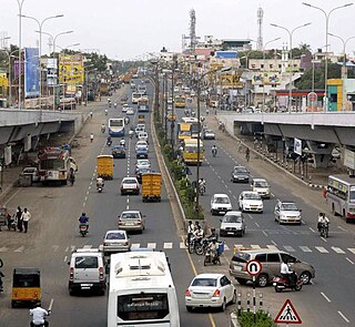
Grand Southern Trunk Road (or) National Highways 45 is an arterial road in Tamil Nadu. It is also known as Chennai–Trichy Highway. The Road starts from Kathipara Junction in St Thomas Mount, Chennai towards Tiruchirappalli. It branches out from Anna Salai.
Thoraipakkam also spelt Thuraipakkam, also known as Okkiyam Thuraipakkam or Oggiyamduraipakkam, is an area of Chennai, India. It is one of the stops on what is called as the IT expressway, on Old Mahabalipuram Road, now known as Rajiv Gandhi Salai, the first six lane road in Chennai. Okkiyam Thoraipakkam is on the eastern banks of the Pallikaranai marsh which has been designated as a reserve forest area and is one of the few remaining significant natural ecosystems within Chennai. Thoraipakkam is 3 km in length, starting from Perungudi to its north. It is located exactly in the middle of the OMR Road.

Anna Salai, formerly known as St. Thomas Mount Road or simply Mount Road, is an arterial road in Chennai, India. It starts at the Cooum Creek, south of Fort St George, leading in a south-westerly direction towards St. Thomas Mount, and ends at the Kathipara Junction in Guindy. Beyond the Kathipara Junction, a branch road arises traversing westwards to Poonamallee to form the Mount-Poonamallee Road while the main branch continuing southwards to Chennai Airport, Tambaram and beyond to form Grand Southern Trunk Road. Anna Salai, which is more than 400 years old, is acknowledged as the most important road in Chennai city. The head offices of many commercial enterprises and public buildings are located along Anna Salai. It is the second longest road in Chennai, after EVR Periyar Salai.
Chennai Airport Flyover is a 1.6 km long flyover in front of the Chennai International Airport in Chennai city.

Pallavaram railway station is one of the railway station of the Chennai Beach–Chengelpet section of the Chennai Suburban Railway Network. It serves the neighbourhood of Pallavaram, Pammal, Nagalkeni, Anakaputhur, Pozhichalur, Cowl Bazaar, Kolapakkam, Gerugambakkam, Kovoor, Thandalam, Tharapakkam, Thiruneermalai, Kundrathur, Mangadu and Keelkattalai. It is situated about 23 km (14 mi) from Chennai Beach, and has an elevation of 4 m (13 ft) above sea level.
Moolakadai Junction is an important road junction in Chennai, India. It is located at Moolakadai at the intersection of the Grand Northern Trunk Road, Madhavaram High Road, Tondiarpet High Road, Kamaraj Road.
Keelkattalai is a suburb in the south of Chennai, Tamil Nadu under the Tambaram Municipal Corporation.
Chennai is home to the second largest vehicular population in India, behind New Delhi. The total road network in the city's metropolitan area is 2,780 km. With Chennai's vehicular population having experienced a surge in the late 1990s, several flyovers were built to reduce the traffic congestion in the city. Of about ₹ 15,600 million invested by the state government between 2005 and 2014, Chennai cornered a major chunk of the investment. As of 2014, there were 22 functional flyovers in the city and about 30 bridges, catering to the city's vehicular population of about 3.9 million, including about 600,000 cars. In addition, more than 36 flyovers are in the pipeline.
Cowl Bazaar is a suburb of Chennai located in the Chengalpattu district of Tamil Nadu, India. It is a village panchayat in St.Thomas Mount Block located north of Pozhichalur and west of Chennai International Airport along the banks of Adyar River. It is located about 21 kilometres (13 mi) Marina Beach and 3 km (1.9 mi) Porur. It is located closer to other major suburban areas like Pammal, Pallavaram, Anakaputhur and Kundrathur. The neighborhood is served by Pallavaram railway station of the Chennai Suburban Railway Network. The Cowl Bazaar Bridge connects Pallavaram, Pammal and Pozhichalur with Kolapakkam, Porur, Moulivakkam and Manapakkam. The Pallavaram - Kolapakkam Road connects Pallavaram with Kolapakkam via Pammal and Pozhichalur runs along Cowl Bazaar.
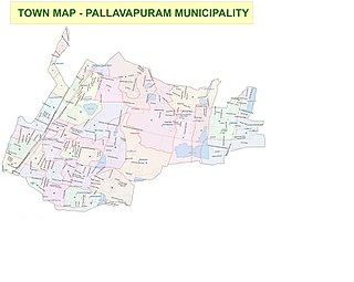
Pallavaram taluk is a taluk in Greater Chennai City formed from the bifurcation of Alandur taluk in 2015. It also included some areas from Sriperumbudur Taluk. Its headquarters are in the town of Pallavaram near Pallavaram–Thuraipakkam Radial Road. It comes under Chennai Metropolitan Development Authority (CMDA). It shares its boundaries with Alandur Taluk in Chennai District on the north, Kundrathur Taluk in Kanchipuram district on the west, Sholinganallur Taluk in Chennai District on the east.
Pallavaram Friday Market is a market in Pallavaram, Chennai, Tamil Nadu. It is an ancient marketplace for vendors where food items, plant saplings, animals and electronic goods are available.
Pallavaram–Thuraipakkam Radial Road is an arterial road in Chennai connecting Grand Southern Trunk Road in Pallavaram with Rajiv Gandhi Salai in Thuraipakkam. The road was constructed by State Highways in 2000. Construction of Road divides Pallavaram Eri on the either side of the road. Now Lake is available only on the Northern Side of the Road.
Pallavaram, is a major place in Chennai, Tamil Nadu.
