Delaware County, New York

Last updated

Delaware County
Delaware County Courthouse and Clerk's Office Apr 09.jpg
Delaware County Courthouse
Flag of Delaware County, New York.jpg
Seal of Delaware County, New York.png
Map of New York highlighting Delaware County.svg
Location within the U.S. state of New York
New York in United States.svg
New York's location within the U.S.
Coordinates: 42°12′N74°58′W / 42.2°N 74.96°W / 42.2; -74.96
CountryFlag of the United States.svg United States
StateFlag of New York.svg New York
Founded1797
Named after Delaware River
Seat Delhi
Largest village Sidney
Area
  Total
1,467 sq mi (3,800 km2)
  Land1,442 sq mi (3,730 km2)
  Water25 sq mi (60 km2)  1.7%
Population
 (2020)
  Total
44,308 Decrease2.svg
  Density30.7/sq mi (11.9/km2)
Time zone UTC−5 (Eastern)
  Summer (DST) UTC−4 (EDT)
Congressional district 19th
Website delcony.us

Delaware County is a county located in the US state of New York. As of the 2020 United States census, the population was 44,308. [1] The county seat is Delhi. [2] The county is named after the Delaware River, which was named in honor of Thomas West, 3rd Baron De La Warr, appointed governor of Virginia in 1609. The county is part of the Southern Tier region of the state.

Contents

History

When counties were established in New York State in 1683, the present area of Delaware County was divided between Albany and Ulster Counties.

Albany County was an enormous county, including the northern part of New York State as well as all of the present State of Vermont and, in theory, extending westward to the Pacific Ocean. This county was reduced in size on July 3, 1766, by the creation of Cumberland County, and further on March 16, 1770, by the creation of Gloucester County, both containing territory now in Vermont. On March 12, 1772, what was left of Albany County was split into three parts, one remaining under the name Albany County. One of the other pieces, Tryon County, contained the western portion (and thus, since no western boundary was specified, theoretically still extended west to the Pacific). The eastern boundary of Tryon County was approximately five miles west of the present city of Schenectady, and the county included the western part of the Adirondack Mountains and the area west of the West Branch of the Delaware River. The area then designated as Tryon County now includes 37 counties of New York State. The county was named for William Tryon, British colonial governor of New York.

In the years prior to 1776, most of the Loyalists in Tryon County fled to Canada. In 1784, following the peace treaty that ended the American Revolutionary War, the name of Tryon County was changed to Montgomery County to honor the general, Richard Montgomery, who had captured several places in Canada and died attempting to capture the city of Quebec, replacing the name of Tryon.

During the late 1780s, New York State governor De Witt Clinton issued land grants to military officers, doctors and other veterans of the American Revolutionary War, which brought many patriot veterans to settle in the area. [3]

In 1789, Montgomery County was reduced in size by the splitting off of Ontario County. The actual area split off from Montgomery County was much larger than the present county, also including the present Allegany, Cattaraugus, Chautauqua, Erie, Genesee, Livingston, Monroe, Niagara, Orleans, Steuben, Wyoming, Yates, and part of Schuyler and Wayne Counties.

In 1791, Otsego was one of three counties that were split off from Montgomery (the other two being Herkimer and Tioga Counties).

Ulster County was an original county of New York State, considerably larger than the present Ulster County, and at the time that Delaware County was created it still contained most of its original area.

Delaware County was formed in 1797 by combining portions of Otsego and Ulster counties.
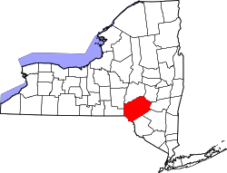
Geography

According to the U.S. Census Bureau, the county has a total area of 1,467 square miles (3,800 km2), of which 1,442 square miles (3,730 km2) is land and 25 square miles (65 km2) (1.7%) is water. [4] It is the fifth-largest county in New York by land area.

Delaware County is located in the southern part of the state, separated from the state of Pennsylvania by the Delaware River. It is east of Binghamton and southwest of Albany. The county contains part of the Catskill Mountains. The county is within a region called the Southern Tier of New York State.

The highest point is an approximately 3,520-foot (1,070 m) summit of Bearpen Mountain along the Greene County line. The lowest point is along the Delaware River. The county is drained by the headwaters of the Delaware. It has a hilly surface, and the soil in the valleys is exceedingly fertile. The Delaware and Susquehanna rivers are here navigable by boats. [5]

Adjacent counties

National protected area

Demographics

Historical population
CensusPop.Note
1800 10,228
1810 20,30398.5%
1820 26,58731.0%
1830 33,02424.2%
1840 35,3967.2%
1850 39,83412.5%
1860 42,4656.6%
1870 42,9721.2%
1880 42,721−0.6%
1890 45,4966.5%
1900 46,4132.0%
1910 45,575−1.8%
1920 42,774−6.1%
1930 41,163−3.8%
1940 40,989−0.4%
1950 44,4208.4%
1960 43,540−2.0%
1970 44,7182.7%
1980 46,8244.7%
1990 47,2250.9%
2000 48,0551.8%
2010 47,980−0.2%
2020 44,308−7.7%
U.S. Decennial Census [6]
1790–1960 [7] 1900–1990 [8]
1990–2000 [9] 2010–2020 [1] [10]

2020 census

Delaware County, New York – Racial and ethnic composition
Note: the US Census treats Hispanic/Latino as an ethnic category. This table excludes Latinos from the racial categories and assigns them to a separate category. Hispanics/Latinos may be of any race.
Race / Ethnicity (NH = Non-Hispanic)Pop 1980 [11] Pop 1990 [12] Pop 2000 [13] Pop 2010 [14] Pop 2020 [15] % 1980% 1990% 2000% 2010% 2020
White alone (NH)45,97545,93045,69344,70638,82198.19%97.26%95.08%93.18%87.62%
Black or African American alone (NH)2794475296911,0030.60%0.95%1.10%1.44%2.26%
Native American or Alaska Native alone (NH)88111134102930.19%0.24%0.28%0.21%0.21%
Asian alone (NH)1241832533634800.26%0.39%0.53%0.76%1.08%
Native Hawaiian or Pacific Islander alone (NH)x [16] x [17] 667xx0.01%0.01%0.02%
Other race alone (NH)651842311540.14%0.04%0.09%0.06%0.35%
Mixed race or Multiracial (NH)x [18] x [19] 4155211,765xx0.86%1.09%3.98%
Hispanic or Latino (any race)2935369831,5601,9850.63%1.13%2.05%3.25%4.48%
Total46,82447,22548,05547,98044,308 100.00%100.00%100.00%100.00%100.00%

2000 census

As of the census [20] of 2000, there were 48,055 people, 19,270 households, and 12,737 families residing in the county. The population density was 13 people per square mile (5.0 people/km2), making it the least densely populated in the state outside the Adirondacks. There were 28,952 housing units at an average density of 20 units per square mile (7.7/km2). The racial makeup of the county was 96.44% White, 1.18% Black or African American, 0.31% Native American, 0.53% Asian, 0.01% Pacific Islander, 0.53% from other races, and 0.99% from two or more races. 2.05% of the population were Hispanic or Latino of any race. 23.9% were of English ancestry, 16.9% were of German ancestry and 14.1% were of Irish ancestry according to the 2012 Community Survey. [21] [22] 94.5% spoke English, 2.0% Spanish and 1.1% German as their first language.

There were 19,270 households, out of which 28.10% had children under the age of 18 living with them, 52.80% were married couples living together, 9.00% had a female householder with no husband present, and 33.90% were non-families. 28.30% of all households were made up of individuals, and 13.60% had someone living alone who was 65 years of age or older. The average household size was 2.39 and the average family size was 2.90.

In the county, the population was spread out, with 23.10% under the age of 18, 8.20% from 18 to 24, 24.00% from 25 to 44, 26.20% from 45 to 64, and 18.60% who were 65 years of age or older. The median age was 41 years. For every 100 females there were 97.00 males. For every 100 females age 18 and over, there were 93.80 males.

The median income for a household in the county was $32,461, and the median income for a family was $39,695. Males had a median income of $27,732 versus $22,262 for females. The per capita income for the county was $17,357. About 9.30% of families and 12.90% of the population were below the poverty line, including 18.60% of those under age 18 and 8.60% of those age 65 or over.

Education

The State University of New York at Delhi is located in Delaware County. DCMO BOCES (Delaware-Chenango-Madison-Otsego; Board of Cooperative Educational Services) – Robert W. Harrold Campus is located in Sidney Center.

Transportation

Delaware County has some transportation operated by Coach USA. [23]

Major highways

Communities

Larger settlements

#LocationPopulationTypeSector
1 Sidney 3,900VillageNorthwest
2 Walton 3,088VillageSouthwest
3Delhi 3,087VillageNortheast
4Deposit 1,663VillageSouthwest
5 Stamford 1,119VillageNortheast
6 Hancock 1,031VillageSouthwest
7 Downsville 617CDPSouthwest
8 Margaretville 596VillageSoutheast
9 Hobart 441VillageNortheast
10 Franklin 374VillageNorthwest
11 Fleischmanns 351VillageSoutheast
12 Davenport Center 349CDPNortheast
13††Andes 252CDPSoutheast
14 Bloomville 213CDPSouthwest

† – County Seat

†† – Former Village

‡ – Not Wholly in this County

Towns

Unincorporated communities

Politics

Delaware County typically votes for Republicans in local, state, and national elections. The county has voted for two Democratic presidential candidates in its history, Bill Clinton in 1996 and Lyndon B. Johnson in 1964. The last Democrat to win the majority of votes on the gubernatorial level was Andrew Cuomo in 2010. [24]

United States presidential election results for Delaware County, New York [25]
Year Republican Democratic Third party(ies)
No.%No.%No.%
2024 13,78959.28%9,23739.71%2341.01%
2020 13,38758.14%9,14339.71%4952.15%
2016 11,94260.34%6,62733.48%1,2236.18%
2012 9,93853.32%8,30444.55%3962.12%
2008 10,52451.62%9,46246.41%4031.98%
2004 11,95856.49%8,72441.22%4852.29%
2000 10,66252.84%8,45041.88%1,0645.27%
1996 7,68439.62%8,72444.98%2,98615.40%
1992 8,82943.01%7,15234.84%4,54922.16%
1988 11,39159.92%7,46339.26%1560.82%
1984 14,00270.61%5,74528.97%830.42%
1980 10,60955.36%6,33333.05%2,22211.59%
1976 12,44362.76%7,25436.59%1300.66%
1972 15,13674.10%5,24325.67%470.23%
1968 12,36665.44%5,36028.36%1,1726.20%
1964 8,35941.66%11,68658.24%190.09%
1960 16,33674.21%5,66225.72%150.07%
1956 17,36481.91%3,83518.09%00.00%
1952 17,73781.10%4,11618.82%180.08%
1948 14,22673.05%4,96525.50%2831.45%
1944 14,91674.32%5,12825.55%250.12%
1940 15,68472.28%5,96827.50%480.22%
1936 15,16470.98%6,14228.75%580.27%
1932 13,05065.32%6,72333.65%2071.04%
1928 16,22578.59%4,36221.13%580.28%
1924 13,02072.66%4,15823.20%7414.14%
1920 11,71970.17%4,52827.11%4542.72%
1916 6,26653.74%4,98642.76%4083.50%
1912 4,73140.32%4,51138.45%2,49121.23%
1908 7,14258.28%4,64137.87%4723.85%
1904 7,62861.54%4,34735.07%4213.40%
1900 7,62660.16%4,63936.60%4113.24%
1896 7,79061.75%4,45035.28%3752.97%
1892 6,42153.07%4,70638.90%9728.03%
1888 6,60252.33%5,33242.26%6835.41%
1884 5,93451.88%4,95643.33%5494.80%

See also

References

  1. 1 2 "U.S. Census Bureau QuickFacts: Delaware County, New York". United States Census Bureau. Retrieved January 3, 2022.
  2. "Find a County". National Association of Counties. Archived from the original on May 31, 2011. Retrieved June 7, 2011.
  3. Chernow, Ron (2004). Alexander Hamilton. The Penguin Press. p. 177.
  4. "2010 Census Gazetteer Files". United States Census Bureau. August 22, 2012. Archived from the original on May 19, 2014. Retrieved January 4, 2015.
  5. Ripley, George; Dana, Charles A., eds. (1879). "Delaware, the name of five counties in the United States. I. A S. E. county of New York"  . The American Cyclopædia .
  6. "U.S. Decennial Census". United States Census Bureau. Retrieved January 4, 2015.
  7. "Historical Census Browser". University of Virginia Library. Archived from the original on August 11, 2012. Retrieved January 4, 2015.
  8. "Population of Counties by Decennial Census: 1900 to 1990". United States Census Bureau. Archived from the original on February 19, 2015. Retrieved January 4, 2015.
  9. "Census 2000 PHC-T-4. Ranking Tables for Counties: 1990 and 2000" (PDF). United States Census Bureau. Archived (PDF) from the original on December 18, 2014. Retrieved January 4, 2015.
  10. "US Census 2020 Population Dataset Tables for New York". United States Census Bureau. Retrieved January 2, 2022.
  11. "1980 Census of Population - General Population Characteristics - New York - Table 15 - Persons by Race and Table 16 - Total Persons and Spanish Origin Persons by Type of Spanish Origin and Race (p. 34/29-34/70)" (PDF). United States Census Bureau .
  12. "1990 Census of Population - General Population Characteristics - New York - Table 3 - Race and Hispanic Origin" (PDF). United States Census Bureau . p. 45-215.
  13. "P004: Hispanic or Latino, and Not Hispanic or Latino by Race – 2000: DEC Summary File 1 – Delaware County, New York". United States Census Bureau .
  14. "P2: Hispanic or Latino, and Not Hispanic or Latino by Race – 2010: DEC Redistricting Data (PL 94-171) – Delaware County, New York". United States Census Bureau .
  15. "P2: Hispanic or Latino, and Not Hispanic or Latino by Race – 2020: DEC Redistricting Data (PL 94-171) – Delaware County, New York". United States Census Bureau .
  16. included in the Asian category in the 1980 Census
  17. included in the Asian category in the 1990 Census
  18. not an option in the 1980 Census
  19. not an option in the 1990 Census
  20. "U.S. Census website". United States Census Bureau . Retrieved January 31, 2008.
  21. "American Community Survey (ACS)". www.census.gov. Archived from the original on June 25, 2009. Retrieved May 1, 2018.
  22. "Data – Data & Documentation – American Community Survey – U.S. Census Bureau". Archived from the original on December 22, 2015. Retrieved December 7, 2017.
  23. "Archived copy" (PDF). Archived (PDF) from the original on October 23, 2014. Retrieved November 29, 2013.{{cite web}}: CS1 maint: archived copy as title (link)
  24. "New York – Election Results 2010 – The New York Times". www.nytimes.com. Retrieved January 17, 2023.
  25. Leip, David. "Dave Leip's Atlas of U.S. Presidential Elections". uselectionatlas.org. Archived from the original on March 23, 2018. Retrieved May 1, 2018.

Further reading

42°12′N74°58′W / 42.20°N 74.96°W / 42.20; -74.96