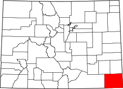
Baca County, Colorado, in 1925, showing the location of Edler
Edler was named for Dr. Edler, one of the first homesteaders in the community.[4]
The Edler, Colorado, post office operated from February 16, 1916, until December 31, 1947.[5] The Springfield, Colorado, post office (ZIP code 81073) now serves the area.[3] Edler was two miles northwest of Holmes City.[6]
In the 1920s, Edler had two mercantiles and a blacksmith shop.[7] The Edler area was noted for its dairy industry, and two cream stations had been established in Edler.[8]
In the 1930s, the community of Edler was the location of several petroleum test sites.[9] In 1936, William A. Arbuthnot organized the Edler Grange. The Edler Grange was #426.[10]
By the 1950s, there was a school and bus barn and the Edler Community Church.[7] Edler's population was 30 in 1960.[12]
By the 1990s, Edler was stated to be "surrounded by sand sagebrush, yucca, blue grama, buffalo grass, side-oats grama, and red threeawn. The population is 25."[13]
Geography
Edler is located within the Comanche National Grassland in southern Baca County.[13] It is located at the junction of County Road P and County Road 17.
This page is based on this Wikipedia article Text is available under the CC BY-SA 4.0 license; additional terms may apply. Images, videos and audio are available under their respective licenses.