
The Murray River is a river in Southeastern Australia. It is Australia's longest river at 2,508 km (1,558 mi) extent. Its tributaries include five of the next six longest rivers of Australia. Together with that of the Murray, the catchments of these rivers form the Murray–Darling basin, which covers about one-seventh the area of Australia. It is widely considered Australia's most important irrigated region.

Echuca is a city on the banks of the Murray River and Campaspe River in Victoria, Australia. The border town of Moama is adjacent on the northern side of the Murray River in New South Wales. Echuca is the administrative centre and largest settlement in the Shire of Campaspe. As of the 2021 census, Echuca had a population of 15,056, and the population of the combined Echuca and Moama townships was 22,568.

Wentworth is a small border town in the far south west of the state of New South Wales, Australia. It lies at the confluence of Australia's two most important rivers, the Darling and the Murray, the latter forming the border with the state of Victoria to the south. The border with the state of South Australia lies approximately 100 kilometres (62 mi) to the west. The town of Wentworth is in the local government area of the same name.

Monaro Highway is a 285-kilometre-long (177 mi) highway in Victoria, New South Wales, and the Australian Capital Territory, in Australia, linking Cann River in Victoria to Canberra in the Australian Capital Territory (ACT) via the Monaro region. From its southern terminus, it follows the nearby Cann River upstream towards the New South Wales border through heavily forested terrain. Within New South Wales (NSW), it makes its way through further forest before reaching the pastures typical of the Monaro. There are multiple towns and villages along the highway, including Bombala, Nimmitabel and Cooma. The terrain within the Monaro is largely hilly, and there are numerous crossings. The road also parallels the former Bombala railway line in several locations. Within the ACT, the road becomes a high volume roadway and serves the southern suburbs of Canberra. The highway has more recently had a grade-separated dual carriageway extension constructed within Canberra, as part of the Eastern Parkway construction project. It is designated part of route M23, and route A23 within Canberra, and route B23 within Victoria and New South Wales, with a concurrency where it also carries route B72 between the two sections of Snowy Mountains Highway.

The Riverina is an agricultural region of southwestern New South Wales, Australia. The Riverina is distinguished from other Australian regions by the combination of flat plains, warm to hot climate and an ample supply of water for irrigation. This combination has allowed the Riverina to develop into one of the most productive and agriculturally diverse areas of Australia. Bordered on the south by the state of Victoria and on the east by the Great Dividing Range, the Riverina covers those areas of New South Wales in the Murray and Murrumbidgee drainage zones to their confluence in the west.

Violet Town is a town in northeastern Victoria, Australia. The town is in the Shire of Strathbogie local government area, 174 kilometres (108 mi) northeast of the state capital, Melbourne on the Hume Highway. At the 2021 census, Violet Town had a population of 936.

Barmah is a town in the state of Victoria, Australia.

The Goulburn Valley is a sub-region, part of the Hume region of the Australian state of Victoria. The sub-region consists of those areas in the catchment of the Goulburn River and other nearby streams, and is part of the Murray-Darling Basin. The Goulburn Valley is bordered on the south by the Great Dividing Range and to the north by the Murray River, the state border with New South Wales. The sub-region is one of Australia's most productive and intensively farmed areas and is predominantly irrigated.

Mathoura is a small town in the Riverina region of southern New South Wales, Australia, in the Murray River Council local government area. At the 2016 census, Mathoura had a population of 938. At the 2021 census the population was 1,002.

The Yorta Yorta, also known as Jotijota, are an Aboriginal Australian people who have traditionally inhabited the area surrounding the junction of the Goulburn and Murray Rivers in present-day north-eastern Victoria and southern New South Wales.

Cummeragunja Reserve or Cummeragunja Station, alternatively spelt Coomeroogunja, Coomeragunja, Cumeroogunga and Cummerguja, was a settlement on the New South Wales side of the Murray River, on the Victorian border near Barmah. It was also referred to as Cumeroogunga Mission, although it was not run by missionaries. The people were mostly Yorta Yorta.

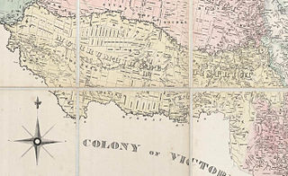
Lands administrative divisions of Australia are the cadastral divisions of Australia for the purposes of identification of land to ensure security of land ownership. Most states term these divisions as counties, parishes, hundreds, and other terms. The eastern states of Queensland, New South Wales, Victoria, and Tasmania were divided into counties and parishes in the 19th century, although the Tasmanian counties were renamed land districts in the 20th century. Parts of South Australia (south-east) and Western Australia (south-west) were similarly divided into counties, and there were also five counties in a small part of the Northern Territory. However South Australia has subdivisions of hundreds instead of parishes, along with the Northern Territory, which was part of South Australia when the hundreds were proclaimed. There were also formerly hundreds in Tasmania. There have been at least 600 counties, 544 hundreds and at least 15,692 parishes in Australia, but there are none of these units for most of the sparsely inhabited central and western parts of the country.
The Murrumbidgee District was a district used in New South Wales in the nineteenth century to refer to the land between the Murrumbidgee River and Murray River, that is now mostly known as the Riverina region. Some maps show the district included the parts of what is now the Australian Capital Territory that was to the west of the Murrumbidgee River. The district was originally one of the districts used to refer to the area outside the limits of location, but later continued to be used as the name after counties were proclaimed within this area. It went out of use after 1884, when new districts were proclaimed.
Dundee is a rural locality about 40 kilometres north of Glen Innes on the Northern Tablelands, New South Wales, Australia. It is situated on the New England Highway at the Severn River in Severn parish, Gough County, New South Wales. The elevation is 985 metres.

Pental Island is an island and locality in Victoria, Australia, bordering Swan Hill, Victoria in the north. The island is bounded by the Murray River in the north and the Little Murray River in the south; the Little Murray diverges from the Murray at Fish Point and converges at Swan Hill. Pental Island is also a parish of the County of Tatchera and the boundaries of the three entities are identical. At the 2016 census, Pental Island had a population of 135, down from 380 ten years earlier. The indigenous Wemba Wemba name for the island is Pakaruk.

Youanmite is a locality in the Shire of Moira. It is located near the intersection of Youanmite and Katamatite roads, approximately 25 km southwest of Yarrawonga and approximately 200 km northeast of Melbourne, Australia. Youanmite was once a small town having its own schools, churches, and post office. Comprising medium to large farms the area is predominantly agricultural, focusing on grain production as well as sheep and cattle grazing.

The Campaspe River, an inland intermittent river of the north–central catchment, part of the Murray-Darling basin, is located in the lower Riverina bioregion and Central Highlands and Wimmera regions of the Australian state of Victoria. The headwaters of the Campaspe River rise on the northern slopes of the Great Dividing Range and descend to flow north into the Murray River, Australia's longest river, near Echuca.
The Pangerang, also spelt Bangerang and Bangarang, are the Indigenous Australians who traditionally occupied much of what is now north-eastern Victoria stretching along the Murray River to Echuca and into the areas of the southern Riverina in New South Wales. They may not have been an independent tribal reality, as Norman Tindale thought, but one of the many Yorta Yorta tribes.
Thyra, New South Wales is a parish and suburb in Cadell County, Southern New South Wales, Australia. It is located 15 km north of Echuca, Victoria at 35°49′54″S 144°41′04″E and is on the Balranald branch line of the Deniliquin railway line and in Murray River Council.

The Moama Historic Precinct is a heritage-listed abandoned settlement location, river wharf and public space on Hunt Street, Moama, New South Wales, Australia. It includes the Echuca – Moama Bridge and the Echuca Wharf on the Victorian side of the river. It was added to the New South Wales State Heritage Register on 2 April 1999.
