St. George's, Newfoundland and Labrador

Last updated

St. George's
South Side, Little Bay
Town
Image of an old saltbox home located in St. George's, Newfoundland by photographer Erik Mclean.jpg
Saltbox home in St. George's
Canada Newfoundland location map.svg
Red pog.svg
St. George's
Location of St. George's in Newfoundland
Coordinates: 48°25′39″N58°28′40″W / 48.42750°N 58.47778°W / 48.42750; -58.47778
Country Canada
Province Newfoundland and Labrador
Settled18th century
Government
  MayorDaniel Conway [1]
  Governing bodySt.George's Town Council
   MHA Scott Reid (Lib)
   MP Gudie Hutchings (Lib)
Population
 (2021)
  Total1,139
Time zone UTC-3:30 (Newfoundland Time)
  Summer (DST) UTC-2:30 (Newfoundland Daylight)
Area code 709
Highways NL TCH sign.svg Route 1 (TCH)
NL Route 461.svg Route 461
Website St. George's official website

St. George's is a Canadian community in the St. George's Bay on the southwest coast of Newfoundland of the province of Newfoundland and Labrador.

Contents

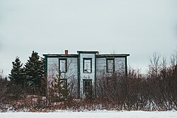
The community, originally known as South Side or Little Bay has its origins in the French fishery of the seventeenth century when the good natural harbour would attract fishermen to spend the summer in the area and return to France for the winter months. Permanently settled in the eighteenth century, the community remained a fishing village for nearly 200 years until the advent of the railroad. [2]

Mi'kmaq

Mi'kmaq villages in St. Georges Bay and Placentia existed in 1594. [3] :11 [4] :220–21 [5] :80 [6] [7] :138 Jeannot Pequidalouet - the eastern Mi'kmaq chief of Cape Breton, who had previously overwintered in Newfoundland - began to create permanent settlements in St. George's Bay and Miawpukek in the 1760s. [8] [9] In May 1767 when James Cook was mapping Newfoundland coast, he met a tribe of Mi'kmaq in St. George's Bay. [10] :12

Early fisheries

In the seventeenth century the French fishermen spent the summer months in St. Georges harbour and returned to France for the winter. They began to overwinter in the eighteenth century and St. Georges continued to be a fishing village "for nearly 200 years until the advent of the railroad." [2]

After the railroad

The railroad came to Western Newfoundland in 1898, and because of the work that the railway created, as well as access to many different types of goods, many people from outlying communities flocked to St. George's. The town quickly became a major centre in Western Newfoundland. The town became a distributor of goods to the surrounding area and the Port au Port Peninsula. Lumbering, fishing and farming were the primary occupations and lobster plants also opened there. A brewery/distillery also operated there for a short time at the turn of the century. The community also became the seat of the magistrate in the area and a courthouse was constructed.

Demographics

In the 2021 Census of Population conducted by Statistics Canada, St. George's had a population of 1,139 living in 543 of its 611 total private dwellings, a change of

Attractions

St. Georges once hosted an Annual Blueberry Festival every August at Blueberry Hill which ran for 25 consecutive years . [12]

Sandy Point, located 3.5 kilometres south of Stephenville, is an uninhabited 2,471-acre (1,000-hectare) island of natural wealth in St. Georges Bay. [13]

Black bank is a black sand beach with beautiful tree lined embankments.

See also

Related Research Articles

<span class="mw-page-title-main">Mi'kmaq</span> Indigenous ethnic group of eastern North America

The Mi'kmaq are a First Nations people of the Northeastern Woodlands, indigenous to the areas of Canada's Atlantic Provinces, primarily Nova Scotia, New Brunswick, Prince Edward Island, and Newfoundland, and the Gaspé Peninsula of Quebec as well as Native Americans in the northeastern region of Maine. The traditional national territory of the Mi'kmaq is named Miꞌkmaꞌki.

<span class="mw-page-title-main">St. Anthony, Newfoundland and Labrador</span> Town in Newfoundland and Labrador, Canada

St. Anthony is a town on the northern reaches of the Great Northern Peninsula of the Canadian province of Newfoundland and Labrador. St. Anthony serves as a main service centre for northern Newfoundland and southern Labrador. St. Anthony had a population of 2,180 in 2021, compared with 2,258 in 2016, 2,418 in 2011, 2,476 in 2006 and 2,730 in 2001.

<span class="mw-page-title-main">Placentia, Newfoundland and Labrador</span> Town in Newfoundland and Labrador, Canada

Placentia is a town located in the Canadian province of Newfoundland and Labrador. It consists of the amalgamated communities of Placentia ("Townside"), Southeast Placentia, Freshwater, Dunville and Jerseyside and also includes the Argentia Industrial Park.

<span class="mw-page-title-main">Old Perlican</span> Town in Newfoundland and Labrador, Canada

Old Perlican is a fishing village on the Avalon Peninsula, Newfoundland and Labrador in Canada. Incorporated in 1971, it is one of the oldest fishing communities in Newfoundland; it served as the major fishing station in Trinity Bay for migratory fisherman from England in the 17th century.

<span class="mw-page-title-main">Port au Port Peninsula</span>

The Port au Port Peninsula is a peninsula in the Canadian province of Newfoundland and Labrador. Roughly triangular in shape, it is located on the west coast of the island of Newfoundland.

Piccadilly Slant-Abraham's Cove is a local service district and designated place in the Canadian province of Newfoundland and Labrador. It is located on the island of Newfoundland, along St. George's Bay, on the Port au Port Peninsula. The DPL consists of the fishing villages of Abraham's Cove and Piccadilly.

<span class="mw-page-title-main">Rose Blanche-Harbour le Cou</span> Town in Newfoundland and Labrador, Canada

Rose Blanche – Harbour le Cou is a small town on Newfoundland's southwest shore, about 45 km at the end of Route 470 from Port aux Basques. This community is located in a barren area on the east side of a small bay. In this bay there are 2 harbours that were mainly used to provide shelter for fishing vessels. Scenery includes the rugged granite coastline, and the white and rocky cliffs of "Diamond Cove". Its granite lighthouse was in operation from 1873 to the 1940s. After it was abandoned in the 1940s the building fell into ruins. The spiral stone staircase extends into the tower wall and kept the tower from collapsing while the remainder of the lighthouse fell to ruin. In 1999 the lighthouse was fully reconstructed and serves as a tourist attraction.

Noel Joseph JeddoreWe’jitu also Newell Jeddore Gietol, Geodol was Saqamaw "grand chief" of the Mi'kmaq at Miawpukek in Bay d'Espoir on the south coast of Newfoundland in the Coast of Islands region. Jeddore served as chief from July 26, 1919 until he was forced into exile to Eskasoni, Nova Scotia, in 1924. He was born at Indian Point, Bay d'Espoir and he died at Eskasoni, Cape Breton.

<span class="mw-page-title-main">Miawpukek First Nation</span> Indian reserve in Newfoundland and Labrador, Canada

Miawpukek First Nation is a Mi'kmaq First Nations band government in Conne River, Newfoundland and Labrador, Canada, with a registered population of 836 living on-reserve as of May 2023, with another 2,265 living off-reserve. They control the reserve of Samiajij Miawpukek in Bay d'Espoir on the island of Newfoundland. It was formerly known as Conne River Indian Reserve until the mid-1980s. Samiajij Miawpukek was established as a federal Indian reserve in 1987, the first in Newfoundland and Labrador. In 1991, Miawpukek was one of the poorest communities in Atlantic Canada. Due in part to increased education of its members, it has gone on to become the most well-off First Nation in Atlantic Canada after Membertou.

<span class="mw-page-title-main">Bay Roberts</span> Town in Newfoundland and Labrador, Canada

Bay Roberts is a town located on the north shore of Conception Bay on the northeastern Avalon Peninsula in the province of Newfoundland and Labrador, Canada. The growth of the local economy can be connected to the town's proximity to other major Newfoundland markets, by road and by water.

New-Wes-Valley is a municipality in Newfoundland and Labrador, Canada.

Admirals Beach is a rural community located in Newfoundland and Labrador, Canada.

<span class="mw-page-title-main">English Harbour East</span> Town in Newfoundland and Labrador, Canada

English Harbour East is a town in the Canadian province of Newfoundland and Labrador. It is located on the northeast side of Fortune Bay. Settled first by the Mi’kmaq of Newfoundland which used land on the "Neck" of the Harbour, they were joined in the early 1800s, by the English Dodge family and by Irishman Thomas Hynes Sr. European fishermen were first brought to the small community by English merchant family of Newman and Co. based in Harbour Breton, the firm of merchant John Gorman, and the Jersey firm of Nicholle and Co. The town had a population of 117 in the Canada 2021 Census.

<span class="mw-page-title-main">Salvage, Newfoundland and Labrador</span> Town in Newfoundland and Labrador, Canada

Salvage is a town located on the Eastport Peninsula of the Canadian province of Newfoundland and Labrador. The town had a population of 108 in the Canada 2021 Census.

<span class="mw-page-title-main">St. Bernard's-Jacques Fontaine</span> Town in Newfoundland and Labrador, Canada

St. Bernard's-Jacques Fontaine is a town in the Canadian province of Newfoundland and Labrador. The town had a population of 433 in the Canada 2021 Census, a drop from 470 in 2011.

<span class="mw-page-title-main">Franco-Newfoundlander</span>

Franco-Newfoundlanders, also known as Franco-Terreneuvians in English or Franco-Terreneuviens in French, are francophone and/or French Canadian residents of the Canadian province of Newfoundland and Labrador. The name Franco-Terreneuvian derives from Terre-Neuve, the French name of Newfoundland.

<span class="mw-page-title-main">Brig Bay</span>

Brig Bay is a local service district and designated place in the Canadian province of Newfoundland and Labrador. It was first mapped by Captain James Cook in September 1764. The name "Brig" was adopted by the French who occupied the bay prior to English occupation. It provided a safe and well-sheltered harbour.

<span class="mw-page-title-main">Newfoundland (island)</span> Island portion of Newfoundland and Labrador, Canada

Newfoundland is a large island situated off the eastern coast of the North American mainland and the western part of the Canadian province of Newfoundland and Labrador, referred to as Labrador.

Lodge Bay is a local service district and designated place in the Canadian province of Newfoundland and Labrador. It is on the southeast coast of Labrador. Encompassing a population of less than one hundred residents, the community has uniquely evolved from both early European colonization of Labrador, and the inimitable patterns of land and resource use by the migratory Inuit population. The name Lodge Bay originated from the title Ranger Lodge, which was the name given to the area by trader and explorer, Captain George Cartwright in the late 18th century. "Ranger" was the name of the wooden-mercantile ship Cartwright used to trade, map and explore the Labrador coast, while "Lodge" was the name given to English hunting camps in Great Britain at that time.

<span class="mw-page-title-main">Qalipu First Nation</span> First nations band government in Newfoundland and Labrador, Canada

The Qalipu First Nation, is a Mi’kmaq band government, created by order-in-council in 2011 pursuant to the Agreement for the Recognition of the Qalipu Mi’kmaq Band. After the band was approved as a First Nation, 100,000 people applied for membership and a total of 23,000 were approved.

References

  1. https://townofstgeorges.com/municipality/mayors-message/
  2. 1 2 "Town History", Town of St. Georges, 2016, retrieved August 5, 2016
  3. Tulk, Jamie Esther (July 2008), "Our Strength is Ourselves: Identity, Status, and Cultural Revitalization among the Mi'kmaq in Newfoundland" (PDF), Memorial University via Collections Canada Theses, Newfoundland, retrieved August 5, 2008
  4. Hanrahan, Maura (2003), "The lasting breach: The omission of Aboriginal people from the Terms of Union between Newfoundland and Canada and its ongoing impacts. Collected research papers of the Royal Commission on renewing and strengthening our place in Canada." (PDF), Royal Commission on Renewing and Strengthening Our Place in Canada, St. John's, retrieved August 5, 2016
  5. Stone, Helen. 1993. Living in time immemorial: Concepts of "time" and "time immemorial": Why Aboriginal rights theory is problematic in the courts and around the negotiating table. Master's thesis, Carleton University.
  6. Wetzel, Jerry (1999). "The hidden Term of Union: Executive summary, confederation and federal abandonment of the Newfoundland Mi'kmaq". Newfoundland Quarterly. 92 (4): 23–28.
  7. Wetzel, Jerry (1995), Decolonizing Ktagmkuk Mi'kmaw history, LL.M Theses, Dalhousie University
  8. Miapukek First Nation: Indian Act: We Got In, We Could Get Out (PDF). AFOA National Conference. February 25–27, 2014. Retrieved August 5, 2016.
  9. Jeddore, Phil (2001), "Lnu'k Saqmawaq of Taqm Mi'kmaq chiefs of Newfoundland", Miawipukek Aknutmaqn: News and Information from Aosamiaji'jij Miawpukek Reserve, Conne River, Taqm (Newfoundland), retrieved August 5, 2016 March 10, 1996, to April 2001
  10. Whiteley, William H. (1975), James Cook in Newfoundland 1762-1767 (PDF), Newfoundland Historical Society Pamphlet, p. 36, retrieved August 6, 2016
  11. "Population and dwelling counts: Canada, provinces and territories, census divisions and census subdivisions (municipalities), Newfoundland and Labrador". Statistics Canada. February 9, 2022. Retrieved March 15, 2022.
  12. "Attractions", Town of St. Georges, 2016, retrieved August 5, 2016
  13. "NCC: Sandy Point". www.natureconservancy.ca. Archived from the original on 2012-03-13.

48°25′39″N58°28′40″W / 48.42750°N 58.47778°W / 48.42750; -58.47778