
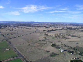
Tarana is a small town in the Central West of New South Wales, Australia in the City of Lithgow.

Muttama is a rural community in the central east part of the Riverina. It is situated by road, about 24 kilometres south of Cootamundra and 17 kilometres north of Coolac.
Niemur is a historic village community in the central west part of the Riverina and the site of a railway station. It is situated about 24 kilometres south east of Moulamein and 27 kilometres north west of Burraboi.
Moolpa is a small rural community in the southwest part of the Riverina in New South Wales, Australia, and is named after a nearby sheep and wheat station. It is situated about 13 kilometres southwest of Pereketen and 34 kilometres northwest of Moulamein by road.

Lake Bathurst is a shallow lake located 27 kilometres (17 mi) south-east of Goulburn, New South Wales in Australia. It is also the name of a nearby locality in the Goulburn Mulwaree Council.

Llangothlin is a rural locality with several houses, 11 kilometres (7 mi) north of Guyra on the Northern Tablelands in the New England region of New South Wales, Australia. Llangothlin was located in the Guyra Shire local government area until that council was amalgamated into the Armidale Regional Council on 12 May 2016.
Kellys Plains is a small rural locality situated about 8 kilometres west south west of Armidale, New South Wales. The settlement is at an altitude of about 1,044 metres on the Northern Tablelands in the New England region of New South Wales, Australia.
Bendick Murrell is a town in the South West Slopes region of New South Wales, Australia.
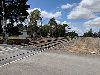
Marinna is a locality in Junee Shire in southern New South Wales, Australia. Its main feature is a grain silo on the Main South railway line. A station was opened in the locality between 1897 and 1975.
Nubba is a locality and former railway station on the Main South railway line in New South Wales, Australia, located midway between Wallendbeen and Harden. The station was open between 1882 and 1975 and has now been demolished.
Kungala is a locality south of Grafton in northern New South Wales, Australia. The North Coast railway passes through, and a railway station and sidings were provided from 1915 to 1974. At the 2006 census, Kungala had a population of 205 people. The town's name is derived from an aboriginal term meaning "to shout and listen".
Kundabung is a locality on the North Coast of New South Wales, Australia.
Napier is a locality in the Riverina district of New South Wales, Australia and also a civil parish of Buccleuch County, New South Wales.
Brownsville is a suburb of the City of Wollongong.

Royalla is a rural locality on the border of New South Wales and the Australian Capital Territory. The area takes its name from the nearby Mount Rob Roy, and was originally a railway settlement on the Bombala railway line known as Rob Roy and changed to the current name in 1905. Modern Royalla is a large rural locality east of the Monaro Highway. The border with the ACT follows the western boundary of the easement of the former railway line to the east of the highway. The town was served by a railway station until 1975. The NSW part of Royalla had a population of 984 at the 2016 census.
Bribbaree is a small village in the South West Slopes region of New South Wales, Australia spanning the boundary of Weddin Shire and Hilltops Council.
"Booyong" is a locality in northern New South Wales, partially in Byron Shire and partially in the City of Lismore. It is named after the Booyong, or ironwood tree.

Tirrannaville is a locality in the Goulburn Mulwaree Council, New South Wales, Australia. It is located about 11 km south of Goulburn on the road to Braidwood. It was formerly called Terranna, which is the name of the parish covering most of the locality. The northern part of the defined locality, including the small settlement of Tirrannaville and cemetery, is in the parish of Goulburn. At the 2016 census, it had a population of 237. The locality mostly consists of grazing land.
Yarra is a locality in the Goulburn Mulwaree Council, New South Wales, Australia. It is located about 18 km southwest of Goulburn, 84 km northeast of Canberra and 213 km southwest of Sydney. It lies at the intersection of the Federal Highway and the Hume Highway. At the 2016 census, it had a population of 173. Yarra railway station was a station on the Main Southern railway line from 1875 to the 1970s. A small settlement grew up around the railway station and the Hume Highway, parts of which were demolished during road widening in the 1970s. It had a public school from 1869 to 1970, operating as a "half-time" school until 1873.

Carrick is a locality in the Goulburn Mulwaree Council, New South Wales, Australia. It is located on the northern side of the Hume Highway to the east of Goulburn. At the 2016 census, it had a population of 136. Carrick railway station was a station on the Main Southern railway line from 1869 to 1975. It had a public school from 1873 to 1909, operating as a "half-time" school from 1887.
