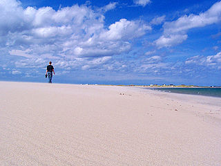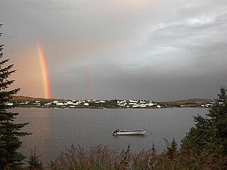
Grand Bank or 'Grand Banc' as the first French settlers pronounced it, is a small rural town in the Canadian province of Newfoundland and Labrador, with a population of 2,580. It is located on the southern tip or "toe" of the Burin Peninsula, 360 km from the province's capital of St. John's.

Old Perlican is a fishing village on the Avalon Peninsula, Newfoundland and Labrador in Canada. Incorporated in 1971, it is one of the oldest fishing communities in Newfoundland; it served as the major fishing station in Trinity Bay for migratory fisherman from England in the 17th century.
The Burin Peninsula is a peninsula located on the south coast of the island of Newfoundland in the province of Newfoundland and Labrador. Marystown is the largest population centre on the peninsula.

Burin is a town on the Burin Peninsula in Placentia Bay, Newfoundland and Labrador, Canada. The Burin Peninsula is often affectionately nicknamed "The Boot" due to its resemblance to the footwear when seen on a map, with the town of Burin located near the "heel". Burin is approximately 318 km from the capital of St. John's. Settlement in Burin dates to the early 18th century, although documentary evidence indicates that French fishermen had been fishing and exploring the area even earlier.

Fortune is a Canadian town located in the province of Newfoundland and Labrador.
Triton is a town that lies on Big Triton Island just off the coast of northeastern Newfoundland, in the Canadian province of Newfoundland and Labrador. Triton is the economic center of Green Bay South. According to Statistics Canada, Triton's population fell from 983 in 2016 to 896 in 2021. The town of Triton has grown more with new businesses and buildings opening in 2017. Triton also has a state of the art swimming pool, skatepark and a small basketball court, there are trailer campsites nearby too.
Red Harbour is a Canadian municipality of Newfoundland and Labrador. It is located 20 kilometres northeast of Marystown.
St. Lawrence is a town located on the Burin Peninsula of Newfoundland and Labrador. As of the 2021 Canadian Census, the population of St. Lawrence was 1,115, down from the 2011 Canadian Census of 1,244. Popular family names in the town include Turpin, Tarrant, Slaney, Pike, Lake, Drake and Edwards.

Pool's Cove is a community located on the north west side of Fortune Bay, on the South Coast of Newfoundland, Canada. The town had a population of 143 in the 2021 Census.
New-Wes-Valley is a municipality in Newfoundland and Labrador, Canada.

Lumsden, formerly known as Cat Harbour, is a community located on the Straight Shore of Newfoundland in Newfoundland and Labrador, Canada, near communities such as Musgrave Harbour and Newtown. Lumsden formerly consisted of two settlements, Lumsden North on the tip of a sandy peninsula and Lumsden South on the main road. Although the harbour in Lumsden is not ideal because it is not sheltered, Lumsden has excellent fishing grounds.

English Harbour East is a town in the Canadian province of Newfoundland and Labrador. It is located on the northeast side of Fortune Bay. Settled first by the Mi’kmaq of Newfoundland which used land on the "Neck" of the Harbour, they were joined in the early 1800s, by the English Dodge family and by Irishman Thomas Hynes Sr. European fishermen were first brought to the small community by English merchant family of Newman and Co. based in Harbour Breton, the firm of merchant John Gorman, and the Jersey firm of Nicholle and Co. The town had a population of 117 in the Canada 2021 Census.

Mary's Harbour is a town in the Canadian province of Newfoundland and Labrador. The town had a population of 312 in the Canada 2021 Census, down from 341 in the Canada 2016 Census. It is serviced by Mary's Harbour Airport.

Salvage is a town located on the Eastport Peninsula of the Canadian province of Newfoundland and Labrador. The town had a population of 108 in the Canada 2021 Census.

St. Bernard's-Jacques Fontaine is a town in the Canadian province of Newfoundland and Labrador. The town had a population of 433 in the Canada 2021 Census, a drop from 470 in 2011.

St. Jacques-Coomb's Cove is a town in the Canadian province of Newfoundland and Labrador. The town had a population of 546 in the Canada 2021 Census. It is located on the south coast of the island of Newfoundland on the north side of Fortune Bay, on the southern tip of the Connaigre Peninsula in what is now known as the Coast of Bays Region. The town consists of six communities, St. Jacques, English Harbour West, Mose Ambrose, Boxey, Coomb's Cove, and Wreck Cove, all nestled within the inlets along the coast. They all had their beginnings in the fisheries and the fisheries have always been the mainstay of employment in the communities. In recent years aquaculture was introduced in the area, providing employment for its residents.

South East Bight (SEB) or Southeast Bight is a local service district and designated place in the Canadian province of Newfoundland and Labrador. It is on the western shore of Placentia Bay on the Burin Peninsula. The community is not connected by road and is only accessible by ferry from Petite Forte. Many people from the community travel to Monkstown in the winter by snowmobile, but is very uncommon to try to get there in the summer, because of marsh, bogs, ponds and hills. To get to South East Bight one must travel towards Marystown on the Burin Peninsula, turn off the highway at Boat Harbour, travel to Petite Forte and then take a half-hour ferry ride to South East Bight.
Spanish Room is a local service district and designated place in the Canadian province of Newfoundland and Labrador.
Division No. 2, Newfoundland and Labrador is a census division in the Canadian province of Newfoundland and Labrador, primarily comprising the Burin Peninsula. Like all census divisions in Newfoundland and Labrador, but unlike the census divisions of some other provinces, the division exists only as a statistical division for census data, and is not a political entity.
Harbour Mille-Little Harbour East is a local service district and designated place in the Canadian province of Newfoundland and Labrador.


