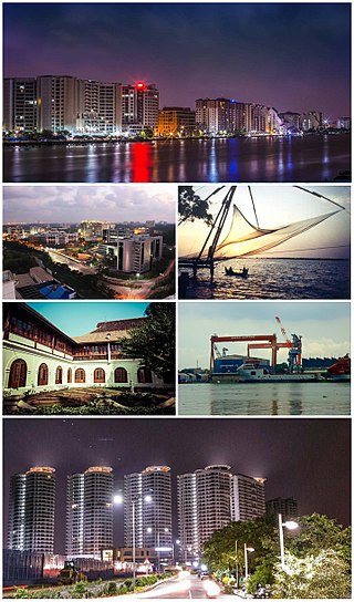
Kochi, also known as Cochin is a major port city on the Malabar Coast of India bordering the Laccadive Sea, which is a part of the Arabian Sea. It is part of the district of Ernakulam in the state of Kerala and is commonly referred to as Ernakulam. Kochi is the most densely populated city in Kerala. As of 2011, it has a corporation limit population of 677,381 within an area of 94.88 km2 and a total urban population of more than of 2.1 million within an area of 440 km2, making it the largest and the most populous metropolitan area in Kerala. Kochi city is also part of the Greater Cochin region and is classified as a Tier-II city by the Government of India. The civic body that governs the city is the Kochi Municipal Corporation, which was constituted in the year 1967, and the statutory bodies that oversee its development are the Greater Cochin Development Authority (GCDA) and the Goshree Islands Development Authority (GIDA). The current metropolitan limits of Kochi include the mainland Ernakulam, Fort Kochi, the suburbs of Edapally, Kalamassery, Aluva and Kakkanad to the northeast; Tripunithura to the southeast; and a group of islands closely scattered in the Vembanad Lake.

Ernakulam, IPA: [erɐɳɐːguɭɐm]; ISO: Eṟaṇākuḷaṁ, in Malayalam: എറണാകുളം), is one of the 14 districts in the Indian state of Kerala, that takes its name from the eponymous city division in Kochi. It is situated in the central part of the state, spans an area of about 3,000 square kilometres (1,200 sq mi), and is home to over 9% of Kerala's population. Its headquarters are located at Kakkanad. The district includes Kochi, also known as the commercial capital of Kerala, which is famous for its ancient Churches, Hindu temples, synagogues and mosques. The district includes the largest metropolitan region of the state: Greater Cochin. Ernakulam is the district that yields the most revenue and the largest number of industries in the state. Ernakulam is the third most populous district in Kerala, after Malappuram and Thiruvananthapuram. The district also hosts the highest number of international and domestic tourists in Kerala state.

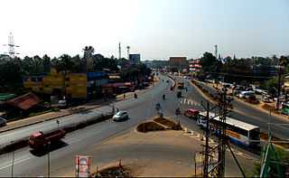
Aluva is a region in Kochi City in Kerala, India. It is also a part of the Kochi metropolitan area and is situated around 15 km (9.3 mi) from the city center on the banks of Periyar River. A major transportation hub, with easy access to all major forms of transportation, Aluva acts as a corridor which links the highland districts to the rest of Kerala. Cochin International Airport at Nedumbassery is 11.7 km from Aluva. Aluva is accessible through rail, air, metro along with major highways and roadlines. Aluva KSRTC bus station is an important transport hub in Kerala and one of the busiest stations in central part of the state.
Willingdon Island is the largest artificial island in India, which forms part of the city of Kochi, in the state of Kerala. Much of the present Willingdon Island was claimed from the Lake of Kochi, filling in dredged soil around a previously existing, but tiny, natural island. Willingdon Island is significant as the home for the Port of Kochi as well as the Kochi Naval Base, the Southern Naval Command of the Indian Navy, Plant Quarantine station, Custom House Cochin and Central Institute of Fisheries Technology, a constituent unit of Indian Council of Agricultural Research.

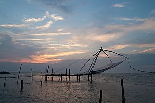
Cherai Beach is a beach located in Cherai in the northern side of Vypin Island, a suburb of the city Kochi in the state of Kerala, India. One of the most visited beaches in the state, it is situated at around 25 km from downtown Kochi and 20 km from Cochin International Airport.

Vypin is one of the group of islands that form part of the city of Kochi (Cochin), in the Indian state of Kerala. Vypin forms a barrier island which lies between the Arabian Sea in the west and the Cochin backwaters formed by the various distributaries of Periyar river, in the east. The northernmost end of the island lies on the estuary of the Periyar river in Muziris (Kodungallur), and the southernmost end in the mouth of the Cochin Backwaters in Kalamukku near Fort Vypin. The island is about 27 kilometres (17 mi) long and is connected to mainland Kochi by a series of bridges known as the Goshree bridges, which start at Kalamukku in Vypin, touch other two islands and then finish at Marine Drive covering a total distance of around three km (1.9 mi). Vypin is 58th most densely populated islands in the world. Njarakkal is one of the most densely populated locations within Vypin.
Mattancherry, is a locality in the city of Kochi, India. It is about 9 km south-west from the city center. It is said that the name Mattancherry comes from "Ancherry Mattom", a ''Namboodiri illam'' which the foreign traders then pronounced it as Matt-Ancherry, gradually became Mattancherry. The place where erstwhile 'Ancherry Mattom' located is now a Tamil Brahmin settlement.
North Paravur. formerly known as Paravur or Parur, is a municipality and suburb in Ernakulam district in the Indian state of Kerala. It is a northern suburb of the city of Kochi and is situated around 20 km from the city centre. It is also the first place in India to use electronic voting machine during the by-elections in 1982.
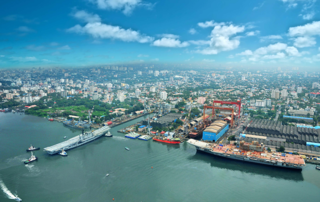
Ernakulam is the Central Business District of the city of Kochi in Kerala, India and has lent its name to the Ernakulam district. Many major establishments, including the Kerala High Court, the office of the Kochi Municipal Corporation and the Cochin Shipyard are situated here.

The Kochi Municipal Corporation is the municipal corporation that manages the Indian city of Kochi in the state of Kerala. Municipal Corporation mechanism in India was introduced during British Rule with formation of municipal corporation in Madras (Chennai) in 1688, later followed by municipal corporations in Bombay (Mumbai) and Calcutta (Kolkata) by 1762. The Corporation manages 94.88 km2 of Kochi city and has a population of 677,381 within that area. It is the most densely populated city corporation in the state. Kochi Municipal Corporation has been formed with functions to improve the infrastructure of town.
The Gundu Island is one of the many islands that make up the city of Kochi, Kerala, India. The November 1967 amalgamation order of the Kerala Legislative Assembly declared Gundu Island as part of Kochi. Gundu is the smallest island around Kochi with an area of 5 acres (20,000 m2) surrounded by coconut trees. The Island lies between Vypin and Vallarpadam islands. The island can be reached from Vypin island only by boat.
Kochi is a city located in the Ernakulam District in the Indian state of Kerala about 200 km from Trivandrum, the capital of Kerala.
Kochi is a major port city in the Indian state of Kerala. The city is widely known as the commercial or economic capital of the state of Kerala.
Vallarpadam is one among the group of islands, that form part of Kochi, in the state of Kerala, India. It is situated in the Vembanad Lake, locally known as The Kochi Lake and has a population of over 10,000. Vallarpadam is one of the two islands, the other being Willingdon Island, around which the Port of Kochi is situated. The International Container Transshipment Terminal of the port is situated entirely in Vallarpadam island. Vypin island lies on its west side and Mulavukad island lies to its east.
Aroor is a census town at the northern end of Alappuzha district and the southern suburb of the city of Kochi in the state of Kerala, India. It is a seafood related industrial area of Alleppey district, and acts as the Southern entry point into Kochi city.

The Kochi metropolitan area or Kochi urban agglomeration is a metropolitan area centered around the city of Kochi, in Ernakulam district, Kerala, India. With a population of more than 2.1 million within an area of 440 km², it is the most populous metropolitan area in Kerala.
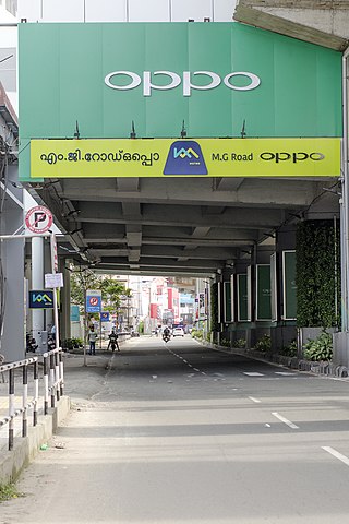
Mahatma Gandhi Road, popularly known as M. G. Road, is the main artery as well as the commercial high street of the city of Kochi, in the state of Kerala, India. The road lies north-south with its boundaries at the Venduruthy bridge, Thevara in the south, and the Madhava Pharmacy Junction in the north, where it intersects the Banerji Road. The road was earlier part of the NH 47A and was later handed over to Kochi Municipal Corporation. The highway was earlier known as Seventy Feet road. The total distance of the road is 4.5 kilometres (2.8 mi).
National Highway 966A or NH 966A starts at Kalamassery and ends at Vallarpadam International Container Transhipment Terminal in Kochi, Kerala, India. The total length of the highway is 17 km (11 mi) and runs only inside Kochi.

