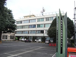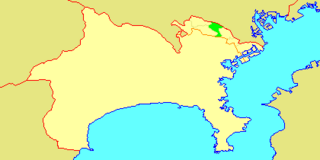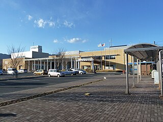
Hachiōji is a city located in the western portion of Tokyo Metropolis, Japan. As of 1 February 2016, the city had an estimated population of 579,330, and a population density of 3110 persons per km2. Its total area is 186.38 square kilometres (71.96 sq mi).

Musashino is a city located in the western portion of Tokyo Metropolis, Japan. As of 1 February 2016, the city had an estimated population of 143,868, and a population density of 13,090 persons per km². Its total area is 10.98 square kilometres (4.24 sq mi).

Mitaka is a city located in the western portion of the Tokyo Metropolis, Japan. As of 1 February 2016, the city had an estimated population of 189,168, and a population density of 11,520 persons per km². Its total area is 16.42 square kilometres (6.34 sq mi).

Ōme is a city located in the western portion of Tokyo Metropolis, Japan. As of 1 February 2016, the city had an estimated population of 136,071, and a population density of 1320 persons per km². Its total area is 103.31 square kilometres (39.89 sq mi).

Fuchū is a city located in western Tokyo Metropolis, Japan. Fuchū is both a regional commercial center and a bedroom community for commuters working in central Tokyo. The city hosts large scale manufacturing facilities for Toshiba, NEC and Suntory as well as the Bank of Japan’s main computer operations center. Local sporting attractions include the Tokyo Racecourse and the training grounds of Top League rugby teams Toshiba Brave Lupus and Suntory Sungoliath.

Akishima is a city located in the western portion of Tokyo Metropolis, Japan. As of 1 February 2016, the city had an estimated population of 111,449, and a population density of 6430 persons per km². Its total area is 17.34 square kilometres (6.70 sq mi).

Machida is a city located in the western portion of Tokyo Metropolis, Japan. As of 1 February 2016, the city had an estimated population of 429,040, and a population density of 5,980 persons per km². Its total area is 71.80 square kilometres (27.72 sq mi).

Koganei is a city located in the western portion of Tokyo, Japan. As of 1 February 2016, the city had an estimated population of 121,516, and a population density of 10,750 persons per km². Its total area is 11.30 square kilometres (4.36 sq mi).

Hino is a city located in the western portion of Tokyo Metropolis, Japan. As of 1 February 2016, the city had an estimated population of 185,133, and a population density of 6720 persons per km². Its total area is 27.55 square kilometres (10.64 sq mi).

Kunitachi is a city located in the western portion of Tokyo Metropolis, Japan. As of 1 February 2016, the city had an estimated population of 75,867, and a population density of 9,310 persons per km². Its total area is 8.15 square kilometres (3.15 sq mi).

Komae is a city located in the western portion of Tokyo Metropolis, Japan. It is one of 30 municipalities in the western portion of Tokyo known as the Tama Area. As of 1 February 2016, the city had an estimated population of 80,464, and a population density of 12,000 persons per km². Its total area is 6.39 square kilometres (2.47 sq mi). It is the smallest administrative city in Tokyo Meotropolis both in area and population, and the second smallest in terms of area in the nation.

Tama is a city located in the western portion of Tokyo Metropolis, Japan. As of 1 February 2016, the city had an estimated population of 147,953, and a population density of 7040 persons per km². Its total area is 21.01 square kilometres (8.11 sq mi).

Inagi is a city located in the western portion of Tokyo Metropolis, Japan. As of 1 February 2016, the city had an estimated population of 87,927, and a population density of 4890 persons per km². Its total area is 17.97 square kilometres (17,970,000 m2).

Takatsu-ku (高津区) is one of the 7 wards of the city of Kawasaki in Kanagawa Prefecture, Japan. As of 2010, the ward had an estimated population of 215,158 and a density of 13,150 persons per km². The total area is 16.38 km².

Tama-ku (多摩区) is one of the eight wards of the city of Kawasaki in Kanagawa Prefecture, Japan. As of 2010, the ward has an estimated population of 211,221 and a population density of 10,310 persons per km². The total area is 20.49 km².

Uenohara is a city located in Yamanashi Prefecture, Japan. As of 1 July 2019, the city had an estimated population of 23,158 in 9987 households, and a population density of 140 persons per km². The total area of the city is 170.57 square kilometres (65.86 sq mi).

Kawasaki is a city in Kanagawa Prefecture, Japan. It is the 8th most populated city in Japan and one of the main cities forming the Greater Tokyo Area and Keihin Industrial Area.

The Kōshū Kaidō (甲州街道) was one of the five routes of the Edo period. It was built to connect Edo with Kai Province in modern-day Yamanashi Prefecture, Japan. The route continues from there to connect with the Nakasendō's Shimosuwa-shuku in Nagano Prefecture. Many feudal lords from Shinano Province made use of the road during sankin-kōtai, including those from the Takatō, Suwa and Iida domains.

Keio Dentetsu Bus Co., Ltd. is a core bus-operating company of the Keio Group which was established on February 1, 2002, inherited business all of the Keio Electric Railway automobile operation division and started business on August 1 of the same year. It has four subsidiaries, Keio Bus Higashi Co., Ltd., Keio Bus Chuo Co., Ltd., Keio Bus Minami Co., Ltd. and Keio Bus Koganei Co., Ltd.. The head office of these companies is located in Fuchu, Tokyo, Japan. The operating area of a general bus on a regular route is mainly the Tokyo Tama area and if the management commission route to each subsidiary company is included, the operating area is reached mostly whole region along all areas along the Keio railroad lines. Moreover, it operates around the expressway bus routes to Nagano Prefecture, Hida-Takayama, Miyagi Prefecture, etc. from Shinjuku.

Tanashi was a city located in the western portion of Tokyo Metropolis, Japan. Tanashi means the land without rice. Because of the area's elevation relative to the Tamagawa River, traditional irrigation and rice farming was impossible. Hence, the area was named Tanashi. At the time of its merger, the city had an estimated population of 78,165 and a density of 11,495 persons per km². The total area was 6.8 km².


