Connecting Link

Last updated
A sign denoting the beginning of a Connecting Link. This particular sign is located on Highway 24 south of Cambridge. Connecting Link Sign 24 Cambridge.png
A sign denoting the beginning of a Connecting Link. This particular sign is located on Highway 24 south of Cambridge.

The Connecting Link program is a provincial subsidy provided to municipalities to assist with road construction, maintenance and repairs in the Canadian province of Ontario. Roads which are designated as connecting links form the portions of provincial highways through built-up communities which are not owned by the Ministry of Transportation (MTO). Connecting links are governed by several regulations, including section 144, subsection 31.1 of the Highway Traffic Act and section 21 of the Public Transportation and Highway Improvement Act. While the road is under local control and can be modified to their needs, extensions and traffic signals require the approval of the MTO to be constructed. [1]

Contents

The Connecting Link program was established in 1927. [2] Today, 355.4 kilometres (220.8 mi) of roadway in 77 municipalities are maintained under the program. These links cross 70 bridges also maintained under the program. [3]

In return for that particular road being downloaded, the town or county receives money and assistance in maintaining it, and is able to still sign and list it as a provincial highway, though not all connecting links are signed as provincial highways. Some connecting links (typically in cases of municipal streets urbanized before the provincial highway system was established), however, were never provincial-maintained highways at all, but rather local streets or even county or regional roads that the town, city, county, or region has assistance in maintaining.

During the large-scale downloading of many provincial highways in 1997, many connecting links were repealed when their parent highways were decommissioned. However, in some cases, where a highway terminated in a city, only the connecting links through the urbanized areas were repealed, while the rest of the highway remained under provincial jurisdiction. An example of this was Highway 10 through Mississauga and Brampton. In one unique case, Highway 11A, the entire highway was decommissioned as a result of it being a connecting link for its full length.

Most connecting links are busy municipal or county roads that were once provincial highways, and are designated by small yellow squares or diamonds with the text "C/L" or "CL" on them at their start and end termini. These are similar to, but not always related to 7000-series highways.

The following table lists the current connecting links in the province by highway. [4]

HighwayMunicipality (community)Local street name(s)Length
Ontario 3.svg  Highway 3 Aylmer Talbot Street2.25 km (1.40 mi)
Windsor Huron Church Road3.75 km (2.33 mi)
Haldimand (Cayuga)Talbot Road1.25 km (0.78 mi)
Haldimand (Dunnville)Broad Street
George Street
Main Street
4.65 km (2.89 mi)
Haldimand (Jarvis)Talbot Street1.65 km (1.03 mi)
Norfolk (Delhi)King Street
James Street
2.10 km (1.30 mi)
Norfolk (Simcoe)Queensway East
Queensway West
4.00 km (2.49 mi)
Ontario 4.svg  Highway 4 Central Huron (Clinton)Victoria Street1.30 km (0.81 mi)
South Huron (Exeter)Main Street3.15 km (1.96 mi)
Lucan Biddulph (Lucan)Main Street2.00 km (1.24 mi)
Ontario 6.svg  Highway 6 South Bruce Peninsula (Wiarton)Berford Street2.00 km (1.24 mi)
Chatsworth Garafraxa Street0.55 km (0.34 mi)
West Grey (Durham)Garafraxa Street2.25 km (1.40 mi)
Haldimand (Hagersville)Main Street1.60 km (0.99 mi)
Haldimand (Jarvis)Main Street2.30 km (1.43 mi)
Centre Wellington (Fergus)St. David Street
Tower Street
Bridge Street
3.00 km (1.86 mi)
Guelph Woolwich Street
Woodlawn Road.
2.55 km (1.58 mi)
Wellington North (Arthur)Smith Street
George Street
1.90 km (1.18 mi)
Wellington North (Mount Forest)Main Street
Market Street
2.65 km (1.65 mi)
NEMI (Little Current)Meredith Street East
Manitowaning Road
1.60 km (0.99 mi)
Espanola Centre Avenue4.10 km (2.55 mi)
Ontario 6.svg Ontario 10.svg  Highway 6  / Highway 10 Owen Sound Highways 6/10
9th Avenue East
1.20 km (0.75 mi)
Ontario 6.svg Ontario 21.svg  Highway 6  / Highway 21 Owen Sound Highways 6/21
10th Avenue West
2.65 km (1.65 mi)
Ontario 7.svg  Highway 7 Halton Hills (Acton)Queen Street
Young Street
Mill Street
Main Street
2.80 km (1.74 mi)
Halton Hills (Georgetown)Guelph Street
Main Street
5.10 km (3.17 mi)
Stratford Erie Street4.00 km (2.49 mi)
Guelph Woodlawn Road
Wellington Street
Wyndham Street
York Road
10.00 km (6.21 mi)
Marmora and Lake Matthew Street1.30 km (0.81 mi)
Havelock-Belmont-Methuen (Havelock)Ottawa Street1.90 km (1.18 mi)
Kawartha Lakes (Omemee)King Street2.35 km (1.46 mi)
Ontario 7.svg Ontario 8.svg  Highway 7  / Highway 8 Stratford Ontario Street3.25 km (2.02 mi)
Ontario 8.svg  Highway 8 Central Huron (Clinton)Huron Street
Ontario Street
2.10 km (1.30 mi)
Goderich Toronto Street
Huron Road
Elgin Avenue
2.10 km (1.30 mi)
Huron East (Seaforth)Goderich Street1.45 km (0.90 mi)
Stratford Huron Street2.55 km (1.58 mi)
West Perth (Mitchell)Ontario Road
Huron Road
2.90 km (1.80 mi)
Ontario 9.svg  Highway 9 South Bruce (Mildmay)Elora Street1.85 km (1.15 mi)
Minto (Clifford)Elora Street1.75 km (1.09 mi)
Minto (Harriston)Elora Street0.80 km (0.50 mi)
Ontario 10.svg  Highway 10 Shelburne Owen Sound Street1.20 km (0.75 mi)
Grey Highlands (Markdale)Toronto Street1.45 km (0.90 mi)
Grey Highlands (Flesherton)Sydenham Street
Toronto Street
0.55 km (0.34 mi)
Ontario 10.svg Ontario 89.svg  Highway 10  / Highway 89 Shelburne Main Street0.95 km (0.59 mi)
Ontario 11.svg  Highway 11 Hearst Front Street (west of Sixth Street)1.75 km (1.09 mi)
Kapuskasing Government Road (Clear Lake Road westerly to Bonnieview Road)6.80 km (4.23 mi)
Fort Frances Scott Street
Rainy River Colonization Road
Mill Road
4.75 km (2.95 mi)
Rainy River Atwood Avenue2.70 km (1.68 mi)
Ontario 11.svg Ontario 71.svg  Highway 11  / Highway 71 Fort Frances Kings Highway
Rainy River Colonization Road
Third Avenue
Central Avenue
Church Street
4.30 km (2.67 mi)
Ontario 15.svg  Highway 15 Smiths Falls Lombard Street
Beckwith Street
Elmsley Street
Cornelia Street
Union Street
4.65 km (2.89 mi)
Ontario 17.svg  Highway 17 Blind River Causley Street (west of Lot 11/12 Concession 1 Stricker)4.35 km (2.70 mi)
Sault Ste. Marie Trunk Road
Black Road
Second Line East
Great Northern Road
19.40 km (12.05 mi)
West Nipissing (Sturgeon Falls)Front Street (west of Coursol Road)2.40 km (1.49 mi)
Dryden Government Road
Grand Trunk Avenue
4.70 km (2.92 mi)
Ontario 19.svg  Highway 19 Tillsonburg Broadway Street
Oxford Street
Simcoe Street
Vienna Street
5.45 km (3.39 mi)
Ontario 21.svg  Highway 21 Saugeen Shores (Port Elgin)Goderich Street4.25 km (2.64 mi)
Saugeen Shores (Southampton)Albert Street
Railway Street
5.55 km (3.45 mi)
Goderich Victoria Street
Bayfield Road
Britannia Road
2.55 km (1.58 mi)
Lambton Shores (Forest)Main Street
King Street
3.55 km (2.21 mi)
Lambton Shores (Grand Bend)Ontario Street3.00 km (1.86 mi)
Ontario 23.svg  Highway 23 North Perth (Listowel)Main Street
Wallace Avenue
2.45 km (1.52 mi)
West Perth (Mitchell)Blanshard Road
Saint George Street
2.10 km (1.30 mi)
Minto (Harriston)Arthur Street0.65 km (0.40 mi)
Ontario 24.svg  Highway 24 Brantford King George Road2.30 km (1.43 mi)
Norfolk (Simcoe)Norfolk Street2.55 km (1.58 mi)
Ontario 26.svg  Highway 26 Barrie Bayfield Street2.40 km (1.49 mi)
Clearview (Stayner)King Street
Main Street
2.00 km (1.24 mi)
Collingwood Lakeshore Street
Front Street
First Street
Huron Street
Hume Street
Pretty River Parkway
11.10 km (6.90 mi)
The Blue Mountains (Thornbury)Arthur Street
King Street
2.40 km (1.49 mi)
Meaford Sykes Street3.45 km (2.14 mi)
Owen Sound Highway 26
16th Street East
2.90 km (1.80 mi)
Ontario 28.svg  Highway 28 Bancroft Monck Road
Bridge Street
3.85 km (2.39 mi)
Ontario 33.svg  Highway 33 Loyalist Township (Bath)Main Street2.75 km (1.71 mi)
Prince Edward (Picton)Main Street
Bridge Street
2.70 km (1.68 mi)
Ontario 34.svg  Highway 34 Champlain (Vankleek Hill)High Street
Queen Street
1.30 km (0.81 mi)
Hawkesbury McGill Street
Main Street East
John Street
2.25 km (1.40 mi)
Ontario 37.svg  Highway 37 Tweed (Tweed)Bridgewater Road
Victoria Street
Georgetown Street
2.10 km (1.30 mi)
Ontario 40.svg  Highway 40 Chatham-Kent (Chatham)Grand Avenue East
Saint Clair Street
7.60 km (4.72 mi)
Chatham-Kent (Wallaceburg)Dufferin Avenue
McNaughton Avenue
Murray Street
4.20 km (2.61 mi)
Ontario 41.svg  Highway 41 Bonnechere Valley (Eganville)Bridge Street
Queen Street
Patrick Street Alice Street
1.20 km (0.75 mi)
Ontario 41.svg Ontario 60.svg  Highway 41  / Highway 60 Bonnechere Valley (Eganville)Bonnechere Street0.80 km (0.50 mi)
Ontario 41.svg Ontario 148.svg  Highway 41  / Highway 148 Pembroke Pembroke Street East
McKay Street River Road
Muskrat Drive
Olympic Drive
6.15 km (3.82 mi)
Ontario 60.svg  Highway 60 Bonnechere Valley (Eganville)Bonnechere Street
Cobden Road
1.30 km (0.81 mi)
Madawaska Valley (Barry's Bay)Opeongo Road1.40 km (0.87 mi)
Ontario 60.svg Ontario 132.svg  Highway 60  / Highway 132 Renfrew O'Brien Street
Coumbes Street
Raglan Street
Stewart Street (Highway 60 only)
Lisgar Avenue (Highway 132 only)
Munro Avenue (Highway 132 only)
6.80 km (4.23 mi)
Ontario 62.svg  Highway 62 Bancroft Mill Street
Hastings Street
7.25 km (4.50 mi)
Belleville North Front Street2.80 km (1.74 mi)
Centre Hastings (Madoc)Russell Street
St. Lawrence Street
Durham Street
2.00 km (1.24 mi)
Prince Edward (Bloomfield)Stanley Street Main Street2.80 km (1.74 mi)
Ontario 63.svg  Highway 63 North Bay Trout Lake Road (Highways 11/17 east to Lee's Road)3.35 km (2.08 mi)
Ontario 64.svg  Highway 64 West Nipissing (Sturgeon Falls)Ottawa Street (north of Highway 17)1.70 km (1.06 mi)
Ontario 66.svg  Highway 66 Kirkland Lake Government Road (east of Goldthorpe Drive)3.70 km (2.30 mi)
Ontario 89.svg  Highway 89 Innisfil (Cookstown)Queen Street
Church Street
1.30 km (0.81 mi)
New Tecumseth (Alliston)Young Street
King Street
Victoria Street
5.30 km (3.29 mi)
Shelburne Main Street0.65 km (0.40 mi)
Minto (Harriston)Arthur Street0.50 km (0.31 mi)
Wellington North (Mount Forest)Queen Street3.15 km (1.96 mi)
Ontario 101.svg  Highway 101 Wawa (Michipicoten)Mission Road
Main Street
1.30 km (0.81 mi)
Timmins (Porcupine)Harold Avenue (west of former railway crossing in Porcupine)
Algonquin Boulevard
Riverside Drive (east to Kamiskotia Road)
21.35 km (13.27 mi)
Black River-Matheson Fourth Avenue0.65 km (0.40 mi)
Ontario 108.svg  Highway 108 Elliot Lake Highway 108 (Esten Drive South north past Timber Road)5.80 km (3.60 mi)
Ontario 118.svg  Highway 118 Dysart et al Sunnyside Street
Maple Street
Mountain Street
Pine Street
1.15 km (0.71 mi)
Ontario 129.svg  Highway 129 Thessalon Wharncliffe Road (north of Highway 17)0.87 km (0.54 mi)
Ontario 138.svg  Highway 138 Cornwall Brookdale Avenue0.95 km (0.59 mi)
Cornwall Route to Seaway International Bridge3.80 km (2.36 mi)
Ontario 420.svg  Highway 420 Niagara (Niagara Falls)From Stanley Avenue to Rainbow Bridge1.50 km (0.93 mi)
Ontario Highway 520.svg  Highway 520 Burk's Falls From South Limit of Burk's Falls to Ryerson Crescent1.05 km (0.65 mi)
Ontario Highway 522.svg  Highway 522 Powassan (Trout Creek)From junction of Highway 522B, southerly to Barrett St0.55 km (0.34 mi)
Ontario Highway 533.svg  Highway 533 Mattawa First Street and Main Street (east of Highway 17)0.95 km (0.59 mi)
Ontario Highway 540.svg  Highway 540 NEMI (Little Current)Meredith Street (Highway 6 to Worthington Street)
Worthington Street (south of Meredith Street)
0.95 km (0.59 mi)
Ontario Highway 550.svg  Highway 550 Sault Ste. Marie Second Line West from Great Northern Road westerly2.21 km (1.37 mi)
Highway 550B Sault Ste. Marie Carmen's Way (Second Line West to Queen Street)
Queen Street (Carmen's Way to Huron Street)
2.88 km (1.79 mi)
Ontario Highway 594.svg  Highway 594 Dryden Duke Street
West River Road
Aubrey Road
3.90 km (2.42 mi)
Ontario Highway 631.svg  Highway 631 Hornepayne Leslie Avenue (Second Street easterly to Becker Road)0.80 km (0.50 mi)
Ontario Highway 634.svg  Highway 634 Smooth Rock Falls Highway 634 by-pass (Highway 11 northerly to Cloutierville Road)3.40 km (2.11 mi)

See also

Related Research Articles

The Provincial Highway Network consists of all the roads in Ontario maintained by the Ministry of Transportation of Ontario (MTO), including those designated as part of the King's Highway, secondary highways, and tertiary roads. Components of the system—comprising 16,900 kilometres (10,500 mi) of roads and 2,880 bridges —range in scale from Highway 401, the busiest highway in North America, to unpaved forestry and mining access roads. The longest highway is nearly 2,000 kilometres (1,200 mi) long, while the shortest is less than a kilometre. Some roads are unsigned highways, lacking signage to indicate their maintenance by the MTO; these may be remnants of highways that are still under provincial control whose designations were decommissioned, roadway segments left over from realignment projects, or proposed highway corridors.

<span class="mw-page-title-main">Ontario Highway 3</span> Ontario provincial highway

King's Highway 3, commonly referred to as Highway 3, is a provincially maintained highway in the Canadian province of Ontario which travels parallel to the northern shoreline of Lake Erie. It has three segments, the first of which travels from the Ambassador Bridge in Windsor to Highway 77 in Leamington. The second portion begins at Talbotville Royal outside of St. Thomas at Highway 4, and travels to the western city limits of Port Colborne. The road is regionally maintained within Port Colborne as Niagara Regional Road 3, but regains its provincial designation at Highway 140. Its third and final terminus is at Edgewood Park, within the Fort Erie town limits. From there, the road continues as Niagara Regional Road 3 to the Peace Bridge, where drivers can cross to the United States. The total length of Highway 3 is 258.2 km (160.4 mi), consisting of 49.2 km (30.6 mi) from Windsor to Leamington, 187.9 km (116.8 mi) from Talbotville Royal to Port Colborne and 21.1 km (13.1 mi) from Port Colborne to Edgewood Park.

King's Highway 17, more commonly known as Highway 17, is a provincially maintained highway and the primary route of the Trans-Canada Highway through the Canadian province of Ontario. It begins at the Manitoba boundary, 50 km (31 mi) west of Kenora, and the main section ends where Highway 417 begins just west of Arnprior. A small disconnected signed section of the highway still remains within the Ottawa Region between County Road 29 and Grants Side Road. This makes it Ontario's longest highway.

<span class="mw-page-title-main">Ontario Highway 638</span> Ontario provincial highway

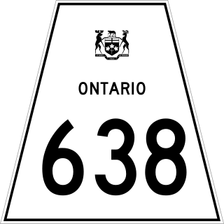
Secondary Highway 638, commonly referred to as Highway 638, is a provincially maintained secondary highway located in the District of Algoma in the Canadian province of Ontario. The route begins at Highway 17B in Echo Bay and travels eastward to Ophir, where it turns south to Bruce Mines, ending 1.1 km (0.7 mi) north of Highway 17. The north–south portion of the route was designated in 1956 as Highway 561. In 1962, Highway 638 was designated from Echo Bay to Highway 561, as well as a segment of the latter route from Ophir to Dunns Valley. The highway took on its current routing in 1989, assuming the route of Highway 561 south from Ophir to Bruce Mines; the section of Highway 638 from Ophir to Dunns Valley was renumbered as Highway 670.

<span class="mw-page-title-main">Ministry of Transportation of Ontario</span> Government ministry in Ontario

The Ministry of Transportation (MTO) is the provincial ministry of the Government of Ontario that is responsible for transport infrastructure and related law in Ontario, Canada. The ministry traces its roots back over a century to the 1890s, when the province began training Provincial Road Building Instructors. In 1916, the Department of Public Highways of Ontario (DPHO) was formed and tasked with establishing a network of provincial highways. The first was designated in 1918, and by the summer of 1925, sixteen highways were numbered. In the mid-1920s, a new Department of Northern Development (DND) was created to manage infrastructure improvements in northern Ontario; it merged with the Department of Highways of Ontario (DHO) on April 1, 1937. In 1971, the Department of Highways took on responsibility for Communications and in 1972 was reorganized as the Ministry of Transportation and Communications (MTC), which then became the Ministry of Transportation in 1987.

King's Highway 50, commonly referred to as Highway 50, was a provincially maintained highway in the Canadian province of Ontario. The highway, which was decommissioned in 1998, is still referred to as Highway 50, though it is now made up of several county and regional roads: Peel Regional Road 50, York Regional Road 24 and Simcoe County Road 50. The route began in the north end corner of the former Etobicoke at Highway 27 as Albion Road, and travelled northwest to Highway 89 west of the town of Alliston. En route, it passed through the villages of Bolton, Palgrave and Loretto. The road south of Bolton has become more suburban as development has encroached from the east and west; but despite this increased urbanization, the removal of highway status, and the fact that it runs through the former Albion Township, the Albion Road name has not been extended to follow it outside Toronto.

King's Highway 5, commonly referred to as Highway 5 and historically as the Dundas Highway and Governor's Road, is a provincially maintained highway in the Canadian province of Ontario. The east–west highway travels a distance of 12.7 km (7.9 mi) between Highway 8 at Peters Corners, north of Hamilton, and Highway 6 at Clappison's Corners. Prior to several sections being downloaded to the municipalities in which they were located, Highway 5 served as bypass to Highway 2, connecting with it in both Paris and Toronto, a distance of 114.3 km (71.0 mi).

King's Highway 24, commonly referred to as Highway 24, is a highway in the Canadian province of Ontario that currently begins at Highway 3 in Simcoe, and ends at the southern city limits of Cambridge. The south–north route travels through Brantford, as well as the community of Scotland. Outside of those communities, Highway 24 travels through a predominantly agricultural area.

<span class="mw-page-title-main">Ontario Highway 537</span> Ontario provincial highway

Secondary Highway 537, commonly referred to as Highway 537, is a provincially maintained secondary highway in the Canadian province of Ontario. The highway is 16.1 kilometres (10.0 mi) in length, connecting Highway 69 near Wanup with Finni Road. It once continued 3.6 km (2.2 mi) further to intersect Highway 17 in Wahnapitae, but was truncated in 1998; this portion of the route is now designated as Greater Sudbury Municipal Road 537. Highway 537 is now the only secondary highway in the province located within a jurisdiction that also maintains its own county/regional road network.

King's Highway 28, commonly referred to as Highway 28, is a provincially maintained highway in the Canadian province of Ontario. The southwest–northeast route extends from Highway 7 east of Peterborough, to Highway 41 in Denbigh. The route passes over undulating hills before entering the Canadian Shield near Burleigh Falls, and gradually turns eastward.

King's Highway 62, commonly referred to as Highway 62, is a provincially maintained highway in the Canadian province of Ontario. The highway travels south–north from Highway 33 at Bloomfield in Prince Edward County, through Belleville, Madoc and Bancroft, to Maynooth, where it ends at a junction with Highway 127. Prior to 1997, the route continued north and east of Maynooth through Cobermere, Barry's Bay, Killaloe, Round Lake and Bonnechere to Highway 17 in Pembroke. This section of highway was redesignated Hastings Highlands Municipal Road 62, Renfrew County Road 62, and Renfrew County Road 58.

King's Highway 49, commonly referred to as Highway 49, is a provincially maintained highway in the Canadian province of Ontario. The 5.8-kilometre (3.6 mi) highway travels across the Quinte Skyway and through the Tyendinaga Mohawk Territory south of Marysville.

King's Highway 3B, commonly referred to as Highway 3B, was a provincially maintained highway within Windsor, in the Canadian province of Ontario. Its purpose was to link Highway 3 and Highway 401 with the Detroit–Windsor Tunnel and downtown Windsor. Highway 3B was routed along the city streets of Ouellette Avenue, Ouellette Place, Howard Avenue, and Dougall Avenue, and the short freeway of Dougall Parkway.

Highway 131 was a provincially maintained highway in the Canadian province of Ontario, located in Simcoe County and the city of Barrie. The route, which connected Highway 27 with Highway 90, existed from 1984 until 1998, after which it was transferred to the responsibility of Simcoe County. Highway 131 was a straight rural highway, located west of Barrie's suburban fringe, though since then those suburbs have grown out to reach the former highway. Otherwise, the highway is abutted by the occasional farm and surrounded by several forests.

Highway 17B was formerly the designation for six business routes of Highway 17, the main route of the Trans-Canada Highway through the Canadian province of Ontario. Each generally followed the original route of Highway 17 through the town or city that it served, and was subsequently given the Highway 17B designation when a newer bypass route was constructed to either reduce traffic pressure on the local street network, or provide a better thoroughfare that avoided urban areas altogether.

<span class="mw-page-title-main">Ontario Highway 503</span> Former Ontario provincial highway

Secondary Highway 503, commonly referred to as Highway 503, was a provincially maintained secondary highway in the Canadian province of Ontario. The 116.8 km (72.6 mi) route existed between 1956 and 1998. Between 1956 and 1963, the highway stretched from Kirkfield to Sebright, and then along the Monck Road from Sebright to Kinmount, entirely within Victoria County. In 1964, the route was extended to Highway 121 in Tory Hill along the route of Highway 500 through the counties of Peterborough and Haliburton. In 1998, the route was transferred to the various counties in which it resided. Today it is known as Kawartha Lakes City Road 6 and 45, Peterborough County Road 503 and Haliburton County Road 503.

King's Highway 80, commonly referred to as Highway 80, was a provincially maintained highway in the Canadian province of Ontario. It travelled in an east–west direction south of Sarnia from Courtright to Strathburn. Beginning at the St. Clair Parkway near the shores of the St. Clair River, the route travelled 69.6 kilometres (43.2 mi), intersecting Highway 40, Highway 21 and Highway 79 before ending at Highway 2. In addition to the towns at either terminus, Highway 80 serviced the communities of Brigden, Glencoe and Alvinston. The entire route was and remains two lanes wide.

Secondary Highway 610, commonly referred to as Highway 610, was a provincially maintained secondary highway in the Canadian province of Ontario that connected Highway 101 at Hoyle, east of Timmins, with former Highway 67 near Barbers Bay, passing through the village of Connaught en route. Highway 610 was assumed by the Department of Highways, predecessor to the modern Ministry of Transportation of Ontario, in 1956, along with many of the secondary highways in Ontario. It remained unchanged between then and 1997, when it was decommissioned and transferred to the CIty of Timmins. The entire route is now known as Frederick House Lake Road.

King's Highway 76, commonly referred to as Highway 76, was a provincially maintained highway in the Canadian province of Ontario. The route began at Highway 3 in Eagle and progressed north through the community of West Lorne, encountering Highway 401 immediately before terminating southwest of Glencoe at Longwoods Road. Today the route it followed is known as Elgin County Road 76 and Middlesex County Road 76.

References

  1. "Law Document English View". 24 July 2014.
  2. "$15M announced for Connecting Link Program – Daily Commercial News". Archived from the original on 2011-07-28. Retrieved 2011-05-15.
  3. "Champlain to receive $1.67m for Highway 34 connecting link | the Review". Archived from the original on 2011-04-20. Retrieved 2011-05-15.
  4. "Ministry of Transportation (MTO) Connecting Links Program 2021-22 Guide" (PDF). Ministry of Transportation of Ontario. September 2021. Retrieved December 20, 2022.