Osage County | |
---|---|
Coordinates: 38°28′N91°52′W / 38.46°N 91.86°W | |
Country | United States |
State | Missouri |
Founded | January 29, 1841 |
Named for | Osage River |
Seat | Linn |
Largest city | Linn |
Area | |
• Total | 611 sq mi (1,580 km2) |
• Land | 604 sq mi (1,560 km2) |
• Water | 6.1 sq mi (16 km2) 1.0% |
Population (2020) | |
• Total | 13,274 |
• Density | 22/sq mi (8.4/km2) |
Time zone | UTC−6 (Central) |
• Summer (DST) | UTC−5 (CDT) |
Congressional district | 3rd |
Website | osagecountygov |
Osage County is a county in the central part of the U.S. state of Missouri. As of the 2020 census, the population was 13,274. [1] Its county seat is Linn. [2] The county was organized January 29, 1841, and named from the Osage River. [3]
Osage County is part of the Jefferson City, MO Metropolitan Statistical Area. Its geography and the founding of Westphalia Vineyards links it to the Missouri Rhineland, extending along the Missouri River valley to the western edges of the St. Louis Metropolitan Area.
According to data from the 2010 census, Osage County is the whitest county in Missouri, with 98.85 percent of residents being white.
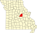
According to the U.S. Census Bureau, the county has a total area of 610 square miles (1,600 km2), of which 604 square miles (1,560 km2) is land and 6.1 square miles (16 km2) (1.0%) is water. [4]
Census | Pop. | Note | %± |
---|---|---|---|
1850 | 6,704 | — | |
1860 | 7,879 | 17.5% | |
1870 | 10,793 | 37.0% | |
1880 | 11,824 | 9.6% | |
1890 | 13,080 | 10.6% | |
1900 | 14,096 | 7.8% | |
1910 | 14,283 | 1.3% | |
1920 | 13,559 | −5.1% | |
1930 | 12,462 | −8.1% | |
1940 | 12,375 | −0.7% | |
1950 | 11,301 | −8.7% | |
1960 | 10,867 | −3.8% | |
1970 | 10,994 | 1.2% | |
1980 | 12,014 | 9.3% | |
1990 | 12,018 | 0.0% | |
2000 | 13,062 | 8.7% | |
2010 | 13,878 | 6.2% | |
2020 | 13,274 | −4.4% | |
U.S. Decennial Census [5] 1790-1960 [6] 1900-1990 [7] 1990-2000 [8] 2010-2015 [9] |
As of the census [10] of 2000, there were 13,062 people, 4,922 households, and 3,578 families residing in the county. The population density was 22 people per square mile (8.5 people/km2). There were 5,904 housing units at an average density of 10 units per square mile (3.9/km2). The racial makeup of the county was 98.64% White, 0.16% Black or African American, 0.24% Native American, 0.08% Asian, 0.02% Pacific Islander, 0.07% from other races, and 0.80% from two or more races. Approximately 0.59% of the population were Hispanic or Latino of any race.
There were 4,922 households, out of which 34.90% had children under the age of 18 living with them, 61.70% were married couples living together, 6.70% had a female householder with no husband present, and 27.30% were non-families. 23.80% of all households were made up of individuals, and 10.80% had someone living alone who was 65 years of age or older. The average household size was 2.61 and the average family size was 3.10.
In the county, the population was spread out, with 26.30% under the age of 18, 9.50% from 18 to 24, 27.70% from 25 to 44, 21.70% from 45 to 64, and 14.70% who were 65 years of age or older. The median age was 36 years. For every 100 females, there were 103.00 males. For every 100 females age 18 and over, there were 102.50 males.
The median income for a household in the county was $39,565, and the median income for a family was $46,503. Males had a median income of $29,538 versus $22,353 for females. The per capita income for the county was $17,245. About 5.90% of families and 8.30% of the population were below the poverty line, including 9.00% of those under age 18 and 10.40% of those age 65 or over.
Race | Num. | Perc. |
---|---|---|
White (NH) | 12,688 | 95.58% |
Black or African American (NH) | 24 | 0.18% |
Native American (NH) | 28 | 0.21% |
Asian (NH) | 3 | 0.02% |
Pacific Islander (NH) | 10 | 0.08% |
Other/Mixed (NH) | 396 | 3% |
Hispanic or Latino | 125 | 1% |
The Republican Party mostly controls politics at the local level in Osage County. Republicans currently hold over half of the elected positions in the county.
Osage County, Missouri | |||
---|---|---|---|
Elected countywide officials | |||
Assessor | Tina Kammerich | Republican | |
Circuit Clerk | Beth Billington | Democratic | |
County Clerk | Nicci Kammerich | Republican | |
Collector | Denise Nolte | Republican | |
Commissioner (Presiding) | Darryl Griffin | Republican | |
Commissioner (District 1) | John Trenshaw | Republican | |
Commissioner (District 2) | Larry Kliethermes | Republican | |
Coroner | A.J. Probst | Republican | |
Prosecuting Attorney | Amanda L. Grellner | Republican | |
Public Administrator | Paul G. Stratman | Republican | |
Recorder | Cindy Hoffman | Democratic | |
Sheriff | Michael Bonham | Republican | |
Surveyor | Timothy Hamburg | Democratic | |
Treasurer | Valerie Prater | Republican |
Year | Republican | Democratic | Third Parties |
---|---|---|---|
2020 | 86.43%6,512 | 12.30% 927 | 1.26% 95 |
2016 | 64.64%4,579 | 32.76% 2,321 | 2.60% 184 |
2012 | 58.37%4,016 | 39.42% 2,712 | 2.21% 152 |
2008 | 59.51%4,212 | 39.45% 2,792 | 1.04% 74 |
2004 | 68.67%4,586 | 30.61% 2,044 | 0.71% 48 |
2000 | 55.78%3,450 | 42.78% 2,646 | 1.44% 89 |
1996 | 38.80% 2,151 | 59.33%3,289 | 1.88% 104 |
Osage County is split between two of the districts that elect members of the Missouri House of Representatives, and both are represented by Republicans.
Party | Candidate | Votes | % | ±% | |
---|---|---|---|---|---|
Republican | Aaron D. Griesheimer | 1,909 | 81.54% | +5.00 | |
Democratic | Pamela A. Menefee | 431 | 18.41% | −5.00 |
Party | Candidate | Votes | % | ±% | |
---|---|---|---|---|---|
Republican | Justin Alferman | 2,147 | 74.63% | −1.48 | |
Democratic | Tom Smith | 593 | 20.61% | +1.48 |
Party | Candidate | Votes | % | ±% | |
---|---|---|---|---|---|
Republican | Dave Schatz | 1,965 | 74.80% | ||
Democratic | Michael Sage | 662 | 25.20% |
Party | Candidate | Votes | % | ±% | |
---|---|---|---|---|---|
Republican | Tom Hurst | 3,906 | 100.00% |
Party | Candidate | Votes | % | ±% | |
---|---|---|---|---|---|
Republican | Tom Hurst | 2,195 | 100.00% | +32.51 |
Party | Candidate | Votes | % | ±% | |
---|---|---|---|---|---|
Republican | Tom Hurst | 2,755 | 67.49% | ||
Democratic | Greg Stratman | 1,327 | 32.51% |
All of Osage County is a part of Missouri's 6th District in the Missouri Senate and is currently represented by Mike Kehoe (R-Jefferson City).
Party | Candidate | Votes | % | ±% | |
---|---|---|---|---|---|
Republican | Mike Kehoe | 3,541 | 85.63% | ||
Democratic | Mollie Kristen Fairbairn | 594 | 14.37% |
Party | Candidate | Votes | % | ±% | |
---|---|---|---|---|---|
Republican | Josh Hawley | 4,626 | 76.04% | +9.30 | |
Democratic | Claire McCaskill | 1,255 | 20.63% | −5.75 | |
Libertarian | Japeth Campbell | 44 | 0.72% | +0.72 | |
Green | Jo Crain | 28 | 0.46% | +0.46 | |
Independent | Craig O'Dear | 80 | 1.31% | +1.31 |
Party | Candidate | Votes | % | ±% | |
---|---|---|---|---|---|
Republican | Todd Akin | 3,986 | 58.49% | ||
Democratic | Claire McCaskill | 2,359 | 34.61% | ||
Libertarian | Jonathan Dine | 470 | 6.90% |
All of Osage County is included in Missouri's 3rd Congressional District and is currently represented by Blaine Luetkemeyer (R-St. Elizabeth) in the U.S. House of Representatives.
Party | Candidate | Votes | % | ±% | |
---|---|---|---|---|---|
Republican | Blaine Luetkemeyer | 5,956 | 84.89% | +2.02 | |
Democratic | Kevin Miller | 889 | 12.67% | −1.71 | |
Libertarian | Dan Hogan | 122 | 1.74% | −0.94 | |
Constitution | Doanita Simmons | 49 | 0.70% | +0.70 |
Party | Candidate | Votes | % | ±% | |
---|---|---|---|---|---|
Republican | Blaine Luetkemeyer | 3,435 | 82.87% | −0.58 | |
Democratic | Courtney Denton | 596 | 14.38% | −0.13 | |
Libertarian | Steven Hedrick | 111 | 2.68% | +0.64 | |
Write-In | Harold Davis | 3 | 0.07% | +0.07 |
Party | Candidate | Votes | % | ±% | |
---|---|---|---|---|---|
Republican | Blaine Luetkemeyer | 5,694 | 83.45% | ||
Democratic | Eric C. Meyer | 990 | 14.51% | ||
Libertarian | Steven Wilson | 139 | 2.04% |
Year | Republican | Democratic | Third party(ies) | |||
---|---|---|---|---|---|---|
No. | % | No. | % | No. | % | |
2024 | 6,603 | 86.16% | 1,002 | 13.07% | 59 | 0.77% |
2020 | 6,425 | 85.14% | 1,037 | 13.74% | 84 | 1.11% |
2016 | 5,856 | 82.60% | 998 | 14.08% | 236 | 3.33% |
2012 | 5,329 | 77.02% | 1,473 | 21.29% | 117 | 1.69% |
2008 | 5,062 | 71.51% | 1,907 | 26.94% | 110 | 1.55% |
2004 | 4,975 | 74.58% | 1,673 | 25.08% | 23 | 0.34% |
2000 | 4,154 | 67.24% | 1,938 | 31.37% | 86 | 1.39% |
1996 | 2,890 | 51.90% | 2,045 | 36.73% | 633 | 11.37% |
1992 | 2,784 | 45.84% | 1,860 | 30.63% | 1,429 | 23.53% |
1988 | 3,885 | 68.58% | 1,771 | 31.26% | 9 | 0.16% |
1984 | 4,381 | 76.54% | 1,343 | 23.46% | 0 | 0.00% |
1980 | 3,679 | 63.19% | 2,045 | 35.13% | 98 | 1.68% |
1976 | 3,224 | 61.19% | 2,015 | 38.24% | 30 | 0.57% |
1972 | 4,266 | 74.18% | 1,485 | 25.82% | 0 | 0.00% |
1968 | 3,107 | 61.63% | 1,540 | 30.55% | 394 | 7.82% |
1964 | 2,712 | 50.98% | 2,608 | 49.02% | 0 | 0.00% |
1960 | 2,678 | 48.01% | 2,900 | 51.99% | 0 | 0.00% |
1956 | 3,077 | 55.72% | 2,445 | 44.28% | 0 | 0.00% |
1952 | 3,404 | 60.73% | 2,191 | 39.09% | 10 | 0.18% |
1948 | 2,488 | 48.12% | 2,672 | 51.68% | 10 | 0.19% |
1944 | 3,284 | 60.68% | 2,121 | 39.19% | 7 | 0.13% |
1940 | 3,743 | 61.50% | 2,332 | 38.32% | 11 | 0.18% |
1936 | 2,836 | 48.08% | 2,995 | 50.77% | 68 | 1.15% |
1932 | 1,798 | 33.38% | 3,567 | 66.21% | 22 | 0.41% |
1928 | 2,474 | 44.40% | 3,092 | 55.49% | 6 | 0.11% |
1924 | 2,496 | 51.98% | 1,986 | 41.36% | 320 | 6.66% |
1920 | 3,699 | 76.17% | 1,118 | 23.02% | 39 | 0.80% |
1916 | 1,769 | 55.56% | 1,383 | 43.44% | 32 | 1.01% |
1912 | 981 | 33.56% | 1,394 | 47.69% | 548 | 18.75% |
1908 | 1,820 | 55.24% | 1,439 | 43.67% | 36 | 1.09% |
1904 | 1,699 | 52.70% | 1,451 | 45.01% | 74 | 2.30% |
1900 | 1,731 | 54.28% | 1,396 | 43.78% | 62 | 1.94% |
1896 | 1,700 | 53.26% | 1,456 | 45.61% | 36 | 1.13% |
1892 | 1,378 | 51.23% | 1,266 | 47.06% | 46 | 1.71% |
1888 | 1,446 | 54.04% | 1,190 | 44.47% | 40 | 1.49% |
Donald J. Trump received more votes, a total of 1,316, than any candidate from either party in Osage County during the 2016 presidential primary.
Montgomery County is a county in the east central part of the U.S. state of Missouri. As of the 2020 census, the population was 11,322. Its county seat is Montgomery City. The county was named in honor of Richard Montgomery, an American Revolutionary War general killed in 1775 while attempting to capture Quebec City, Canada.
Warren County is a county located in the eastern portion of the U.S. state of Missouri. As of the 2020 census, the population was 35,532. The county is located on the north side of the Missouri River. Its county seat is Warrenton. The county was established on January 5, 1833, and was named for General Joseph Warren, who died in the Battle of Bunker Hill during the American Revolutionary War.
Vernon County is a county located in the western region of the U.S. state of Missouri, on the border with Kansas. As of the 2020 census, the population was 19,707. Its county seat is Nevada. The county was organized on February 27, 1855, considerably later than counties in the eastern part of the state. It was named for Colonel Miles Vernon (1786–1867), a state senator and veteran of the Battle of New Orleans. This area was part of the large historic territory of the Osage Nation of Native Americans.
Scott County is a county located in the southeastern portion of the U.S. state of Missouri. As of the 2020 census, the population was 38,059. Its county seat is Benton. The county was organized in 1821 and named for U.S. Representative John Scott, the first federal representative from Missouri. Scott County comprises the Sikeston, MO Micropolitan Statistical Area, which is also included in the Cape Girardeau-Sikeston, MO-IL Combined Statistical Area. The county is home to Scott County Central High School, which has won 18 state championships in boys basketball—the most of any high school in the state.
Moniteau County is a county located in the U.S. state of Missouri. As of the 2020 United States census, the population was 15,473. Its county seat is California. The county was organized February 14, 1845, and named for the Moniteau Creek. 'Moniteau' is a French spelling of Manitou, Algonquian for the Great Spirit.
Miller County is a county located in the northern Ozarks region of the U.S. state of Missouri. As of the 2020 United States census, the population was 24,722. Its county seat is Tuscumbia. The county was organized February 6, 1837, and named for John Miller, former U.S. Representative and Governor of Missouri.
Maries County is a county located in the U.S. state of Missouri. As of the 2020 census, its population was 8,432. Its county seat is Vienna. The county was organized March 2, 1855, and named for the Maries River and Little Maries River. The word "Maries" is derived from the French word marais, which means "marsh, lake, or pond".
Linn County is a county located in the northern portion of the U.S. state of Missouri. As of the 2020 census, the population was 11,874. Its county seat is Linneus. The county was organized January 1, 1837, and named after U.S. Senator Lewis F. Linn of Missouri.
Laclede County is a county located in the U.S. state of Missouri. As of the 2020 census, the population was 36,039. Its county seat is Lebanon. The county was organized February 24, 1849, and was named after Pierre Laclède, founder of St. Louis.
Gasconade County is a county located in the east-central portion of the U.S. state of Missouri. As of the 2020 census, the population was 14,794. The county seat has been Hermann since 1842. The county was named after the Gasconade River.
Franklin County is located in the U.S. state of Missouri. At the 2020 census, the population was 104,682. Its county seat is Union. The county was organized in 1818 and is named after Founding Father Benjamin Franklin. Franklin County is part of the St. Louis, MO-IL Metropolitan Statistical Area and contains some of the city's exurbs. It is located along the south side of the Missouri River. The county has wineries that are included in the Hermann AVA and is part of the region known as the Missouri Rhineland, which extends on both sides of the Missouri River.
Crawford County is a county located in the east-central portion of the U.S. state of Missouri. At the 2020 Census, the population was 23,056. Its county seat is Steelville. The county was organized in 1829 and is named after U.S. Senator William H. Crawford of Georgia.
Cole County is located in the central part of the U.S. state of Missouri. As of the 2020 census, its population was 77,279. Its county seat and largest city is Jefferson City, the state capital. The county was organized November 16, 1820, and named after pioneer William Temple Cole who built Cole's Fort in Boonville.
Camden County is a county located in the U.S. state of Missouri. As of the 2020 Census, the population was 42,745. Its county seat is Camdenton. The county was organized on January 29, 1841, as Kinderhook County and renamed Camden County in 1843 after Charles Pratt, 1st Earl Camden, Lord Chancellor of the United Kingdom and leader of the British Whig Party. Camden County is also the primary setting of the Netflix show Ozark.
Vienna is a city in and the county seat of Maries County, Missouri, United States. Its population was 581 at the 2020 census.
Chamois is a city in Osage County, Missouri, United States. The population was 377 at the 2020 census. It is part of the Jefferson City, Missouri Metropolitan Statistical Area.
Freeburg is a village in Osage County, Missouri, United States. The population was 409 at the 2020 census. It is part of the Jefferson City, Missouri Metropolitan Statistical Area.
Linn is a city in Osage County, Missouri, United States. The population was 1,350 at the 2020 census. It is the county seat of Osage County. Linn is part of the Jefferson City, Missouri Metropolitan Statistical Area.
Belle is a city in northeast Maries County and extending north into southeast Osage County in the U.S. state of Missouri. The population was 1,381 at the 2020 census, down from 1,545 in 2010.
The Jefferson City metropolitan statistical area, as defined by the United States Census Bureau, is an area consisting of four counties – Cole, Callaway, Moniteau, and Osage – in central Missouri anchored by the city of Jefferson City. As of the 2020 census, the MSA had a population of 150,316. The Jefferson City MSA consists of four counties, and borders the Columbia metropolitan area to the north.