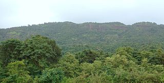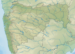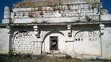
Wai is a town in Satara district of Maharashtra state in India. Located on the Krishna River, Wai was a prominent town during the Peshwa era. Two important Marathi Brahmin from ruling families had their origins here: Rani Lakshmibai of Jhansi and Gopikabai, wife of Nanasaheb Peshwa.

Tikona also known as Vitandgad, is the dominant hill fort in Maval in western India. It is located near Kamshet around 60 km from Pune. The village nearest to the fort is called Tikona-Peth. The 3500 foot high hill is pyramidal in shape and the name Tikona means "triangular".

Ajinkyatara Fort, also known as the "Fort of the Sapta-Rishi," is a historical hill fort located on Ajinkyatara Mountain, one of the seven mountains surrounding the city of Satara in the Sahyadri Mountains of Maharashtra, India. Situated at an altitude of 3,300 feet, the fort overlooks Satara City and is considered one of the major heritage sites in Maharashtra.

Avchitgad is a fort located in the Sahyadri ranges of Maharashtra. The fort is situated near Roha in the Raigad district. At the base of this fort is a village called Medha and Padam - Kharapti.

Rohida fort / Vichitragad Fort is a fort located 10 km from Bhor, Pune district, of Maharashtra. This fort is an important fort in Pune district. The fort restoration is done by the Shree Shivdurga Samvardhan committee with the help of forest dept. and local villagers.
Kalyangad Fort/Nandgiri is in the taluka Koregaon of Satara district of Maharashtra. The fort stands at the end of a spur of the Mahadev range running south-west from the villages of Vikhale and Bhadle, eight miles north of Koregaon and about fourteen miles north-east of Satara. Its elevation is 3,537 feet above sea level.
Pandavgad Fort), 4177 feet above sea level, lies four miles north-west of Wai. The fort is conspicuous over a low spur branching east from its southern angle. From a distance it appears a square fortification with natural escarpment of cut black stone. The fort can be reached by a footpath diverting to the north from Bhoganv, a village 3 miles west of Wai on Wai -Velang State Transport route. In Bhoganv village, there is a small memorial of Vaman Pandit, the celebrated Sanskrit poet of the 15th century.

Kenjalgad Fort in Wai, Maharashtra is a fort eleven miles (18 km) north-west of Wai. It is located on the Mandhardev spur of the Mahadev hill range. The fort is visible from quite a long distance as a stone scarp 30–40 feet high rising as a cap on the irregular hill. The fort is rhomboid in shape with 388m long axis and 175m short axis.
Banawadi is a census village of Satara district in the Indian state of Maharashtra. It is situated near to the Satara Phaltan state highway, about 21 km north of Satara, about 108 km from Pune and 220 km from Mumbai.

Ankai Fort is a historic site found in the Satmala Range hills in western India. It is located in Yeola Taluka of Nashik district in the state of Maharashtra. The fort was built by Yadava of Devgiri. Geographically, it is near Manmad. The Ankai fort and Tankai fort are two different forts on adjacent hills. A common fortification is constructed to secure both. The Ankai fort is located on a hill with perpendicular scarps on all the sides, except for a narrow nose on the eastern side.

Ghangad is a fort situated near 30km from Lonavla-Khandala and 100 km from Pune in Maharashtra state, India. It is an important fort in the Pune district. The fort restoration is done by the Shivaji Trail group with the help of local villagers. Restoration work took place in 2011-12. The fort is at least 300 years old.

Dronagiri Fort is a fort in Navi Mumbai's Raigad district, Maharashtra, India.

Chandan Fort is located in Satara District. This fort is situated on a hilly spur from the main ridge of Sahyadri. This fort is frequently visited by trekkers and pilgrims. The villages at the base are rich in sugarcane and other cultivation. The Chandan and Vandan are adjacent forts. The trek to both the fort can easily be completed in a day.

Surgad, is a hill fort located in a spur, fragmented from the Sahyadri ranges of Maharashtra. The fort is situated near Roha, next to the village of Vaijanath in the Raigad district. This fort was an observation fort, which guarded the trade route along the Kundalika river from Sudhagad to Revdanda fort.

"Bhaskargad Fort, alternatively known as Basgad Fort, is a hill fort situated within the Nashik district of Maharashtra, India. Part of the Trimbak hill range, it lies in proximity to Harihar Fort. Located approximately 48 kilometers away from Igatpuri, Bhaskargad Fort is recognized as a favored site for activities such as trekking and hiking."

Vikatgad / Peb Fort is a fort located 19 km (12 mi) from Karjat, in Raigad district, of Maharashtra. This fort is in continuation with the Malang gad, Tauli Hill and Chanderi fort of the Matheran Hill Range. Vikatgad is a favourite destination for one-day trekkers. The trek path to Vikatgad is along deep ravines and cliffs. Its closeness to Matheran and Neral attracts many trekkers on weekends. The forest department and local villagers are doing plantation and some restoration works on the fort. The altitude of Vikatgad, also known as Peb fort is 640 meters above sea level.
Makrandgad Fort is a fort near Pratapgad Fort. It is located 156km from Pune, in Satara district, of Maharashtra. The fort is located in the midst of the famous Javli forest. The fort is accessible from the Hatlot and Ghonaspur village. The trek to this fort is an easy one day trek for visitors at Mahabaleshwar. The fort consists of two flattened humps with a ridge between them.
Hatgad Fort is a fort located 71 km (44 mi)from Nashik, Nashik district, of Maharashtra. The base village is Hatgad on the Nashik-Saputara Road. The nearest town is Saputara, which is 6 km from Hatgad village. It is a historic monument located in Maharashtra, India, south of the hill station of Saputara and near the border with Gujarat. It was built by the Maratha king Shivaji and is located at an elevation of about 3,600 feet. The way to reach the fort is through a trekking route via a narrow rocky path and car also go up to the stairs of fort. A statue of Lord Shivling is placed on the top of the fort.

Hargad Fort is located in the Baglan area of Nashik district. There are two main hill ranges in Baglan area, the Selbari range is south of the Dolbari hill range. These two ranges run parallel to each other in east-west direction. Hargad is located on Selbari hill range. All these forts were maintained to keep watch on the Burhanpur-Surat ancient commercial road. The road passes between the two hill ranges. Hargad fort is a small fort, close to Mulher fort. These are key forts situated between fertile lands of Khandesh and port city of Surat.


