South Bay (San Diego County)

Last updated

South Bay
Imperial beach ca 2.jpg
Imperial Beach Pier in South Bay
South Bay Communities San Diego.png
The South Bay region, with cities shown in orange, the unincorporated community Bonita in pale orange, and South San Diego in pink
CountySan Diego County
Population
453,901

The South Bay, also known as South County, is a region in southwestern San Diego County, California consisting of the cities and unincorporated communities of Bonita, Chula Vista, East Otay Mesa, Imperial Beach, Lincoln Acres, National City, and South San Diego. [1]

Contents

Defined by its proximity to San Diego Bay and the Mexico-United States border, the South Bay is a mix of heavy industrial complexes and shipyards alongside beaches and residential developments. One of its cities, Imperial Beach, bills itself as "Classic Southern California" for being relatively untouched in terms of other coastal cities.[ clarification needed ]

History

The area encompassing the South Bay was originally inhabited by the Kumeyaay peoples. Under Mexican rule, several Mexican land grants were established in the region, including Rancho Janal, Rancho Otay, and Rancho de la Nación. In the 1870s, South Bay Salt Works began operations. National City was incorporated in 1887, Chula Vista in 1911, and Imperial Beach in 1956. South San Diego, including the communities of San Ysidro, Nestor, Palm City, and Otay Mesa, was annexed by the City of San Diego in 1957.

The term "South Bay" has referred to the region since at least the early 20th century, with one reference dating from 1918. [2]

In 1993, Two boys (Charlie Keever and Jonathan Sellers) were found raped and murdered by Scott Erskine along the Otay River.

In October 2007, South Bay was quickly encroached upon by the Harris Fire, part of a series of fires that ravaged California in the 2007 Fire season.

Traditionally more residential and calmer than North County, in 2010 regional cities were taking on projects that included the development of luxury resorts in efforts to revitalize the South Bay. On May 18, 2010, further development of the Chula Vista Bayfront was authorized by the Unified Port of San Diego and City of Chula Vista.[ citation needed ] Plans included marina expansion, luxury resort development, and the addition of a conference center. Additionally, in Imperial Beach, on September 29, 2010, the Seacoast Inn was demolished to make room for a $20 million resort. [3]

Geography

Tijuana River Estuary with Tijuana Hills in the back Tijuana River Estuary.jpg
Tijuana River Estuary with Tijuana Hills in the back

South Bay borders both San Diego Bay and the Pacific Ocean. The region is at the southern end of the bay and western slope of the coastal mountains to the east. There are a few creeks that make their way from these mountains with their terminus in either the southern end of the bay, the ocean, or the Tijuana River estuary. Its boundaries are the San Diego Bay on the west, the United States–Mexico border on the south, National City's border with northern San Diego and Coronado to the north, and the unincorporated communities and Otay Lakes to the east.

Ecology

Nature preserve areas in South Bay include San Diego Bay National Wildlife Refuge, Otay Mountain Wilderness, Tijuana Slough National Wildlife Refuge and Tijuana River National Estuarine Research Reserve. The Tijuana River Estuary is located on the southern coast of South Bay. The river which feeds it has a watershed that drains from both Tijuana Municipality and San Diego County. There have been problems with the cleanliness of the estuary, from the Tijuana part of the watershed, which has led to constructive measures with efforts to clean the water. Located within the Tijuana River National Estuarine Reserve, the Tijuana River estuary is the largest wetland in Southern California. [4] The wetland supports over 370 species of migratory and year-round dwelling waterfowl. [4]

Demographics

The population was 462,843 as of 2005, an 18.3% increase from 2000. South Bay is the third-largest region of Greater San Diego in population, ahead of East County and behind North County.

The South Bay is known for its relatively large immigrant population, with many first-generation Mexican-Americans and Filipino-Americans. [1] 26% of San Diego County's Hispanic population, the vast majority of which is of Mexican origin, lives in the South Bay. [5] As of January 2018, descendants of the early explorers of Alta California continue to live in the South Bay. [6]

As of 2010, South San Diego, National City and Chula Vista have Hispanic majorities, while Imperial Beach has a Hispanic plurality and Bonita has a non-Hispanic white plurality.

Communities

Populations are as of the 2020 census with the exception of South San Diego.

Incorporated cities

Census-designated place

Other unincorporated communities

Federal military reservations

Education

Southwestern College campus Swccampus.jpg
Southwestern College campus

Primary and secondary schools

South Bay is served by the Sweetwater Union High School District, Chula Vista Elementary School District, National School District, San Ysidro School District, and the South Bay Union School District. There are approximately fourteen high schools, fourteen middle schools, and numerous elementary schools. The South Bay area is also served by charter and private schools.

Colleges and universities

Located in Chula Vista is Southwestern College, a two-year community college and feeder school to University of California, San Diego and San Diego State University.

Government

The South County Regional Center contains the South Bay Courthouse of the San Diego Superior Court as well as offices for the San Diego County Sheriff, the San Diego District Attorney, the San Diego County Board of Supervisors, and others. The center is located in downtown Chula Vista.

Media

Newspapers

South Bay is served by the San Diego Union-Tribune, whose website features a "South County" section that is largely congruent with South Bay, although the "South County" section includes Coronado. South Bay also receives coverage from the weekly San Diego Reader.

Chula Vista, National City, and Bonita are served by the weekly newspaper The Star-News, which was formed in 1954 upon the merger of the Chula Vista Star with the National City News. [7] Imperial Beach is served by the weekly Imperial Beach and South County Eagle & Times. [8]

San Ysidro was once served by the weekly San Ysidro Border Press. [9]

Radio

No radio station is licensed to any city in the South Bay area. The area is instead served by stations licensed to the Baja California municipalities of Tijuana and Tecate, all of which effectively cover the area. [10] However, XHLTN-FM maintains a sales office in Chula Vista, and XHGLX-FM had a similar setup in National City, both stations sending data to cross-border control rooms. The area is also served by other San Diego area radio stations. During tropospheric ducting, the signals of out of market stations KYSR, KBIG, KRTH, and KRUZ can reach the area, while sensitive radio tuners have picked up KIIS-FM on occasion.

Television

Terrestrial digital television stations KNSD and KUSI-TV have their transmitters on Mount San Miguel. The area is also served by XETV and XHDTV. The selection of local stations on cable and satellite services vary by provider.

Landmarks

Important landmarks in South Bay include:

Politics

South Bay is located entirely within Supervisorial District 1 at the county level, which is represented by Democrat Nora Vargas. [11]

See also

Related Research Articles

<span class="mw-page-title-main">Chula Vista, California</span> City in California, United States

Chula Vista is a city in San Diego County, California, United States. It is also the second-largest city in the San Diego metropolitan area, the seventh largest city in Southern California, the fifteenth largest city in the state of California, and the 78th-largest city in the United States. The population was 275,487 as of the 2020 census, up from 243,916 as of the 2010 census. Located about halfway—7.5 miles (12.1 km)—between the two downtowns of San Diego and Tijuana in the South Bay, the city is at the center of one of the richest culturally diverse zones in the United States. Chula Vista is so named because of its scenic location between the San Diego Bay and coastal mountain foothills.

<span class="mw-page-title-main">Imperial Beach, California</span> City in California, United States

Imperial Beach is a residential beach city in San Diego County, California, with a population of 26,137 at the 2020 United States census, down from 26,324 at the 2010 census. The city is the southernmost city in California and the West Coast of the United States. It is in the South Bay area of San Diego County, 14.1 miles (22.7 km) south of downtown San Diego and 5 miles (8 km) northwest of downtown Tijuana, Mexico.

<span class="mw-page-title-main">San Ysidro, San Diego</span> Community of San Diego in California

San Ysidro is a district of the City of San Diego, immediately north of the Mexico–United States border. It neighbors Otay Mesa West to the north, Otay Mesa to the east, and Nestor and the Tijuana River Valley to the west; together these communities form South San Diego, a practical exclave of the City of San Diego. Major thoroughfares include Beyer Boulevard and San Ysidro Boulevard.

<span class="mw-page-title-main">Tijuana River</span> River in Mexico and California

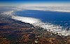
The Tijuana River is an intermittent river, 120 mi (195 km) long, near the Pacific coast of northern Baja California state in northwestern Mexico and Southern California in the western United States. The river is heavily polluted with raw sewage from the city of Tijuana, Mexico.

<span class="mw-page-title-main">Sweetwater Union High School District</span> School district in California

The Sweetwater Union High School District is a school district headquartered in Chula Vista, California. As of 2011, the school district is the largest secondary school district in California.

<span class="mw-page-title-main">San Diego-Imperial Council</span> Boy Scouts council

The San Diego-Imperial Council is headquartered in San Diego, California, and serves youth members and volunteer leaders through Scout units in San Diego and Imperial counties of Southern California, as well as a portion of Arizona.

Otay Mesa is a community in the southern exclave of the city of San Diego, just north of the U.S.–Mexico border.

<span class="mw-page-title-main">Sweetwater River (California)</span> River in California, United States

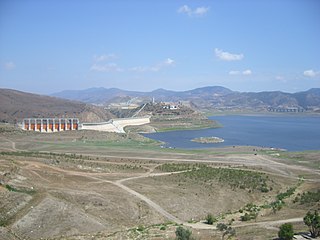
The Sweetwater River is a 55-mile (89 km) long stream in San Diego County, California.

California's 52nd congressional district is a congressional district in the U.S. state of California. The district is currently represented by Democrat Juan Vargas.

<span class="mw-page-title-main">San Diego–Tijuana</span> Transborder agglomeration of the Californias

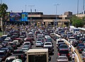
San Diego–Tijuana is an international transborder agglomeration, straddling the border of the adjacent North American coastal cities of San Diego, California, United States, and Tijuana, Baja California, Mexico. The 2020 population of the region was 5,456,577, making it the largest bi-national conurbation shared between the United States and Mexico, and the second-largest shared between the US and another country. The conurbation consists of the San Diego metropolitan area, in the United States and the municipalities of Tijuana, Rosarito Beach (126,980), and Tecate (108,440) in Mexico. It is the third most populous region in the California–Baja California region, smaller only than the metropolitan areas of Greater Los Angeles and the San Francisco Bay Area.

South San Diego is a district within the City of San Diego, and is in the larger South Bay region of southwestern San Diego County, California. South San Diego is a practical exclave of San Diego, having no land connection with the rest of the city. It is the only part of the city which borders Mexico. South San Diego includes four of the city's official community planning areas: Otay Mesa, Otay Mesa-Nestor, San Ysidro, and the Tijuana River Valley.

<span class="mw-page-title-main">California's 18th senatorial district</span> American legislative district

California's 18th senatorial district is one of 40 California State Senate districts. It is currently represented by Democrat Steve Padilla of Chula Vista.

<span class="mw-page-title-main">San Diego County, California</span> County in California, United States

San Diego County, officially the County of San Diego, is a county in the southwestern corner of the U.S. state of California. As of the 2020 census, the population was 3,298,634, making it California's second-most populous county and the fifth-most populous in the United States. Its county seat is San Diego, the second-most populous city in California and the eighth-most populous city in the United States. It is the southwesternmost county in the 48 contiguous United States, and is a border county. It is also home to 18 Native American tribal reservations, the most of any county in the United States.

<span class="mw-page-title-main">Nestor, San Diego</span> Community of San Diego in California

Nestor is a residential neighborhood in the southern section of San Diego, and part of the Otay Mesa-Nestor community planning area. It neighbors Palm City and Otay Mesa West to the east, Egger Highlands to the north, San Ysidro to the southeast and the Tijuana River Valley to the south. Major thoroughfares include Coronado Avenue, Saturn Boulevard, Hollister Street, and Tocayo Avenue.

Palm City is a neighborhood in the southern section of San Diego. Its neighbors are Otay Mesa West to the south and east, Egger Highlands and Nestor to the west, and Chula Vista to the north. It also serves as a gateway to the beach cities of Imperial Beach, and Coronado, by way of the Silver Strand isthmus, due to it being where California State Route 75 meets Interstate 5. Major thoroughfares include Coronado Avenue, Hollister Street, Beyer Boulevard, and Palm Avenue.

Transportation in San Diego–Tijuana occurs by various means. Though, in the four cities of San Diego, Tijuana, Tecate, and Rosarito Beach, the automobile serves as most important means of transportation. The international metropolitan region maintains an intricate highway infrastructure. As a large metropolitan area in Western North America, many roadways, including Interstates, State Routes, and Mexican Federal Highways, hold a terminus in the area. These roads have grown accustomed to support the masses of the commuting populace within the international region and are constantly being expanded and/or renovated. Transportation is a crucial issue in the metropolitan area. The streets and highways of the region affect environmental health and have influence over the degree of regional connectivity. Binational discussions about coordinating public transportation across the border are currently underway. San Diego–Tijuana is the site of two major international airports and numerous regional airports. It is also the site of the Port of San Diego and miles from the nearby Port of Ensenada.
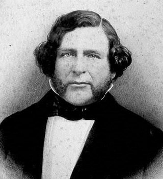
<span class="mw-page-title-main">Rancho Melijo</span>

Rancho Melijo, or Milijo, named after a local Kumeyaay village. It was later called Rancho La Punta for the location of the Arguello family ranch house, on a point of hills overlooking the south end of San Diego Bay, north of the Otay River and east of where the river entered the south bend of the bay. It was a Mexican land grant rancho, granted by Governor José Figueroa in 1833 to Santiago E. Argüello.

<span class="mw-page-title-main">Goat Canyon (Tijuana River Valley)</span> Canyon in the Mexican state of Baja California and the US state of California

Goat Canyon also known as Cañón de los Laureles, begins in Tijuana, Mexico, and ends in the United States just north of the Mexico–U.S. border. The canyon is formed by Goat Canyon Creek, which receives water and other runoff from areas south of the border. Most of the canyon and its watershed lies within Baja California.

References

  1. 1 2 Herrera, Angelica P., Lee, Jerry , Palos, Guadalupe, and Torres-Vigil, Isabel. Cultural Influences in the Patterns of Long-Term Care Use Among Mexican American Family Caregivers, Journal of Applied Gerontology, Vol. 27 No. 2, April 2008 p.146.
  2. California Development Board, San Diego County (Calif.). Board of Supervisors, San Diego Chamber of Commerce. Agricultural and soil survey of San Diego County, California. Frye & Smith 1918. p. 34.
  3. Zúñiga, Janine (September 29, 2010). "Seacoast Inn demolition underway". San Diego Union-Tribune.
  4. 1 2 "River Mouth: South McCoy Trails". Trails.com. Retrieved March 10, 2011.
  5. Kada, Naoko, Kiy, Richard, eds. Blurred Borders: Trans-Boundary Impacts & Solutions in the San Diego-Tijuana Border Region. International Community Foundation. March 2004.
  6. Cortez, Mario A. (January 30, 2018). "South Bay's 'Fronterizo' History now on Display". La Prensa San Diego. Retrieved May 12, 2018.
  7. "About this Newspaper: The star-news". Chronicling America. The Library of Congress. Retrieved March 5, 2011.
  8. "Eagle & Times". Imperial Beach Chamber of Commerce. May 2009. Retrieved March 5, 2011.
  9. "About this Newspaper: San Ysidro border press". Chronicling America. Library of Congress. Retrieved March 5, 2011.
  10. "REC California information for San Diego". REC Networks. Retrieved November 25, 2020.
  11. Acevedo, Laura (November 12, 2020). "Nora Vargas to become first Latina to serve on San Diego County Board of Supervisors". ABC 10News . Scripps Media. Retrieved November 25, 2020.