Kit Carson, Colorado | |
---|---|
Coordinates: 38°45′50″N102°47′38″W / 38.76389°N 102.79389°W | |
Country | United States |
State | Colorado |
County | Cheyenne [1] |
Incorporated | July 13, 1931 [2] |
Area | |
• Total | 0.58 sq mi (1.51 km2) |
• Land | 0.58 sq mi (1.51 km2) |
• Water | 0.00 sq mi (0.00 km2) |
Elevation | 4,285 ft (1,306 m) |
Population | |
• Total | 255 |
• Density | 440/sq mi (170/km2) |
Time zone | UTC-7 (MST) |
• Summer (DST) | UTC-6 (MDT) |
ZIP code [6] | 80825 |
Area code | 719 |
FIPS code | 08-41010 |
GNIS feature ID | 0195254 |
Website | Official website |
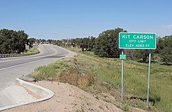
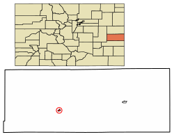
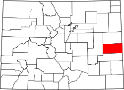
Kit Carson is a statutory town in Cheyenne County, Colorado, United States. The population was 255 at the 2020 United States Census. [5]
The town was named in honor of frontiersman Christopher Houston "Kit" Carson. [7]
Kit Carson is located at 38°45′50″N102°47′38″W / 38.76389°N 102.79389°W (38.763999, -102.793843). [8]
According to the United States Census Bureau, the town has a total area of 0.6 square miles (1.6 km2), all land.
Climate data for Kit Carson, Colorado (1991–2020 normals, extremes 1939–present) | |||||||||||||
---|---|---|---|---|---|---|---|---|---|---|---|---|---|
Month | Jan | Feb | Mar | Apr | May | Jun | Jul | Aug | Sep | Oct | Nov | Dec | Year |
Record high °F (°C) | 77 (25) | 83 (28) | 87 (31) | 94 (34) | 106 (41) | 109 (43) | 108 (42) | 106 (41) | 102 (39) | 96 (36) | 85 (29) | 79 (26) | 109 (43) |
Mean daily maximum °F (°C) | 45.4 (7.4) | 47.8 (8.8) | 57.7 (14.3) | 65.9 (18.8) | 75.3 (24.1) | 86.7 (30.4) | 92.2 (33.4) | 89.2 (31.8) | 82.3 (27.9) | 68.8 (20.4) | 55.3 (12.9) | 45.4 (7.4) | 67.7 (19.8) |
Daily mean °F (°C) | 28.6 (−1.9) | 31.1 (−0.5) | 40.6 (4.8) | 48.8 (9.3) | 59.2 (15.1) | 70.2 (21.2) | 75.7 (24.3) | 73.3 (22.9) | 64.8 (18.2) | 50.9 (10.5) | 38.2 (3.4) | 29.2 (−1.6) | 50.9 (10.5) |
Mean daily minimum °F (°C) | 11.7 (−11.3) | 14.4 (−9.8) | 23.5 (−4.7) | 31.7 (−0.2) | 43.2 (6.2) | 53.8 (12.1) | 59.2 (15.1) | 57.5 (14.2) | 47.3 (8.5) | 33.0 (0.6) | 21.0 (−6.1) | 12.9 (−10.6) | 34.1 (1.2) |
Record low °F (°C) | −32 (−36) | −29 (−34) | −24 (−31) | 5 (−15) | 19 (−7) | 31 (−1) | 37 (3) | 36 (2) | 17 (−8) | 7 (−14) | −17 (−27) | −29 (−34) | −32 (−36) |
Average precipitation inches (mm) | 0.26 (6.6) | 0.35 (8.9) | 0.65 (17) | 1.32 (34) | 2.24 (57) | 2.25 (57) | 2.65 (67) | 2.71 (69) | 0.90 (23) | 1.25 (32) | 0.42 (11) | 0.42 (11) | 15.42 (392) |
Average snowfall inches (cm) | 2.4 (6.1) | 3.0 (7.6) | 3.0 (7.6) | 0.9 (2.3) | 0.0 (0.0) | 0.0 (0.0) | 0.0 (0.0) | 0.0 (0.0) | 0.0 (0.0) | 0.2 (0.51) | 2.4 (6.1) | 4.0 (10) | 15.9 (40) |
Average precipitation days (≥ 0.01 in) | 1.7 | 2.5 | 3.3 | 4.5 | 6.4 | 5.8 | 7.3 | 6.5 | 3.2 | 3.0 | 2.2 | 2.1 | 48.5 |
Average snowy days (≥ 0.1 in) | 1.1 | 1.5 | 1.5 | 0.8 | 0.0 | 0.0 | 0.0 | 0.0 | 0.0 | 0.1 | 1.2 | 2.0 | 8.2 |
Source: NOAA [9] [10] |
Census | Pop. | Note | %± |
---|---|---|---|
1940 | 333 | — | |
1950 | 379 | 13.8% | |
1960 | 356 | −6.1% | |
1970 | 220 | −38.2% | |
1980 | 278 | 26.4% | |
1990 | 305 | 9.7% | |
2000 | 253 | −17.0% | |
2010 | 233 | −7.9% | |
2020 | 255 | 9.4% | |
U.S. Decennial Census |
Yuma County is a county located in the U.S. state of Colorado. As of the 2020 census, the population was 9,988. The county seat is Wray.
Kit Carson County is a county located in the U.S. state of Colorado. As of the 2020 census, the population was 7,087. The county seat is Burlington. The county was established in 1889 and named for American frontiersman and Indian fighter Kit Carson.
Cheyenne County is a county located in the U.S. state of Colorado. The county population was 1,748 at 2020 census. The county seat is Cheyenne Wells.
Cheyenne Wells is the statutory town that is the county seat and the most populous municipality of Cheyenne County, Colorado, United States. The town population was 758 at the 2020 United States Census.
Eads is a statutory town, county seat, and the most populous municipality of Kiowa County, Colorado, United States. The town population was 672 at the 2020 United States Census.
Sheridan Lake is a statutory town located in Kiowa County, Colorado, United States. The population was 55 at the 2020 census.
Bethune is a Statutory Town located in Kit Carson County, Colorado, United States. The town population was 183 at the 2020 United States Census. It is located along U.S. Highway 24 that is north of an exit on Interstate 70.
Flagler is a Statutory Town in western Kit Carson County, Colorado, United States. The town population was 567 at the 2020 United States Census. Flagler is near Exit 395 on I-70.
Seibert is a statutory town in Kit Carson County, Colorado, United States. The population was 172 at the 2020 census.
Stratton is a statutory town in Kit Carson County, Colorado, United States. The population was 656 at the 2020 census. Stratton was named in honor of the gold miner and philanthropist Winfield Scott Stratton.
Vona is a statutory town in Kit Carson County, Colorado, United States. The population was 95 at the 2020 census.
The Town of Crook is a Statutory Town in Logan County, Colorado, United States. The town population was 133 at the 2020 United States Census. Crook is a part of the Sterling, CO Micropolitan Statistical Area.
The Town of Fleming is a statutory town in Logan County, Colorado, United States. The town population was 428 at the 2020 United States Census. Fleming is a part of the Sterling, CO Micropolitan Statistical Area.
Holyoke is the home rule municipality that is the county seat and the most populous municipality of Phillips County, Colorado, United States. The city population was 2,346 at the 2020 United States Census.
Rye is a Statutory Town in Pueblo County, Colorado, United States. The population was 206 at the 2020 census.
Julesburg is the statutory town that is the county seat and the most populous municipality of Sedgwick County, Colorado, United States. The population was 1,307 at the 2020 United States Census.
Sedgwick is a statutory town in Sedgwick County, Colorado, United States. The population was 172 at the 2020 census.
Akron is the Statutory Town that is the county seat and the most populous municipality of Washington County, Colorado, United States. The town population was 1,757 at the 2020 United States Census.
Wray is the home rule municipality that is the county seat of Yuma County, Colorado, United States. Located in the Colorado Plains, the city is 170 miles east of Denver, 9 miles west of the Nebraska state line, and 25 miles northwest of the Kansas state line. The population was 2,358 at the 2020 United States census.
Yuma is a home rule municipality that is the most populous municipality in Yuma County, Colorado, United States. The population was 3,456 at the 2020 census.